
What are
/r/GeorgiaCampAndHike's
favorite Products & Services?
From 3.5 billion Reddit comments
The most popular Products mentioned in /r/GeorgiaCampAndHike:


The most popular Services mentioned in /r/GeorgiaCampAndHike:
AllTrails
Airbnb
f.lux
The most popular reviews in /r/GeorgiaCampAndHike:
Bug spray with as much deet as possible (do not use if wife is preggers) and for the cooler you can get a regular ass one, buy a case of bottled waters, freeze them solid for a day or two before your trip, and then use those as “ice”. When they thaw, you got some cold ass water. Dry ice at the bottom also works, just lay a wash cloth or something similar to act as a barrier. In terms of hiking, it really depends on how far and how strenuous you wanna go, (this site gives some good suggestions.)[https://www.alltrails.com/explore/us/georgia/mineral-bluff]
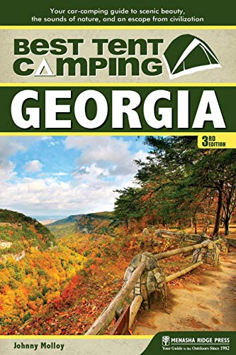
Get this book its great.
Look for other books by Johnny molloy.
There are great trails. Chattooga river trail, Bartram trail, the cohutta wilderness, Duncan ridge trail, benton McKay trail, foots hills trail, the big frog and citico wilderness and many more. The AT is crowded. Avoid.
Carters lake has great boat in camping.
Army corps has great waterfront campgrounds that are not on reservations.gov
Chattahoochee and Nantahala national forests has lots of forest service road dispersed camping.
Covid has everything packed like I've never seen it before in my life.
https://www.alltrails.com/trail/us/georgia/whitly-gap-trail
This is the trail you want. Don’t go all the way down to the shelter though. Once you’re up you’re on a ridge with a wide open view of the sky facing west
I hiked the Stoneplace Trail back in 2019. It was pretty decent and the gnats should be gone by now. I did have to check in at the visitor center and get a permit.
Check out my activity on AllTrails. https://www.alltrails.com/explore/recording/stoneplace-trail--60?p=-1
This is the link to the route I took. I did 4 mts on this day, but if you follow from the start to Flint it's less then a mile hike. The dirt road to the trail head is a little rough, so no corvettes.
https://www.alltrails.com/explore/recording/alex-flint-knob-flat-top-and-rabun-bald-bbeb0c1
If you have a red flashlight, that is best. Also, there are smartphone apps and computer apps that can turn your screen to "darkroom mode" - e.g. red monochrome. f.lux for Mac has a darkroom mode.
We hiked to the top of Rabun Bald on Saturday and the weather was absolutely gorgeous. Following the week of rain and overcast skies the view was very clear. Definitely one of our favorite hikes we've done so far.
We hiked the northern approach on the Bartram trail:
https://www.alltrails.com/trail/us/georgia/rabun-bald-via-bartram-trail
The Pinhoti is a great 57 mile trail.
https://www.alltrails.com/explore/trail/us/georgia/pinhoti-trail
No bears, fantastic trail, and far less people than the A.T.
Be aware that in October the bears in the north GA mountains will be stuffing their faces.
Lake Russell WMA is good along certain trails. Especially this one. So long as you hike out to where it gets away from the road, human noise levels should be low.
I camped a Duckett Lake in the WMA a couple of weeks ago. It wasn't far from the road and a bunch of partying teenagers were far too close for my liking, though the frogs all day and night was splendid.
Hey neighbor, we also live in a Gainesville. You should check out Standing Indian Campground, it’s just over the state line in North Carolina. We typically avoid designated camping but this location is great for us and our two young kids. There is a lot of hiking and the Nantahala river runs right through it. We’ve yet to be shafted on finding a spot, they have a bunch of both reservations and first come first serve. They open back up in April I think.
Standing Indian Campground https://goo.gl/maps/uk9pyR3NB7TfhymdA
Also, this is a killer map if you can find it. Chattahoochee National Forest https://www.amazon.com/dp/1593516525/ref=cm_sw_r_cp_api_glt_fabc_9R90RBEJ4G5SBJMW6ZAT?_encoding=UTF8&psc=1
One other resource you may want to try is downloading the Gaia map files for the Georgia Traverse Trail. It lists some campsites and also gives you a good route to follow if you want to do some recon, I found that the forest service roads are great for car seat sleeping babies.
I’ve also had good luck with various FB groups for state or region specific areas. I loathe FB in general but there are still some redeeming qualities to be found there.
Hit me up in a PM if you have any other questions and welcome to Gainesville!
A friend who is good with botans sez: This is by far the best and most intuitive guide to perennials, vines and shrubs. We used it in my herbalism training course.
No, I covered about 8.5 miles starting from the top of the ridge (Monument Falls road) Tobacco Pouch and Falls Creek trails converge, down to Buice falls and back up again. Here is my AllTrails link
I use Permethrin to treat my clothing and that keeps most of them away. It also handles ticks very well, with enough exposure it kills them.
You can also treat things like tarps to make a giant repellent, but it does not last nearly as long on waterproof items, it needs to soak in to be effective. I do usually treat my backpack regardless.
I usually watch places like Tractor Supply and buy livestock sized bottles to make a tub of it at a time and dip my clothing rather than spray it. That is easier and more effective.
Do not dump the tub, cover it with a mesh or anything that allows sunlight through (it is highly toxic to cats when liquid or still wet, fine once dried) and allow it to sit, UV light breaks it down. That will prevent you from killing anything with it. I usually just wait a few days, as long as it's covered it's not harming anything to let it break down like that.
Sorry for your loss. Sounds like you are taking good steps to take care of yourself again so good on you for doing so. Have you heard of All Trails before? It’s a great site where you can search by a general area or a specific trail. If you search for Blue Ridge it will come up with tons of hikes in that area, it will tell you how difficult it is, if it’s dog friendly, how long, how much elevation, and so on. Start with something easy like the Lake Blue Ridge Loop and take your time, it’s a marathon not a sprint. Id also recommend trekking poles if you do anything with some elevation change as they will save your knees some strain, especially on the down hills.
I couldn't find anything of a solid length when I was there last year and looking for some trail running. Ended up driving north 2 hours to South Carolina for this trail that turned out to become a 21 miler when the trail completely disappeared when crossing Conifer Rd and I had to backtrack. It was very runnable though, nothing technical or hilly.
Looks like folks jump in the quarry after all as per a recent review on AllTrails -https://www.alltrails.com/trail/us/georgia/pine-log-creek-trail. Have fun!
I believe deep creek to Clingman's dome loop was the trail we did. 35 miles, 3 days, 3rd day is mostly downhill.
In case someone else is looking for info on the Duncan Ridge Trail/Georgia Loop: I found this recording on alltrails. Troy marked all water sources and campsites with pictures :) https://www.alltrails.com/explore/recording/georgia-loop--7
There used to be a beautiful flowery field across from the Kolb Farm Loop Trail parking area: https://www.alltrails.com/trail/us/georgia/kolbs-farm-loop-trail
I did it via the Bartram Trail. So it was around 8 miles total round trip going this way. The first two miles are relatively flat and then the climb begins. Another good thing is that this trail is almost completely shaded. Just take plenty of water with you and take breaks as needed, you’ll get to the summit!
Here is the link to it on AllTrails: https://www.alltrails.com/trail/us/georgia/rabun-bald-via-bartram-trail?p=-1
It’s rated as “moderate” at 3.3 miles, ~1k gain . There was a variety of people on the trail (fitness and age) last I went and they all did just fine. Take breaks when needed, and enjoy the scenery!
You want the chattooga river trail. Its in the North East corner and there are multiple places to start. https://www.alltrails.com/trail/us/georgia/chattooga-river-trail The actual trail is on the SC side but you can still fish with a GA licence.
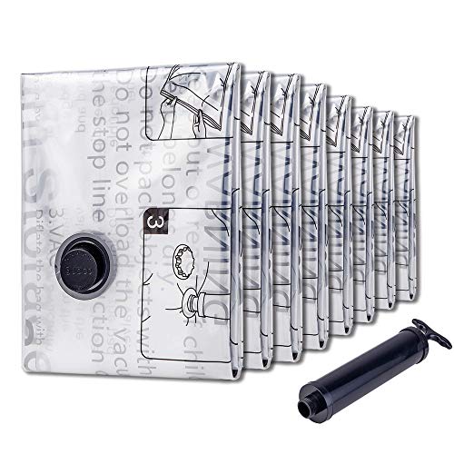
If you are car camping, the best advice I can give you is skip the air mattress. Invest in a 2-3 inch memory foam bed topper and the large bags that can compress it without a vacuum (like the one linked below). You will get a better night's sleep.
​
I have the older edition of this, which as you can see is pretty old itself. But it's still a good starting point. It's not like campsites change very often.
Check out the book below. Of course you have to adjust your expectations for an intown hike but there are some good ones. He even gives directions via public transport when applicable.
https://www.amazon.com/Hiking-Atlantas-Hidden-Forests-Intown/dp/1889596299
ITP hikes that I do on the regular are Constitution Lakes (do it after a dry spell; very muddy after rain), Hahn Woods at Emory, Morningside Nature Preserve, and Cascade Springs Nature Preserve (leave nothing in your car; break-ins are common here). OTP, but not too far are Sweetwater Creek S.P., Pine Mountain in Cartersville, Red Top Mountain S.P., Stone Mountain, and Arabia Mountain.
Raven cliff had the best campsites in all of North Ga in my option.
If you keep going down the gravel road there are plenty of campsites my favorite is the last one of all the car camping spots. If you go car camping it gives you the freedom to bring extra things like more blankets if you get cold( but based on the sleeping bag you won’t have that problem) you can bring a cooler with food etc.
However, the trail at raven cliff isn’t hard at all just be sure to bring a water filtration, weather that’s a sawyer squeeze, drops, pill etc. About 1.8-2 miles in there a dope campsite. You have to cross a fallen tree over the river. It’s probably4-5 feet wide so it’s not challenging to cross. But this will provide a bit more privacy then the camp spots right on the trail.
As for the pad I agree with Stella it helps a ton. A sleeping bag works only when it can trap air to keep you warm. so when you’re on the ground there no gap and the the sleeping bag is compressed it can’t do it’s job so you’ll be cold from your back. Bring a stove Camp Stove Titanium Stove... https://www.amazon.com/dp/B01N5WRJ8A?ref=ppx_pop_mob_ap_share this one is super light weight, cheap, and very minimalist. Also Don’t forget a headlamp.
I will be camping raven cliff this weekend with my dog so perhaps I will be seeing you there!
Ok, I got mine from amazon but I’ve also gotten one from a forest service office and I’ve seen them occasionally at state park visitor center and the brasstown bald visitor center. I know the amazon link is one that’s not available for sale but it has the isdn number in there and that may help your search.
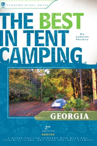
Get this book, The best tent camping: Georgia
https://www.amazon.com/Best-Tent-Camping-Car-Camping-Civilization/dp/0897324986
> If I want to camp somewhere, do I have to gain permission? And do I have to camp in designated spots?
Yes, and yes. It's easy to find campsites that give you permission though. There are state parks, national recreation areas, national forests, etc. that have designated campgrounds. They will have campsite rules posted, but generally speaking don't be a jerk and leave no trace.Check out this book. It lists campsites that are more secluded and not right next to RV's. As far as your college, I would ask someone in the recreation(?) department. It's private property so how it's used is completely up to them. I'm not sure where you're thinking about hanging your hammock, but I'm sure it's fine unless you do something dumb like hang it across a trail or on a 1,000-year-old endangered tree.
This book is limited to the AT but it's really phenomenal. It walks you through the entire trail page by page and shows you water, shelters, etc so you always feel comfortable.