
What are
/r/GlacierNationalPark's
favorite Products & Services?
From 3.5 billion Reddit comments
The most popular Products mentioned in /r/GlacierNationalPark:


The most popular Services mentioned in /r/GlacierNationalPark:
AllTrails
Weather Underground
The most popular reviews in /r/GlacierNationalPark:
Do the Highline Trail to Granite Park Chalet! Add on the 0.6-mile (quite steep) offshoot up to Grinnell Glacier Overlook and you're looking at ~16 miles roundtrip. On this hike, you'll have great views of GTTSR and a good chance of spotting mountain goats and bighorn sheep.
For sure!! It just takes a bit of planning. But with the parks everything sort of takes planning so no biggie.
The AllTrails website does a nice job of helping out with the planning we've found. Here's a link just in case you're not familiar.
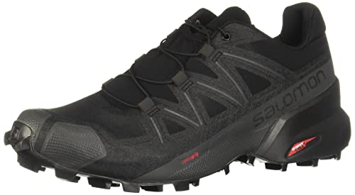
Second this! I recently switched to trail running shoes and loved it. Light, comfortable, and all the traction you need. Agree with above comment, unless you’re doing some serious mountaineering or have ankle issues, no need for a traditional hiking shoe/boot.
I wear Salomon Speedcross 5 Trail Running Shoes and they worked great when I hiked High Line trail to Grinnell Glacier this summer. The high line trail is an absolute must. Not as difficult as it appears since there is minimal elevation gain.
You may get partial answers but this will give you all you seek: https://www.amazon.com/Moon-Glacier-National-Park-Camping/dp/1640494375/ref=mp_s_a_1_3?crid=2TI7TXVI1460O&keywords=glacier+national+park+moon&qid=1656781095&sprefix=glacier+national+park+moon%2Caps%2C114&sr=8-3#
It is a very complete and readable guidebook.
>Motor Inn rooms are not in the cabins. They're in the long buildings. All have their own bathrooms; some cabins don't. They tend to be quieter. Fewer people walking through.
That's what I understood/inferred. Both Swiftcurrent and Many sounded like they had the same basic amenities (bathroom, sink, etc.), but only Many had the view. Smaller bed at Many, but no differences otherwise. Made this post to catch any details I was unaware of.
Our white noise machine will drown out any disturbances. Not terribly concerned about that.
Otherwise, sounds like it's in favor of Many Glacier over Swiftcurrent.
Haha yeah.
Actually I was confused between this:
Or
The Elevation gain between the two is vast! I believe both are point to point.
I'm assuming you're reading this link.
I felt real silly when I realized that for an out and back style trail, the elevation gain listed is for the whole thing. So for the Logan to Chalet half, its 1250ft, then for the Chalet to Logan half, it's another 1250ft.
Maybe you know this already, but I thought it was 2500ft on the out and 2500ft on the return, which would have been nuts for my level.
On AllTrails I can see a “Highline Trail: Logan Pass to Granite Park Chalet”. Is that the one you’re referring to?
Check out this trail on AllTrails. https://www.alltrails.com/trail/us/montana/highline-trail?p=-1
I wish there were more people offering this. thank you.
We are planning a trip to Glacier during the last two weeks in August and we're trying to find out if we can get to Upper Grinnell Lake or if that area is only accessible from the east and therefore closed? All Trails is stating the trail is closed but people are leaving reviews so it's kind of confusing. https://www.alltrails.com/trail/us/montana/grinnell-glacier-trail
We've noticed the parking lots are filling up quickly, trying to figure out best time to get there with out having to have to wait? Is 9am local time to late during the week.
Any other info in regards to road closures/traffic is also helpful.
I’m going in on a couple weeks so I’ll let you know if I see any but this is what I’ve found:
Trail Closures
Hidden Lake Trail closed from Logan to the Lake - Bear frequenting
Akokala Lake Trail - Bear frequenting
Akokala Creek Trail- Bear frequenting
Trail Postings
Huckleberry Lookout Trail - Bear Frequenting
Apgar Bike Path - Bear Frequenting
Sperry Chalet to Comeau Pass - Bear Frequenting
Old Flathead Ranger Station Trail - Bear Frequenting
Check out this list I created on AllTrails: https://www.alltrails.com/lists/glacier--3989
The NatGeo map has all backcountry site names, as well as any guide book, as well as the Park website.