
What are
/r/PAWilds'
favorite Products & Services?
From 3.5 billion Reddit comments
The most popular Products mentioned in /r/PAWilds:


The most popular Services mentioned in /r/PAWilds:
The most popular reviews in /r/PAWilds:
A few of the recent trip reports on Alltrails were reporting dry or low water levels on most sources. I'm planning to hike the BFT from 8/5 - 8/7. Hopefully the recent rain will change this.
I hiked Old Loggers Path last weekend (8/21-8/23) and water levels were very low there. Pleasant Stream and Rock Run were about 1/3 of their normal water levels, and many of the smaller streams were completely dry. It ended up working out fine since we camped out next to both streams, but if you consume a lot of water it may cause some uncertainty on trail.
WE park: https://www.alltrails.com/explore/us/pennsylvania/forksville
I'm a fan of the two Loyalsock trails, but I cut across some of the others depending on the number of miles I am targeting.
If you're going by Rickett's Glenn (SE of you a ways), then the fall's trail is awesome. 25 waterfalls, tallest is about 90ft. Though I recommend starting at the far parking lot, so you end at the park office.
I usually use All Trails when figuring out a route. They have you parking just off Ellenton Ridge Rd, from there we would go counter clockwise on OLP and down to Pleasant Stream Rd, then they have you going up Long Run Trail and back out to Ellenton Ridge Rd. Still deciding if I wanna do that or just park at Masten and walk back to the car once we hit Pleasant Stream Rd. I'll leave those decisions up to the girlfriend. Don't want her to be absolutely miserable on her first trip, the goal is to have her want to do it again..ha ha.
Check out this trail on AllTrails. https://www.alltrails.com/trail/us/pennsylvania/old-loggers-path-to-long-run-trail?p=-1
The Pinnacle along the AT isn't a bad spot:
https://www.alltrails.com/trail/us/pennsylvania/hawk-and-pinnacle-mountains-via-appalachian-trail
There are a number of good locations along the Appalachian Trail in PA and they mostly offer a different type of view than the other recommendations here. The AT often runs along the southern most mountain ridge so the overlooks let you see very far across the lower rolling hills to the south with open farm land instead of just forest.
The Pulpit and Pinnacle loop trail is a popular hike with two overlooks. It can get very crowded on weekends with nice weather.
There are good views in either direction on the AT from highway 501. Following the AT North (really heading east) there's a good out and back hike to Hertlein campsite that has a couple good overlooks and at the turnaround at Hertlein there's some nice converging streams going to a dammed up pond with waterfall flowing out. In the other direction on the AT there's an overlook a very short distance down the trail (maybe tenth of a mile).
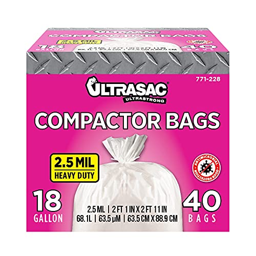
I use trash compactor bags. Make sure they are not scented.
I used these. https://www.amazon.com/dp/B00DH4J25U/ref=cm_sw_r_cp_apap_R628cWZn5gmwK
I put one in the bottom of my pack and then stuff my sleeping bag in and some clothes. I close it up and then put in the rest of my stuff. I have a rain fly for my pack and I bring an extra trash compactor bag l.
I have one of these, and it has served me well through thousands of miles of backpacking and camping over the last decade and a half.
I recommend getting AllTrails. You can visit their website or download an app on your phone, it’ll tell you just about all the trails near your area. Also it’ll give you directions to the trail. Here’s the link for Pinnacle Overlook on AllTrails. Check out this trail on AllTrails.
General directions would be to get onto 61 towards Port Clinton. Depending on the direction you’re coming you’ll either be making a left or a right onto Mountajn Rd. it’s right near the bridge over the river in Port Clinton and somewhat follows the river. You’ll stay on Mountain Rd. Until you can turn left onto reservoir rd. Which will take you to the Hamburg reservoir. There’s a gravel parking lot for those using the trail. From there you can walk up the gate gravel path, where eventually you’ll start seeing white blazes for the Appalachian trail.
There are a number trails in the State Park and we combined several for a 7 mile hike. Afterwards we drove to the Ridenour and Hawn's Overlooks for pictures of the dam. Here's our hike route: https://www.alltrails.com/explore/recording/trough-creek-5-sites-loop-cf77e1f
With the short distance, the super accessible location, and the beauty and variety of the forest, I was blown away that I was the only one there in the late morning on a perfect Saturday. https://www.alltrails.com/trail/us/pennsylvania/sawmill-trail--2
I totally understand the budget thing. But speaking of the stove, you can get a super cheap, super light stove. Like this one, which I have and works great (all you need is a gas canister) or this one, which is a favorite of r/ultralight.
Definitely with the little things it is easier to stay within a budget while going light. I understand that the sleep system and such is expensive to cut weight in, I haven't gone with an ultralight sleep system yet for that reason too!
This looks really great...I haven't really done any hiking in the Harrisburg area, and my work partnered up to help fundraise for the Kittatinny Ridge so I'd like to check it out.
Did you have a preference for the east or west side of the river? My dog is 7 and does great on 5-6 mile day hikes but I'm not sure how she'll handle 16 miles in 2 days, especially with the steep climbs.
May put this one to the top of the list, unless you've got another recommendation, thanks!
Basically referring to this, west of the river: https://www.alltrails.com/explore/trail/us/pennsylvania/appalachian-trail-peters-mountain-to-cove-mountain-shelter-to-pa-850?mobileMap=false&ref=sidebar-view-full-map
There is also a shelter located on top of Blue Mountain, but it isn't shown on this particular route. You can hike to that shelter from the parking area on Trindle Road.
Nice man. check out this tick spray it's really solid and won't ruin clothing. Ticks fall off dead when they get on your clothing.