
What are
/r/PNWhiking's
favorite Products & Services?
From 3.5 billion Reddit comments
The most popular Products mentioned in /r/PNWhiking:


The most popular Services mentioned in /r/PNWhiking:
AllTrails
DuckDuckGo
OpenStreetMap
The most popular Android Apps mentioned in /r/PNWhiking:
The most popular reviews in /r/PNWhiking:
I like to use the BenchMap app for this sort of thing (https://play.google.com/store/apps/details?id=com.tsqmadness.bmmaps)
Doesn't look like there's one on the highest point of the lip, but a handful of them around http://i.imgur.com/bS74jIJ.jpg
Edit: this->thing
It is a very concerning pattern indeed. Summer of 2019 I took a quick first time trip to Alaska, only to find it had record breaking heat and was on fire. It was hearbreaking.
Here’s a good book that may help with the dread.
If you are doing the Loowit - June Lake, South Fork Toutle, and Plains of Abraham are pretty popular camping sites. But, you are allowed to camp anywhere near the trail except in the blast zone. Make sure you carry plenty of water, there aren't a ton of water sources this time of year.
https://www.alltrails.com/trail/us/washington/loowit-loop-trail
Latourell Falls is an awesome nearby hike. It’s a 2 mile, moderate loop with two waterfalls, sounds of a creek, and a viewpoint overlooking the gorge. It’s one of my very favorites and not as hard as Angel’s rest or as crowded as Bridal Veil nearby.
The best way to use canisters in the snow is using a stove that has a preheat loop where you can invert the canister and push liquid fuel. Or get canisters that are a propane / butane mix. The jetboil branded canisters are a mix, MSR is a mix, and Coleman is a mix.
That said, warming the canister is smart. Know that the propane will burn off faster in cold temps leaving you with a butane canister eventually. :)
For a simple and fairly cheap remote stove with a preheat loop, check out the Kovea Spider - amazon
Good luck! Hiking, Skiing, or Snowshoeing in the cascades is AWESOME.
Maybe Lower Lena lake. It’s on the Olympic peninsula and a quick search on All Trails sounds like the snow is very minimal. It’s a nice in and back hike All Trails link
Look at AllTrails and WTA they have hikers leave useful information there. Latest information was around Feb 9 on All Trails. https://www.alltrails.com/trail/us/washington/melmont-ghost-town-via-foothills-trail
Cool Creek to Devils Peak Lookout is a really good, steep hike. The top has snow at this time of year but come April, it’s a great hike with amazing views.
https://www.alltrails.com/trail/us/oregon/cool-creek-trail-to-devils-peak
I really like Oyster Dome for an all-seasons hike. It's up near Bellingham. There are two trailheads - I'd recommend the lower trailhead on Chuckanut Drive if you have a lower clearance vehicle. It's beautiful! Even in the rain! https://www.alltrails.com/trail/us/washington/oyster-dome-trail
It's a little outside your range but my wife and I are going to do some hike in camping at this spot for NYE tomorrow night. We'll be traveling there in our Ford Focus.
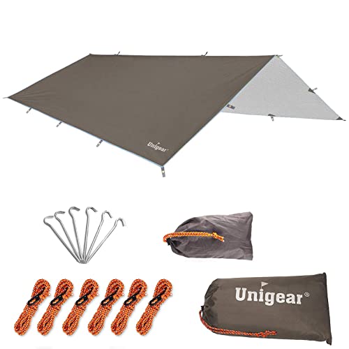
100% I would not even think about doing an Olympic trip without bringing a tarp. Something like this is enough to give you some space to hangout/cook/party (I don't know about this particular brand, just giving you an idea of what would be useful - a small backing tarp). https://www.amazon.com/Unigear-Waterproof-Protection-Lightweight-Backpacking/dp/B071VDVR2W/ref=sr_1_6?crid=394RIX6H0YGHX&keywords=lightweight+tarp&qid=1652908795&sprefix=lightweight+tarp%2Caps%2C385&sr=8-6
I’m a big fan of Black Diamond Alpine Pants.
I also like the flexibility and convenience of convertible pants, especially when I might be gaining and losing significant elevation and/or traipsing through wet underbrush some of the time.
I have a good rain shell coat from REI’s house brand. GoreTex really does do the job and can be refreshed when laundered properly (REI has a YouTube video on this).
As others have said, though, get out there in whatcha got, if it’s not going to make you uncomfortable or unsafe. See you on the trail!
Took my jetboil, hand grinder, and Aeropress with me when I headed up to the top of Round Mountain a couple weeks ago. Decent 1800ft gain over 2.7mi (each way) with incredible views at the top. Easy parking, with a well maintained Forest road to the trailhead.
Our friend group did Norse Peak last weekend and had great views of Rainier (photo from Alltrails, not my camera roll!) from the NE. You can also see Adams to the SW once you gain some more elevation. It took us ~2 hrs to get to the trailhead from Cap Hill.
The road is closed 2 miles from the trail head. I would keep checking on alltrails to see what people are saying about the trail. My guess its going to be almost ready for next month. Some parts of the trail are still covered in snow.
​
https://www.alltrails.com/explore/trail/us/washington/cascade-pass-and-sahale-arm-trail--2
The Enchanted Valley hike is a great experience and seems to match your description.
I did the trip as my first solo backpacking experience a few years back (trip recording). My trip covered ~3.7k gain over 29 miles - it seems like it would be quite manageable for a 9 year old, but you can shorten the trip if you don't want to hike all the way into the Valley.
The route follows the Quinault River the entire way. I'm not sure about regulations regarding fishing, but barring any red tape, you'd have ample fishing spots here. I don't believe there are any restrictions on campfires, and I remember lighting a fire myself. I did see several black bears at a safe distance, so make sure to store any caught fish accordingly :)
I haven't done that many in the area, but recently went to Tuck and Robin lakes and it was awesome. It's recommended to have 4wd or drive reeeally slow and careful as we did, bc the last cca 5mi are a dusty bumpy road. The hike itself is not that intense if you've hiked some before. Ofc it's pretty much uphill. Easy to come on Friday eve after work, hike first ~3mi and camp. Get to the lakes the next day and make it down. Or camp near the lakes. It was beautiful and accessible. Would recommend again.
> You'd need permits for the trails in MRNP/ONP, which you might be able to get by walking in. The walk-in permits usually open up a day or two before the actual date (I'm not sure exactly. You'd have to look up the park website to find out).
Yep, I've got it on my to-dos to call the ranger office
> Glacier Peak Wilderness Loop
Is this the Spider Gap - Buck Creek Pass? I have it in mind...
> Alpine Lakes Wilderness - There's quite a of trails here that don't need pre-reserved permits.
> A section of the PCT
So I've spent a lot of time looking at these options, and have narrowed it down to either hiking up to Tank Lakes and hanging out/exploring up there for a couple days before the descent, or doing something like this loop
Thoughts? Tank Lakes in particular looks very interesting and fun. I'd love to do the full Tank Lakes High Route, but I have more or less zero route-finding experience.
> Goat Rocks Wilderness
Keep seeing this pop up, will inspect.
Thanks!
one of my favorite hikes up in the North Cascades would be Hidden Lake Lookout. There is an old fire lookout at the top that is maintained by volunteers and you can sleep in it. First come first serve, but it has some of the best views. I agree with others that you would want to cutout the Olympics. You might consider at least visiting Rainier visitor center area and then do your hikes in the North Cascades.
Have you used alltrails before? It's a pretty sweet site/app that has filters for hikes (you can search for a hike with specified mile range,what to see, etc.).
Last summer my cousin and I hiked part of the timberline trail [Mt Hood] to McNeil Point and it was magical. I bet doing the whole loop would be even better:
Personally, I'd love to go to Bend, Oregon and hike around 3 sisters and such. You should look into that area too.
1)This weekend looks warm and dry, shouldn't be an issue. Check out freshsat or another updated satellite for current imagery.
2)not sketchy at all. The main trails are busy enough. Even off trail I dont worry about any of that.
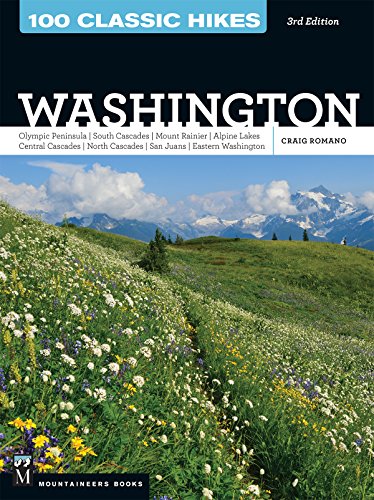
3) This book is a great guide. Do some homework, find something you like, and hike to it.
Pro tip: Walmart lets you charge your car free while shopping. Fred Meyer too. Perhaps only certain locations but I’ve seen them everywhere in WA except Renton Walmart.
Insurance: No one is paying me to tell you this. Get a cat cover ( https://www.amazon.com/Cat-Security-Catalytic-Converter-Protection/dp/B087D8ZSV8 ) to protect your catalytic converter.
PNW Hikes: Anything with a waterfall-go early. *Franklin falls is cool in fall and there’s a nice little train ride you can take (book ahead/take an Uber/have a beer).
*Bridal Veil Falls-pretty legit/easy hike (moderate but easy).
*Wallace Falls has terrible parking situation for anything after 10:00AM but nice little hike (I think it’s easy (there’s probably a rating guide somewhere) but we just did Camelback Mountain (Echo Canyon Trail) in Phx/Scottsdale AZ)).
By the way, the Prius fallacy is something to lookup (those engines take a long journey to get to the US and then aren’t recycled). Is it really better for the environment? Debatable. Js.
Ive used This One for years, Brought it to many elevations in many weather conditions. Never have had a problem, never leaks, and still works today.
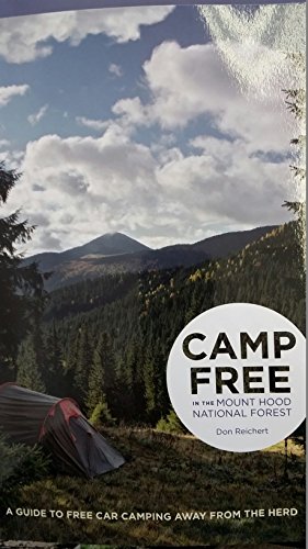
This guidebook would be a good place to start:
https://www.amazon.com/Backpacking-Washington-Volcanic-Rainforest-Valleys/dp/0899978568
Your local library might be able to interlibrary loan it for you as well. Several hikes in there are in the 50-90 mile range and it should give a good idea of your options.
The Spring/Manning books are still excellent. I like to keep multiple editions (for example) and compare what's missing/changed etc.
This book is my bible and is a must buy:
Can not go wrong with any of them
Geology, ecology, hiking. It doesn't take place exclusively in the PNW but it is written by an author from Seattle. It is really good, as you can guess by the rare amazon 5 star rating. If you like learning about how small impacts by man can affect ecology through history it's a great read.