
What is Reddit's opinion of
Avare?
From 3.5 billion Reddit comments
Popularity Score: 13
This app was mentioned in 17 comments, with an average of 1.94 upvotes
Best Comments
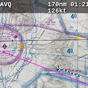
If you're an Android phone/tablet user there's "Avare" - a free nav app with free VFR charts, IFR stuff (I'm not an IFR pilot) airport diagrams etc. etc.
Not Foreflight, but it fits in your phone/tablet, works well and the price is right.
Avare, while clunky, I found to be sufficient for VFR flying. I only moved to Garmin Pilot after I got my instrument rating and found Avare to get in the way a bit.
But, if I were just flying VFR, I'd 100% go back to Avare. Once you "get it", it's perfectly fine.
Avare is free because it's open source.
https://play.google.com/store/apps/details?id=com.ds.avare&hl=en_US&gl=US
I use an app called Avare, it's intended for actual flight planning but it works well enough for me. You just need to DL the sectionals for the area you're going to be flying, which is done from within the app.
Link: https://play.google.com/store/apps/details?id=com.ds.avare&hl=en
I use Avare. It's a free EFB that gives quick access to all the FAA charts and sectionals. There is a plugin that lets you connect to FSX/P3D/X-Plane so you can display your position on all georeferenced charts (instrument approach plates and airport diagrams).
Almost everyone in /r/flying is an Apple fanboy, but don't let that get to you.
I've used Avare and it is both intuitive and functional. I've heard FltPlan Go is good too, but I cannot get past that awful name.
Avare for Android?
check this out - https://play.google.com/store/apps/details?id=com.ds.avare&hl=en
NOTE: I have not used the app, but heard good things about it. If you use it, please do share your opinion
I've used AvAre ($0; needs the helper to work with Stratux), FltPlan Go ($0), and DroidEFB (30 day full trial, $150/yr for georef'ed plates). (Links go to the Google Play store)
Of the free ones, I found AvAre to be better (FltPlan Go has some nice features like overlaying approach plates on the chart, but it has some quirks I didn't want to deal with, like needing to select the procedures to update on each update). I quite like DroidEFB, and their support has been very responsive whenever I had issues. Their engineering team is quite small AFAIK, so it can take a while for new features to get added.
Well, you get free charts with Avare. But I wonder if the EFB's will have to be updated more frequently too?
What is the reason you want to use Foreflight? E.g. would Avare work for you too? https://play.google.com/store/apps/details?id=com.ds.avare
Avare has on option to draw radius rings around your current position.
I signed up for the free student membership when I was doing primary training. I wanted to be able to read Flight Training magazine and have access to flight planning tools.
After getting my certificate, I bought a yearly membership so I could keep reading the magazine, get a cute little blue flight bag, and to hopefully have my interests represented in D.C. (third class medical reform was still in Congress, an issue which was important to me/a member of my family).
When my next renewal comes up, I don't know what I'll do. I don't use any of their tools now (I'm now using https://skyvector.com/, http://flightaware.com/, and Avare...oh and SkyDemon when I fly in Europe but that's kinda off the current topic). I still look at the magazines but they're not a primary source of info by any means (allow me to recommend /r/flying).
If they started making noise about discrimination against color deficient pilots, I'd probably become a hardcore AOPA supporter. I think the way it went down in Australia is pretty interesting (see http://www.cvdpa.com/).
Ok, so people have mentioned ForeFlight, Garmin Pilot, and generically geo-referenced diagrams/plates/maps/charts. All of these apps can be categorized as Electronic Flight Bags (EFBs).
Another popular, open-source Android EFB is Avare. It's clunky and kind of ugly, but it works.
Recently, people involved with the stratux project have forked Avare and have been showing it some much-needed love. Perhaps that would be a good place to start?
Here's mine:
Pants
Belt
Shoes
(I ride a motorcycle to the airport)
Sporty's SP-200 handheld radio. Purchased used from Goodwill
Flightcom 4DX Classic. Purchased from a local flea market, and repaired by myself.
This hunting headlamp. Purchased on closeout from woot!.
GPS capable Samsung Galaxy Tab 3 7.0 on FreedomPop, to run Avare. Purchased refurbished for $50, on a free plan for 500 MB/mo.
Nook Simple Touch with Glowlight, used for a checklist and rooted to run an HP 48G emulator. Also purchased from Goodwill.
An actual HP 48G. Stolen from my parents' house.
Do I get the prize for most eccentric? Maybe the most frugal?
I tried it, but really missed having my Avare on my tablet, but finally got it to work with an older Simconnect, since the Avare in/out software hasnt been updated yet. XCONN. This way, I have all my radio frequencies, and actual airspace restrictions in front of me, with airport charts, approach charts too, and updated NEXRAD overlay.
Avare : https://play.google.com/store/apps/details?id=com.ds.avare&hl=en_US
XCONN : https://www.pocketfms.com/2-DownUtility.asp
FSX SIMCONNECT: 3 different versions available https://www.pocketfms.com/2-DownUtility.asp