
What are
/r/BAbike's
favorite Products & Services?
From 3.5 billion Reddit comments
The most popular Products mentioned in /r/BAbike:


The most popular Services mentioned in /r/BAbike:
Ride With GPS
Strava
Komoot
MapMyRIDE
AllTrails
OfferUp
Bikemap
Google Groups
Animoto
Nextdoor
Trustpilot
Facebook Marketplace
Weather Underground
Medium
Scribd
The most popular reviews in /r/BAbike:
Also keep in mind that with all the mountains on the peninsula, you don't even have to drive.
This is one of my all time favorite rides. You can take the train to Redwood City and then ride to the start.
It can sometimes be difficult to find parking in Woodside on the weekend.
Not a rental recommendation, but a ride:
70 miles and as much elevation as you can find puts the summit of Mount Diablo in reach from Oakland. Here is a (randomly selected from Google) ride: https://ridewithgps.com/routes/32464245
In addition to what others have said about the basics (climb OLH, descend 84) and since you asked about La Honda, another popular spin on this route is to descend West 84, ascend West OLH (which is quite pretty) and then descend 84. Something like this: https://ridewithgps.com/routes/37922140
You can also descend to La Honda (the place) on 84 and climb back up West Alpine, but that's significantly longer and has less bang for the buck in terms of nice scenery vs. climbing effort.
Lots of bike theft in SF - get a top-of-the-line lock, register your bike and never leave it long on the street.
I'm in the South Bay - and love hitting the roads in the Santa Cruz Mountains. I only have a road bike (actually a hybrid). But ideally, I would also have a gravel bike.
For routes, ask this sub, try the routes recommended by Standford riders or try bikemap.
SF is often foggy and wet in the winter - but it will often be 10 - 20 degrees warmer outside of the city - and dryer - so, so long as you can get out of town, you can ride most days. We also get wide temperature swings - so have a range of clothes.
That Morgan Hill ride is a classic - especially if you're looking for a rare Bay Area ride with less climbing than the typical ~100ft/mile cumulative elevation profile
For another southbay ride, consider climbing Old Santa Cruz to Mount Charlie to Summit, ride the entire length of no centerline/narrow Summit and Skyline northwest, and descend Black Rd back to the reservoir: https://ridewithgps.com/routes/38105447
These are small roads with extremely little traffic.
Gist Rd is also a cute climb - a variation of the above is to only descend the top of Black, climb up Gist, and then return south on Skyline/Summit to Mount Charlie. Or you could climb Black and Gist to start the ride before heading south on Skyline.
Give this route a shot. Almost exactly 50 miles, about half as much elevation per mile than your "typical" fun Bay Area ride. The first ~7 miles aren't great in terms of traffic level (but at least there's a good bike lane); after that you rapidly get into rural farm country.
You can skip the detour into Morgan Hill between miles 17 and 24 if you don't need a mid-route pitstop to grab lunch/water.
Whats your start point in the city?
I load up my bike often and drive to either Orinda BART where there are a ton of Loop possibilities. Other times I drop down to Woodside which has a whole bunch of mountain routes. Both work well for me as I live next to 280 so its super fast to get to either place in the car.
City rides I look at in two different ways, super casual dgf or daily exercise. For super casual Ill ride Embarcadero, BallPark, Valencia street, any where that I know will be full of tourist and traffic and people.
For daily exercise I plan my routes around where there are less people, Lake Merced, Great Highway, down to South City and San Bruno mountain.
Check out my feed for city route inspiration.
How about something like this?
https://ridewithgps.com/routes/35048538
Basically, up OLH, down WOLH, to San Gregorio. Then up Tunitas, down Kings.
That route isn't quite a metric century, but hits some classic spots. You can detour for coffee or pastries on the way out or back for some extra miles if you really want the 100km.
Or OP can just ride down south, through Planet of the Aps, all the way past Pacifica, Half Moon Bay, and then climb Tunitas to Palo Alto to take Caltrain back to the city. If feeling adventurous, OP can easily extend riding miles by taking Cañada road, and then Sawyer Camp northbound, to Hillsborough and then down to Millbrae BART.
Kind of like this: https://ridewithgps.com/routes/206197?lang=en
Just did this route over the weekend. 64.9 miles total and starts from Woodside. You can always modify it to your needs like starting from Palo Alto and climb Sand Hill to get you to the start point. The ride itself is stunning as it takes you through redwoods, ocean views, gravel trails, and lakes. Definitely recommend it for your metric century needs.
It's Russian River area, I did this route. Water is a consideration if it's hot, there is a spigot / fountain somewhere at Ratna Ling retreat center. I realized it after my ride so can't give specifics as to where it is, but it's the perfect spot to refill bottles and slam some calories. Maybe someone else here can chime in on the specifics of the water there.
Otherwise it's a really great route. Bring your climbing legs, and be prepared for a loose interpretation of the term 'paved road' as the surface is poor most of the way. 10/10 views, highly recommend the ride.
I rode up the paved part, and saw the unpaved part of the road was closed for construction...this was in late November, so they likely done by now but may want to double check. probably for the best it was closed since I was on 26cs and wearing cleats lol.
I ended up doing this route the next day - was a big climb for me (not used to the grades; had to stop and stretch a few times) but otherwise a beautiful tour through wine country : https://ridewithgps.com/routes/27041240
have a BLAST.
I've ridden Mountain View -> Hicks -> Um -> Loma Prieta -> watsonville -> Monterey. It was recommended by a friend who lived near Loma Prieta, I didn't quite realize "how illegal" it was (e.g. I ride illegal downhill in UCSC/Pacifica and don't think twice, but here it's pretty obvious the locals don't want you here - think numerous no bikes signs, private rd., no trespassing, bullet holes in signs, etc.). Rumor has it it's very easy to get a ticket here too. That said, I don't regret that fence hop... But I wouldn't make a habit of it. Probably won't ever do it again, but glad I did it once. Weekday, solo.
It's absolutely fabulous gravel/dirt riding along Loma Prieta with views in both directions.
Here's an interesting read and there's a link to this ride which shows a route you could work from to set up a legal route. I'd do this route in a heartbeat.
Here's a route I made that I'm wanting to ride soon, as I too am wanting to bump my long rides up while minimizing climbs! A bit of an out and back lollipop loop through Fairfax, around the Nicasio Resevoir, and back. Highest elevation is only about 600ft. 65mi from south end of GGB.
The imgur you link to suggests that these t-shirts are for sale on shopjone dotcom, which is based in India. However it's also clear that your US side relationship is run by "gearlaunch"
Here is what people say about gearlaunch. Spoiler alert: It's not positive ://www.trustpilot.com/reviews/60607476f85d75087039d784
https://www.strava.com/routes/4465999 - here you go! I based some sections on https://www.strava.com/activities/sf2g-eric-s-bayshore-express-528-188507 because I have never done the MTV-84 section directly. I used to the Willow & 84 route north about once a week when I commuted from PA to SF.
A couple notes - I made a few mistakes that a bug won't let me fix without re-doing the route from new. So, accidental loop at Amphitheatre & Charleston in Mountain View, accidental loop at 84 & Willow, puts you on the sidewalk on Twin Dolphin. Standard warning: if it looks wrong, trust your judgement.
Yeah, Strava routes can be exported. Won't do turn by turn though. I've done it with a 500 and it's good enough to get by without turn-by-turn.
A couple modifications people do:
- Feral Cat Freeway (FCF) is the path around Foster City. It's nice, can be windy. (Morning Yawyabs more often than not are into the wind)
- Some people take Tunnel to 3rd St/Bayshore instead of going around Candlestick. I found the traffic on 3rd, while I was going uphill, more stressful than it was worth. Not going around Candlestick is an easy way to lop off some distance if you don't find 3rd there stressful.
- There are a bunch of other little variations on this, everyone's got their stretch that they like road A vs road/bike path B.
Yep, just keep climbing up Alpine instead of turning right on Portola at Robert's Market. It's a really easy out-and-back if you're dipping a toe into steeper rides
I highly recommend Planet of the Apes. It's an abandoned road from the days before freeways that has regressed into a dirt trail. It goes from the Taco Bell in Pacifica over the hill into Montara, completely circumventing Devil's Slide.
Here's the specific route as well as an overview of the entire ride from SF to Pescadero
Strava has some good route suggestions, though may are on the longer side.
https://www.strava.com/local/us/san-francisco/cycling/routes
The butterlap could be exactly what you want, at 19 miles staying in the city:
https://www.strava.com/local/us/san-francisco/cycling/routes/599
Or as others have said cross the Golden Gate bridge to and take a ferry back.
I had this link saved for some time but never done the rides yet. https://ridewithgps.com/ambassadors/47-wine-country-bikes
You can always stop by Russian River brewing co on your way back to make the drive worth it though, hahaha
Here’s the loop route we have taken in previous years as part of our spring ride series, starting and ending at Pleasant Hill BART: https://ridewithgps.com/routes/17041829.
It’s about 40 miles and 4000 feet of climbing if you go all the way to the top of Mt Diablo, or 31 miles and 2400 feet of climbing if you go straight from Southgate Rd to Northgate at the junction without heading to the summit. It’s a great ride either way, and keep in mind that the last 1000 after the junction gets even steeper.
Also, this time of year it can get very cold and windy on Mt Diablo, even if it’s warm in the surrounding area. So make sure to pack extra layers, full finger gloves, and a windbreaker if you are headed up there, as the long descent can get very uncomfortable and even dangerous without the right gear.
On the descent make sure to manage your speed and look out for oncoming drivers who might cross over the center line through the blind curves. Going up in the early morning is the best way to beat most of the traffic.
Had a small back up battery that I was carrying but that was dead. I was using ridewithgps for turn by turn directions (https://ridewithgps.com/routes/32039649) which was probably the drain on the battery. Wife was at the top of Resurrection and had a larger back up battery so when I got to the top I took hers. For the record - had I just used my Garmin, it was down to only 65% by the end.
No need to risk getting in a car accident to get to the trail. Ride your bike. If the trail is too far, don't go. Parks are getting closed due to overcrowding because people aren't staying in their neighborhood.
Here's a video from the city encouraging you to stay in your neighborhood to keep parks open
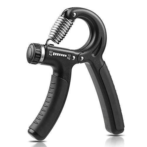
First, go as slow as you like. As for the hand pain, I assume your tired from the long sustained braking. Improve your grip strength. Doing some dead hangs every day or using a grip strength trainer helps. I have a pullup bar at home and use it for pullups and dead hangs.
- nope
- lights, helmet~~, did it come with pedals? (fairly common for road bikes not to come with pedals)~~. I like a saddle bag, something like this to keep a spare tube and tire levers in just in case. Pump. Water bottle.
58 will probably probably be a little big, but probably fine for you (for ref I ride a 58 at 6'7", it's definitely too small but I get on fine).
Maintenance, ask the shop if they have a discount for the first x months after purchase (sports basement do free for first 6 months I think).
Basic home maintenance though - CLEAN (and lube) YOUR CHAIN! Make sure you've got enough air in tires, and for anything more complicated hit youtube. GCN (and GCN tech) have a million bike maintenance vids (ignore the product placement/ads - the main content still good I think.
One more thing- google/youtube how to set the bike up to fit you, there are a ton of guides online and having the bars/seat etc in the right spot for you will make a big difference.
Enjoy the new bike!
edit - just looked it up, seems to come with pedals.
I was there for that! It was a comment on a bike tag, which has long since passed so I guess i can share what was shared with me. I haven’t tried it yet, actually rode the road section 2 weeks ago and it wasn’t bad at 7 AM on Saturday. But the alternative courtesy of u/lunchWithNewts:
Follow red trail to pedro point headlands parking area, then dotted path down to devil’s slide. Units trail out of Ace Hardware parking is single track, steep in sections and maybe muddy with fog drip, but is a gentle old dirt road after that.
https://www.alltrails.com/trail/us/california/ace-trail-to-pedro-point-loop
Not Palo Alto - but if you are willing to start near Morgan Hill, this is a nice ride - 50 miles, about 2000 ft elevation, most of it on lovely country roads with little or no traffic. The last 10 miles is on a bigger road - but it has a bike lane:
u/boo_baup not sure why I can’t respond to your comment on the new route (it’s locked!) but yes, that new ride includes the most stunning section of hawk hill. the climb is great, with a bike lane for the first half and relatively little traffic for the last, and incredible views. but the descent, where it’s one lane with you and almost no cars, is totally unique. be careful at the very top, it’s steep AF and the turns are tight and a little off camber here or there. turns 3,4, and 5 on the descent also sometimes have a bit of gravel, pick your line carefully. but it’s amazing, world class, not to be missed. it’s also very very nicely paved.
the modified route which does the hawk hill / valley -> tunnel loop and then paradise is nice. if you’re feeling more energetic, there are several routes up and over the coastal hills/mountains that aren’t dirt. they’re all much longer climbs, some with more traffic, but pretty epic in their own way. you can ride the bridge, then the coast, then a redwood forest, then rolling grassland, all in a few hours. LMK if you want to see some routes, many of which are suggested above.
also, I would not take that route through the city. the presidio is a beautiful start to your ride, is closed to cars in many places, and doesn’t add much distance. I’d suggest sutter-> polk -> pacific -> Steiner -> clay -> arguello one way, and along the waterfront on the other way. as noted by others, DO NOT ride on van ness. it’s a total mess, not safe or pleasant right now.
here’s a RWGPS link if you like. 56 miles. https://ridewithgps.com/routes/37476336
This is a pretty good ride. The Paradise Loop (out to Tiburon and and back) is a real classic.
If you're feeling strong, might I suggest this climb up to the top of Tam? It's closer to 50 miles than 40, but it's worth it.
The bulk of the climb is a fire road, but it's a very gentle climb - I've done it on a bike with 25mm tires and rim brakes. And the descent along Ridgecrest/Pantoll/Panoramic is one of the prettiest descents in the bay area.
My only experience in that area is joining the Strawberry Fields Forever century. It might help with some ideas:
https://ridewithgps.com/routes/29637644
Strava Heatmaps also show that many folks just ride Soquel
https://www.strava.com/heatmap#14.52/-121.90854/36.97633/hot/ride
I've done almost all my riding so far in Marin County. Check out the Headlands Loop starting at the roundabout on Hawk Hill for a great pre- or post-work ride, or some of the "hotter" routes on the Heat Map in Marin. Fortunately given the terrain and national park status means there aren't an overwhelming number of routes to choose from, but they're all pretty epic compared to Toronto. If you're feeling homesick head out to the Great Highway by Ocean Beach if you're looking for something flat and fast. I haven't yet been south or east bay but there's supposed to be good stuff out there too... I just haven't gotten tired of Marin yet.
I just mapped out this double crown that I am planning to ride soon. This covers just Diablo and Hamilton, and starts and ends at train stations. 122 miles, 12,000 ft of elevation. RideWithGPS has a bunch of triple crown options. This one starts and ends at Caltrain Stations. Some psychos have done the quadruple crown by adding Umunhum.
Not from that area, but Eureka Canyon (and Hazel Dell) has always been part of the annual Strawberry Fields Century, and I've joined friends on that several times. Maybe the many cyclists scared cars away or slowed them down, or it was too early, but even on Sunday AM it was always pleasant in terms of traffic. Mt. Madonna Road to Pole Line was also my "bonus climb" near the end of the day if I was more fit and had to wait for friends. It was also pleasant on a Sunday afternoon, but steep.
Bummer.
I have a friend staying with me with me this weekend, then flys permanently to Hawaii, so basically only chance to do this with him is this weekend.
looking at current forecast, looks like rain should stop around Wednesday
So hopefully we can still have some fun...looking at the trail map, looks like half of main loop is on paved roads?
Also, in general, would our gear still be there if we left them at the campsite and went biking around CC?
Yup, I've done SF to Oakland via that route. OP, congrats, well done. That's great route-building, and a great ride. Also, if you started from near your house, you and I are neighbors.
Edit: my route was the Carquinez bridge, not the Benicia
This is great advice here... the only other thing I might add is to suggest starting at a flatter starting point to give your body a chance to warm up before hitting elevation right away. For example, Cataldi Park is a good starting point that allows you to get a 5-10 minute warm-up before hitting the climb right away.
Here's a route sheet you can use: https://ridewithgps.com/routes/13193498
I found this one on Reddit a while ago. Made some modifications, have yet to ride it. Hopefully sometime this year 3 Bridges Loop
I asked San Jose DOT if the current repaving project includes protected bike lanes, and they had this to say:
> Yes, from Oakland Road to Capitol Ave. Buffered bike lanes should go in by the end of October. The protected elements will be installed once a vendor bid is finalized. Protected bike lanes aren't feasible between Capitol and Piedmont
So it sounds like they're intending to follow the Better Bike Plan 2025 during their current round of paving. I've asked a follow-up on if the project includes any design changes at intersections.
Riding around parts of SF (or Seattle or Portland) it’s unfortunately not uncommon to see people chopping bikes apart on the side walk or alleys.
I personally had wheels & parts stolen when I had a shared garage that was broken into, frame stayed as they didn’t succeed in getting through the u lock. My wife’s bike was stolen out of her secure lot before we moved in together.
Since then I’ve opted to store my bikes in the apartment. Feedback sports makes a great freestanding bike rack.
It’s not uncommon to hear about garage break ins in my area on nextdoor.
Generally advice I’ve been given is don’t ride your nice bike as a commuter in the city, which is easier said than done.
I opt for double u-lock and cable for parking and don’t leave it out of sight for any extended period of time around town. I aim for more annoying than the bike locked next to mine.
I opted for these lights that are going to require some disassembly to remove that I’m happy with.
https://www.amazon.com/dp/B00K09V2WG/ref=cm_sw_r_cp_awdb_imm_P9QC16DP0RRQ051TJ8KE
I once read that most bike accidents are from being hit from behind. So I would put one under my seat. I actually bought one of these and got an older gopro off CL for cheap. Works perfectly during daylight. http://www.amazon.com/K-EDGE-Saddle-Mount-GoPro-K13-430/dp/B005YVTJS4/
I later also bought the handlebar mount by the same company and it works perfectly too.
This is a great idea and I do this in the headlands a lot! You're getting a lot of haters here but probably because the crowd is more into just riding and driving to things.
There are definitely spots to lock up, at least a road sign within 500ft of every trailhead. With a cheaper e-bike+airtag I wouldn't worry about theft. For the clothes aspect you could try getting some sort of thick stuff-sack and then tie a lock or cable lock like the otto-lock around it. Or get something with a zipper and use a lock on the zipper and then lock that to your bike somehow. Might just be easier to take your clothes with you in a bag. You could also secure something like this box to a rack with hose clamps: https://www.amazon.com/Urban-August-Combination-Keyed-Lockbox/dp/B09K2HBHJ6/ref=sr\_1\_7?crid=1CHUXUUMSYT0W&keywords=locking+box+plastic&qid=1665120680&sprefix=locking+box+plast%2Caps%2C298&sr=8-7
I've been perfectly satisfied buying cheap chinese LED lights via Amazon, all in the $12-20 range.
Here (1, 2 - for the second, we have both the front and rear lights) are a couple I currently have on bikes in my household. On my road bike I have more expensive lights (Garmin Varia radar in the back and a much brighter LED option in the front), but I've found these cheaper options to be perfectly great for most things.
They don’t sell the one I ordered anymore, but I’m sure this is the same thing: https://smile.amazon.com/dp/B07HF3NJTP/
You’ll need to cut on side of the plastic to get the belt in, it’s not hard (a rotary tool makes it very quick). Great to keep them from wriggling their arms out.
You would be best served if you plan your rides ahead of time (which I think you already do in your mind?) on cycling specific apps such as ridewithgps.com or https://www.strava.com/routes both of which are free and I believe both also help you print cue sheets or guide you via the app during the ride. I'd focus on those and not use driving aimed apps like Google or Apple Maps on cycling rides!
Somebody mapped out a route here. 200 miles, 19,700 ft of climbing. The closest I've come to this was the Death Ride, and that was 55 miles shorter with only 15,000 ft of vertical. And it took all day.
Here's a much better route thanks to /u/lojic pointing out that some of the EBMUD trails do allow bikes. There's a few options for getting from Kennedy Grove to Sobrante Ridge and I just arbitrarily picked one that I've ridden before; it may not be the best one. Note that the map makes it look like you can go further in Kennedy Grove before exiting to Hillside Drive, but that exit road is currently closed.
This route goes right by Fernandez Ranch but drops back down to Alhambra Valley Rd instead of going in, but going through Fernandez Ranch instead would be a great option too.
This isn't going to work as-is but is the general idea. I'm pretty sure everything up to Christie works, although you might need to take a different exit from the residential area (there's a bunch of options that might work). I know there's a route from Christie to Franklin Canyon Road, but not if the specific one marked there is it. Once on FCR the dirt trails are optional and you can just follow FCR if it turns out you can't get into Dutra Ranch.
I would not ride Sloat. The only reason that bike lane there is to make that street narrower after they lowered the speed limit after a teen was killed by a drunk driver when crossing the street. Take take Vicente or Ocean. Either one is going to be more pleasant. Vicente will help you avoid the mess at St Francis Circle where 5 or 6 streets intersect.
Also I would prefer to ride the opposite way. Going from Market towards Fisherman's Wharf only has T intersections so it is more pleasant. Going from FW towards Market has a lot of intersections and a lot of right turn lanes that open on your right and then you have to exchange sides - I find it really stressful.
Near the 11 mark, there is no bike path that goes through along your line. You're going to encounter a bunch of stairs over there. You could bike it like this. Then continue straight through VA or go around the north side of the VA campus. Then take the path at the end of Fort Miley 7 down towards the USS San Francisco memorial.
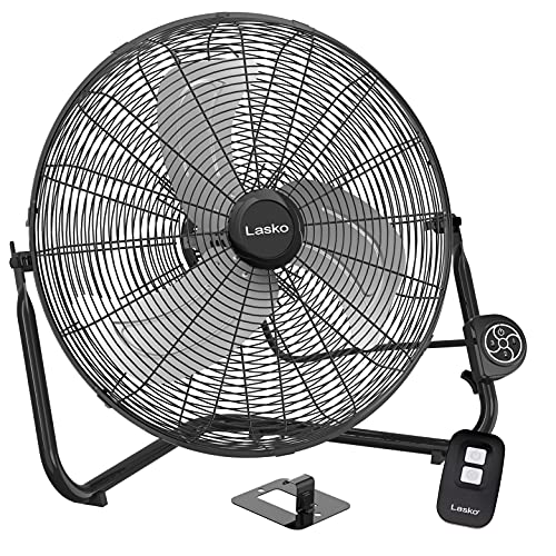
That’s fair. The headwind is cool, but quite pricey! You could try something like this https://www.amazon.com/Lasko-H20660-All-Metal-Commercial-Electric/dp/B081HDXB41/ref=mp_s_a_1_6?keywords=lasko+fan+remote&qid=1643777911&sr=8-6
My bicycle poncho showed up the day after the rains in SF stopped, so tbd. ;) I saw someone with a more expensive version of the one I got and he confirmed that the “over the handlebars” style kept him remarkably dry, legs and all. Looking forward to trying it. https://www.amazon.com/dp/B0894LTMRW
The East Bay Bus Rapid Transit (BRT) project includes bike lanes on parts of E 12th Street (Lake Merritt to 14th Ave connecting to the existing bike lanes) and on International/E 14th Street (53rd Ave to 81st Ave). The bike lanes are pretty basic, as this is primarily a transit project, but between that and the bus-only lanes and boarding islands on E 12th and International I think it will be transformative for that corridor and make the whole area much safer for biking and walking. The rapid buses will also have interior bike storage and 5-minute headways between buses, so taking a bike on the BRT will probably be an even better option than biking on the improved International Blvd.
This project is fully approved, funded, and bid out to a contractor, so all that needs to happen at this point is for the thing to be built, which will happen in phases mostly between 2016 and 2017. Some of this work is already underway, but it is a big project and will take a while.
I put the lane striping schematics online at the link below to view or download, in case anyone is interested in checking them out. Please note that these plans are a bit old and some changes, mostly improvements to keep the bike lanes more continuous, may have been implemented since: https://www.scribd.com/doc/290423409/East-Bay-BRT-striping-schematics-Oakland-and-San-Leandro
Los Gatos Creek Trail to St. Joe’s Hill:
https://www.alltrails.com/trail/us/california/los-gatos-creek-trail-to-saint-josephs-hill
and Kennedy Trail:
https://www.mtbproject.com/trail/7015874/kennedy-trail
Great Views and easy technical riding on both routes.
You might try Spine's trail, but I think it's just as steep. Here is a good map: https://www.alltrails.com/explore/trail/us/california/french-trail-gods-and-spine-trail-sullys?ref=sidebar-view-full-map
> Are you in the city? What's your favorite route(s) so far? I've only really done GGP, twin peaks, great highway. Building up the base/guts to do GGB / Hawk Hill.
I'm out in the East Bay and relatively new to road cycling (was a mtbiker before this, still am). I've been mostly riding in my local area since the weather has been really pleasant. Tons of great route in the Tri-Valley area. Here are just some of the rides I've done in the last 2 months: https://ridewithgps.com/users/1042735
I did Tam on Thanksgiving.
https://ridewithgps.com/trips/79077412
Thinking Highway 1 to Tunitas and back to the city for Christmas.
Like this, but on the road instead of gravel. https://ridewithgps.com/routes/38094837
Here's a ride I did recently: https://ridewithgps.com/routes/38022325
I used bart to complete the loop because I was gassed, it'd been awhile since I rode. There's still some time spent around cars, but from Fremont Bart to Dumbarton you're following an official bike route (road painted and street signs). Not a segregated trail, but I did it on a weekend and it was mostly very quiet. As was the stretch from Fremont Blvd to Warm Springs Bart.
Here's OSCH and some surrounding roads, it's what I did on Sunday: https://ridewithgps.com/routes/37922868
Note that the ~1.5mi stretch between Los Gatos and the Lexington Reservoir is gravel - there's no way to avoid this if you're coming in from Los Gatos. There are some parking lots on the east side of the reservoir if you'd rather start there and avoid the gravel.
Ditto for the ~0.5mi chunk of gravel on the west side of the reservoir - there's no way to avoid that gravel if you're returning on the west side of the reservoir. You could always return back on the east side, however.
Near the top of OSCH, if you're heading west rather than just turning around and going back down, I like to turn right and climb Mt. Charlie for the last 3/4 of a mile to Summit. It starts off with a bit of a steep kicker, but there aren't good shoulders on Summit between the top of OSCH and 17. On the other hand, if you're just going to turn around at the top (or ride further east on Summit!), just take OSCH all the way up.
The route includes a big out&back after reaching Summit - the entire length of narrow, no-centerline Summit and Skyline. There's very little traffic along that stretch and it's incredibly pretty; it's one of my favorite roads in the bay area.
As routed, the ride descends the top half of Black and then climbs Gist back up to Skyline. Gist is steep, but a pretty unique Santa Cruz mountain road - there are some impressive terraced switchbacks. But if you aren't an experienced climber, you're probably not going to opt for that on your first ride in the area...
Instead of returning all the way back to OSCH on Skyline and Summit (but if you've ridden all the way out to the top of Black, it's mostly downhill on the way back...), you could shorten the ride by descending straight back to the reservoir on Black Rd or Bear Creek.
That's a ton of territory with a lot of good riding
On the north end, ride up Alpine Rd to the trailhead for Alpine Trail. The trail used to be a road and is generally pretty well graded, although there are a few sections that washed out years ago and have been bypassed with steeper singletrack. Along Alpine Trail, there are three exits to the right: First, Crazy Pete's trail - this is pretty chill, although the final pavement climbout at the top to Skyline is steep. Second, Cloud's Rest - STEEP; not my favorite. Third, Meadow Trail - overall pretty easy but some fun short technical climbs. Or you can just keep following Alpine all the way to near the top of Page Mill (easiest). Climbing any of these gives you easy access to Russian Ridge, Montebello, and Skyline Ridge preserves, all of which have great riding for gravel bikes. There are also tons of good trails heading south along Skyline through Long Ridge Preserve and Saratoga Gap to Sanborn County Park.
This is a favorite chill afternoon spin - I used to do this route on 40-45mm slicks, no sweat. This is a much longer and more punishing version of the ride.
Further south, you can climb up Steven's Canyon Rd in Cupertino. The road turns into a trail and very gently climbs straight into the bottom of Montebello Preserve, or you can cut left midway up the trail and climb steeper up Grizzly Flat straight to Long Ridge Preserve. Or rather than the trail, you could climb (steep) pavement up Montebello Road and connect on gravel over the top of Black Mountain into the very top of Montebello Preseve.
Even further south, you can climb up John Nicholas Trail in Sanborn County Park up to the south end of the Skyline Ridge Trail.
If you can tell us how much distance you want to do, I could offer up some more specific routes.
oooh definitely. i'd actually do washington though. lake is a slow street, washington is closed to cars past arguello. nice little ride.
i updated the route:
personally i'd agree with the west side approach, although i hate about 1 mile of it through daly city.
here's the route i'd take. the part within SF around lake merced, up the great highway, through the park, and then to the end of the panhandle and over to fulton is a route i do several times a week. great highway is open to cars again on the weekdays, which is a bummer, but it's still a nice easy ride. once you get to the end of the panhandle some will suggest the wiggle and then up market street; i prefer fulton and polk and then up post, even though post has no bike lanes at all. for me it's not worth crossing market twice to get to union square from the civic center.
I've done the inland route several times. It's a fantastic alternative to Highway 1. Here's the route we took from Berryessa BART to Santa Barbara in March: https://ridewithgps.com/routes/35352473
Personally I prefer the inland route in the spring when things are green, and the wildflowers are out. In the fall, you'll want to make sure the temperatures are doable and the air is breathable.
From Solvang, you can take the Amtrak bus back to the Bay Area: you can store your bikes for free in the bus's luggage compartment. Happy to talk more about specifics if you're interested!
I have a set of "windstopper" tights, which is a material that stops wind but allows moisture to escape. They are considerably warmer than regular spandex.
I often wear a jacket I got off Amazon, which is designed for bicycling, has plenty of pockets and zips full open and closed for cold and hot day. I gave up "stylish" for "I bet you see me now, and comfortable" long ago.
​
I have read that there are some "steal" to be had on offerup.com
There prob plenty of option if you just need something for transit from beater bikes on amazon, bikedirect , or even a cheap ebike or escooter
here's a longer version of this ride (though missing the park section, easily added back in) that I do all the time. Great loop for seeing the city. Go counter-clockwise, though - hardest hill is the long, steady Sloat to a few steep blocks of Monterey.
I like to go both up and down the more northerly part of the loop, up Miller to the end, left on Throckmorton, etc, but I'm a timid descender. It goes on very quiet streets, and never gets terribly steep except right near the summit. My main riding partner prefers to go up the northerly part of the loop, and down the southerly part of the loop, continuing down Panoramic Highway at Four Corners, but he likes to go very fast. Bonus: there are bathrooms Old Mill Park, just at the start of the ascent.
https://ridewithgps.com/routes/1359604
It's not my route; I just borrowed the url.
I have no desire to ever do it, but my dad did it when it was part of the Triple Crown series. I think this is the route maybe it's still part of the Triple Crown events??
Heres what ive found on ridewithgps: https://ridewithgps.com/find/search?search%5Boffset%5D=0&search%5Bstart_distance%5D=50&search%5Bstart_location%5D=94501&search%5Bkeywords%5D=gravel&search%5Blength_min%5D=&search%5Blength_max%5D=&search%5Belevation_min%5D=&search%5Belevation_max%5D=&search%5Bsort_by%5D=
I haven't done it yet but I've created this one that starts in Castro Valley. It is around 9000 feet of climbing though.
I'd actually like to get others opinions on it since it would be my first century if I do this route.
Came here to also say RWGPS. The route search tool is pretty great: https://ridewithgps.com/find. I’ve had good success finding a base route that starts close to me which I can make tweaks to my liking. They recently added a heat map of commonly cycled roads and trails too which has been amazing to use.
1) Golden Gate Park. There are miles and miles and miles of good trails. Deeply underappreciated, and probably not anxiety inducing because there's no pressure when you're not miles away from the nearest road if stuff feels dicey.
2) Marin Headlands. You said "no fire roads" but baby steps, right? Here's a good Headlands Circuit that hits a lot of the fun stuff. There's some fun singletrack in here too - Dias Ridge dropping into Muir Beach and Coastal View Trail climbing out are both a real good time.
3) Russian Ridge. Some good, relatively easy singletrack. Also Montebello, Long Ridge, Saratoga Gap... lots of good stuff out there. Here's a pretty big day at Russian Ridge, starting from way down at the bottom in Coal Creek: https://ridewithgps.com/routes/34821856
You can use the last part of my SF to Oakland route, in reverse, obviously. I was trying to limit mileage and climbing, so my route through Crockett, San Pablo, Hercules and Richmond was chosen more for efficiency than aesthetics. If you don't mind the initial climb, you could start out with Spruce >> San Pablo Dam Rd >> Castro Ranch Rd >> Pinole Valley Rd, and then hook back up with this route. Not too many options for the rest of it, though, you pretty much have to do the Carquinez Bridge and then follow 29.
I did San Francisco to Oakland a couple of years ago. Here's the route. The Richmond Bridge bike path wasn't open then; now, you could do a full loop around the North Bay from either SF or the East Bay, which would be smaller than my route, overall.
100%. Riding around stanford/south bay beats driving, parking, and crossing the bridge.
OP how far do you want to go? Do the coastal classic. It's wonderful.
OP, if you're looking to knock off a century, an extra 28 miles isn't going to kill you! :)
SFR has wisely suspended all activities, but when they restart, look for a populaire. These are more social "recruitment" events catering to newbies and the interested. They're about 70 miles in length and generally not too hilly (don't want scare away the newbies, LOL). Here's one example. If you're in solid shape, you'll have no problem finishing a populaire with riders of similar capabilities, chatting the miles away. Remember, it's not a race, and the time limits are generous (averaging just above 10mph, stops included).
I’d say that the Hamilton loop is really awesome and one of the best of the bay. There are so few stop lights. Once you combat Hamilton and a bit of climbing on the other side, it’s slightly downhill with no stopping for so long! And the climb back up and calaveras is really nice
https://ridewithgps.com/routes/1838070?lang=en
It’s best done with friends because the backside of Hamilton is pretty “off the grid” It also can be hot so it’s getting to a good time of year to do it.
I just got back from an overnight bikepacking trip from El Cerrito over to Pantoll campground in Mt Tamalpais state park. The campground was really nice, had clean bathrooms and was well maintained. There is a hike and bike spot open for folks on bikes too in case it gets full.
I was able to piece together some nice (and never ridden before to me) fire roads on both days which made it feel more adventurous. There was also plenty of civilization nearby for restocking water or getting food. Water was really tricky since all of my planned resupply points had it turned off at parks. The trip was about 90 miles total and 9k feet of climbing over two days.
Here are my route from El Cerrito over the Richmond bridge: https://ridewithgps.com/routes/34434523
Some photos as well: https://imgur.com/a/aYulnwN
Here is a premise one, but it includes going to the Mt. Diablo summit. It’s a great ride up if you want to, but you can just cruise through the junction to Walnut Creek if you don’t. https://ridewithgps.com/routes/5083139
Here is the Bicyclean map that was sent out on June. I don't personally know how up to date it is.
Certainly I feel more useful picking up trash on some of my local climbs than on major roadways.
Ride down to San Mateo / Palo Alto / SJ via Skyline, Sawyer Camp, Cañada - bail at Crystal Springs or Sand Hill Rd
Pt. Reyes Station / Nicasio Loop (73mi) - https://ridewithgps.com/routes/1770391
BIG ride would be climb up to Four Corners via Mill Valley, then ride to Highway 1 and north up to Pt. Reyes Station, then loop back. Highway 1 north of Stinson has hills that aren't quite rollers, tho.
I also know folks who've ridden Alpine Dam / Seven Sisters fixed.
Water is scarce, and none of the water sources in the park are potable. Pack in enough water for your whole trip if it's your first time, and bring a way to filter water. I highly recommend buying the Pine Ridge Association trail map at HQ - it's highly detailed and has locations of all of the springs within the park.
Coe is a real rollercoaster. Bring your gears and your legs.
One of my favorite chill overnighters is to start at Hunting Hollow and do a loop out to Mississippi Lake and back. You can also go and camp on top of Bear Mountain if you prefer the big views up top - and if you do that, rather than coming back via the route in the link, there's always the option to drop down the (steep!) west face of Bear Mountain into the center of the park, ride through The Narrows for a bit, and then climb over Mahoney Meadows to head home.
I rode from SFO to Oakland a few years ago, and worked out the best available route from Petaluma to Vallejo if you want to avoid 37, which I did. For future reference, here's the gpx that shows that route.
Here's a nice route from near the Lexington Reservoir out to Boulder Creek that I rode a couple of weeks ago. Some really nice, quiet roads and the descent down Big Basin Way is beautiful.
https://ridewithgps.com/trips/49470456
45 miles down and back to Burlingame, extending another 20 would be easy.
41 miles one way to Google from the Mission
This is always fun too, cause you can stop at the airport and use the restroom.
Marshall Wall is my standard Marin century starting in SF. It's beautiful. https://ridewithgps.com/routes/2549126
You can break it up every 20 miles or so by stopping in Fairfax for breakfast sandwich at Perry's Deli, then rest and refill bottles at the lake at French Marin Cheeae Factory, get the big climb in for the day getting over the wall into Marshall, and keep your eyes peeled for blackberry bushes whole descending, then lunch in Pt Reyes Station, and a final stop again at Perry's in Fairfax for ice cream before the final 20 miles home. Great day.
I don't know about "reasonable" but several area bike shops offer demos for around $100 / day. There are others, but Mike's Bikes is a California chain that does this http://mikesbikes.com/about/bike-demos-at-mikes-pg900.htm
As for routes: so many options and so little time :-)
From the east side of SJC airport I recommend Mt Hamilton out and back. It's a long hill with marvelous views from the top, but it's not too horribly steep. Here's the canonical route --
http://www.mapmyride.com/us/east-foothills-ca/mt-hamilton-route-14728802
From the airport area it's about eight miles to the start of this route -- use Google Maps for the route.
I'm guessing you're staying at a hotel along 1st Street somewhere? If you want to stay with a flat route and need to stay close, you might also try the Guadalupe River Trail, which connects downtown with the airport and to the Bay Trail. Go north on the Guadalupe, turn left at the 237 trail, which connects to several other trails including the Bay Trail, San Tomas Aquino Creek Trail, Stevens Creek, etc.
If you have the time, I recommend driving or taking the bus over to Santa Cruz, and spend the day riding north along the coast, turning around when you get tired. Prevailing winds are usually from the north, and can really pick up after noon, so start early. Bring cash for coffee and a snack at the Whale City Cafe in Davenport. If this sounds interesting to you ping me and I might join you :-)
Here's a North Oakland to Sacramento route that a local fundraising group called Ride for a Reason does every year. They've honed this route over the past 6 years or so, and in my opinion this is the best way to go since it avoids the most hills and the most traffic: http://ridewithgps.com/routes/7588147
A slightly shorter version starting at Pleasant Hill BART and avoiding the Oakland/Berkeley hills at the beginning can be found here: http://www.mapmyride.com/routes/view/340793497 This one ends in Davis, but you can continue to Sacramento using the directions from the route above.
If you would like a route sheet with turns, mileage, suggested water stops, and caution notes, let me know and I can post a download link.
If you are riding BART, it would be easier to get off at Union City and take Decoto Rd. westbound. You can either hang a right on Paseo Padre and follow that to Marshlands road. Or you could go straight on Decoto and pick up this trail just past the 880 offramp. That will take you out to Jarvis where you can head west towards 84.
I used to ride that route when I worked in Redwood City.
I've never done a complete loop, but I've gone from Santa Clara to Oakland hugging the bay and also gone from San Bruno / SFO to Santa Clara along the bay as well as Daly City to Santa Clara along the base of the hills.
https://ridewithgps.com/trips/47954791
There's a bit of gravel on the Bay Trail between Hayward and San Leandro, but its flat and easily doable on a road bike.
Gotcha, sorry hoped that would help. My friend uses Ridewithgps.com
I'm not sure if you could upload that to your Wahoo, or load that into Strava, but maybe you can look at that?
The San Francisco Randonneurs have a Berkeley to Davis route. You can find a map of it here.
It obviously adds a little bit by heading down to Castro Valley first, but the rest of the route is a nice, quiet way up to Davis.
Ahhh okay good to know. I'm pretty unfamiliar with the East Bay, but here's some links to some of my favorite South Bay, 1-3 day back packing routes, reachable from my work by bike, so starting at just any Caltrain stop in the area wouldn't add very much distance!
You could try climbing Metcalf and descending down San Felipe. Metcalf is a short but steep climb and the San Felipe descent is quite gradual and easy.
https://ridechronicles.com/2015/01/18/santa-clara-metcalf-san-felipe-hassler/
I sometimes bike to a CalTrain station and then take the train back. As in this example, which has a good mix of paved trail and lightly trafficked roads (but inevitably with some trafficky roads too).
If you're going on the southbound direction and want to avoid as much car traffic as possible, I'd consider this route. Taking Edgewater Boulevard can also work if you're OK with some relatively light traffic.
I'd personally avoid the overpass on Foster City Boulevard since it has heavier traffic that's frequently rushing to make the lights to get onto or off the freeway.
For sure! Here's the route I initially made. I used Komoot instead of Strava. One thing to watch out for is the shoreline section near Hayward. My plan was to ride some gravel trails through there, but it was closed that weekend for duck hunting.
This trail is generally closed to the public since the land belongs to the SFPUC.
They do guided rides every couple weeks (for free) for which you can sign up on their website: https://sfwater.org/Trails/
Here's an overview of the ride itself: https://www.komoot.com/tour/269809508
I definitely recommend it. Though I did feel my 700x40c GR1 Team Issue tires were a bit less grabby than ideal for this trail and some of the climbs were intense.
Also, I learned a valuable lesson regarding loose gravel on downhills. Fortunately I was wearing gloves (one of which took the brunt of the impact) and then I slid on my shoulder / arm, they are sore, but no deep cuts or broken bones.
added https://www.komoot.com/tour/115265414 ... this is the raw version ... there are some parts where a had to loop back when i missed turns or the direction were just bad.. one part of the bay trail they said we could ride over some gas lines...
Same, it's much cheaper. $100 vs $40
I got this: https://www.amazon.com/gp/product/B00C5ZL2EG/
and some hex sockets. Might need an adapter if it's smaller than 1/4" for the sockets