
What are
/r/UKhiking's
favorite Products & Services?
From 3.5 billion Reddit comments
The most popular Products mentioned in /r/UKhiking:


The most popular Services mentioned in /r/UKhiking:
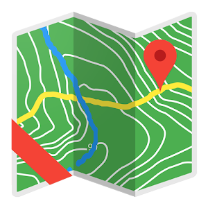
Komoot
OpenStreetMap
Bing Maps
AccuWeather
Outdooractive
AllTrails
Trainline - Captain Train
Meetup
The most popular Android Apps mentioned in /r/UKhiking:
The most popular reviews in /r/UKhiking:
Alltrails has a good range of trails across the Peak, find a distance and elevation gain that matches your fitness then pick the one you like the look of. The rating system generally puts the popular beginner routes near the top!
If I had to recommend anything for you to start out on, it would be Mam Tor, but there are some great routes closer to you. Avoid anything rated as "easy" unless you're particularly unfit. https://www.alltrails.com/explore/trail/england/derbyshire/castleton-mam-tor-and-the-great-ridge-walk?u=i
SWCP is not the only long-distance hike in the UK. As noted above, there are many trails and you can string many of them together. Personally, I don't really care for long coastal trails. They can be very difficult on the joints but mostly, it's the same scenery every day. But to each their own. I'd recommend looking at the Coast to Coast linking to the Cleveland Way, the Pennine Way linking to St Cuthbert's Way or the West Highland Way linking to the Great Glen Way.
If you had time for the AT, you have time for Land's End to John O' Groats aka LeJog. 1100-1400 miles depending on your route. There are dozens of people hiking it right now. Many people loosely follow the path in this guide but the magic of LeJog is the ability to choose your own route. If you're interested, I'd be happy to point you towards some online resources.
To answer your question though, you will be fine for wild camping the SWCP most of the time. If all else fails, find a secluded beach. There are also many campgrounds on the path. You rarely go more than 10 miles without some sort of settlement with running water. As noted above, the SWCP is profoundly undulated. If you're not used to carrying weight up and down hills, your joints might start barking (I know mine did at about 40). Especially after the cumulative effect of walking every day starts to set in. Trekking poles are a godsend in this department.
Good luck. Sorry about the AT. As an American, I'm checking every day for news that transatlantic travel will be opened again but as of today, it sounds like "early June" is the earliest we will hear of anything.
if you do kinderscout, I'd advise avoiding grindsbrook clough, especially down it. Head up the hill just to the west, or walk along to jacobs ladder (which sets you up nicely to walk up to kinder downfall and loop back across the moor path if the weather is ok).
https://www.bing.com/maps set the overlay to ordinance survey and zoom in for the detailed maps and names.
closer to you is the roaches and luds church, which is a nice walk, and you can see the peregrine falcons if you are lucky that are resident on the roaches, which is always nice.
I just use a small thermos soup flask for day hiking. You can put other things in the soup flask as long as its got a sauce it stays warm pretty well, its just the wide necked flask you want.
Something like this
If I'm doing a very long full day walk, I may take a dehydrated meal and a small stove,
I've recently done a Lose Hill, Mam Tor, Edale circular! Pretty good route, relatively easy underfoot! Here's the route I used:
I recently got this off amazon which seems to be a nice middle ground of all the expensive packs other people are recommending. It looks like its not on sale on amazon but I picked it up for £30 and you can still read about it/see it and could probably find it on other sites.
I was very pleasantly surprised at all the features off it - stuff I wouldn't normally think of that actually comes in handy. I went with a low capacity one (This is 20L) as I didn't think I needed much room, which I don't, but just beware its a little smaller than you think.
I managed to fit; a cap, a beanie, a Russian hat (indecisive), 2 bottles of 284ml Stella, a full 3L hydration bladder, 4 mini sausage rolls, full first aid kit, thick waterproof gloves, 2 cans of energy drinks, and 3 packets of mini cheddars in mine. But it was a bit of a squeeze (great hiking gear... I know)
I got this from amazon and it's superb - it has hand drawn maps as well as survey maps, historic info on places, info on where to stay and eat and just about everything you might need.
It's a newer edition of the book, the older edition had outstanding reviews and this is the same except for updated information.
I've done Pen Y Fan quite a few times and alot of other Welsh mountains I usually plan my holidays with accuweather as for the most part ive never had an issue following it https://www.accuweather.com/en/gb/y-fan/sy18-6/may-weather/2530448
It's been mostly correct each time and gave my partner and I the best weather for Scotland. Good luck and enjoy it!
One of my best hiking purchases was this. Can't imagine hiking without it any more.
If you want gluten free dehydrated meals I've found the easiest way to be Amazon prime drop off points.
https://www.amazon.co.uk/gp/help/customer/display.html?nodeId=GZTXM2L3YLZFSQ6W
I know expedition foods have gluten free options, the Thai green curry is good, the hotpot was reasonable.
I have some of these: https://www.amazon.co.uk/gp/product/B08G1L7CP4/?th=1&psc=1
I wear a pair for walking and for everyday use as well.
They're still a bit hot in the summer, but not nearly as hot as wool socks. Plus, they handles sweat really really well and dry really quickly if they get wet. I've found them to be THE best 3 season walking socks I've ever had. I've had mine for at least a couple of years of every day wear and they're still going strong.
I recommend getting a book of local walks. We are currently working through this one
Walking in the Cotswolds: 30 circular walks in the AONB (Cicerone Guide) https://www.amazon.co.uk/dp/1852848332/ref=cm_sw_r_awdo_SKXKN4EH8CXQ20EPT0TD
There are also some good routes on Komoot
One was a JvGoal 20ah and the other also a JvGoal 10ah unfortunately both outh of stock but plenty of others on there with different branding. The percentage display is better than what Anker use, and they both fast-charge my Huawei (with the right cable) and my girlfriend's awkward-to-charge Samsung via the USB-C port
I have the Amicus with the igniter! It's really fantastic, I like it a lot.
Pot (£18): https://www.amazon.co.uk/gp/product/B07F1QJS27 Cup (£4): https://www.decathlon.co.uk/p/stainless-steel-outdoor-mug-0-4l/_/R-p-174671
Inside the pot I can fit a 100g canister, the cup, the stove, a spare lighter, a sponge and a metal scrubber.
The only things I keep outside are a windshield, and a long spoon. Very convenient system, super small. And fairly cheap :)
Here just the pants were $20 but again, looked heavy https://www.amazon.com/FROGG-TOGGS-Standard-Classic-X-Large/dp/B00H4Y8HIC/ref=mp_s_a_1_13?crid=H12SRA0GEO1Y&keywords=frogg+toggs&qid=1645549560&sprefix=fogg+toggs%2Caps%2C231&sr=8-13
I think it comes down to what map style you prefer, both Trailblazer and Cicerone have their merits - I used a trailblazer guide book when I walked Offa's Dyke and while the book has loads of great info I did not get along with the map format at all. This is much less of an issue for Hadrian's Wall I imagine as the lack of scale and contour markings doesn't matter so much. You can pretty much follow the Vellum from coast to coast even when the remains of the wall aren't apparent so getting lost shouldn't be much of a problem!
If you have the time I really recommend that you read a good history of the wall, there's so much more to it than being a simple defensive barrier to keep out the pesky Picts.
I use this website for train journeys, you can get some good deals with it, also has an app so your ticket is on your phone.
For the Lake distict you can get off at Lancaster for South Lakes or Penrith for North, if you play around with stations to pass through you can get some good savings.
Hi, I parked at Rhyd Ddu carpark last week. I don't think they have electric charge points. But you don't have to book, just pay £6 for the day with contactless. The route is one of the quietest ones up snowdon and feels more wild and the views are also lovely!
Here is the route I did on Komoot. https://www.komoot.com/tour/656727604?ref=atd
Hope this helps!
Thanks knopper13 for the response! This is about the national 3 peaks yeah, i've done a few big hikes before and this one has been on the bucket list for so long, also in my research I saw a yorkshire 3 peaks group on the platform 'meetup.com' who are going in the next few months in case that was of interest as well :) Best of luck with your hike!
As others have said you need less kit than you think to be safe. It doesn't have to be branded as hiking kit in order for it to work for you
Rule number the first! Consider how you are going to keep yourself safe before you head out for fun. Please tell someone where you are going, when you are going to be back and wft to do if you miss your return time. Consider leaving them some sort of route plan.
Free: sign your phone up for the 999 text service, download the what 3 words app. If you buy an OS map it will come with a code to use in their map+gps app
Running shoes or similar, waterproof, thin fleece that fits under waterproof, some sort of gym top as a base layer (not cotton), non cotton underwear (stuff you would wear to the gym is fine), 2 pairs of hiking socks that fit into your footwear well (carry one pair as spare in case of wet feet). Hat.
Water bottle (£1 'disposable' ones with a sports top are fine, you can re-use them), map of wherever you are walking, compass, phone, bit of food. Rucksack to put all this crap in.
The above is really aimed at beginners, hopefully you can see that a lot of it is stuff that you may already have. There are other 'nice to haves', these could be requirements for longer / more remote walks: power bank for your phone, charging cable for phone, survival bag, small first aid kit (especially a blister pack), cheap head torch, whistle, gaiters, gloves. Walking boots. Navigation or map app for phone.
Other nice to haves: Hillwalking : The Official Handbook of the Mountain Training Walking Schemes https://www.amazon.co.uk/dp/0954151194/ref=cm_sw_r_apan_glt_i_8P5YVGJAKRMQHMGVSEMT
Mountains of England and Wales: Vol 2 England: (The Nuttalls) https://www.amazon.co.uk/dp/1852845899/ref=cm_sw_r_apan_glt_i_TCVB4PNQR63CDFH4B2KT
Hope this helps a bit
That the ultrasound thing? My physio did a few sessions of that, and I started wearing one of these and, in addition the the standard stretches, it’s been fine since. And it had been a right pain, literally, for a couple of years before then.
Have you looked into Sistema bottles? You can find them in most cookery shops, Homesense/TK Maxx, or online. BPA free and very light. Personally I’m not a huge fan of the ones you need to suck water out of (may not be an issue for you), so I got this Thermos plastic water bottle and it’s perfect:
I am on Android and use a combination of two apps.
You don't have to own a Suunto watch to build routes. The Suunto app has a useful feature where you can view heat maps of common used trails which makes for easy route building.
Once I've built the route in the Suunto I export the route to OsmAnd and navigate from there.
I believe both apps are available on IOS as well.
There's also a 1L version.
I'm 34 and this was my first visit! So there is definitely no shame! The route I went up was exceedingly fun lots of scrambling.
It didn't record the first part of my tour but I started and finished in the same place.
Not long at all and I'm sure there's a car park right by it. If you fancy a longer walk, parking down in Edale you can do a nice loop which includes kinder scout! With it finishing in Edale too it makes it great to stop for a drink or some food once the hike is done!
Super, in recently discovered this but haven't done anythingnwith it yet.
I wouldn't even mind if I had to buy them again as I teach map reading skills and it's the defacto in the UK, which most people have a basic awareness of when they start out.
I have made updates to osm historically, and also encourage others to do the same. There are lots of apps, I highly reccomend Street Complete https://play.google.com/store/apps/details?id=de.westnordost.streetcomplete
Replying to this to highlight that MWIS is probably the most reliable forecast for the uplands in the UK. Relevant area for the Ben is the West Highlands.
​
Also, if the visibility fails at the top then follow the cairns (big piles of rocks) and you'll be ok. If it gets really bad on the descent be aware that you need to head SW from the summit shelter for about 150m before then heading W down the path. There is a large gully that you'd want to avoid which you'd hit if you went West immediately. Worth checking out the route on Bing maps (they have an OS map feature)
I've not hikeed near Windemere yet but Homeground is gob-smackingly delicious.
Komoot has some great suggestions for vantage points and walks, looks like.
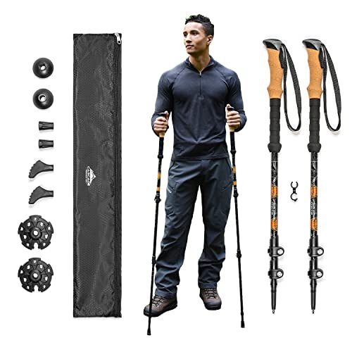
They actually have them on Amazon UK now! Just ordered another set as a gift for my dad :) https://www.amazon.co.uk/Cascade-Mountain-Tech-Aluminum-Trekking/dp/B01L2HYPNW/ref=asc_df_B01L2HYPNW/?tag=googshopuk-21&linkCode=df0&hvadid=330941257570&hvpos=&hvnetw=g&hvrand=3482244583688502077&hvpone=&hvptwo=&hvq...
I pronate too, and ended up trying about 12 different insoles via Amazon.
I quite like these: https://www.amazon.co.uk/gp/product/B0033BPBD4/ref=ppx_yo_dt_b_search_asin_title?ie=UTF8&psc=1
But what works for you is going to be personal to your feet. I would find some well suited innersoles and put them in a lightweight ankle-high boot.
I like the TrailBlazer guides (I've used quite a few of them and I like the handdrawn maps), and that went North to South. https://www.amazon.co.uk/Offas-Dyke-Path-Trailblazer-Large-Scale/dp/1905864655/
It would be easy enough to navigate using the guide book in reverse though - it's an extremely well signposted route! Various other guide books go south-north. Going south ends with slightly longer/harder days (although not exactly "hard") so nice to get your walking legs before that I guess. Although day 2 was fairly tough going, mostly due to the extremely hot weather I had.
I can't remember it having stuff like that, but most of the path has several campsites where you can stop so it's about if you are doing the walk in say four days or six (or faster or slower). Unfortunately I'm not in the UK right now and won't be for several weeks, so can't check on the details.
Here is that earlier edition of that book, good for checking reviews
You should be able to click on "Look inside" on both links to see examples of what the contents is like.
hi, i used the tony hopkins south & north books here http://www.amazon.co.uk/Pennine-South-National-Trail-Guides/dp/184513639X/ref=sr_1_3?s=books&ie=UTF8&qid=1446735172&sr=1-3&keywords=pennine+way+south
each weighing roughly 500g, i promptly left behind the south book as soon as I reached Bowes.
definitely get your kit weight down below 11kg. my total weight carried including shoes and worn clothes was under 11kg, and that included 16 mountain house brand dehydrated meals and always 1l of water.
get yourself a pack that sticks to your torso length. it took me 7 or more packs to finally get one that fitted me well, a Lightwave fastpack 40 litre. get one they are great packs.
get a sub 400g down bag if you are walking it in summer. mine was a 550g phd minim and i was roasting. a 300g bag would of sufficed!
a bivi bag does not work on 2+ day hikes,, the idea is nice, but not practical. you will suffer with a bivi bag, so an ultralight tent is a must have. terra nova lazer comp 1 was what i had.
avoid bringing any extra clothing. a flashlight/headtorch is also wasted weight during the summer months.
I have this guide, bit more abridged, but has the necessary maps and the main points of interests listed.
I definitely won't be aiming to do it as fast as you, so I'm not too fussed about getting my gear all the way down to 11kg. Ultralight gear is absurdly expensive.