
What are
/r/OsmAnd's
favorite Products & Services?
From 3.5 billion Reddit comments
The most popular Services mentioned in /r/OsmAnd:
OsmAnd
OpenStreetMap
Telegram
Disqus
microG
Aurora Store
The most popular Android Apps mentioned in /r/OsmAnd:

Maps & GPS Navigation OsmAnd+
Solid Explorer File Manager

File Manager
Vespucci OSM Editor

GPSTest
BRouter Offline Navigation
The most popular reviews in /r/OsmAnd:
As u/lel31 said, you can add POI (locations) from within the app. See https://osmand.net/features/osm-editing-plugin for more details. A nice way to contribute data is also the app StreetComplete : it will ask you all sorts of questions about mapped objects, to increase the level of detail. You can swicht off topics if they don't interest you. A nice way to add highly detailed thematic data is https://mapcomplete.osm.be , where you can add now POI or add detail in several specific topics. You can add all the topics you like to your home screen, so you can add a new thing very fast. All this data can then be used to make OsmAnd even better. Happy mapping! (note that you will need to refresh your map data to see the improvements you made!)
I had the same problem and thought it was battery saving. In the end it was a setting called "Minimum accuracy" inside the "Trip recording" plugin. If the GPS signal doesn't have enough accuracy, it will stop recording those points. More info here
What did you buy earlier?
What you want to install here (Contour lines)? https://osmand.net/features/osmand_purchases#ios_extended_features
Hello.
It wasn't possible to activate the map by pressing the power button.
But now you can use "turn screen on", read more here https://osmand.net/blog/osmand-3-4-released
We deleted OSRM service for navigation. Now we use only offline and straight line service for calculation. There were bugs with OSRM, and OSRM is not OsmAnd service. We have the plan to find and use one of online service in the future.
Now you can use old version. You should write to [email protected] for getting link to old version of OsmAnd+. If you use OsmAnd Free you will download old version here (version 3.2 and less)
When you go to "Download maps" then to "Local" under "Online and chached tile maps" you can config your online maps sources. Maybe you can find something helpfull there. Also you can add custom online map sources to Osmand under "Map source" and then "Add".
Or simply use an other app than Osmand, sure it is very good at what it is made for. But it was not primarily developed as an online map viewer.
Unfortunately I don't know much about online viewers from the Playstore, but after a spontaneous search I came across the following:
Maybe one of these or any other similar app would work for you.
On my side, I have a raspberry checking regularly for maps updates and sends an email when available. Upon the email reception, I use Solid explorer on my mobile to copy maps from a windows share on my local network.
https://play.google.com/store/apps/details?id=pl.solidexplorer2
For a different routing algorithm, it's in the Navigation Settings (within Configure Profile or dynamically within Options).
Within Navigation Settings, there's a Navigation type selection. Tap it and you should^(*) see an Offline and Online tab. Online comes with a few choices (ZLZK, OSM.DE) with an Add option for Graphhopper, OSRM, Openrouteservice, and GPX. If you use Android and install the BRouter app and download data for it and configure it, a "BRouter (offline)" item will be added in an External section of the Offline tab.
Note: I haven't really tried these alternatives, just checked that they exist via installs.
^(*) There might be plugins required to be enabled; I have most enabled on my "nightly" install. You mentioned OsmAnd+ so I assume you're using the paid version.
That is whack, I have noticed this before but also could not figure it out
I have now merged two crossing roads with a common node, but this should not have caused it
Also fixed this wrong relation, just one lane and turn option (said 2 before):
https://www.openstreetmap.org/relation/11283540
maybe the math here that did not work out confused it
If you can see your city on OpenStreetMap you should be able to get it in OsmAnd.
The amount of data suitable for import varies from region to region though, so it's unclear how much of a leg up your local mappers may have had.
Not on with the default rendering at https://www.openstreetmap.org but it is pretty easy to to it yourself if you render your own maps.
You could also go to a website like CalTopo for a U.S. centric rendering. However that site seems to take a month or two from the time an edit is made in OSM until it shows up.
I was able to get an .obf file to show up in the map menu so I think it was a vector file but there is no way to over/underlay it.
I would be happy with an online WMS source.
Here is another thread with some info https://disqus.com/by/moooreee/?utm_source=reply&utm_medium=email&utm_content=button
from OsmAnd site" We have chosen Telegram as the most open social platform since it has an Open API, Open SDK and, moreover, it will eventually have an Open Server implementation (Blockchain). "
from privacy policy of Telegram - https://telegram.org/privacy#4-keeping-your-personal-data-safe
​
There is also the map legend here: https://osmand.net/help-online/map-legend
It could be the track types. Or some are footways and others are paths
If you mean something different, I suggest you post a link to an image or to some coordinates. I have myself sometimes a lot of trouble to find a correct legend
Try using OsmAnd with:
- offline maps
- contour lines
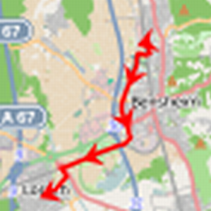
- topo profile (see example map rendering here)
and you'll get something similar to ARKOD.
I want to switch from German to English in my preferred language, but I absolutely cannot find the setting? According to the OSMand help, it should be in in this screenshot. But it isn't?
I seem to have the newest app version (no update offered).
Help very welcome, it's driving me a bit crazy :)
13 August occurred the error while sending the first email and a win notification template was sent, although the Giveaway has not started yet.
We are sorry, but this email does not contain a promo code.
You can take part in the giveaway by registering using the link in the last letter.
Or here - https://osmand.net/#osmand_giveaway
Kind regards,
OsmAnd team
We release various versions of the application:
The free version allows you to make up to 7 installations / updates of maps.
OsmAnd + / OsmAnd Unlimited are full versions of the application. They are identical in functionality, but OsmAnd + is a separate paid application that can be shared with other accounts using the Google Play Family Share service. In the meantime, OsmAnd Unlimited can only be activated in the free version of the application and this version cannot be shared. These versions of the application provide:
Unlimited map downloads
Monthly map updates (in the first days of each month)
Wikipedia and WikiVoyage articles available offline
It is important to note that the plug-ins of the contour lines and sea depths are not included the functionality of these versions, however, they can be purchased separately.
​
A monthly OsmAnd Live subscription is also available, which includes all the possible OsmAnd functionality and additionally the ability to update maps up to once per hour automatically.
More about the different versions and features of the application can be found here: https://osmand.net/en/features/osmand_purchases.
OsmAnd+ and OsmAnd unlimited (in-app of OsmAnd Free):
Unlimited map downloads
- Map updates one time at a month (at first dates of a month)
- Wikipedia and WikiVoyage articles available offline
hi,
please, check your parameters of "Follow trip"
https://osmand.net/features/navigation#Save_navigation_route_GPX_file_iOS
maybe, there is a problem with "Calculate OsmAnd route for first and last route segment" or something else of this. Would you change it and calculate again your trip using GPX-track.
That's gonna be a custom rendering to make the map look different.
I wanted the same thing. I played around a little, but lost interest and gave up.
We don't plan this features for iOS at this year.
From our resolution at this year (https://osmand.net/blog/2019-ny-resolutions):
- iOS improvements: OsmAnd Live, Quick Action, OSM Editing.
2018 was decisive for iOS version and we've started to work hard on features to reduce the gap between Android / iPhone version. In 2019, we are planning to release the most requested features, and the good sign is that iOS audience is growing very fast, reacting to the changes we do. OsmAnd Live, OSM Editing and Quick Action are even a shorter list what we plan to achieve in 2019.
You may read privacy policy of OsmAnd p.3.6. OsmAnd doesn't collect any your information. You may read the mission of OsmAnd ( Respect for Privacy)
I know one way how to see OsmAnd map from any browser without any apps. When you are using OsmAnd Telegram and sharing your location to Telegram you can click to text with Location (for example https://osmand.net/go.html?lat=-13.87919876&lon=-76.12176873)
It is probably useful for only a small subset of your apps users, but I'd like a way for other apps to query OsmAnd for geocoded information.
My ideal case would be for OsmAnd could implement the microG address backend API. The next best would be for OsmAnd to present an API that was compatible with Google's geocoder (which I could then use to write a microG address backend).
The use case would be for geographically aware apps running on a Google free phone to still be able to use location lookup and/or reverse geocoding, at least for the areas the user has downloaded OsmAnd maps, even if data service is not available. By using OsmAnd for this apps that rely on Google could still do their "geo thing". And for apps that do not rely on Google, it would mean that they would not need to have their own map files, etc.
I don't know if you already know this, but as a hint, you can access those folders with an external file manager like this one or Total Commander for example.
Unfortunately, coordinate sharing only works in one way: from OsmAnd or another App to GoogleMaps. If you try to share a coordinate or a Waypoint from GoogleMaps to OsmAnd or another App you will not be able to to be made. But there is a trick that works perfectly.
Use Map2Geo, an app that weighs less than 1MB. What it does is transform the Google coordinates so that other apps can open them.
https://play.google.com/store/apps/details?id=catfish.android.map2geo