
What are
/r/Yosemite's
favorite Products & Services?
From 3.5 billion Reddit comments
The most popular Products mentioned in /r/Yosemite:


The most popular Services mentioned in /r/Yosemite:
AllTrails
Weather Underground
The Weather Channel
EveryTrail
Windy
Airbnb
Google Fonts
Microsoft Bing
Google Street View
AccuWeather
TinyURL
TripAdvisor
Google Arts & Culture
Lifehacker
Flickr
The most popular reviews in /r/Yosemite:
Forecast has been bouncing around every time I've looked- appears to be one of those where the exact elevation of the snowline will be important. Keep in mind that 2 inches of precipitation is roughly 20 inches of snow.
I haven't seen the official storm advisory out of the Hanford Weather Service yet- but they were calling for a snowline down to 6000' (i.e. below the Valley Rim). Hopefully we'll get something more detailed/specific out of them today.
If you are planning on being at 7k Wed evening into Thu you should go prepared for the possibility that you'll wake up Thursday morning w/ a foot or two of unconsolidated snow and obscured trails. It may or may not happen but its definitely in the realm of possibility and one should be prepared for that if heading into the backcountry into an approaching winter storm.
Edit: Here's the official storm advisory calling for 6-20 inches of snow above 7,000':
https://www.wunderground.com/severe/us/ca/yosemite-national-park/37.74%2C-119.57
I haven't done this trail, but if I had 4 free days, I'd do the Grand Canyon of Tuolumne Loop.
https://www.alltrails.com/explore/trail/us/california/grand-canyon-of-the-tuolumne
Looks like as of this morning the White Wolf -> Pate trailhead is open July 19. Fill out the permit application, and use an online service to fax it in.
If you are ok with snowshoeing maybe look at Lake Winnemucca out of Carson pass.
If you are looking for actual eastside trailheads I've seen reports that a couple were open for the start of fishing season this past weekend but don't know enough about current conditions to make recommendations.
The forecasts are bouncing around and it looks like they are currently showing all the rain (3.5" !) being pulled into Sunday and just snow showers Late Monday into tuesday
https://www.wunderground.com/forecast/us/ca/yosemite-national-park/KCAYOSEM33
This is going to be one of those warm storms where a one or two degree temperature difference raises or lowers the snow line 1000 feet.
Waiting for the NWS statement on the storm, which usually is the best estimate of what is coming.
Weekend traffic could be a bit of an issue in a Valley , but you won't be waiting on an entry gate too long on Sunday, especially with you getting there at 1 or 2 PM. Yosemite are definitely worth a day trip and it's amazing to see them. In fact, I'm heading up there this weekend from San Francisco as well :)
I'd check Lower Yosemite Falls (10 minutes walk towards them assuming you will be fine with parking) and would hike Vernal Falls (~1.5 hrs roundtrip hike) and then head back to SF
Your real challenge here though will be weather. So far it looks like it might be raining on Sunday : https://www.wunderground.com/forecast/us/ca/yosemite-national-park?cm_ven=localwx_10day
It keeps changing every few hours though, I'm very actively monitoring it myself to be honest. Enjoy Yosemite !
...WINTER STORM WATCH IN EFFECT FROM WEDNESDAY AFTERNOON THROUGH THURSDAY MORNING...
WHAT...Heavy snow possible. Total snow accumulations of 6 to 15 inches above 7000 feet with up to 20 inches possible.
WHERE...Sierra Nevada from Yosemite to Kings Canyon and Tulare County Mountains.
WHEN...From Wednesday afternoon through Thursday morning.
ADDITIONAL DETAILS...Travel could be very difficult to impossible. Holiday travelers should be prepared for long delays and possible road closures. If traveling consider alternate plans, remember to carry tire chains, extra food, water and clothing.
PRECAUTIONARY/PREPAREDNESS ACTIONS...
A Winter Storm Watch means there is potential for significant snow, sleet or ice accumulations that may impact travel. Continue to monitor the latest forecasts.
https://www.wunderground.com/severe/us/ca/yosemite-national-park/37.74%2C-119.57
Forecast is looking to be wet and cold in the valley, snowy in the high country for the next week. Come prepared for winter.
https://www.wunderground.com/forecast/us/ca/yosemite-national-park/95389?cm_ven=localwx_10day
Make sure you are carrying tire chains and know how to use them if you are driving into a storm. (And note that most US car rental agencies do not allow chain installation)
I'd highly recommend the Berry Creek falls hike in Big Basin. Its a bit closer than Big Sur and IMHO the best hike in the Bay Area. (You can do this from either Hwy 1 or from Park HQ)
There is a giant redwood grove at park HQ as well
http://www.everytrail.com/guide/berry-creek-falls-loop-at-big-basin-redwoods-state-park
Nelson is about 6 miles from the trailhead and the use trail past Elizabeth is reasonably easy to follow. Should be more than doable as an overnight.
Schaffer covers the route in his Yosemite guide book- if you don't have a copy you should be able to see the route description on the Amazon "Look Inside" preview. Its on page 235 or just search for "Nelson Lake"
https://www.amazon.com/Yosemite-National-Park-Complete-Hikers/dp/0899973833
BTW, all of Schaffer's guidebooks are excellent and everyone should own them all :)
>You can also go up Yosemite falls trail and hike to the top.
Here's the route on AllTrails for it: https://www.alltrails.com/explore/trail/us/california/el-capitan-trail-historical--2?mobileMap=false&ref=sidebar-static-map&ref=sidebar-view-full-map
If you zoom in, you'll see a trail that climbs a little shelf right by Metlicott Dome. Thats a fun hike, and also if you don't mind going off trail a bit, you can go east from the lakes over the saddle to Budd lake. There's a trail down from there, but it'll be down to the Cathedral lakes trailhead, not to the shelf trailhead
If it's your first trip, most folks like to see the Valley, as you'll see a lot of iconic Yosemite landmarks there (El Cap, Yos Falls, etc). The recommendations view are all in (and very close to) the Valley:
Lower Yosemite Falls trail is short, easy, walk and has great views: https://www.alltrails.com/trail/us/california/lower-yosemite-falls-trail
I'd also recommend driving to Glacier Point. It's above the valley, so you have some really incredible views right from the parking lot.
Like the other poster mentioned, definitely stop at Tunnel View and enjoy the view that Ansel Adams made quite famous. You may drive through, depending on where you enter the park.
Finally, it'll likely be pretty warm, so you can take the kids to Sentinel Beach - it has incredible views of El Cap, you can swim, and you can eat and hang out.
Hope you enjoy your trip!
Weather Underground is entirely dependent on what crowd sourced weather stations are available. But their search is wonky and you often get Yosemetie, KY if you just search for that name.
Up here in Tahoe they're the only service I've found that will give me a forecast for Heavenly Village at 7k instead of the lake level forecasts for Stateline/South Lake.
Their currently available Ahwahnee Meadow sensor is good for Yosemite Valley:
What forecast are you looking at? If you're looking at this forecast: https://weather.com/weather/tenday/l/CANPYOSE:13:US I'm guessing that it's for the higher elevations, as the temps are way too low for Yosemite Valley for this time of year. Accuweather (which is more accurate for the Valley, I think) is not showing rain for next Saturday. The most reliable is this site: https://www.nps.gov/yose/planyourvisit/weathermap.htm but it only has a 7-day forecast so you'll have to wait.
Trail runners for shoes and a base layer + light jacket. It will be hot in the afternoon but cold enough for the jacket overnight. (And you might want a light long sleeve base layer in case the skeeters are out)
https://www.wunderground.com/cgi-bin/findweather/getForecast?query=Yosemite+Natl+Park%2C+CA
Yes if things are bad, go to Sequoia and Kings Canyon parks. Lots to do and see.
I haven't been, but if youre really into domes, theres this one, outside the park
Sorry, fixed the link.
I've never done Ten Lakes, it was something I picked up as a backup in case my top options didn't go through. This is roughly what I was thinking for an overnighter.
Honestly, I would just get Ten Lakes as a backup, show up to the Wilder Center day before, talk to the rangers and see what's available. If you show up early enough almost certainly you will be able to get one of the popular Tioga trailheads (Valley might be different story). Very least they'll be able to point you to something good and open.
> The route down on the JMT from Nevada Falls between the Falls and Clark Point (i.e. the "Ice Cut") is still closed.
Ah, thanks for the notice! Would you recommend going back down through the Mist trail (as you mentioned here)?
I think we are going to most likely try doing the hike of Upper Yosemite, Nevada Falls (along with Vernal Falls along the way), and Dewey Point for our trip. Is the Panorama Trail (found here) open at this time of year? That could probably take the place of the Nevada Falls loop.
I will likely call a park ranger tomorrow to ask for his/her recs but I'm trying to get an idea as of current.
I'm trying to see if anyone has a photo of the particular junction. You pass the lake, you go uphill for about a mile, then the trail splits in opposite directions, left for Half Dome and right for Cloud's Rest. But the steel sign doesn't actually say Cloud's Rest, it's chalked on by other hikers to keep it fairly legible. However, if you're new to hiking, or started the hike without a map, then I feel like you'd be fairly confused as to where to go (just like the 20+ people I encountered at the junction and countless others headed up the trail as I was descending.)
If you check out these hiking instructions, I believe it's junction 6, then you're 1.5 miles from the beginning of the Cloud's Rest foot trail. This site, though, shows that there was a sign, which there definitely wasn't at the junction I'm talking about.
I recommend a particulate respirator if anyone is going to be in the thick of it. I wore one in Yosemite one year when it was really smokey during my visit, and it's like breathing in clean air even when it's smokey. Hike on.
~~https://www.amazon.com/gp/product/B0002YKBV2/~~ (Not sure if that Amazon link is still pointing to the one I purchased awhile back since that one says sanding, but these are ones I used: http://www.3m.com/3M/en_US/company-us/all-3m-products/~/3M-Particulate-Respirator-8511-N95-80-EA-Case?N=5002385+3294780243&rt=rud)
Two things I've worn while hiking in the rain made all the difference for me:
Frogg Toggs rainsuit: This thing kept me totally dry except for around the wrists (I wasn't wearing gloves): https://www.froggtoggs.com/the-frogg-toggsr-ultra-lite2tm-36729/
Waterproof socks. I wore Randy Sun socks that I got from Amazon (I can't find a website for Randy Sun). https://www.amazon.com/Certified-RANDY-SUN-Waterproof-Breathable/dp/B01GFO3U3I
If you're anti Amazon go to your local truck stop, also the ones I've linked are too long you want the shortest ones possible since it just has to cover the face of your wheel and have tension on your slack in the chains. Probably 8 inch ones will be fine (that's what she said)
Valley Loop Trail on the south side of the Valley is usually less icy than Valley Loop Trail on the north side (the section that's east of El Cap is really shaded).
I would be interested to hear how you found the trails when you get back. There's an interesting side trail, Old Oak Flat Road, just past El Cap (it starts as a forest service road, regular traffic banned, I have never seen traffic on it at all) and heads up. It gets too steep for me at a mile or two in, but if you started at the El Cap meadow area, you could run quite a distance to the west, using the trail near the road and then taking side trails as you wished.
https://www.alltrails.com/trail/us/california/old-big-oak-flat-road--3
That trail is challenging, but if you're into trail running with some kind of elevation change and challenge, it's a good one.
Thanks for watching! The Lyell and Maclure Glaciers are the only ones left in Yosemite. They are located on Mt. Lyell - the highest peak in the park. (Here’s a hike that takes you up there https://www.alltrails.com/trail/us/california/mount-lyell--2)
When I visited the park with a couple of younger kids (7,11), we hiked to mirror lake. There are multiple ways to getting there but this https://www.alltrails.com/trail/us/california/mirror-lake--3 is the one we took. Hope this helps!
Thanks for the advice.
- This NPS site says the group site is open year around. Tbh, don't really know the difference between a group site and the loops. Taking your advice, I'll go ahead and book Upper Pines for the night of the 3rd and 4th
- Literally booking after this message. Thanks for the tip.
- After looking through the weather, I don't expect it to be snowy conditions. With only one day of 40% snow showers and the rest sunny with highs in the 60's, is it unreasonable to think conditions would be great to do this hike in a day? Not trying to be stubborn, trying to get a second opinion. I don't consider myself an expert, but I consider myself quite good.
Thanks, again.
Wife & I share 1 large cup comprised of two kinds of instant coffee. Costs about $1.25 for a big double cup. We use a Korean instant because it has milk and sugar included, -things which absolutely suck to bring separately
Two Maxim All-in-One Red, cream & sugar incl. 2x$0.50
One Starbucks Via for punch $0.75:
You are right - THIS was the map that I actually bought, looks like it's not available anymore - is this the older version of the one you linked?
It definitely got the job done but just would have liked a bit more detail in some parts as it was my first time out there.
Um, your link goes to an Amazon page that shows the Tom Harrison Yosemite Recreation map. I do not think that's the same as the one that everybody here swears by (myself included). See this one.
No signs naming the stops, but some are obvious. You'll probably see people putting in the rental rafts at Stoneman. Housekeeping Beach is really large, and you'll see Housekeeping Camp on the southside of the river before you get there. Swinging bridge is wooden and pedestrian only, and the supports look surprisingly easy to climb up! Where the rentals pull out is clearly marked.
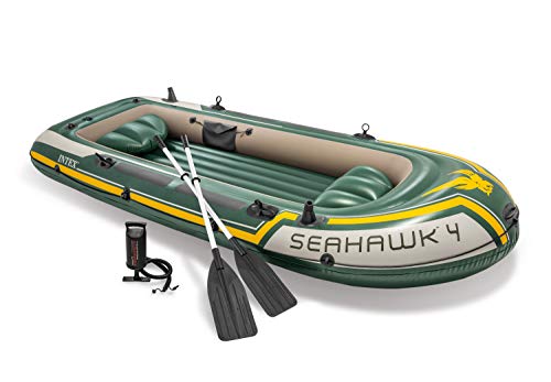
We park a car at one of the beaches we plan on going to and ride our bikes back to camp. I've never taken the shuttle, but I've got a larger raft and don't feel like sitting on a bus with a wet, sandy, heavy raft on my lap. Not to mention a cooler, oars, water guns, and who know what else. I've seen some people kayak, and river tubes look like your ass is going to be wet the whole time. Almost everyone in my group has a Seahawk 3 or 4. They pack up small, come with everything you need, and last for years. Do not plan to row back to camp.
I basically had a climbing harness and I got two sets of 8mm cord, and 3-4 carabiners. I had one prusik and one double-carabiner "leash" as my two forms of fall protection.
They sell sewn prusik loops on amazon like These but I found out the hard way that they are a little too short for use as prusik knots. In order to untie them you need slack in the loop, and when they're short, its tougher to loosen the knot when the half dome cables are constantly tugging them down towards the rock face.
It’s Pothole dome on the way to Tuolumne Meadows: pothole dome trail. It was such a surprise, my wife saw it from the road and said she wanted to climb it so we did:)
Park at Cathedral Lakes trailhead and follow the climbers approach to Cathedral Peak - when the trail branches into two, go left uphill toward Budd lake (the other trail goes right toward cathedral peak): https://www.alltrails.com/trail/us/california/cathedral-peak-climbers-approach
Hope you enjoy your first Yosemite trip! I get out there every weekend and still feel like I have so much left to see.
https://www.alltrails.com/trail/us/california/mirror-lake-via-valley-loop-trail
about 6 miles total but very flat and pretty nice! we needed a recovery hike after we did 22 miles the day before so this was perfect, but it's down in the valley with no real elevation, so you're looking up at half dome and the peaks but not getting those sweeping views.
Here is a link to our recent trip that we took. We went the opposite direction but you could hit Merced lake and Emeric lake. We did not see anyone at either lake on our hike and the alpenglow at Emeric was spectacular. Great swimming spots as well along the river. https://www.alltrails.com/explore/recording/tuolumne-meadows-to-yosemite-valley-trail-40f4da3?p=-1 We took the Yart from the valley to Tuolumne Meadows to start.
Just past Merced lake heading towards LYV. There are many great swimming pools along the river along with the bunnell casecade pool. It is about 8 miles from LYV To Merced Lake. All trails recording with pics
That's ... early. I thought dragging the kids out of bed at 6 was bad enough. There won't be anyone at the gate on 120 to check your reservation at that time, it looked like there was a sort of 'self service' check-in option when we went through but I'm not sure how that works. You might want to consider some of the really nice hikes on Tioga Road (CA120) as an alternative if you aren't using this as a route to somewhere. We looked into that but from where we were staying it was to far. We'd been looking at Tenaya Lake Trail (https://www.alltrails.com/explore/trail/us/california/tenaya-lake-trail) and Olmstead Point.(https://www.alltrails.com/explore/trail/us/california/olmsted-point-nature-trail) close by. Might save you a good 4-5 hours of driving. I'm sure there are lots of other great hikes along that road too. It's actually on our 'next time' list to try that side of the park.
I’ll let someone else help with campground, as far as Sentinel Dome —- we hiked up there last Saturday and there were several kids there around the age of your two.
Check out this site
https://www.alltrails.com/trail/us/california/sentinel-dome-trail
I love the tunnel view. I went to Yosemite at the end of March and took this picture. It's one of those types of subject that no matter how photographed I always enjoy seeing.
Cables for Subaru; specifically something like this: https://www.amazon.com/gp/product/B002KQG7TK
Only use them when there's actual snow on the road, otherwise the subie can handle itself
Saturday's storm is looking to be bigger than the 1st leg but Sunday is going to be the worst of it. The storm warning starts at 4pm Sat.
https://www.wunderground.com/severe/us/ca/yosemite-national-park/37.74%2C-119.57
The forecasts with the best information on snow levels will be in the storm advisories put out by the Hanford, Sacramento, and Reno NWS offices. They often publish infographics to social media with this information as well.
Here's the one for this week's storm: https://www.wunderground.com/severe/us/nv/glenbrook/KNVGLENB14
Inside the park, there are numerous webcams that show current conditions:
The last storm brought the snow line down to 1000'- haven't seen the forecast w/ the expected snow levels for the next storm yet. You might be able to get away with w/o chaining up if you are entering via 140 and only going as far as the lodge. But it will be up to you to make that judgement call.
At the moment it appears the forecast for Mariposa this weekend is just rain and El Portal has a rain/snow mix:
https://www.wunderground.com/forecast/us/ca/el-portal?cm_ven=localwx_10day
Here's the date of the event: https://blog.aaronmphotography.com/2019/01/04/horsetail-falls-2019-yosemite-national-park/
According the ten day forecast, there's going be snow and cloud covers obscuring the view: https://weather.com/weather/tenday/l/USCA1269:1:US
If you go to Mt Diablo SP you can tack on some of the surrounding peaks along with Mt Diablo itself, to make a larger loop that would get you close to the distance and elevation gain of Half Dome.
I can't speak for North Peak (didn't look to be anything special, just a radio tower on top) but I've done more or less this trail and it comes with nice views. Pick a day with good visibility and you can get a nice view of the Sierra.
Not too sure about the mileage. You can use caltopo.com or alltrails.com to map it out. I’m guessing between 15-20 miles round trip from cathedral lakes trailhead. You can do tenaya lake if you’re looking for something shorter. THIS is our total route for the trip which was incredibly epic. There’s a ton of places in Yosemite that are worth visiting. If you’re set on clouds rest than go ahead and go for it but there a many places in the backcountry that are equally epic if not more that are much less populated and just as beautiful.
don't like to mention this because it's such a great spot without a soul in sight, but... if tioga road is open, make the drive to the east entrance of the park, and do the 3.5 mile round trip hike to gaylor lake.
we did this hike 2 weeks ago and saw 4 other people on the trail the whole way. the pay off is a spectacular alpine lake. so quiet, serene, just perfect.
https://www.alltrails.com/trail/us/california/gaylor-lakes-trail
Hopefully you don't need to fly to get there, and are able to make a last minute decision. It really depends if the wind would be blowing smoke in the direction of the park or not, on that day.
This would give you a good indication - if it is blue or close to blue, the air will be good. And there's a few webcam links in the map as well for a live view: https://www.windy.com/-PM2-5-pm2p5?cams,pm2p5,,37.456,-119.736,10
Here’s a link to a map and the Elevation change. Shouldn’t be too difficult with a baby, but it’s more than double 3.5 miles out and back. Hope you have fun! Yosemite is amazing. https://www.alltrails.com/trail/us/california/cathedral-lake-trail?p=-1
First, where will you camp? The campgrounds in the Valley are slowing opening more sites, but they get reserved really fast. There's now a lottery for Camp Four (but still FCFS if you're lucky).
Crane Flat?
You'd need a wilderness permit to do 40 miles on trails in 3 nights. They're handling those permits at Big Oak Flat Wilderness Center and Wawona Wilderness Center, but you'd need to know which trail. All of the high country has snow, so even if you entered, say, at Yosemite Falls, you'd end up with the same situation of high creek crossings and tons of snow once you were up top.
Maybe look into the Little Yosemite Valley (still gonna be lots of snow). Maybe a trailheads at Hetch Hetchy? There's this sort of weird trail from Glacier Point to Tunnel View (with backpacker camping at Bridalveil Creek - but not sure it's open yet). Certainly not a 3 day trip.
https://www.alltrails.com/trail/us/california/hetch-hetchy-trail-to-rancheria-falls
I've not done the rancheria falls trail but it doesn't look like it would have snow. It's not going to get you 40 miles though.
You could switch to the Tioga Lake area and hike in the National Forest, I guess.
I've only been to Yosemite twice, but just went 2 weeks ago, so hopefully I can give you some tips??
Note that Yosemite Valley, where you'll probably spend all your time, is like an hour inside the park. Idk about Oakhurt, but confirm whether it's an hour from the park, or an hour from Yosemite Valley. Just a couple weeks ago we stayed at this airbnb, and it was incredible for the price. I felt the pics on airbnb didnt do it justice: Clean room, kitchenette, grill on the patio. And inside the park, only 20 minutes from Yosemite Valley! Stop at a store along the way, do breakfast and dinners in the studio.
So we drove in, did a half day in the valley, and just walked around the valley floor, did very short hikes. TBH i was bored day 1, so maybe recommend lining up something bigger.
But day 2, HIGHLY HIGHLY recommend Nevada Falls. We followed the advice in this article to go clockwise; up Mist trail, down John Muir. It was awesome, took us about 6 hours with lots of stopping for pics.
regrettably no bananas. ripe idea though! hehe
I do upload them to Amazon and RedBubble. Here's the link to amazon: https://www.amazon.com/dp/B09M49QFMX?customId=B0752XJYNL&th=1
RedBubble does stickers and wall art, but amazon's shirt quality is a little better. I can send that too if you'd like
I recommend latex gloves similar to these. I started climbing with leather gloves and the cables were slick and the leather didn't help much. Halfway up, the guy I met at the campfire the night before handed me his latex gloves while he was on the way down. The latex gloves allow great contact and feel on the slick cables. I'm not sure how the cables will be during summer, but barehanded on the cold cables in early October was not pleasant.
I think I wouldn't recommend this one for a 10 year old. Or maybe at least not for the first trip.
- About 6 miles
- Quite challenging, especially the first part
- Haven't seen any, but same regulations apply
- No idea, sorry
- The first part of the trail is in very bad condition, however you won't notice anything near Kibbie lake.
You can read more about the trail and the elevation gain here. It's a really nice destination and you most likely won't meet anyone else. Maybe you can skip the hard uphill section by parking somewhere else to make it easier for the kid.
My current plan is not to go down the falls but to continue on along the rim past Yosemite point, then North dome, then eventually snow creek down into the valley.
Here are a couple options I was playing with. One goes back to trailhead, the other finishes down in the valley and relies on the hiker bus to get to the trailhead:
https://www.alltrails.com/explore/map/yosemite-trip--19
As a side note, part of snow creek is closed to overnight camping at the moment but I don't think it's really necessary to stop overnight there. Something to keep in mind though.
I hadn’t herd of that! Must be new because I know someone did it last week. The upper Yosemite fall trail is another fantastic hike. And if you go up to Yosemite point it is like being on glacier point. The difference is your on the north rim rather than the south rim. Not many people go up there either. I do that hike every winter and it usually takes me about 6 hours up and back.
https://www.alltrails.com/trail/us/california/yosemite-point
In the schedule linked above you'll find maps that contain the routes, including distance, elevation and estimated camp locations. All details are from AllTrails.com.
A couple things to help you get the most out of your time there (This ended up being really long-winded, but I really stand by it and I think you'll have a great experience if you choose to do any of these):
Drive up to Glacier point. Walk around and check it out, then drive down the road to sentinel dome trailhead and do both Taft Point and Sentinel Dome in one loop with an extension.
Mist trail is 6.7 miles RT to Nevada Falls, but definitely worth it. If you didn't want to go all the way, you could detour to Clark Point, and do that as a loop. Probably cuts off half the distance at least.
If you really want to see sequoias, Merced grove is pretty cool, but it's not in valley. If you're already driving out there, I think you may consider just going all the way to Lembert Dome and Tuolome. Make sure you stop at Olmstead point along the way and do the brief jaunt out there to one of the best photo ops in the park. This is could easily be a whole day on its own merit. If you want to spend some time chilling at Tenaya lake, I couldn't blame you!
Fishing in valley not worth your time (there's so much awesome stuff to go and see). However, if you're looking for a pretty chill activity, rent bikes in Curry Village and ride to the main valley attractions (Yosemite falls, mirror lake, El Cap, Bridalveil Falls). I personally think this is a better bet than the float. There are plenty of places to go rafting in US. There is no greater concentration of natural wonders than right in yosemite valley (hyperbole). It's an amazing place.
Cheers!
Nice. I'd recommend also trying out AutoStitch. It does a great job of aligning/blending and the demo version worked quite well for me in the past.
That's amazing!
- What was the focal length you used?
- Did you use a special tripod + head to get perfect overlap?
- How long did it take to stitch everything together?
- How did you manage to get the empty blue sky photos which look like they contain nothing to gauge by?
- If you use something more dedicated to panorama stitching you can play with the projection and get a more natural looking image - try hugin
I second the recommendation for Geology Underfoot: Yosemite. It is well written and not too-technical. The book is organized as a series of chapters about a Yosemite place of geological interest or a Yosemite geology related topic.
In some ways Yosemite geology is pretty straight forward - granite and glaciers. If you know just a little bit it really enhances your experience in Yosemite. It's fun to check out the glacial moraines at the west end of Yosemite valley or learn the different types of granite in Yosemite or figure out how glaciers moved through the high country based on the glacial polish and striations you see in the granite.
Not specifically what you are looking for, but I'd like to throw a shout out for Jeffrey Schaffer's "Yosemite National Park: A Complete Hikers Guide" which is my favorite trail guide for the park. His similar Tahoe, Emigrant, and Big Sur guides are also excellent.
https://www.amazon.com/Yosemite-National-Park-Complete-Hikers/dp/0899973833
My wife and I just did the climb of half dome earlier this month. These gloves worked great. Decent gloves and decent shoes that can grip the rock are worth it. I didn’t see anyone with a harness when we climbed but that could be an option if you are really scared of heights. Mad Grip F50 Pro Palm Knuckler Gloves https://www.amazon.com/dp/B00DN2G5J2/ref=cm_sw_r_sms_api_glt_fabc_3EKB4XEX3FD1JJ8GB899?_encoding=UTF8&psc=1
I used these gloves and they worked well for me: https://www.amazon.com/gp/product/B00DN2GBW8/ref=ppx_yo_dt_b_asin_title_o00_s00?ie=UTF8&psc=1
I also don't recommend a harness.
Large power bank type charger like this:
https://www.amazon.com/gp/product/B07T48L6CF/ref=ppx_yo_dt_b_search_asin_title?ie=UTF8&psc=1
I climbed Half Dome yesterday, too. It's a long hike up there! We started the trail at 4:50am. Took the Mist Trail up. Summited Half Dome at noon (big traffic jam on the cables). Took the John Muir Trail down. Got back to Curry village at 5:30pm.
Definitely bring gloves. Ones with a rubber grip worked really well.
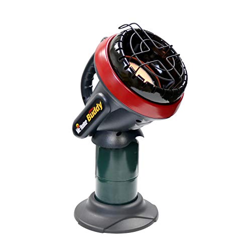
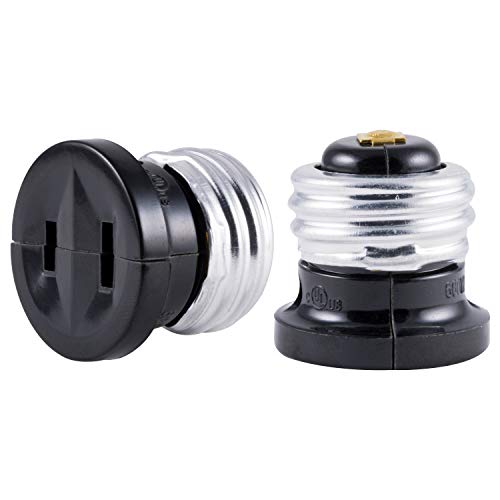
If you have an Edison bulb to outlet, you could get some power from the light bulb in each cabin. I would not suggest leaving it plugged in as it might be against the rules, especially when housekeeping comes by.
You get the first come first serve wilderness permits the day before you start your hike. So if you're starting Thursday morning you want to grab your permit Wednesday morning.
I've gotten permits 3 years in a row this way. It's not too hard. Just make sure you go to the wilderness center closest to your starting trail head. For me that was tuolumne as I was starting from either sunrise or cathedral.
I always showed up at 4am to get in line. In my 3 years experience, people tend to start showing up around 6. If you want to play it safe you could show up earlier. I wouldn't show up much later than 6 though and hope for a spot, especially starting at a popular trailhead.
It's actually pretty fun crashing the permits. You can meet some friends. Bring some cards, beers, food, whatever. I recommend some coffee or something warm for the morning. Also it's cold out so dress warm and bring a sleeping bag and a chair to sit in.
You totally can plan this trip in time but read up lots of info on it. You need to be prepared and know what you're in for.
Here's a good book on the half dome hike One Best Hike: Yosemite's Half Dome https://www.amazon.com/dp/0899976743/ref=cm_sw_r_cp_awd_WMJ.wbN98J7JN
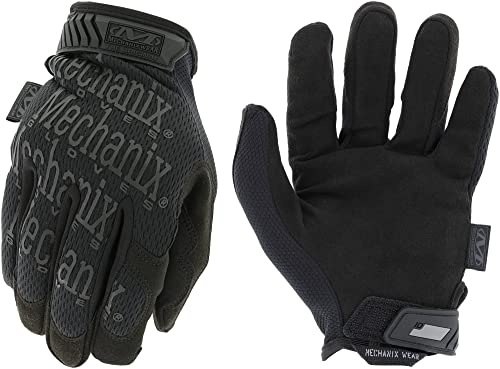
BRING GLOVES FOR THE CABLES. I used mechanix I bought at auto zone. Worked great.
Good luck. If you have any more specific questions let me know.
I use a pair of Mechanix gloves and just cut the finger tips off.
Sometimes Lowes, Home Depot, and those type of stores will have them for under $10.
yea, I only had 35mm on it, and stuck with it. I've been using Peak Design camera clip for years (http://www.amazon.com/Peak-Design-Capture-Camera-PEAKCAMCLIP/dp/B005JZ7EV4)
Although it is time to get a new one, its gotten banged up so much that the clip does not insert smoothly anymore. This thing is pretty much bulletproof (so far!). I've even gone on bike rides with the camera attached to my belt or backpack shoulder strap.
The article only lists a dozen or so places- a much better resorce for this is Peter Browning's Yosemite Place Names which covers nearly everly named geographic feature in the park.