
What are
/r/area51's
favorite Products & Services?
From 3.5 billion Reddit comments
The most popular Products mentioned in /r/area51:


The most popular Services mentioned in /r/area51:
OpenStreetMap
SemanticScholar
Player FM
Magic Lantern
Yandex.Maps
The most popular Android Apps mentioned in /r/area51:

The most popular reviews in /r/area51:
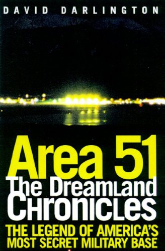
I just told you. It is full of errors. This is my favorite Area 51 book, out of print but you can find used copies.
https://www.amazon.ca/Area-Dreamland-Chronicles-David-Darlington-ebook/dp/B00GQ603BS
Or search for "TD Barnes" on Amazon. He worked there, and has written some books. Or Peter Merlin's books.
If you read MO's account carefully, he used 4G as an initial control mechanism in place of a standard RC transmitter. This was a fairly standard practice for attempting long distance flights while still maintaining aircraft control. Because the US now has general prohibitions against "beyond visual line of sight" operations, 4G control is probably mostly used by hobbyists illicitly. And as noted, requires a decent cell signal.
His 4G control was limited to getting the aircraft to an initial waypoint at which point the preprogrammed GPS flight path took over. From that point until it's return the aircraft would have flown without emitting any RF. What I don't understand is how MO knew when it returned, unless it went into a circling hold over its launch point (and upon seeing it took 4G control), or it executed a programed landing and went in hard.
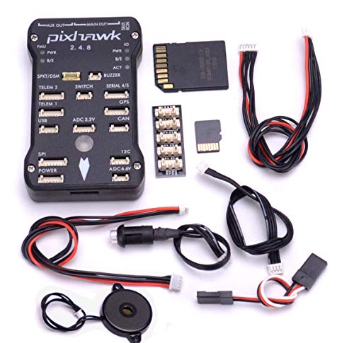
If true, this is a pretty surprising (and f'ing stupid) feat. The Parrot Flying wing is essentially a toy that was upgraded. Somebody using a hobby-grade autopilot like a Pixhawk could do all that has been described and a LOT more. Other than localized GPS jamming/spoofing, there's really no defense against one of these things flying dark. Drone hobbyists have known about these capabilities for over ten years but generally don't talk about it much to avoid drawing attention to it.
Glenn Campbell got an official map. He used to sell copies at the research center. Well when he had copies to sell. I imagine anything old (as in off that map) is accurately labeled. But as new buildings were built, the "community" added new numbers of their own.
I had my Windows laptop w/Virtual Radar installed last trip, with a homebrew coaxial colinear antenna. Looks like there are some apps for an Android tablet, which I also carry with me for my drone. Gonna try the app next trip, the laptop setup is a bit bulky.
https://play.google.com/store/apps/details?id=com.wilsonae.android.usbserial&hl=en\_CA&gl=US
Well there is yandex as an alternative to Google Earth. This is the TTR. https://yandex.com/maps/?l=sat&ll=-116.777943%2C37.801414&z=13.78 And of course Bing.
https://www.planet.com/ Had a free demo offer. I couldn't figure it out. But "The Drive" pays for their service.
when I said fmc I meant Flight Management Computer probably better known as the fms. and Not sure if the photos are legit but here are some I found.
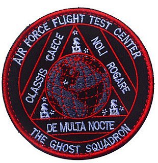
https://www.amazon.com/Squadron-Helicopter-Aviation-Embroidery-Patch/dp/B07G2X8GQY
Sometimes the number and shape of stars are significant, sometimes not. I've seen a number that have "51" i.e. Area 51, indicated by number, shape of stars. Like 5 stars, then 1 off a bit, or 5 total and 1 is a different color. Probably coincidental, but on the second patch above the eagle...
Trevor Paglen has a book with a number of "secret" patches in it.
https://www.amazon.ca/Could-Tell-Then-Would-Destroyed/dp/193555414X