
What are
/r/bikepacking's
favorite Products & Services?
From 3.5 billion Reddit comments
The most popular Products mentioned in /r/bikepacking:


The most popular Services mentioned in /r/bikepacking:
Ride With GPS
Komoot
AllTrails
Bikemap
OsmAnd
Gumtree
Facebook Marketplace
Trustroots
Strava
MapMyRIDE
TeeSpring
Windy
QMapShack
Ecosia
Lifehacker
The most popular Android Apps mentioned in /r/bikepacking:

MapLocs Cycling Route Planner
BackCountry Navigator TOPO GPS
The most popular reviews in /r/bikepacking:
Route: https://www.komoot.com/tour/591416574?ref=atd
Initial plan was to continue all the way to Portugal following European divide trail after Almadén, but Omicron Variant spooked me and Canadian government who introduced additional restrictions on arrivals which to make story short would make me spend Christmas eve/Christmas at Toronto airport if i followed my initial plan. The only way to prevent that without paying through the nose was to cut the trip short so i ended up in Seville which is where I'll be flying out of in couple of days.
Pros of touring Spain: excellent coffee everywhere, lots of cool backroads, beautiful Baja-like scenery, Córdoba is the most beautiful city I've ever seen, beautiful fall weather in December, drivers are very respectful of cyclists. Super helpful people.
Cons: no water except in cities/towns. Don't even bring the filter. Food is disappointing, at least for vegeterians. Subpar wild camping options, of which there are only few. Off-season hotels and hostels are relatively cheap though. Spanish trains have a thing against bikes. Don't by into bikepacking.com "media distancia trains are great with bikes" thing. Getting from Madrid to Córdoba was an adventure and a half (which involved shipping my bike with local currier), next time I'd fly into Seville instead. Basically no wilderness, which i guess is to be expected but still a disappointment.
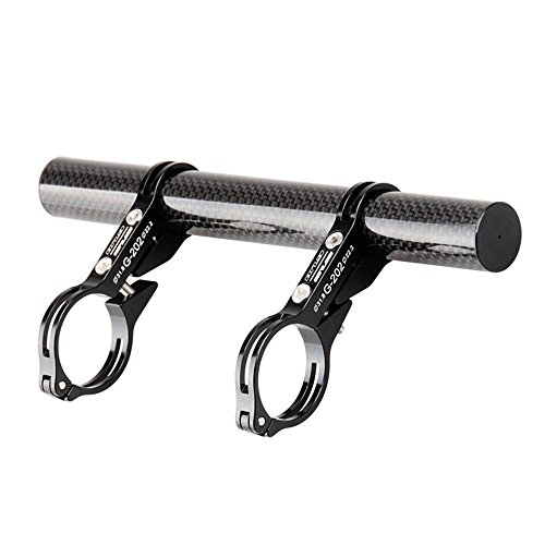
Alternatively, I've found these to be a great handlebar option. It's rather large, but I've done several rides without too much knee interference. It can even store a standard canister cook-kit.
I did the <em>exact</em> same thing recently!
If you're looking for an easier bikepacking experience, I have a modified variant of the Boulder Bikepacking Loop that avoids some of the nastier climbs and is much more doable on a gravel bike. Going down Switzerland is super fun but very rocky/bumpy on a gravel bike, and 505 is an interesting technical challenge (but also very fun). I haven't run that variant yet myself, but I planned it on the advice of a Boulder Cycle Sport employee and a desire to never, ever climb Magnolia again.
- 15% singletrack through some stunning volcanic areas and along the flowy Lewis River Trail
- 18% gravel
- 67% abandoned or closed National Forest roads (washouts and slides) which ensures a minimal amount of traffic. Bonus right now is that NF-99, the road up to the Windy Ridge viewpoint, which is normally full of tourists, is closed to vehicles due to road damage.
- 3-4 days
- +15,000 ft elevation gain
- Food and resupply points spread out evenly along the way.
With some luck, the route could make an appearance on Bikepacking.com
Desert LNT;
Camp in established sites
Bring plenty of water
Don't bust the biologic soil crust
Don't touch ancient rock images
Pack out your poop
​
https://ridewithgps.com/routes/35707308
​
Tread Lightly and enjoy!
Through Oregon there are like 3 non-pavement routes you can take depending on where you approach Oregon - The Outback trail, Oregon Timber trail (which you can mix and match with Outback as they criss cross couple times), and the one which name I don't remember but it follows logging roads fairly close to the coast.
Then there's this: https://ridewithgps.com/routes/27636508. I'm sure you can take some parts of it. Don't know how "gravel" it is as the author rode a fat bike.
Finally there's Komoot. Its advantage over ridewithgps is that it breaks down riding surface by types, allowing you to reroute highway/pavement sections (manually).
You could use a bar extender like this one. That’s just an example found on a random google search. I’m not vouching for that specific one. But the idea is to provide a connection point out past the cables. Rockgeist integrates something similar into their Barjam harness system, and some other harness/handlebar bag makers do as well.
Eheh, due to time limit and shitty weather, I actually took a train to Augsburg (Kissing). Then through Süd Tyrol : https://ridewithgps.com/routes/37247349
I wish I went more direction Innsbruck and then towards Switzerland, but yeah, short on time.
Most of it. A great deal of it was push and carry due to downed trees and steep ascents. Lots of brush out there to tear up your lower legs. Here's my tracks for the 6 days I was able to manage on the trail: https://ridewithgps.com/events/23088-3-sisters-3-rivers-take-1#routes/15335243/preview It was one of the most difficult rides of my life. Here's a crap load of photos: https://www.flickr.com/photos/tomascosauce/albums/72157671544285805 If you plan on doing this route, you're going to be carrying and pushing your bike often. You're going to need 4+ liters of water a day. You should have about 3 days of food on you at all times. Top off when you can. THIS ROUTE IS HARDCORE. Bring lots of bug spray as the mosquitos will be worse than a Zerg Rush.
went with a buddy on a 6 day intense tour (1 rest day) through from florence tuscany towards rome, then along the coast to napoli.
super fun and hot!
komoot gpx here: https://www.komoot.com/collection/1217203/-firenze-napoli
Okay so that is a big question. I would first start with what type of Carey system you are going to use, that will indicate how much room you have to pack
I do like those little stoves, but did switch to a JetBoil because it is an all in one system with pot and stove and the file canister fits right inside, in the end it is more compact than the sum of the parts.
For the true bike packing experience you will need a carry bags (panniers, frame bags), tent, sleeping bag, ground mat/mattress, stove/fuel, eating implements, clothes -both riding and around camp, repair kit, a leather man type knife. Also food and water.
Of the items you suggested, I am not sure if you need a compass, unless you are going way off road. You are better with a multipurpose knife like a leather man than a simple knife. For eating implements I really like the long necked spork - they work great with a jet boil and with freeze dried meals.
https://www.amazon.ca/dp/B00GLD3Q7O/ref=cm_sw_r_cp_awdb_imm_t1_1Vi.FbD2RZ1RR
I also like the plasma lighters for getting a fire started.
Hope this helps
https://ridewithgps.com/routes/33507872 This was the planned route, mostly following the bc trail or continental divide. I did not do the trail section from nelson to castlegar though, instead riding on the highway. I also took a city bus from hope to agaziss, as I had to catch the last ferry home and had to hurry up, and would also just be on highway for the entire time.
This is a link to the full route map:
https://ridewithgps.com/routes/27441087
I believe we did end up deviating slightly from this at times due to various reasons but it's more or less the exact route.
You don’t need backcountry permits, but right now most of the sites in BBNP are on recreation.gov to reserve ahead of time. The camp sites along the river road, however, are first come, first serve, and booked at the visitor’s center when you arrive, so if you plan to camp on the river road, you must be flexible.
Edit:
https://ridewithgps.com/routes/34621685
Here’s the route I did in December, which is essentially the route linked elsewhere in the thread without the out and back along the full River Road. We started at Rio Grande Visitor’s center and camped at McKinney Spring and Pine Canyon 1.
https://ridewithgps.com/trips/40759690?privacy_code=F69pcOEHPyxnfqbF
This is the route I’m taking. There’s dispersed camping at Lake Tiorati. You could also do the Beaver Pond Campground, but it’s 15bux a night. I hear of other stealth options, but I can’t comment on that.
And they are easy to take on and off. Get to a new city and want to bike around? Drop off the panniers at a hotel (or stach somewhere) and ride around without having to watch your stuff.
Here's the inked version. I'm painting it at the moment. It was a big hit with the FB bikepacking community. Figured I'd post it here. Prints - https://society6.com/product/bikepacking_print#1=45
Tshirts - https://teespring.com/bikepacking
Hey! I was planning to do c2c about a month ago, and didn't get to. I wanted to share my route with you in case you find it helpful. I found there were a few sections where you have to make your own way since the c2c technically isn't complete. So for those sections, you can see the choices I made if you're interested. I studied the Strava heatmap and google maps in making decisions about those few sections.
Here is a rough outline of the route in rwgps: https://ridewithgps.com/routes/28342088
There are a few "straight line" areas where rwgps does not have trail information. In between Nine Mile and Big Eau Pleine, the route cuts through the Burma Forest using ATV trail 1 [there are other options, but we used 1 as it is the most direct route]. The route ends as you get into Big Eau Pleine because there is not singletrack mapped in rwgps. We rode the singletrack on the north side of the main road out to the south unit campground. There are electric and non-electric sites available and there is a water source. Between Nine Mile and Eau Pleine, though, the only food/water available is at Hammer Down Bar [roughly halfway].
On the return ride, we rode the BEP horse trails to the singletrack near the west campground and then out to the main road. There is another water source right by the ranger A-frame. After leaving BEP there are no services until you get through Nine Mile [there is a water source that is sometimes on at the storage building... I would not necessarily count on it being on].
The other noteworthy "straight line" portion is at the far north end where the route goes through Sylvan Hill Park. This is now a bike park but, again, the trails are not on rwgps. I rode the outside, Sylvan's Loop, as it does not have jumps other than a few B-lines.
The route uses about 99% of Nine Mile's singletrack and roughly 75% of BEP's singletrack. If you have any questions on that portion of the route or any other parts, let me know.
In case this is of interest to anyone, I combined the Blue Ridge Parkway, the New River Trail, and the Virginia Creeper Trail (along with lots of country roads) for this 3-day loop: https://ridewithgps.com/routes/20799868
Began/Finished at Doughton Park on the BRP (which is pretty easy to get to from Central NC where I'm at).
Thank you! For this ride, we drove to the starting line, since the city I reside in is a bit north of this particular territory. I'd say the route as I have it mapped (and as we rode it) is 75% road, 15% bike path, 10% singletrack. However, of that 75% road, 90% of it is some form of gravel, logging road, abandoned railway bed, aka "fun" roads. Time on actual pavement was minimal. The route could be extended with more trails in the forest. https://ridewithgps.com/routes/13323171
Thank you! Yeah, Here’s the route info with elevation and what not:
https://www.komoot.com/collection/1262442/-from-beverly-shores-to-goodrich
As far as how I managed them, just grit my teeth and shout a few profanities at myself - haha.
I checked out several different sites and apps after posting this same question.
https://www.komoot.com Koomot seems to be where it's at! Design your route online and it can sync to your phone app, similar to trailforks in that respect. It shows trail type designations and surface type, gravel, rails to trails, bike paths, etc..
Here's the wiki for the different sites and apps: https://en.wikipedia.org/wiki/Comparison_of_bicycle_route_planning_websites
I've started bringing my .4oz Esbit stove on shorter rides. That stove and one or two fuel tablets are perfect for an overnighter.
I have one, they are legit magnificent.
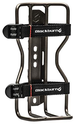
Additionally, Zefal makes a 1-liter water bottle that fits in normal cages; no need for a heavy-ass Nalgene unless you want to go all the way up to 1.5L. So the Woho Anti-Sway and two Zefal Magnums gets you two liters, which is enough for many climates. If you're somewhere dry, another liter under the downtube (if it fits) and another on the fork should be plenty.
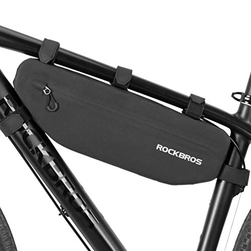
Not aliexpress, but I bought this $15 frame bag from Amazon, intending for it just to last me a trip or two until I decided whether bikepacking is something I really enjoy, in which case I would buy a higher-quality (and expensive) Revelate or whatever. Four years and a lot of use later, it's still in great shape.
The Large fits my size-medium Surly Ogre perfectly.
We did some trail exploring in Western Massachusetts. Mostly a usual route of ours with a few side tracks to find new connections. Amherst up to Wendell - then back down through Sunderland (Mt. Toby) back to Amherst.
I've been using RwGPS on a computer and love it. The ability to swap underlaying maps among the 12(!) versions of the same area is helpful to illuminate some pathways/roads that don't show up on all maps. Sometimes it's 'follow road' function is attracted to pavement but stepping along the path I want is doable or if there's no possible way on any of the maps there is always the 'draw line' function to get me to the next bit of pathway. Sharing routes is very easy and you can download the course in about 7 different formats https://ridewithgps.com/routes/35054177
You bet. Here you go:
https://ridewithgps.com/trips/52812276
I think I started at about mile 3 following that route.
I parked at the Schultz Creek Trailhead dirt lot:
Schultz Creek Trailhead https://goo.gl/maps/rs9cWfjUGFTViVQp8
This trip beat me up. 81 miles, 6,000ft. of climbing, two days, a lot of singletrack, and sometimes the path disappeared leaving us to bushwhacking our way. But it was awesome. If anyone near north Jersey wants a little challenge, this is a good one. Not impossible, but not easy either.
I did this in May!
Here’s a link to the entire route we did https://ridewithgps.com/trips/65486893
The first 2 nights we weren’t so prepared so we had to just camp in a random spot on the side of the road in the woods, but once we got to key west there was a nice one called “Boyd’s Campground” with a shower and everything.
Here is the route. We opted to remain on Highway 66 after Big Elbow as we were short on time. We camped at Sawmill as it is now a designated camping area for hiker-bikers (or any other self supported travelers).
https://ridewithgps.com/trips/71429700
Here’s a link to my recorded ride. On the southern section at about mile 68 you have to get onto Wamic Road and take that to another detour onto FR 4880 that will take you back to wamic and up to mile mark 93. This forces you to take off some miles of the route but I still really enjoyed the ride and it does shave some highway miles off which was nice. I also suggest only filling up water at Jean Lake and not camp. It’s incredibly beautiful but the mosquitoes were awful and there are some amazing camping spots with huge vistas just 2 or 3 miles further up the trail!
https://ridewithgps.com/routes/33707035
Rode from my house to the Max station, and took that to the end in Hillsboro. I turned south instead of going into TIllamook.
Ended up with 112 miles and 6100' elevation.
I grew up in the Applegate (Ruch), so most of my suggestions are in that area. I think if you could do it mid week, there are tons of dispersed camping options south of Applegate Lake along the Californian portion of the Applegate River. I say mid week because it gets a little busier on weekends and traffic can get busy and the road is pretty dusty. But the river is beautiful and there are dozens of swimming holes.
I had the opportunity to ride with some folks from Ashland and they had lots of good things to say about the forrest roads south of the Crest. You could either drive or bike up to Mt Ashland and then head over into the Californian side from there. Beaver Creek camp. Here's a good route although you can do it in chunks. https://ridewithgps.com/routes/30209290?privacy_code=upd8ZYpBnJuGUcbP
https://www.siskiyousaddletramps.com/multiday-adventures is another good resource if you want to do gravel bikepacking.
I would try and find a buddy to do it with, it's pretty remote down there.
There's a great route in development that runs from the Katahdin Woods and Waters National Monument all the way to Bethel, about 225 miles, but it's still being developed and permissions being worked out with loggers, etc.
Unfortunately at the moment, there isn't a great option for long distance gravel in Maine, without piecing it together between longish paved sections. There are lots of great rail trails, logging roads, and dirt roads, but no unifying route that links them together in a way that lends itself to bikepacking.
That said, you might want to look into this route: https://ridewithgps.com/routes/33300174
I haven't ridden it, but I know the guy who developed it, and I'm sure he'd be happy to talk to you about ways to extend it. Message me, and I'd be happy to connect you.
route out of Dufur, OR Exploring Mount Hood National Forest via gravel, road and single track. We had to adjust route along the way with recent fires and dead fall from windstorm. Original route is on Oregon Bikepacking Lots of climbing (11k), amazing weather and adventure. Probably the best bikepacking trip thus far.
To everyone who was asking about the route- I'm sharing it here on the thread so it's searchable for anyone in the future!
Brooklyn to Lake Skentonto (Via Henry Hudson)
The route is a modified copy of an existing route, so the cues on there for food, water and groceries aren't mine and we didn't use them, but they seem like a good resource. We took Henry Hudson to spend less time on Route 9W and it was beautiful but most likely hillier. There was a road closure but we just went around it and no one gave us any shit. There's about 10 miles of gravel between Nyack and Haverstraw which was a gorgeous ride. Once you get to Seven Lakes Road, you'll come to another road closure- this is the former access point to Lake Sebago which has been closed down since ~2011 when the beach and structures there were destroyed by a hurricane. You can pass through and follow the route and you'll skirt around Sebago and eventually be brought to the eastern bank of Skentono- the route ends right at the site we camped at but there are lots of little nooks along the banks and on the other side, too. It was pretty populated while we were there which made us feel a bit better since it felt so 'abandoned' and closed off. When we got to the road closure at Sebago, there was this older couple at the gate (who we think were stoned out of their minds) who ominously told us "you can't go down that road", but once they realized we were down, they relaxed and told us a bit about the history. It's a really sweet site- we'll definitely be back. If you have any questions about the route, just ask! This goes to folks who stumble on this thread down the line, too.
Go up six mile road (just past duhamel store) and camp at Sasquatch lake then down lemon creek fsr on the other side to the Slocan rail trail
We’ve done the Mpls-Danbury portion in one day and we’ve done it in two days. I was the only one doing it fully loaded in one day because I arrived too late to put stuff in the sag wagon. It was tough. Two days is definitely the way to go if you have gear. We take the Gateway to the end, then get onto Norell->Square Lake->MN 95 to Interstate Park. We camped at an off-the-books spot a few miles north on the WI side. The second picture is the view from the campsite on the first night.
From there you just get onto the Gandy Dancer and take that to Danbury.
You can also take this gravel route on the way back to switch things up: https://ridewithgps.com/routes/34069150
Bikepacking Washington is a challenge because the terrain is generally steep on public lands. Looking at Bikepacking.com, there are way more routes in Oregon, which has less relief. I use ridewithgps.com to fined routes using "bikepacking" and "gravel" as search terms. Theres some nice looking routes south of Mt Adams in the Gifford Pinchot.
I'm following part of Tomas's GCOR. Starting from the southeast tip at the base of the Hood Canal and heading west, I'll finish either in Forks or La Push. It will be fairly short mileage days this time but I have some side trips planned.
It is probably not possible. But if you want ride the Cassiar Hwy and want to reduce the HWY km, you could try to get to the abandoned railway line that was intended to link Dease Lake and Fort St James.
https://ridewithgps.com/routes/11364464
I haven´t ridden it, don´t know the conditions. I rode the Cassiar on 2016 and I remember seeing the abandoned railway line from the highway.
This is more or less the route. Certain bits were changed a bit because of hike a bike/hiking only trails.
https://ridewithgps.com/routes/31569203
Edit: Also, I should add that we originally planned on riding to the top of tam and taking more dirt on the way back but day one was huge and with fully loaded bikepacking rigs and cameras, it kind of crushed us so we went easy on the way home. This is a hearty two day trip.
Finally, descending from Pantoll ranger station, we didn't take the exact route shown. We bombed some not quite legal single track that is possibly the best section of single/flow trail in all of Marin. It's obvious. Just follow the last POV cam footage in the video and it will lead you right into it. HAve fun!
Would be happy to join you, but I'm leaving mid-June on my way to MT. I'm worried about the eastern WA heat too, but still need the snow to melt in the Rockies. In fact, both the Cascades and Rockies are getting snow dumps tomorrow! Phft.
Suggestion: check out the XWA route as a better path to cross the Columbia River vs riding over I90, unless you already have a car shuttle lined up. While technically you can ride over the I90 bridge, there's a mile stretch of no median, and I don't think it's safe (speaking as a former NYC biker).
Here's the XWA route...
https://ridewithgps.com/routes/26681188
XWA = Cross Washington Route, which is a race from the coast to the ID border.
> On another note, im curious where in Colombia you had some adventures?!
A good route is Oh Boyaca! route from bikepacking.com
I started doing it but had to bail due to the combination of non-existent Spanish, bad physical condition, and problems with altitide acclimatization. All predictable but somehow I had to cycle for two days to really understand how unfortunate the combination of all three is :) Two friends of mine did and liked it. It's all gravel road, no singletrack (and don't think about doing single speed dude)
I then spent two weeks in Medellin taking some intense Spanish lessons all the while riding every day to get in better shape, and then I did this route: https://ridewithgps.com/routes/28961034
Just something I stitched together in Komoot plus following advice from one of the locals who loves cycling off pavement. The route is about 50/50 pavement and gravel, however all pavement (with the exception of Las Palmas climb out of Medellin) has very quiet traffic, locals only.
I didn't ride the last ~60 kms of that route because I fell off the bike and got food poisoning on the same day, and decided to call it a trip, and paid sombody with a pick up truck to drive me to Manizales, but from what I've seen from the window of the car it was very beautiful.
Myself and a group of 3-4 others are planning on doing a lengthened 5 day version of the Tour de Chequamegon in early September. https://ridewithgps.com/routes/26793328
Welcome!
I'm on the Pacific coast, and can't speak to any routes in the East. Two really good resources to get you started are:
Bikepacking.com has a ton of interesting routes, and
ridewithgps.com is a great tool to plan out routes, daily distance, elevation gain.
NIce! If you can, please share your route. This is roughly what I'm doing is ~3.5 weeks. Cannot wait to get back out to WA/OR. If I could move there, I'd be there yesterday
Yeh sure, you can get the .GPX here. The route is fairly hilly and very remote so some prep is definitely required as there are long sections without food. Its a fairly relaxed three days, a big two days and as far as we are aware nobody has completed it in 24 hours.
I would recommend using a CX bike with the biggest tyres you can fit (35+) a mountain bike is fine but you want fast tyres as there is a lot of long gravel roads.
Canmore, AB to Castlegar, BC.
Then in 2019 Vancouver, BC to Castlegar, BC to complete the trip.
https://ridewithgps.com/routes/26649569
I combined the Alberta GDMBR portion with the BC Trail and this looks like a fun ride. Sad I can't do it all in one go.
The group ride was cancelled a few years ago because dummies weren't cleaning up after themselves. Doesn't mean you can't still ride it whenever you want.
https://ridewithgps.com/ambassador_routes/28-the-oregon-outback-ob-edition
if you are interested in riding gravel, there is beautiful and surprisingly rugged riding on the roads in the northwest corner of the state. last summer i rode 130 miles of this route in a day and was struck by its ruggedness and beauty. the only legal camping on the route is in apple canyon state park and along the mississippi river near blanding, but there were some good opportunities for stealth camping throughout the ride. if you're interested in more singletrack-y riding i'm afraid i won't be able to help you there.
I'm planning on doing this journey later in the summer (need to get into better shape first!)
For a one night trip, you could head up the Humber river trail and continue on until you reach the country roads, then find somewhere to camp out there. Then in the morning just cycle back into town the same way you came.
Just trimmed up the route a bit and connected a few dots for new stuff I found on the route. There are 3 singletrack sections that I've removed for now until some better planning is done. This route should be ridable, though.
Route trimmed up to a rideable state. There will be some changes made in the future to include 3 more singletrack sections that just didn't pan out on this trip. They need a little more planning.
I ended up making this route
Still gettting used to the idea of wild camping. I’ve wild camped in a bivy before in Germany, since it was minimalistic i did not have a problem then.
I was frightened at first but I enjoyed the feeling then. I’m more worried about selecting the site
We are going to Camp as much as possible. In the big City's( Vienna and Budapest) we are probably looking for AirBnB's because we want to stay there for a few days .
​
For the route: Its going to spontaneous but in the end we will just follow the Danube. For specific waypoints i looked at this route already.
https://www.komoot.com/collection/359/the-danube-cycle-path-from-donaueschingen-to-budapest
I followed a variation of the Scottish C2C (Annan to Edinburgh) which is a road route, so added in a trip though this forest for some gravel.
I use Komoot to plan routes and am not sure how to upload here, but it seems the forest has a multitude of forestry roads through it connecting wind farms etc.
Here’s a link for the portion through the forest, not sure if it will work tho, let me know!
https://www.komoot.com/invite-tour/61623464?code=zclfuv-R-lJdBuc2dG45_fS6CjEEr3MSuxcYwGeMGARTuTbePU
Love that there are more podcasts related to bikepacking! I know when I switched to Android from Apple (I liked their Podcast format) it was hard to correlate all the podcasts I liked from one new location. I found Player FM to be pretty good. https://player.fm
This is what I bought. I ride a Surly Pack Rat that had the 8 pack on it when I bought it. It fits fine on the rack. I strap it down with bungees. You can attach it to the handle bars but I found it interferes with the brake cables when i do that.
This is technically two bags but I think it is perfect. My sleeping bag, fuel, stove, and hammock all fit in the larger one with room to spare. The smaller one that sits on top I am using for food.
Love hardtail packing!! If you want an extra fun setup item, I had great luck with putting two of these bottle holders on my fork arms 👍👍 https://www.amazon.com/dp/B07ZRWGX8R/ref=cm_sw_r_cp_apa_glt_fabc_A2W9DC3P47ZF7PWN84KQ?_encoding=UTF8&psc=1
$40 and easily the most popular lightest rain jacket for people hiking the PCT/AT etc. Works great as a wind jacket too. Really like mine for biking
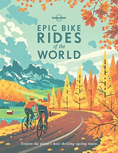
I enjoyed the book and have a great appreciation of the toughness of this race.
The only protection is for the chain, I’ve not added anything else 👍The size is 27cm wide :-) Here is the link Lizard Skins LI9960 Protège base... https://www.amazon.fr/dp/B0186OOBFG?ref=ppx_pop_mob_ap_share
Wait, are you expecting nighttime lows to be 15 degrees or -15 degrees? Big difference between the two for sure.
If it's really gonna be -15, you should call the trip off. Those are serious, dangerous cold temps. I rarely turn down a sufferfest, but that wouldn't even be fun in the Type 2 kind of way... it would just be slowing freezing to death.
If it's 15 degrees as a forecast low, that's a little more manageable. It's still gonna suck in a 30 degree bag though. Best things you can do:
- bring any extra insulation you can - down jacket, puffy pants, down quilt (there are packable ones available - like this https://www.amazon.com/Marine-Black-Diamond-Packable-inches/dp/B074PJ7C4C/?th=1). If you don't have down, fleece or synthetic insulation is fine too.
- Bring an extra foam sleeping pad if sleeping on snow
- Bring a dry change of baselayers, wear them only to sleep.
- Bring a nalgene, fill with hot water before bed, wrap in a t-shirt and put in your sleeping bag. You may have to reboil in the middle of the night too.
- Eat lots of high-fat food before bed - chocolate, cheese, nuts. Keep some handy if you get cold in the middle of the night.
- Try to dial in your campsite selection to be in a warm place. Cold air tends to 'sink' to low spots, so valley bottoms, river banks, right on the shore of a lake, etc. are going to be the coldest places around. Anywhere near water will also have more moisture in the air which will lead to condensation and wilt your down. If you can, being under tree cover on a clear night will be warmer than being in the open. Being protected from the wind can make a really big difference too.
>Can it make a 16oz coffee in one shot? I really don't like brewing twice for a single cup...
Nope. It appears to be a "3 cup" Moka pot, which brews about 5-6oz of concentrated coffee. You can dilute it with water and make something like an Americano.
>I drink a lot of coffee.
You'd be happier with the "6 cup" size that brews 10-12oz. It's pretty strong coffee and it's super cheap to see if you like it.
$7 https://www.amazon.com/B120-43V-Aluminum-Espresso-Stovetop-Silver/dp/B00164QTY0
Stainless pots are in the $20 range and won't hold on to bad flavors like the aluminum pots eventually do.
Cafe Bustelo is the go-to coffee for these things. You can pick up a can or brick for a couple of bucks. If you don't normally use sugar, you'll probably want to with this stuff. I usually use cream too even though I was strictly a black coffee drinker for decades.
That's what this is for. I have a Shimano savanna on one of theserods
There are several versions of this thing that can be helpful. https://www.amazon.com/UPANBIKE-Handlebar-Extension-Speedometer-Headlight/dp/B074498GPL/ref=mp_s_a_1_3?dchild=1&keywords=carbon+toddler+handlebar&qid=1610255263&sr=8-3
He was cycling touring long distance across the world and (I presume, haven’t read the book yet) that was the best food he had at the time on him. He rescued her and looked after her ever since.
I recommend using a structured training plan along with your new indoor trainer. There are many ways to go about it, but I'm a fan of Trainer Road, which is a subscription app that takes the guesswork out of periodized training. For bikepacking and touring, a good approach is to use their sweet spot base training for a start. The main benefit of structured training is that it helps you maximize your efficiency. Meaning, you will get fit much faster than doing it in an unstructured way. If you want the deep dive, check out Joe Friel's aptly named book.
You don't have to use the trainer all the time, but it will help you understand your zones of effort and give you the tools to do so outdoors.
Strength training and core workouts are also key to enjoying long days in the saddle, as well as a solid bike fit.
I'd get the Massdrop x Klymit UL Static V (Insulated) instead. Cheaper than the Alpkit, and about the same weight as the Exped while having an higher R-value.
The Alpkit is just a rebranded Chinese pad btw. You can find it for less on Amazon.
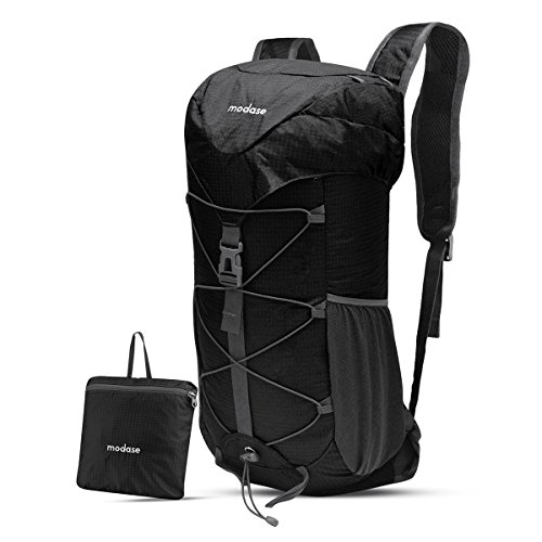
I've used a pack like this for ultralight backpacking trips. Be warned, it's definitely not 40L, probably just a hair over 20 realistically. There are similar, larger bags on Amazon. The one I have packs down to about a 1 liter size.
If you are using a frameless pack, you have to pay extra attention to packing. You don't want an overly large bag. I use my sleeping pad as a "frame" by packing it closest to my back. Everything else needs to packed tightly. I would not use such a set up for much more than 15 pounds.
It's an Aegismax is size large. I actually got it from Aliexpress for faster shipping and availability. It's not the best quality but is still good after two bikepacking trips for a total of 20 nights.
It's a light down sleeping bag great for summer, I was in short and t-shirt and didn't get cold, thought summer nights are warm. It could be considered a 3 season sleeping bag. We chose it for it's very compact size.
These things work pretty well. A friend of mine has had one for 3+ years and uses it quite regularly. They can pack really small but the materials aren't the lightest.
Thanks for the advice! We actually bought a mosquito net from Amazon as all the videos and travel guides keep mentioning this.
link
I use this one: https://www.amazon.ca/gp/product/B01743BX1A/ref=ppx_yo_dt_b_asin_image_o00_s00?ie=UTF8&psc=1
There's a number of literally same pots sold by various vendors, as is often the case with cheap chinese stuff. This one is a cooking set, but I only use a pot, just couldn't find a pot alone.
I like what this guy has done:
https://www.youtube.com/watch?v=GDLwGfeO2Jo
This little solar panel is available all over the place. I found the same one on amazon for 20. He trimmed the edges off. The original shape had eyelets like this:
https://www.amazon.fr/gp/product/B09F64C58Z
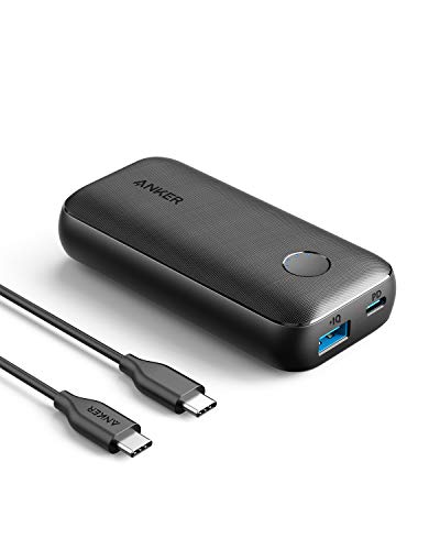
He says he can recharge a 10000mAh battery with it. That's all he needs. I will try it out. I might post something in the Randonneuring sub.
I use a connex by wipperman link that doesn't require tools to put on/remove and lasts longer than your chain will last. The one I've got on my bike is at least 3 years old and has outlasted 5 or 6 chains.
I also carry a multitool so that I have pliers and have used that to pull a thorn out of my leg and for all the reasons that everyone else has commented on.
Oooh best had to be my hydration pack (well not mine actually I borrowed it from a friend), can't beat having water super easy to get to. Plus it was pretty, visible and had detachable wings! https://www.amazon.com/Dan-Pak-Hydration-Discount-hydrtion-Holographic/dp/B07DWMN9XT?ref_=ast_sto_dp
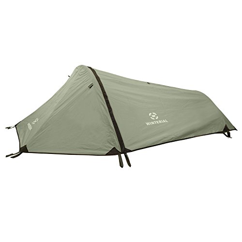
Hmmmm I don't think I had a worst piece of gear, I only took stuff I really wanted or really needed. My tent was kinda annoying cause it wasn't freestanding but I usually made it work and it was light and great on soft ground so can't complain too much honestly. I've got a vango Nevis 200.
The yellow things in the picture look nothing like my Pedro’s levers - they look like these
Can you afford 60 big ones? I got one of these:
https://www.amazon.fr/Z%C3%A9fal-Adventure-Sacoche-Bikepacking-Universelle/dp/B07GWXW8XG
Throw in a Woho and you're looking at ~90
For bar bags something like this maybe:
https://www.amazon.fr/VAUDE-Aqua-Sacoche-Guidon-pour/dp/B01M15LWJ7
OK? This is 60 or 60 + 90 = 150 for both. I'm not a huge fan of this kind of bag but way way better than a fishing box.
You can but those little refillable silicone tubes to put chamois butt'r in in the future. I think I'll probably try this for my next trip that's more than one or two nights
I have a pair of these and really like them. They stuff rather neatly into the back pocket. On the slim chance that you are size small (hah! get it??), Amazon has them for $100.
The stiching on this pack is very weak where the straps connect the pack. They broke during the 3 day trip, I might have overpacked it but I also know my friends have moved to other packs due to durability issues. I bought this Osprey after and it has held up to loading beer, food & water fine. https://www.amazon.com/Osprey-Ultralight-Stuff-Pack-Shadow/dp/B00RZV7WKS
I didn’t want to spend a bunch when trying one so I went with this:
I haven’t found a reason to spend more yet other than for lighter weight more compact. Still using this $40 one.
For eye protection, I like to bring a bunch of lens wipes (https://www.amazon.com/Zeiss-Pre-Moistened-Lens-Cleaning-Wipes/dp/B00GL64QG6). My eye-wear gets mucked up so easily and it sucks not being able to enjoy the scenery.
I picked up a cheap one off Amazon with water bottle pockets on either side for a recent trip. Would definitely do it again and avoid the overly expensive options from big brands that lack useful features.
This is what I purchased… https://www.amazon.com/4Monster-Resistant-Lightweight-Packable-Backpack/dp/B08M5PCXBN
It's funny that I find myself here answering questions about how to deal with problems that only used to apply to racers. I quit coffee years ago when I realized that it was robbing me of what little sleep I would get during a multi-day race. I drink an occasional decaf now. If I need to stay awake on the last day of a four day ride I will take a caffeine pill. I used to use these Mule Bar gels:
https://www.amazon.fr/Gel-%C3%A9nerg%C3%A9tique-Mulebar-caf%C3%A9-caf%C3%A9ine/dp/B08XK8NQXL/
Until I realized that there where destroying my ability to concentrate.
Are you doing this for fun or to race? If you are doing this for fun than why not bring a thermos of coffee, some instant, or maybe make coffee? Making coffee is fun, more fun than drinking cold coffee out of a thermos.
I have used a saddle double water bottle bracket and strap the bag to it. Keeps wag to a minimum, spent not even $15 on the bracket and have an additional place to attach 2 more water bottles for remote trips
I got this ultralight, super cheap, hyper compact down sleeping bag for those kind of summer trips. Just used it on a canoe camping trip, +-14 degree at night, and it did the job just fine. It's not the best nor the warmest, but it's super small and cheap.
This one. Not great reviews, I admit, but by buying it I could leave a much heavier multitool at home. We'll see if I end up regretting that!
Axiom makes one, $16. Make sure you get the diameter right!
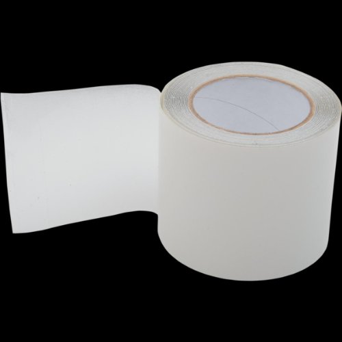
Just clean up with some water and maybe a few drops of Dr. Bronner's soap at the end of each day. Beyond that, different things work for different folks. A little Gold Bond body powder is nice overnight to dry everything up. I like Chamois Butt'r for really long days. I have a big bottle at home and I put it in one of these collapsible travel squeeze bottles to save some weight/space. A&D ointment is popular in the ultra racing community.
Nice, that you've noticed it - I'm proud of it, since it's kind of DIY 😄
I bought a cheap waterproof bag and mounted it using straps. It took a while to come up with the proper straps, which are easy to use. But eventually it feels solid and handy.
Lanolin ointment for nursing mothers. https://www.amazon.ca/Lansinoh-FBA_ASSPH-HPA-Lanolin-40g/dp/B00BLA3EPQ
Does not make the shorts chamois a breeding ground or produce funky smells. Wipes off without residue but aids in preventing skin breakdown. Used this brand for several bikepacking races. May have to get some oragel (the non gritty stuff) to numb the inevitable saddle sores after 10-12 days of all day riding.
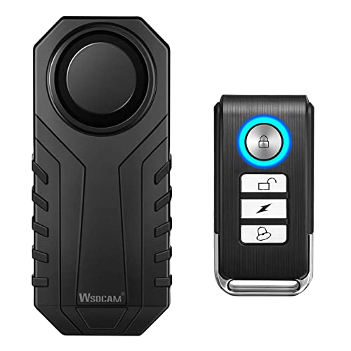
A bike is its own getaway-mobile. 1/2 the battle is making sure nobody jumps on a rides away;)