
What are
/r/britishcolumbia's
favorite Products & Services?
From 3.5 billion Reddit comments
The most popular Products mentioned in /r/britishcolumbia:


The most popular Services mentioned in /r/britishcolumbia:
AllTrails
Weather Underground
AccuWeather
Weatherspark
Windy
Plotly
Roadtrippers
OpenStreetMap
Wikiwand
Ecosia
Fast.com
ConsumerReports.org
Notion
Rumble
Wikimedia Commons
The most popular Android Apps mentioned in /r/britishcolumbia:

Call Recorder - ACR

Maps & GPS Navigation — OsmAnd
Fuelio: Gas log & costs

VoIP.ms SMS
The most popular reviews in /r/britishcolumbia:
Some Info.
Old Glory mountain seen from the top of Grey Mountain at Red Resort ski hill.
https://www.alltrails.com/trail/canada/british-columbia/old-glory-trail
The other peaks to the right is where the bike trail Seven Summits preside.
What about reflective arm bands that just wrap around your sleeve? I travel with them for when I use bike shares in different cities.
I don't see the exact thing on amazon, but they look similar to this. Mine fold up a lot smaller though.
This book has been handy for me. Roadside geology of southern BC.
One of my favourite spots. I first visited the lighthouse when I was working as a naturalist on BC Ferries, doing a talk about the history of lighthouses. I got the cool experience of helping to carry the new, massive panes of curved glass from a truck down to the old foghorn building for storage. That glass is actually all hand-made and cost hundreds of dollars per pane.
If you are interested in lighthouse history in BC (or just want to read about really nutty people going insane off of mercury fumes or epic women carrying out acts of heroism), <strong>Keepers of the Light</strong> and its sequel <strong>Lights of the Inside Passage</strong> provide an in-depth look at what life was like in the era before telephones or even telegraphs at remote lighthouses on our coast.
I can barely see across the street.
Just note that I didn't goto a concert in the town over in Vernon because the traffic, road closures and the need to stay out of the way for fire fighting logistics.
Tourists are not going to be appreciated here. Stay home and out of the way k thanks bye.
Business would have to be even more competitive in their pay. But what I think people don't realize is that it also depends on the business, there are a lot of people who'd rather do social enterprise work and actually work for less pay because they are making the world a better place instead of helping the boss get his third lamborghini. Studies have shown that there is increased sharing and pooling of funds, and there's a lot more potential here to help with social entrepreneurial projects: http://list.ly/list/1RdG-ubi-research-links-universal-basic-income-evidence for example crowdfunding of social-entrep projects.
This is using data compiled by: u/robinmonks found here: https://www.notion.so/0da991652caa406f9a38015ffecfd65f?v=d60241b8721343698a4a6a17123c89e7
Basically what this shows is that when you control for targeted hits, while using the number of victims as an outcome, there is an association with the location of the hit. Specifically, there is about 2.9 odds (you can think of this as 190% higher) that a hit occurs outside a restaurant. This is the exponentiated estimate for "restaurant".
The caveat with this analysis is how the locations have been binned and obviously the small sample size; n=40 with 36 complete events (hence 35 degrees of freedom), though the overall model is significant for describing the distribution of variance that we see from the dataset.
I thought that this was interesting, because people had hypothesized that restaurants were not safe. This provides weak, objective evidence in support of this conjecture.
Let me know if you have any questions and I can try and reply when I have a moment.
I am not sure where you heard that or why you think that you could just brazenly state such a wrong fact, but - you're wrong. Here is a chart that shows in very clear detail just how much less carbon-intensive a plant-based diet is.
Which experts are these? Nutritionists? Because of course, yes, they will probably balk at veganism, because it is harder to do without becoming deficient in something. Vegetarianism (which is what I initially put forth, and where the lion's share of the carbon savings are made) is quite easy.
There is not a climate expert on the planet who would suggest that plant-based is on balance more carbon intensive than omnivorous.
OK, here's the total hectares burned in BC each year since 1950, from the Wildfire Service: (https://catalogue.data.gov.bc.ca/dataset/fire-incident-locations-historical)
If you plot these (throw em in Excel or something) and fit a line, it does actually show a slight yearly increase on average, but 2017 is really dominating the results -- it's a bit of an outlier IMHO, but I could be wrong.
Drop 2017, and the quality of fit is about the same (not very good) but showing a slight decreasing trend. My assessment would be that the area burned in BC yearly is not showing any significant trend either way since 1950, but it's certainly possible that 2017 was a sign of things to come. I don't think Weaver has any evidence to support this really though, which makes his tweet seem kinda posturey...
edit: not sure why the downvoting -- perhaps too lazy to plot the numbers? In that case you can check them out graphically here: https://plot.ly/~jkf/1/
There are fairly steep sections that go through old debris fields. That means lots of scrambling over and through large and small boulders and tree roots. Not a place I'd take a baby, but that's just me [shrugs]. Lots more info on AllTrails
Oh, and the trail and parking lot will be absolutely packed after 9 am -- it's the most popular hike in the valley, and not worth doing at the busy times. Also, if you do it early in the morning there are barely any bugs (was just up there at 8 am on the 29th)
I just got back from a big BC roadtrip! We went from Vancouver to Prince Rupert, and I would say the highlights were the Cariboo region so Clinton / Quesnel area and then Prince Rupert was beautiful. I would definitely recommend bringing a bottle of hair sanitizer cause it's all outhouses. There's also a fun website called Roadtrippers that can help you plan your route, TripAdvisor has a good version of this too.
Interesting read -- for a BC perspective, I made a quick plot of yearly fire areas as reported by the Forest Service from 1950-2017 for a recent thread, it's here: https://plot.ly/%7Ejkf/1/#/
Too bad the pre 1950 data is not easily accessible for BC, but even so you can see that the past 20 years don't seem wildly different from the period 1950-1970, for instance. Seems to support Dr. Mass' thesis in any case.
For plants, Northwest Foraging is a classic and easy to reference.
For mushrooms, THE definitive book in my opinion is All That the Rain Promises and More. It’s pocket sized, has great photos, and it’s succinct. I have quite a few mushrooming books, and this is a go-to for me and a lot of mushroom hunters.
I provided the Amazon links, but try to order through a local bookstore if you can.
Theres a scale of severity https://www.wunderground.com/cat6/Cat-1-Cat-5-Scale-Atmospheric-Rivers
I've seen atmospheric rivers dump 100mm in a 24hr period. Usually they're multiple day events. We camped during one a few years ago. It rained 150mm over two days.
Checking a wind map that lists PM 2.5 or CO levels is helpful for determining the quality of air. https://www.windy.com/?cosc,48.850,-115.928,6 Just be advised its going to probably smell like smoke until there is rain.
Not a wild fire map, but here is a weather map of the CO2 concentration.
Kinda shows where the smoke is all coming from. There are also filters for showing SO2.
these two systems are not perfect as they are mostly community built/imported data.
https://osmand.net/ when installed on mobile you can enable a extra layer option to show walking paths under "configure map" as well there is an option to download wikipedia entries on a province basis so items in wikipedia that have gps coordinates will show up on your map to learn about them also an addon plugin lets you see elevations. I've used this on my phone a lot when im in parks that are horrible map signs where ill be able check if im on the right path and the pathway actually shows up in the app. I have found a few that are missing so as i said its not perfect, extra bonus is if you go for the pay version you can download offline data for when you are really out in the bush with no service.
it uses open street maps which if you visit that web page you can enable other features ie, silver star ski mountain here https://www.openstreetmap.org/#map=13/50.3666/-119.0290&layers=NDG
on the right hand side you can enable layers such as cycling layer will show elevations pathways and public GPS traces will show common paths people take when logging with their GPS on so you can see the new cycle path silver star built shows up on that view but in some other views might not show up as they are not added officially yet.
The whole idea behind the login process is to make it easy for users to get in even with fake email addresses - although I'm changing the workflow so users who'd like to try out the tool wouldn't have to sign up.
The security of the website is handled by Auth0, which is the leading authentication as a service provider in the world, and the payment processing is handled by Stripe, which is one of the best online processing systems out there. So don't you worry about security 😉
Final note, if you don't see any value in the thing I made, you don't have to throw F bombs - I'm just a human being who's trying to do something nice for the community and since I put many hours of my time building this and have to take care of the maintenance costs I charge $9.99 per month and that's only for premium features.
The Golden Spruce is one of my favorite books ever. The opening covers quite a lot of the history of the Haida, and Haida Gwai. It's a non-fiction revolving around a tree that was sacred to the Haida. Just a heads up though it covers a weird amount of other stuff (the DSM, the history of logging in Canada etc.) so it isn't just about indigenous culture, if that's what you're after.
You need winter tires of course, but that's been outlined here already. I always use this app to understand what I'm up against when I know I'm taking the #5...
https://play.google.com/store/apps/details?id=com.airsenze.bchighways
Camera's let me know if I'm going to survive the expedition.
These ones are perfectly legal and do work really well, I have used them for years
Hunh. I would start turning off circuits and watch the main meter for significant changes. Or maybe your library has a Kill A Watt meter you can borrow (like this:https://www.amazon.ca/P3-P3IP4400-Electricity-Usage-Monitor/dp/B00009MDBU) that you can use to check devices and see which might be the culprit?
Pretty weird to be comparing BC to the monsoon season of a desert. This seems to be like dishonest journalism and cherrypicking by dailyhive.
Do you not believe that people locked up in mental wards are force fed drugs?
The solution isn't a harder government hand, its a smart approach. Look I agree with your desire for a safer streets, id just rather achieve it though other methods. first lets try better solutions like the ones proposed in San Fransicko, then lets maybe actually allow people to protect themselves....
I agree things will get worse if nothing is done. I just think its hilarious that people think "This time the government will get taking away people rights and locking them up the RIGHT way".
There are so many other good solutions, you should give San Fransicko a read, lots of other good solutions proposed other than giving the government wild approval to force feed drugs to people.
I think some of it has to do with the Canadian Culture towards Winter and the outdoors. Despite the mythology of Canadians having a really great Winter culture, I think most people view it as a nuisance and try to minimize their exposure to the outdoors as much as possible during the Winter months. If instead, people would think about the Winter with a more positive attitude and embrace the cold, have some fun with it, I think they would find a whole new appreciation for where they live. Currently reading Frostbike by Calgarian Tom Babin (https://www.amazon.com/Frostbike-Pain-Numbness-Winter-Cycling/dp/177160106X) and it talks a lot about how Canadian culture shuns Winter and that sort of thing.
If you want to invest a little more in your grow show, this is the best cheap grow light I've purchased:
I think you're the type that lacks constructive criticism of such policies. I think diversity can help but it certainly has a dark side . https://prezi.com/cjzapiknhqwb/pros-and-cons-of-cultural-diversity/
It actually is LITERALLY impossible. The saying was invented by the poor in England who were laughing at the assholes who wanted them to be able to do the impossible, which was to get up out of the dirt with nothing. Have you ever tried to pull yourself up by your boot straps? It's a joke. The phrase has taken on it's own meaning which is to do something without ay help, bt nevertheless it is LITERALLY impossible to pull oneself up by ones bootstraps.
https://zapier.com/blog/you-cant-pull-yourself-up-by-your-bootstraps/
On a sidenote, I so love my high viz Mechanix gloves. They no longer carry them at Canadian Tire, but I see them at Amazon. https://www.amazon.ca/Mechanix-Wear-Hi-Viz-FastFit-Yellow/dp/B002XISTVO
At times I find myself stopping traffic with them crossing the street at night.
I recommend using Document Widget PDF JPG
With this app you can put the PDF directly on home screen and you can also zoom to perfectly frame in the QR code.
1 bottle of Gatorade mixed with 1 small packet of certo (used for making jams/jellies) the night before your test, another 1 hour before, and you should pass.
I would not inform your employer.
This app has all camp sites listed on it along with satellite, topographical and road maps for all of bc. It also shows public and private land in BC.
For the ultimate BC experience I recommend Stephen Hume's story collections. He is a long-time journalist and writes nonfiction. The stories within the collections range from 1500-3000 words and most have an element of history. Sometimes the focus is interesting characters or locations. Often there are environmental angles. The stories span the entire province. I've read A Walk With the Rainy Sisters and Bush Telegraph
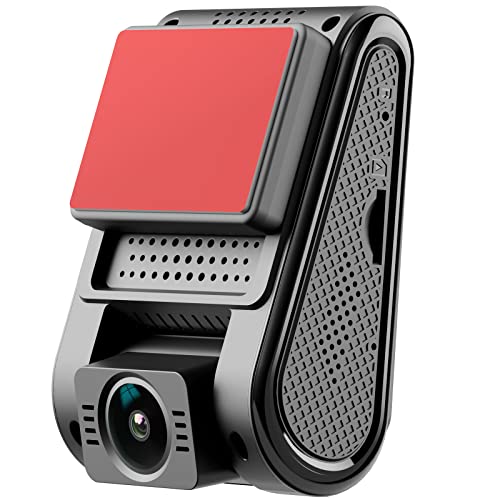
I have a Viofo A119 in each of my two vehicles. It’s a decent unit. I got them on EBay for $80 US as I have a mailbox in Blaine.
Ditto! This sort of mouthguard was already common in East Asian fast food chains before the pandemic. The salad bar sneeze guard was patented back in 1959 and it's crazy how the same concept was never extended to the kitchen staff directly.
Definitely no trail. Has probably been done by a few hardy souls over the centuries. Guy Edwards and some companions skied from Vancouver to Alaska. Climbing and Hiking in SW BC might have some historical information. But it would be a rugged and challenging route, bushwacking through some thick brush and steep mountains.
If you look on google maps though, there are roads leading north from Stave Lake. You could follow those, then climb over a mountain range into the upper Pitt River. Soak in the Pitt River hot springs, then up the back of Mamquam mountain, over to Opal Cone, around the North side of Mount Garilbaldi to Garibaldi Lake and on to the Helm Creek trail around the North side of the Black Tusk and down to Cheakamus Lake and you're just outside Whistler!
I decided to order this vest since it's adjustable and seemed to have decent reviews, plus it'll fit under the PPE he already has. https://www.amazon.ca/ARRIS-Electric-Adjustable-Heating-Suitable/dp/B0828LZ2MZ/ref=mp_s_a_1_5?crid=24YOA1UEKMEPQ&keywords=heated+vest+men&qid=1644090088&sprefix=heated+vest+men+%2Caps%2C133&sr=8-5
Not to deflate you aspirations but this province has become unaffordable due to housing costs.
If you can find work in industry paying over $25.00 per hour in a smaller town it can be done.
Places like Golden, Revelstoke, Invermere, Kamloops to Osoyoos as well as the lower mainland and the island are cost prohibitive.
As for sun shine, look up the stats on https://weatherspark.com/
The sunniest place I believe is Cranbrook. Most of the places I mentioned above are socked in most of the winter months.
The massive High Pressure Ridge that likes to give us our hot sunny days, is too far East right now. It is centered over New Mexico. If it was further West over Arizona and Colorado, it would block storms from hitting us and send them into Northern BC and Alaska. It's being very stubborn to move to its usual Summer location, and BC is getting the rain and colder temperatures as a result. It's an unusual summer weather pattern for sure. https://www.wunderground.com/maps/wind/jet-stream
While I recognize your frustration, and I can’t even begin to understand how hard it is to just workout outside as a woman, I do think there’s options out there that might work, so here’s a couple:
Do you have an actual bicycle? If so you can get the indoor cycle trainers for it. It takes up next to no space and you just pop your bike on there and it turns it into an indoor exercise bike.
Failing that, my friend has a suuuper thin treadmill he keeps under his bed and takes out to his kitchen to work out. He’s got a small apartment and makes it work (just found the same one on Amazon):
Whatever....give me a break, take some responsibility!
$35 for $10 N95 masks...all of $3.51/each and that includes free shipping.....prohibitive cost my ass....wow that was difficult https://www.amazon.ca/dp/B0002YKBV2/ref=cm_sw_r_apan_glt_i_QHDT684KC97PVP0JCJ5F
Appreciation of first responders is very much a part of our family and we are so thankful for Paramedics. I've personally had to be taken to hospital in an ambulance twice and I am so grateful for their hard work. My FIL was a Fire Cheif and so was his father. My Aunt-in law is a RN and so is my SIL. I am a first aider and was a lifeguard for years we all understand and appreciate the important jobs Paramedics do.
FYI Playmobile has 3 or 4 Paramedic sets. They're on my son's Amazon Wishlist. One of his favourite shows to watch with me is 9-1-1. He loves to watch "the helpers".
https://www.accuweather.com/en/ca/vancouver/v6c/june-weather/53286
We’re actually around the average for this time of year. The last few years have been unusually hot and dry and smoky so this seems weird now, but it is more in line with typical weather this time of year.
Looks like 1.4km at most from the junction. Full map here: https://www.alltrails.com/explore/trail/canada/british-columbia/needle-peak-trail?ref=sidebar-view-full-map
Lake is just under the "Flatiron" peak to the SW.
Something to consider as an alternative approach... if you have coax in the house, you can use that wiring instead, along with MOCA adapters like these...
https://www.amazon.ca/gp/product/B088KV2YYL
I was about to do a huge, complicated and messy cat5 wiring project in my fully finished house when I discovered this. I had coax in all the right places and these devices work flawlessly. There is even a MOCA port right on the Telus hub to connect to.
Oh ya you can get a mini split done for alot less than that! They quoted me around $12,000 for an entire ducted central heat pump. If i wanted a dual head mini split it was like $6,000. But that's with them installing it. You could buy and install your own dual head mini split for under $3,000! But to qualify for the rebate it has to be professional installed. You can buy a quad head mini split for $3500.
https://www.amazon.ca/dp/B00UV3LL1S/ref=cm_sw_r_apan_glt_i_C1YZ1NCS96SM3E98KTQV
https://www.amazon.ca/dp/B00J7Y9JFW/ref=cm_sw_r_apan_glt_i_HQF0SN7XE7K7GNX1AX00
You can look at weather history for any city and see what the weather has been like. Pick a generally rainy month and while it rains for 4-5 days straight sometimes we also see beautiful sunny weather in between that. September 10th 2020 was one of the hottest days of the year for example. Generally you see cloudy or overcast weather from October 1st - May 15 55-75% of the time and clear 25-45% of the time, and the reverse from June through September, though of course this varies as it is weather. Source: https://weatherspark.com/y/998/Average-Weather-in-New-Westminster-Canada-Year-Round
It was still good info! I appreciate your stoned effort. I can't refute your claim what so ever though it at least sounds pretty legit. My main issue with this article is them saying things like "it could hit zero emissions" making it sound 100% clean, when the battery bank alone makes a huge carbon foot print since those things are packed full of all sorts of toxins and rare earth metals and they don't have a way to recycle them. Here is a quick link here about it though I am sure there are better ones out there, I've seen issues like this mentioned many times in regards to Electric modes of transportation.
Wonder if there is a section in the book on how to properly rub shit on cars belonging to people who use public trails your entitled ass has decided are your own.
Book title should be relieve yourselves on their rides.
Looking at weather data for Whitehorse in April daytime highs are above freezing but nights are below.
https://weatherspark.com/m/287/4/Average-Weather-in-April-in-Whitehorse-Canada
Expect a mix of slush ice and water, but not much new snow, which means that the roads will be plowed down to bare pavement. I assume that you have good snow tires.
This was a good book
Next time these geniuses gather use old school STINK BOMBS to disperse them. They're cheap, legal and super effective. They can be used totally inconspicuously.
Braving the wilderness - Brene Brown is a massive fucking eye opener into how we are being manipulated with the media's us/vs them shame cycle.
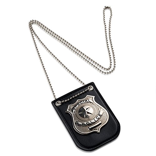
I heard about one person that was using a badge to imitate a police officer, and the badge that they used was just this one from amazon:
but they also had a Victoria police Id card or 2nd badge (can't remember exactly, I just know it was the above and then a 2nd thing with "Victoria" on it)
I would assume just using a counterfeit/fake badge and having the confidence of "I'm a cop" attitude will trick a lot of people.
One of the logging companies I deliver to takes up totes that I fill up when I deliver to their yard up in to the bush then fills their equipment from that tote either directly from the tote or by filling up special DEF Jerry cans if that's more convenient to get it to the equipment. Another one uses fancy portable tanks.
First one uses something like this for the def, but different brand. Refilling the jugs that come in the cardboard is not recommended.
https://www.amazon.ca/dp/B07NNQXW9Q/ref=cm_sw_r_cp_apa_i_J397VH4AHHQBMKES718S
And the portable tanks are these. This company has lots of interesting products for DEF.
https://www.fluidall.com/def-system/def-tote/
I know lots of the totes that get delivered in Vans go out to logging and mining companies. Depending on the location of the shop and volume shipping it with an LTL carrier is cheaper and more efficient than sending up a tanker to refill totes/tanks.
No different than how your service truck that comes in to the bush will have bulk oil on board for the oil changes and topping up engine/hydraulic oil. Probably filled up from a tank at the shop, that one of the oil distributors I deliver to then delivered to your shop. (Unless it's shell oil, until next month I think)
Some Mobile refueling companies are delivering DEF with fuel as well. We also deliver in bulk to some mines. The one I went to yesterday takes ~12,000L every week to week and a half.
My rough math from your numbers say your company would go through about a tote per month. Feel free to DM me for 3 suppliers that sell in totes and bulk delivery. Even with having to invest some capital in to jerry cans and or tanks, with it being about half the price in bulk, payback period would be definitely attractive to management.
Do you mean the one in Strathcona Park on Vancouver Island?
I haven't been up Celeste but have spent a lot of time in Strathcona Park and can provide a bit of info.
You'd need a few days to climb it as it's quite a ways from any roads. No formal trail for most of the way. It would be a great trip as you'd be spending quite a bit of time in the alpine. August or September would be best unless you're comfortable hiking on snow. You'd want to have some experience as you need to navigate in the alpine for days on end.
A guidebook like Hiking trails 3 might be useful. About 20 years ago the guidebook had useful information about the 'routes' in the park - not developed trails but passage through the forests and mountains that was marked by a bit of flagging tape and had a few branches cut here and there.
Good luck, it would be a great trip for someone with enough experience!
VoIP.ms and this app.
Works great and it's just a couple of dollars per month. Port your existing # in for free, too.
Pay them w/ PayPal and you can be texting 10 mins from now, with a real #, no sim card needed.
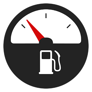
If you're interested, I use the Fuelio app on Android. I used to use FuelLog, but I like this one better. You can do data backups to your google account as well. I mostly use it for tracking my vehicle's mileage performance over time, as well as determining my average gas expenses per month for budgeting purposes.
The Cascades are an entire range, with all that implies for hiking. Mt. Rainier is a huge volcano that stands alone. Lots of great of hiking on it, but it is a standalone feature -- You'll mostly be looking up at the same mountain all the time. The Olympic peninsula has mountains, but you're really going there for the coastal rainforests, I would expect.
For me, the north Cascades would win out. More options for hiking, the combination of alpine lakes, peaks, glaciers, etc., are what I go for.
The drive to the Cascades is only 2.5-3 hours from Vancouver, I believe. If you can find this book, generally the Copelands provide great hiking advice and the book would offer some good suggestions for day hikes.
Think about crossing into the U.S. and taking in the north Cascades area. The Mt. Baker area, in particular, has some fabulous hiking, but the best hikes might still be snowbound at that time of year. Also in the US, Mt. Rainier is absolutely incredible to see, but will be a bit more a trek from Vancouver, so may not be worth it given a limited schedule.
There are a lot of hikes in the Whistler, Pemberton, Duffey Lake Road corridor. This book has some great options to check out. You can camp at Nairn Falls Provincial Park, just south of Pemberton and that puts you 30 minutes north of Whistler and about 45 minutes south of Joffre Lakes. The drive up the Sea-to-Sky and through to the Duffey is worth a day, even if you didn't get out of the car.