
What are
/r/InfrastructurePorn's
favorite Products & Services?
From 3.5 billion Reddit comments
The most popular Products mentioned in /r/InfrastructurePorn:


The most popular Services mentioned in /r/InfrastructurePorn:
500px
OpenStreetMap
Google Maps
Wikimedia Commons
Flickr
Weather Underground
EveryTrail
Wikiwand
Bing Maps
Gizmodo
Wikitravel
Shutterstock
Worldcat
EyeEm
Pexels
The most popular Android Apps mentioned in /r/InfrastructurePorn:

The most popular reviews in /r/InfrastructurePorn:
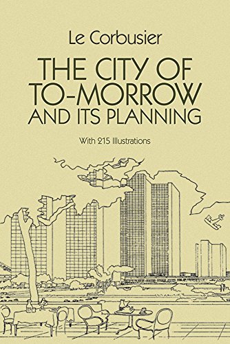
Urban Planner here: This is an example of a Radiant City as proposed by the frenchman Le Corbuiser in his 1924 book "The City of To-morrow and Its Planning". Essentially it is a modern utopianist view of urban planning that grew out of a conception of capitalist authority and a pseudo-appreciation for workers' individual freedoms. A Radiant City is composed of superblocks of high-rise living in towers surrounded by green space and bisected by high-speed vehicular routes.
Brasilia is one of the best examples of the Radiant City, which is why its a UNESCO Heritage Site. As you can plainly see in the image, Brasilia has all the traits of a Radiant City with an urban design system based on a large-scale grid of arterial streets, superblocks composed of high-rise towers, and individual zones for factory, commercial, and government uses.
That said, in its current design it will not fare well in a post peak-oil society.
Did you know Amazon will donate a portion of every purchase if you shop by going to smile.amazon.com instead? Over $50,000,000 has been raised for charity - all you need to do is change the URL!
Here are your smile-ified links:
Here's a "quick" primer
^^i'm ^^a ^^friendly bot
I believe this is the Vance creek bridge: https://roadtrippers.com/stories/not-for-the-faint-of-heart-vance-creek-bridge-is-americas-second-tallest-bridge
Google maps view: https://www.google.com/maps/place/47%C2%B020'05.6%22N+123%C2%B019'14.2%22W/@47.3348054,-123.322469,546m/data=!3m1!1e3!4m2!3m1!1s0x0:0x0
Not to mention the NYC mass transit system runs all the time, 24/7. It never shuts down except during emergencies like 9/11, strong storms, or really nasty weather. Heck, the NYC subway has 450+ stations, Tokyo's subway has a meager 142 stations.
> The official count of stations is 468; however, this tabulation classifies some transfer stations as two or more stations, which are called "station complexes" within the nomenclature of the New York City Subway. If station complexes are counted as one station each, the number of stations is 421
http://www.wikiwand.com/en/List_of_New_York_City_Subway_stations
> There are a total of 142 “unique” stations (i.e., counting stations served by multiple lines only once) on the Tokyo Metro network, or 179 total stations if each station on each line counts as one station.
Where the fuck is the pedestrian interconnectivity? Enjoy your 20-minute drive to buy bread. /r/urbanhell
Edit: ok, I retract my statement, having checked OSM you actually don't have to go as far as I thought around the circle for pedestrian and cyclist shortcuts. That's Europe vs. the USA for you, and makes this much less like being trapped in a desert of suburbia.
Still, I'm not convinced that in practice this is a good design for residents and visitors. You wouldn't see the Netherlands putting "But it looks good on paper" over everyday usability
> "if bigmapblog were to try to make an argument... in ANY urban planning or urban studies class at an American university he would rightly so be shot down in the face of 50 years of academic research"
Many (more than a hundred) schools of urban planning and urban studies have purchased the film, and dozens are using them in their coursework and instruction as we speak. Here's 350 institutions, (several of them schools of planning, design, or urban studies) who currently have the film in their holdings.
I bring this up not to brag at all, but to illustrate that the film and its arguments are not as abhorrent to academics as you seem to think.
I've spoken at over a dozen universities in this past year -- most at schools of architecture, but with much crossover from urban studies -- and while some generated a spirited debate, and not everyone was at all times completely in agreement, the reception from the academy has been overwhelmingly positive.
Far from being "shot down", it has been embraced to some degree, and we're very thankful for that.
This is the only turntable I could find around there.
Found a video of this spot nowadays: https://www.youtube.com/watch?v=xB5_dTBNZk0
Sources I found say the steam tours are focused on tourists, but most services are diesel with more modern carriages and those are still heavily used by locals
Here's Agony Point on a map
This is the light railway in the northwest New Territories, Hong Kong, intersecting the West Rail Line at Tin Shui Wai station.
Go ahead and be amused. Locally, two roundabouts were just replaced by a diverging diamond interchange after a casino opened and traffic turned into an absolute nightmare. As others have said, for high traffic interchanges, the roundabouts were not appropriate. Locals seem to like the diverging diamond so far.
This is not in Jakarta or even in Indonesia.
This is the Putra Mosque in Putrajaya, Malaysia.
> as a passenger I loathe these complicated stations where the travel time between surface and train is often longer than the train ride itself. This seems to be an unrecognized problem for planners
I can assure you that transportation planners do think about this. Trains are quite limited in the grades they can climb and the radius of curves they can safely navigate at speed. Planning and engineering are all about tradeoffs.
In this particular case, the station will connect a surface subway travelling along the west flank of Mont Royal (opened 1988) with a deep tunnel travelling E-W under Mont Royal (opened 1918). They aren't digging a hundred-meter-deep station because they want to.
Here's the same 'road' above the highway a couple of hundred meters to the east.
Sumburgh airport in Shetland has something similar.
It's towards the end of the runway, but the road still has to be closed when a plane is landing or taking off.
> 36°52'35.78"N 76°19'5.91"W
bing actually has a 900ft coal cargo ship docked with cargo bays open https://binged.it/2ugbh2M
mapquest has two
If you were building from the ground up, certainly.
This is the intersection in question before they did this new interchange.
This design was able to maximize efficiency without making massive changes to the existing infrastructure. Also theoretically this is safer than a cloverleaf because you aren't forcing people to go from freeway to speed to ~25 and make a sharp turn to change.
We also went from thee signal phases down to two, which is an improvement. The wikipedia article someone else posted also lists some general advantages of this interchange.
Here are some photos that I took inside the Huntly Power Station. Also a report I wrote on Huntly Power Station
Original Post at /r/BritPics, the UK's national photography sub!
>billions on metros to connect these well.
Yeah. Here in Europe the argument for these stations is also often that they're initially much cheaper to build, but that's probably simply the case because the only 'connection' that gets build is a parking lot. So why not upgrade existing, inner-city stations through tunnels? I think that on the long run this makes much more sense.
But of course there might be cases where new 'outer' stations do make sense, because of topography, network structure, urban growing patterns. This example from Afragola here seems to be absolutely reasonable. Roma-Salerno trains can avoid Napoli centrale and save time while Napoli centrale probably still retains most connections because most trains don't even go further south and end there anyway. Also Afragola seems like a good place for a hub to connect the northern suburbs to the network. But this would require links to the regional network, and when I look at the photo here or the map it doesn't seem like there's anything more than the high speed platforms and the parking lot.
Hill Road, in Shek Tong Tsui
The bbq duck soup noodle cafe is one of the best in Hong Kong and is open late night.
Pic taken in 2010 on a commercial flight landing in San Jose.
>This energy is used in numerous ways, including the generation of electricity via a steam turbine, making hydrogen fuel, testing reentry materials for space vehicles, or performing high-temperature metallurgic experiments. The massive maximum temperatures Odeillo achieves even allow for the production of carbon nanotubes and zinc nanoparticles via solar induced sublimation. (source)
You might want to also post this in /r/whereisthis.
Map of the current entire Lodge Interstate for reference.
Near where Rosa Parks Boulevard approaches the Interstate there seems to be a gap in development running from WSW to ENE that seems consistent with a former railroad.
looking at the area in OpenStreetMap it's connected to a network of hiking trails, so I'd say that the station is entirely for the benefit of hikers and daytrippers
Is this Chinese construction? Lets hope it doesn't collapse like the last one which was not build over an active rift but a simple river I dare say.
This is indeed the Goat Canyon trestle and you can hike or mountain bike your way to this location. The railroad has been abandoned and last ran in 2008. Technically hikers / bikers are trespassing, yet enforcement is rare. The bridge is quite stable and not as scary as it looks. I assure you, there are places along the way that are more frightening due to the sheer drop into the canyon.
Hmm.. microclimates I guess. For San Jose, you can see how I would imagine ~6 months of no rain. 4.6 inches in 8 months is basically a desert since <10" annually is the definition of desert. Source for rainfall
| Month | Actual | Average |
|---|---|---|
| Apr 2016 | 1.53" | 1.06" |
| May 2016 | 0.32" | 0.39" |
| June 2016 | 0.00" | 0.09" |
| July 2016 | 0.00" | 0.00" |
| Aug 2016 | 0.00" | 0.00" |
| Sept 2016 | 0.00" | 0.18" |
| Oct 2016 | 1.45" | 0.80" |
| Nov 2016 | 1.31" | 1.68" |
| Total | 4.61" | 4.20" |
Slightly above average in what was supposed to be an el nino year.
edit: I also lived in LA in 2008 :)
OK... This is a WTF moment. Google maps has started censoring planes from their maps.
Compare Google's view of CDG to the view on Bing maps. Notice the lack of jets on the former and the lack of a lack on the latter. I checked several other airports on google, and they also show a suspicious lack of jets. WTF is up with that?
I read a book from my school's library from the late '50s about the infrastructure beneath NYC also. I'm not sure how it compares to this one but it's interesting to see how things were back then. <em>The World Beneath the City</em> by Robert Daley.
This reminds me of the book Underground by David Macaulay. It has some fascinating illustrations that show stuff like this and is accessible to everyone.
https://www.amazon.com/Underground-David-Macaulay/dp/0395340659
Hi guys, I would recommend a great solar lights seller on Amazon I have bought and used for years since It is time to get new beautiful solar lights for your yard. The seller is also a 15 years solar lighting manufacturer.
Here is a beautifulSolar garden lights on Amazon I like best:
I read this book some time ago: http://www.amazon.com/Train-Man-P-T-Deutermann/dp/0312973705
In there this bridge gets destroyed. Now is the first time I actually see the bridge. Quite a pity to destroy this beautiful construction.