
What are
/r/geography's
favorite Products & Services?
From 3.5 billion Reddit comments
The most popular Products mentioned in /r/geography:


The most popular Services mentioned in /r/geography:
OpenStreetMap
GeoGuessr
Wikimedia Commons
QGIS
Encyclopædia Britannica
Google Scholar
Wikitravel
Weatherspark
Wikimapia
Bing Maps
Google Docs
Online Etymology Dictionary
Mapbox Studio
Geocaching
MetaFilter
The most popular Android Apps mentioned in /r/geography:
World Geography - Quiz Game

Sync for reddit
US Topo Maps Free

World Map Quiz
The most popular reviews in /r/geography:
Correct.
Edit: I just did some looking up, and sources like (Brittanica and Merriam Webster seem to say that it's a subcontinental piece of land surrounded by a body of water.
This really depends on a number of factors, as there are a different software's available, depending on your price range.
If you're solely looking at statistics, I would suggest R as an introductory software. It is free and not so hard to pick up, as it is simple programming for statistical analysis.
Finally, you should also check out r/gis, the GIS subreddit.
this article does a really good job of discussing the issue. Notably, volcanic islands tend to have lower population densities, but more complex social heirarchies, while coral-type islands have higher population densities but less complex social heirarchies. I wish I had a way to give you unfettered access to the document, but maybe if you're a student, you can log in through your local school library and access the JSTOR version.
The south eastern one is roncador bank. Here is a map from bing. Still looking for the others
Wikimapia. They're excellent at filling in detail that the mapping sources miss. This brings it up as Vostok Island. http://wikimapia.org/#lang=en&lat=-10.060000&lon=-152.310000&z=13&m=b&search=10.06S%2C152.31W
Go to Google Earth. Even if it doesn't identify it you can pull up the Panoramio overlay and sift through the titles to find out what it is and see pictures. A quick glance showed 50-100 pics of it.
When I find something like that, I go to openstreetmap.org. Chances are someone already mapped them:
If y'all are looking at a regular old Google Map in this argument - Alaska is greatly over-sized.
A globe is the best way to see a less-distorted representation of the world.
E: http://thetruesize.com/ to visualize how latitude can greatly affect the perceived size of places.
I'm currently reading a book called Geography (that's the Amazon link) it's wonderful and links almost every strand of Geography and how they all relate to each other. It's also not very long or complex and a very easy read :)
Karum is not the proper name of a specific place, it's a generic word for Assyrian trading station in Anatolia (and so should be written without capitalization). The most important karum was at a city called Kaniš, which is associated with the Kültepe archaeological site in the Kayseri province of Turkey. But there were other karums as well, such as at Hattuš, the settlement which later became the capital of the Hittite kingdom. Its site is Boğazköy, near Boğazkale in the Çorum province.
Why are these waves shaped so strangely? Because they're Seiche waves, like waves in your bathtub.
There was a great discussion of this over at Metafilter a few weeks ago.
You can write it out in any number of different ways. + for latitude is N and - is South. + for Longitude is East and - is west.
44.942400 -93.617786
44.942400°N 93.617786°W
44°56'32.6"N 93°37'04.0"W
The last is based in minutes and seconds (base 60) rather than decimal (base 10).
In openstreetmap: https://www.openstreetmap.org/search?query=44%C2%B056%2732.6%22N%2093%C2%B037%2704.0%22W#map=17/44.94170/-93.61821
It's okay. It's not necessarily that I'm taking it as an insult - it's just something that I've heard frequently from (US) southerners and people on the West Coast regarding cities like Chicago or Cleveland. In reality, the cities on the southern ends of the Great Lakes tend to have more moderate temperatures, and it's the cities on the plains or in the mountains that experience more dramatic "cold weather" (and windier weather!). However, people see snow in Detroit on TV and think of it as an arctic wasteland, even though it's in the same hardiness zone as parts of southern Oklahoma and northern Georgia. Anyway, I don't even live in the Great Lakes area and I'm not offended, I just figured I'd comment since this thread is about furthering American geography knowledge in general
etymonline.com says that pak is a play on the word "pure" in "Iranian", So 'pakistan' could be construed to mean "land of the pure".
Kuwait and its capital Kuwait City would be an example of this:
>Persian Gulf country, named for its capital city (said to have been founded in current form 1705), which is from Arabic al-kuwayt, dim. of kut, a word used in southern Iraq and eastern Arabia for a fortress-like house surrounded by a settlement and protected by encircling water, and said to be ultimately from Persian. Source
The country is Singapore was also named after the city of Singapore. But, then again, Singapore is city-state.
Sure. So it uses Google App Engine, and it's coded in Golang (https://golang.org/). App Engine is a super easy way to get a web app up and running (and free for low traffic use). I super recommend having a look in to it (if you can stomach being yet another cog in Google's giant evil machine etc. etc.)
It gives you Google based logins with absolutely no work, but I've learned from the comments here that logging in with Google tends to make people a bit uncomfortable (which I guess I understand). If I redid this, it would store your progress locally on the browser, with an option to save your progress by logging in.
I'd suggest ArcMAP but it's hella expensive. There's similar free products like qgis. Not sure if it can export as universally as ESRI can, but it's worth a shot.
It almost sounds like you just want a graph/chart rather than a map...so it really depends on what you want your finished product to look like.
depending on your needs and skills, throwing up a simple web map can be really easy. http://leafletjs.com/examples/choropleth.html
you'd just need to structure your data as GeoJSON, which should not be hard to do, especially with a tool like QGIS. I think the manual drawing solution is fine if you don't care about updating the data or testing multiple styles. Otherwise you'll benefit from using QGIS.
You may find these interesting . I know there’s a game or app that drops you in a street view like mapcrunch, but you try to pinpoint where the picture is and get points based off proximity.
Edit: geoguessr is the game I’m thinking of.
Short answer: no
Long answer: you cannot say, because modern political borders don't always follow geographical and even more important cultural borders. So anyone who lives along a border is always a bit of both sides, there is no way to avoid the influence of your neighbours. And this is why I find borders fascinating. They are supposed to divide, but in reality you mark a distinction on something that is gradual. I've just bought a book about the Northern Italian border, and along its entire length you have the influence of the country on the other side.
This one is pretty easy to read, and is a good Segway into hydrology. I can check my shelf after the weekend, but reading up on Darcy’s Law is helpful.
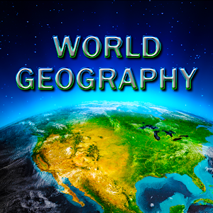
World Geograohy. A quiz app that let's you learn a lot about geography. Countries, capitals, flags etc. I'm quite sure the picture OP uses, is a screenshot from that app.
I was just in the NYC Public Library shop and saw this book and it would be a fantastic gift:
https://play.google.com/store/apps/details?id=com.Mostakshef.mostakshef_elatlas
Try it out and let me know your thoughts I'd really appreciate it
I'm a big fan of this book
Unfortunately, my particular favorite bathroom atlases are out-of-print, but check out History of the World by Map from DK and National Geographic's Family Reference Atlas of the World. It's also really worth visiting your local used book store if you have a good one. It's nice to be able to check them out in person, and you can often find out-of-print atlases or the crazy-expensive-deluxe atlases that run for $100-$200 at a fraction of that price.
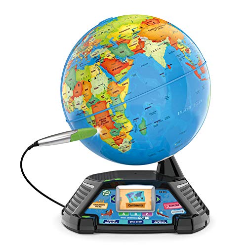
I remember having something like this in my classroom growing up and loving it: https://www.amazon.ca/Talking-Interactive-Colorful-Learning-Teaching/dp/B08DL32XFX/ref=mp_s_a_1_4?keywords=Interactive+Globe&qid=1662591430&sr=8-4
You have no idea what you have just done for me. For over 20 odd years I've been looking for a book on the South Australian wheat fields and the reasons for advance or retreat. Almost everything I could find was about the Goyder line per se but one author I had read was more inclusive of wider reasoning iirc. Anyhow been looking for Meany and without success. Then I saw your comment and you said Meinig then fucking BINGO. This was the author. Looked him up and there it was "https://www.amazon.com/Margins-Earth-Australian-Frontier-1869-1884/dp/1014087708" It was pure joy. The thing was again excuse if I recall incorrectly, the chap albeit a trained geographer just did a quick trip out there. It wasn't a 6 month study tour and look at a rainfall maps - he was there for a very short period of time and came up with a remarkable work that more than earned its place in Australian Economic History syllabuses.
So thank you very much ScallopOolong you have recovered for me after over 20 years of searching a work that I have possibly misremembered but will hope to recapture when it arrives the awe and thrill of his scholarship.
Thank you again.
I’ll do you one better. I somehow stumbled across this book, having little to no interest in geology or nonfiction in general, and it’s the most fascinating thing I’ve ever read.
Seterra which you mentioned is my favorite but also World Geography by Atom Games
Not an app but a site: Worldle - have 6 tries to guess the country from silhouette; each guess, it tells you the distance and direction to correct answer
I read this one for a class last semester and found it interesting. Though I'm not entirely sure if this fits in the realm of cultural geography. Does it?
Anyway, it's still a very informative read!
Gringolandia: The Construction of a New Tourist Space in Mexico
I finished a write-up on this. Can someone check it out and let me know if I did it correctly?
I'll give you imaginary internet points if you do!
Many state boundaries were adjusted from their original territories in order to gain access to navigable rivers that could reach the ocean. A lot of this is covered in this book and its accompanying TV series.
https://www.amazon.com/How-States-Got-Their-Shapes/dp/0061431397
https://en.wikipedia.org/wiki/How_the_States_Got_Their_Shapes
I've written a novel about the first circumnavigation of the globe. The crew of the armada went through absolute hell on earth doing this. It's included in Kindle Unlimited for those who might be interested. https://www.amazon.co.uk/dp/B0B4G3DY6N/ref=cm_sw_r_apan_5A5QQPC6TF8FQP6RXXY3
>No, but it's like the foundation
No, absolutely. You can learn geography, even get a degree, without the need to know the names of all the countries. Do you need to know the existance of Tuvalu to be able to read Richard Scarry?
I use this app, it's great for learning countries, shapes, flags, cities, etc.
Here's the link for Google Play. I'm sure it's also for IOS.
The World: A Brief Introduction by Richard Haass is a great and accessible introduction to geopolitics. I bought a copy for my high school aged niece a few months ago.
Man thats just an old me,I used struggle with geography so much back then like I thought France was in asia lol(its in Europe)but I got recommended a geo video by drew durnil on yt and I watched it and I was overwhelmed by the knowledge he had about geography and I looked through his channel and did other things related to this and I was bored just learning about countries and other stuff and I wanted to test my self so badly so I roamed through most of the apps in playstore and I found a game called world map quiz(only for mobile tho) and it had many tests for me and also a interactive world map to learn more :)
https://play.google.com/store/apps/details?id=com.qbis.guessthecountry
This is the one I use: https://play.google.com/store/apps/details?id=com.age.wgg.appspot&hl=en_US&gl=US
It's on iOS as well.
It has flags early on but you have to progress to get more questions. But it has lots more than flags and extends beyond countries to flags of the US, islands, and other autonomous regions.
What you're looking for is an island near the equator. Water is the best regulator of heat. A place like Siberia on a continental interior for example would have a continental climate with huge variances in temperature during the year. However on an island like the Maldives, the city of Male has very little variance of only 2-3 degrees throughout the year and only around 5-6 degrees between high and low temps.
https://weatherspark.com/y/107507/Average-Weather-in-Male-Maldives-Year-Round
This one's tricky. “Murichurich” is totally not a Slavic (Polish, Russian or Ukrainian) toponym. Assuming the name on the 1929 petition indeed refers to Rowno / Rivne, it might be a corruption of Międzyrzec, which was the Polish name of a village in the Rowno county (powiat rowieński) of the 2nd Polish Republic. In Ukrainian and Russian it was variously named Mezhyrichi, Mezhyrich; the modern official name is Velyki Mezhyrichi. However, imagining this name miswritten as “Murichurich” requires me to stress my imagination to great limits; so, in fact, the place might be something else entirely. I suggest you ask this on /r/ukraine, they might have a better insight.
The writing in the 1933 document is more or less unreadable. I wouldn't trust the AI's reading; it's probably correct about “Poland”, as it's a word which comes up often, but the name of the town / village is a vague guess (not to mention that it can be another mangled transcription).
It must be Lomachintsy. Before WW1, it was part of the Bessarabia Governorate of the Russian Empire. The region was occupied and annexed by Romania in 1918, then recovered by the USSR in 1940, and assigned to the Chernovtsy Region of Ukraine (though it was again under Romanian occupation during WW2).
I rather enjoyed the book "Trivia Lover's Guide to the World" when I was younger. I think it does a good job of covering interesting topics while also explaining the importance of geographic knowledge as well as how it's more than just looking at maps.
https://www.amazon.com/Trivia-Lovers-Guide-World-Geography/dp/1442214031/ref=asc_df_1442214031/
I've used the book Geography: A Very Short Introduction as supplementary literature (There were two textbooks) for intro courses. The very short introduction series is a great way to get... very short introductions.
​
Think they spelt 'cults' wrong.
If seeking a career, which would you choose? One where you had to work one day a week, or one where you worked six days a week and on the seventh day, visited the guy working one day a week.
Gutenberg is far better a man than most give him credit for.
>There are quite many rivers in La Paz
>
> https://www.openstreetmap.org/?mlat=-16.5&mlon=-68.15&zoom=12#map=14/-16.4972/-68.1660
I think that the National Geographic Almanac of World History would be perfect, though it looks like it's out of print and I could only find it in hardcover. Still totally worth it if it's not over your budget.
Ok so this is obviously EXTREMELY low quality, but you can get a beach ball globe on amazon using that same Blue Marble style imagery:
Jet Creations 16 inch NASA imagery Inflatable Earth Globe, View from Space, Great Toys for 6+ years old Kids Boys Girls and Adults, Learning Educational Party Decorations and Favors , GTO-16AEG
by Jet Creations Inc
​
If you did find a decent globe like this holler. I want something for my toddler that won’t be out of date by the time they learn to read. So… geographical features not political ones.
Yep, I've checked average weather at weatherspark.com and central PA seems to fit quite good. Summer is a little warmer and annual precipitation higher, but overall, it looks pretty similar. Thanks.
Start on page 77; you can deduce the exact location (I'd do it for you but I'm beat.)
Has he played https://www.geoguessr.com/ ?
It'd be really fun to watch a kid and see how they do. If he is good or entertaining enough you could exploit him and post them to youtube for our enjoyment. Just kidding, maybe?
Read through "The People" section, again that's 10,000 years of history in an area spanning an entire continent, there has been farming, mining, deforestation, hydrological impacts, clikate change, introduction of nonnative species, pollution, infrastructure, etc., etc., etc..
You can get a much more interesting answer if you narrow your question.
Have you tried a Google Scholar search? I used your keywords are found this:
Natural Disasters and the Risk of Violent Civil Conflict
I'm sure there are probably more good reads there.
You're right, I thought that Nambia/Botswana/Zimbabwe came together at the confluence of Chobe and Zambezi at a point (a la The Four Corners region of the US), but obviously that is not correct <insert that gif of Buzz Lightyear here>.
And for the record, I was counting the maritime boundary, which I thought had created a tri-point between Israel and Jordan, but, apparently not.
It's in Asia, but the continental divide is right outside the city, some 30 km. south or 45 km. west of the centre. The divide is designated by a number of markers, ranging in size from monumental obelisks erected by the authorities to humble stones and wooden poles put up by local enthusiasts. You can see a list and some photos on this page (in Russian), and I've made a quick map of all locations near Ekaterinburg, except the misplaced ones.
[Upd.] On the map, I've also marked Lake Chusovoie, which is curious in that it drains to two basins on two continents: to the south, an unnamed brook flows out to Chusovaia river (a tributary of Kama, further of Volga); to the north, another brook is the headwater of Patrushikha (a tributary of Iset, further of Tobol, Irtysh, and Ob).
You may want to have a look at NASA's World Wind virtual globe. Similar concept to Google Earth, but without the patchwork of imagery.
Base data is NASA's (beautiful) "Blue Marble" and you can select other higher-resolution data sources as you zoom in.
This looks to be the Moruroa Atoll, where the French Government undertook nuke testing in the 70s, and the 90s.
Here it is on OpenStreetMap: Link
That was super interesting to look up!
https://www.geoguessr.com here's a link. Essentially it drops you somewhere using street view and you can move around as much as you want until you're ready to make a guess at where it dropped you was. The closer you are the higher your score.
Apple Maps have high res of the following cities.
Use satellite and then 3D option to see it. It was done using Cruse Missile tech with low flights over the cities and then stitched together the photos using computers and people (80/20).
https://www.apple.com/ios/feature-availability/#maps-flyover
Thanks, I could have tried finding better pics but I'm not a geographer or anything, just interested. Here's what I noticed: near Lake Victoria in central Africa there seems to be a fairly large spike in lightning. It almost makes a crescent shape reminding me of a mountain range but I couldn't find a name for it. In case you're interested: http://www.eoearth.org/view/article/154364/ . That's as far as I could find just browsing around. It could be the smaller lakes around it creating the spike in lightning, but I wonder why.
I assume this is a class that you're enrolled in for this next semester? Is there a class description?
Post it here and we can better answer some questions you may have about the class.
Depending on the software you use, there is a lot of work you can do without knowing any code. Information, Data, Tables, Databases... get used to these words... a lot of GIS work is just this. Learn SQL, you can learn on your own. Start here http://sqlzoo.net/wiki/Main_Page.
My [now] 6 year old loves this thing...
I remember a book from decades ago The Geography Behind History being very interesting. If it's like that I definitely will have to take a look.
I think this was it:
https://www.amazon.com/Geography-Behind-History-Gordon-East/dp/0393004198
Ah, then I have the book for you. Geography: A Very Short Introduction. It's a bout as basic as you can get when it comes to fundamentals.
There are books like this "The Myth of Continents: A Critique of Metageography"
https://www.amazon.com/Myth-Continents-Critique-Metageography/dp/0520207432
You can argue that Europe and Asia should just be Eurasia.
You could argue that things should be based on plate tectonics but the names of continents like Europe, Asia, and Africa were named thousands of years before scientists discovered plate tectonics.
Africa is splitting in two (see the Great Rift Valley) Will we make up new names after the split in a few million years?
While not perfect, I use www.lizardpoint.com/geography. Over the past year, while still working 40 hours+ a week, raising a toddler, and living a life, I've learned the countries, capitals, flags, and world leaders.
Also, while on the go, I use Map Pie Google Play Link
I think it was $3.99 to unlock everything but you could unlock it all by just playing. There are far more things to learn on this (physical features and such) but it's a tad outdated with flags and capital names.
https://play.google.com/store/apps/details?id=com.age.wgg.appspot
I went from knowing almost nothing to knowing nearly every country, capital, and flag. The game has a great progression system and slowly grows in difficulty as you play more and level up. It's such a simple looking game but it's incredibly functional and feels like it's dedicated to learning rather than spamming you with social integration like most games.
People had named some of the continents thousands of years ago (Asia, Europe, Africa) and the others like the Americas, Australia, Antarctica hundreds of years ago. This was long before scientists had even discovered tectonic plates.
You may find this book interesting.
The Myth of Continents: A Critique of Metageography
https://www.amazon.com/Myth-Continents-Critique-Metageography/dp/0520207432
An irrelevant aside, but your comment reminds me of what King had to say about writing Cujo in On Writing. He realised later on that the beast was an allegory for his chemical addictions, and regrets that he has almost no memory of writing the book.
I was thinking something like this, more classical but still beautiful in my opinion. But i would need to cut out cork and glue it under the string, in order to be easier to attach the pins. Is it hard to cut cork or can i do it with a cutter?
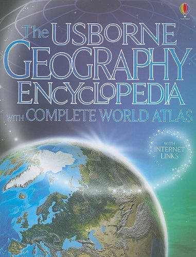
http://www.amazon.com/Usborne-Geography-Encyclopedia-Complete-World/dp/0794526985
When I was about her age I received one of these as a gift. I was able to use it to help with some school assignments. Assuming the newer editions are like the copy I have it covers a lot and is very informative.
Behind the Beautiful Forevers by Katherine Boo and Planet of Slums by Mike Davis
City, region, US, and world, plus any others you find interesting. Old and new maps, then and now, etc. I bought some 1800s era maps of India from a flea market for around $30 some time back...Obviously not everyone's cup of tea.
That reminds me, not exactly the same thing, but this book has some really nice then and now pictures http://www.amazon.com/Earth-Then-Now-Amazing-Changing/dp/1554077710/ref=sr_1_1?s=books&ie=UTF8&qid=1424323197&sr=1-1&keywords=earth+then+and+now
On a better vein, this coffee table book has some really amazing pictures and stories about India. I think you can get it for less than $5 now..Quite worth it http://www.amazon.com/gp/product/1587592177/ref=oh_aui_search_detailpage?ie=UTF8&psc=1
I don't know what your position is right now..and the kids might be a little too young to understand and experience it...but travel! A week in Europe would be much more culturally enriching than a week in Florida...Not that there is anything wrong with Disneyworld. Bonus points for going to Asia, double bonus for South America, and triple bonus for Africa.
Geography Matters: More Than Ever by Harm de Blij is a good, interesting and readable book.
Currently I'm reading The Accidental Super Power, it is very deterministic like the Revenge of Geography, but so far so good.
Academic GIS --> Chrisman's Exploring Geographic Information Systems is a great, comprehensive look at why and how we manipulate geographic information on computers. It's completely software agnostic (applies just as well to QGIS as ArcMap) and talks about the reasoning behind GIS operations. Don't look to this for information about LiDAR or inverse Kriging, but a solid intro to information science via geography.
Indeed. I could have gone into this more explicitly. The term has been used since before any contemporary religions existed, unless you count Proto-Indo-European Neo-Pagan Reconstructionists. It was first spread widely as a place name suffix by the Sasanian Empire, a Zoroastrian state, and was deeply entrenched in the region before Islam came to the region. Even so, the Central Asian Muslim cultures of the -stans remained non-Arab, some -stans remained largely Christian or Zoroastrian or Tengrist for a long time, and -stan only became associated with Islam by the view of outsiders (mostly Russians and British), who were the ones responsible for official names including -stan.