
What are
/r/mapmaking's
favorite Products & Services?
From 3.5 billion Reddit comments
The most popular Products mentioned in /r/mapmaking:


The most popular Services mentioned in /r/mapmaking:
Azgaar's Fantasy Map Generator
Wonderdraft
Gumroad
Mapbox Studio
GIMP
Inkscape
NationStates
Google Groups
Open Culture
Windy
Leaflet
OpenStreetMap
Dundjinni
Paint.NET
phpBB
The most popular reviews in /r/mapmaking:
I have a fair amount of experience with photoshop and used Noah Bradley's guide to map making pack along with JPcartography brush pack. Both are free and watch the guide by noah bradley to get an idea on how to make the maps.
I made this map of Mandate, a fictional capital of the developing nation of Mandira. https://www.nationstates.net/nation=greater_mandira Mandate is poor, has a population of 50 million, and is generally deregulated with extensive private developent.
I loosely based it off of Beijing and New Delhi. Criticism welcome, especially as to 'realism' Made in Inkscape!
The Realm of Aesen is the world in which me and my closest friends play D&D 5e in. It had a humble beginning where i only made a very small location map with a few towns strewn in and it has grown into this world map which it is today.
Summarize of the realm: The realm has five major factions. The Northern Kingdoms, the Last Sovereign, the Order of the Raven, the Empire of the Gods and the Emerald Enclave.
The Northern Kingdoms hold the north protected by a barrier of mountains from the rest of the realm. Here the all the dwarfish kingdoms have rose to unite under the banner of the High-King.
The Last Sovereign control the Aspaarian deserts of the east as well as much of the land surrounding it as well. Here all races who want to seek a better life live in coexistence in the huge cities erected by the now deceased Sovereign Gwyneth.
The Order of the Raven lies in the murky and dark south of the realm. Here the landscape is harsh and the reign of the King even harsher. But even the king fall under the dominion of the Raven God Nevermore, who controls the faction from the shadows.
The Empire of the Gods rest in the west as the strongest of the five major factions. The empire has always followed of the Gods of old, whom where shattered during the War of Mortality. Even though their Gods have gone, they still hold true to the traditions and principles they left behind.
The Emerald Enclave have complete and utter control of the center of the realm, they built their whole society around the dead corpse of a God, Zaw'mjir, who was the world tree and the one to control nature itself. After his passing the faction took it upon themselves to uphold his job.
I made this using the latest version of Photoshop CC and THIS brush set by Joel Pigou.
Start with a piece of paper and a pencil.
If you already have a device with a pen where you can draw digital you can use Krita. An Open Source drawing software. https://krita.org
Inkarnate is nice, but you don't draw you maps. It's more like a copy and paste.
Thanks! This guide helped me a lot in digital mapmaking using GIMP, if you end up using it this will help you a great deal. GIMP sure has a bit of a learning curve, but once you get acquainted with it you can make really good looking maps. I'm by no means a master, I'm not even close to being adept at digital mapmaking. This cost me so much time to make. But I got better since I started making this map, and learned a lot by practicing. Though if you wish for a much more easy to use softare, I recommend Wonderdraft. I do not own it, I live in Turkey and because our currency is so worthless it would cost me 170₺, which I cannot afford at the moment. But if you live somewhere where $30 is affordable, you should definitely check it out. There are lots of downloadable assets for it too. r/wonderdraft would have more info.
Or if they do, it's at the river delta, which is typically much closer to the coast than this and riddled with channels and whatnot.
The Saar Commune
​
The Saar Commune is a landlocked unitary Marxist-Leninist one-party socialist republic bordering Germany in the east, France in the south and in the west, and Luxembourg in the north. It was declared in 1955 by Erich Honecker, who returned to his birthplace after the end of World War II and managed to sway the voter's opinion towards independence instead of reintegrating into the Federal Republic of Germany.
​
There's a whole wiki-style article about the lore you can read here.
from [the wiki](/r/mapmaking/wiki)
67,000 Historic Maps (in High Resolution) from the Wonderful David Rumsey Map Collection. Some inspiration here..
These are my first maps, and I wanted to know what I could do to improve them. Curious if there is a preferred "style."
The maps were made using Photoshop and Joel Pigou's brushes.
http://sourceforge.net/projects/autorealm/
Has a bit of a learning curve (though not too steep) but otherwise it's a pretty powerful piece of software. I suggest melding this with GIMP for touchups.
Paint.net is actually the name of a downloadable software, not an online tool. You can get it here.
The name comes from the fact that it intends to be a replacement for the Paint program that comes with Windows, and that it's done using the .NET programming stack.
Looks good! My only critique would be that your coastlines look too uniformly jagged. Actual coastlines have a surprising amount of variation both on a large and small scale. On a large scale, take Europe and Africa. Europe has a much jaggier coast than Africa, which has many straight sections of its coast. On a small scale, take Norway and the Iberian Peninsula (Spain and Portugal). Norway, with its many fjords, has a much jaggier coast than the Iberian Peninsula. Looking at your map, there is very little variation. Another issue with your coasts is that they are completely devoid of any islands. Remember to scatter in occasional small islands in your coastline, it really helps establish a sense of scale for your world. Also, it would also help to add some smaller islands right up against your larger islands between your two continents. Most islands have smaller islands right next to them. (Take the Isle of Man and the Calf of Man, for example.) I know this map is not done yet, but I thought I should point this out anyway! Anyhow, your map is looking really good so far. I'm loving your coastline, mountain, and river styles! Getting the curve and thickness of rivers right for me has always been a real challenge. Great work, can't wait to see the final product!!
Yes! I'm assuming you want to get maps of real world areas?
You should look into QGIS, it looks really complicated but getting visualizations like that is actually pretty easy. They got the road data from Openstreetmap
On this page: https://github.com/Mindwerks/lands/releases
there should be also an exe file
Unfortunately that version is working only from the command line, while recently we introduced a GUI.
In our google group we will announce the new Windows version (with the GUI) as soon as we have them: https://groups.google.com/forum/#!forum/lands_worldsynth
I firmly recommend GIMP and Wilbur as map making software.
If you're already familiar with Photoshop you can probably use Photoshop instead of GIMP, Wilbur is an extremely good programme for simulating errosion on a height map. It helps a lot for finding river placement and for making realistic landscape shapes (both contours and coastlines) from a height map. It's certainly allowed me to massively up my map-making game.
You might look into MapServer. Fairly easy to implement on a small server, Apache freindly, a little PHP-heavy for my taste (or at least it was when I set one up a few years ago), but that made it all the easier to learn & go.
Yep, totally. It’s complex software but what you are trying to do is really basic. It’s great for cartography and there are heaps of resources. Mapbox might be easier, but I’m not sure how you would go about adding your “proposed 2050 route” layer. If you plan on doing anything professionally using mapmaking, it’s worth using the proper tools.
Strictly speaking ArcGIS is industry standard, but QGIS is open source (free) and most of the skills are interchangeable.
Well, if you're willing to put in the hours you're not going to regret using Photoshop.
If you wanna make decent looking maps easily and fastlike, i think Wonderdraft is the best choice.
Context: I started drawing this map a few month back with Wonderdraft. Most of the places don't have a "story", yet but I have a detailed continent map of the upper left continent and even a city map. Then I thought, would be cool if you could just zoom in and the detailed maps load google-maps-like. So with the help of leaflet and several tools (some self-written), I got this this together :)
nice design - obviously inspired by europe.
I would try rotating and flipping the map a couple of different ways for a different feel.
by way of example
good start
Not yet, though the original intent was to highlight some spots that DMs might wish to name for their campaigns. I had meant to have the name list, but got totally sidetracked over the weekend by artbreeder.com. Definitely a cool thing to check out. ;)
You're probably aware ~~Illustrator~~ Photoshop has a rather robust set of vector tools these days, but if you/anyone is looking for an Illustrator-like program that's a fraction of the cost, start here.
Really happy with how this is going so far, and thought I'd share.
Tools used:
- Azgaar's Fantasy Map Generator: Fiddled with some settings to get a land shape I liked, then modified the height map and world characteristics to generate a variety of biomes. Exported a handful of different views of that map as PNG files for later reference. I also leveraged the culture and state name generators in Azgaar's to help label all of the nations on this continent. I'm not *that* creative, so a quality name generator really helps.
- Wonderdraft: The easiest to pick up and use mapping tool I know of. Buying it has been one of the best decisions I've made for solving the problem of not being able to draw worth a damn while needing to create good-looking maps. By removing the coastal effects in Azgaar's generator and exporting the landmass, I was able to directly import the shape of the continent to Wonderdraft. Then all I had to do was refer to the heightmap for placing mountains, and pick and choose which of the randomly generated rivers I'd add myself. I also colored the terrain based on the biome Azgaar's came up with for each region of the map based on the settings I used.
My plan is to use this for a Dungeons and Dragons campaign (well, probably more than one) inspired by the setting of Pillars of Eternity. Some kind of Age of Sail meets Sword and Sorcery thing.
Sounds really fun!
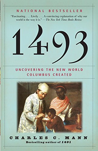
I don't know what books / resources you're using, but if you're looking for a big-picture context of the political, social, and economic forces in the colonial era, I hear that1493 is great book.
For a more focused view on colonial life, Alan Taylor's work has received praise as a good history that takes into account both European and Native peoples.
To be clear, I haven't read these books - I only mention them as popular sources. If you're looking for something more detailed, I bet r/AmericanHistory or r/history would have all sorts of great resources and people with much better recommendations.
First of all, /worldbuilding discusses this stuff too so subscribe there if you haven't already done so.
Second, ask yourself three questions:
are you ever going to want to move your maps onto a computer as other than a simple scan? If so, using a proper cartographic base is a good idea.
are you going to be working in a 'hard science' or a 'science-lite' framework? If hard science, be prepared to learn a ton about climate systems, ocean circulation, geology, … If not, then make the map that pleases you!
are you going to work at a variety of scales (e.g. an overview map and then drill down to a more detailed set of maps)? If so, ask about hierarchical map systems based on squares or hexes.
In terms of drawing, a few tricks:
a. get some 11x17 paper and draw at that scale. Minor errors are less noticeable on a bigger map
b. make sure you are using a very smooth substrate (e.g. a proper drawing tablet) underneath or the 'texture' of the surface below may show through especially when you do shading
c. test all pens / pencils on a piece of throw-away paper of the same type as your 'good' map as some inks will bleed, some papers will encourage bleeding, … and it's better to be safe than sorry
d. browse libraries of hand-drawn maps to decide your own graphic style. Keep a journal book of hand drawn ideas for things like symbols, …
e. if your drawing skill needs work, I'd recommend Betty Edwards 'Drawing on the Right Side of the Brain' as an excellent place to start.
GLHF
[the r/mapmaking wiki](/r/mapmaking/wiki) has this info and link
> 67,000 Historic Maps (in High Resolution) from the Wonderful David Rumsey Map Collection. You can download some impressively high resolution images to print out for your purposes. > > Article: http://www.openculture.com/2016/04/download-67000-historic-maps-in-high-resolution-from-the-wonderful-david-rumsey-map-collection.html > > Website: http://www.davidrumsey.com/luna/servlet/RUMSEY~8~1
Vintage Leather Journal - Lock Closure, Book of Shadows Journal, Grimoire Journal, Witch Journal, Vintage Journal 240 pages Antique Deckle Edge Paper https://www.amazon.com/dp/B09BR9S5GX/ref=cm_sw_r_cp_api_i_H8XJNTXGT572G25FWJYQ?_encoding=UTF8&psc=1
Yep, sometimes I just can't find any I like over the oceans but that does make it super simple. I'm sure I could find a better radar too, I just use weather.com and it only has so much range before it cuts out over the ocean. It doesn't take too long to get out all the unwanted colors though.
Haha, yep. QGIS would be the go to if you want to make a really high end product with infinite variations.
There are plenty of tutorials to help get you started, and it is well worth the time investment as you will almost certainly need those skills again in the future.
You will want to start with a relatively blank base map showing cities, geographic features etc then add data from open street map for your railways.
Good luck
Hiya! I made this map using a neat little tool called Wonderdraft. Along with some Unit assets from Cartographyassets.com
Wonderdraft link:
Okay so. As far as the masses of little islands, I could certainly sit there and just draw a mass of slightly irregular circles, but that's god awful use of my time.
So I use this website: https://azgaar.github.io/Fantasy-Map-Generator/
I create a map without any layers (shattered is best for this purpose), then import the blank one, remove all the little extra stuff so it's just flat land geometry. From there, you just repeat those until you have a ton of them, import to your map, make sure to scale them all identically so you don't end up with islands with differing levels of detail like I currently do (though there's an option to reduce the number of points when creating a new map in case you want islands with easier shorelines, but I'd just draw them myself at that point.)
The fun part is next. Just move the tiny little shattery islands around wherever you think they look good, and if you have large land masses that need more coastal detail, you'll be using the pathfinder tool. Unite to add two shapes into one and minus front if you want to subtract the higher geometry from the lower. And that's basically it! I have a video you can watch if there's any confusion
here yah go fren. To be honest I am color blind enough that I can't see those suttle shifts of white and some others.
I do know that Strathmore has a Bristol 300 series paper that is off-white and very thick and sturdy yet with a smooth surface, bristol can withstand lots of erasing and ink and doesn't curl from the heat on your hand. Here it is
What's your project?
I've been building a map as complete as I can for my world, full of unnecessary characteristics because I just like these details; they make the world seem more "alive" to me.
However, I'm no geographer, and my knowledge on the area is quite limited. This image is my attempt to make a believable hydrographic map, and the keyword here is "believable. It's not exhaustive, I think. Besides the blank areas, where I haven't worked yet, Mark Rosenfelder stated that rivers tend to be roughly 10 Km apart from one another, and this interesting US map shows that rivers are much more numerous than we usually think.
Do you guys have anything to comment on it? Are there any big flaws? Is the fact that there are so many small rivers and streams going straight to the coast realistic? Or should we expect only the major rivers to flow directly to the sea?
CSV file could lead to quite big files, but we could consider it, in particular if it could be useful for some project like yours :)
Is the game a commercial one? Open source? Is that anyway our project could help yours?
Civs is just a pet project, and as you said it is just a simulation. I would love to hear more about your project. Is there any website or resource can you suggest?
Btw, Bret Curtis (author of WorldSynth and now maintaining this project with me) also worked on similar simulations, we could share ideas if you want.
Please feel free to write to me at f dot tomassetti at gmail dot com or to write in our google group https://groups.google.com/forum/#!forum/lands_worldsynth
Good luck with your project, I hope to hear more about it!
Thanks, I appreciate it very much! P.s. you could be interested in subscribing our new group: https://groups.google.com/forum/#!forum/lands_worldsynth there we will discuss new features and improvements for Lands + WorldSynth, interesting times are coming!
Thanks, I used the paid pack for this one a bit. I'm not 100% sure if I used other brush packs or not but I know I tried his out here and they worked great.
Edit- this: https://gumroad.com/l/QDxZK
https://www.reddit.com/r/mapmaking/comments/9g3tf0/making_maps_of_the_different_countries_in_my
That's the first map I posted.
If anyone has any feedback(for either one) I'd appreciate it. Still have some nitpicky changes to make but I think these two are basically done.
The map was created in Photoshop. I'll make a list of brushes used for the details later.
Resources used:
https://gumroad.com/l/QDxZK
Put it in gimp and download these brushes https://gumroad.com/l/VgwKU Fantasy Cartography Brushes - Essentials - Gumroad
Draw over the geography first in different layers,then draw your coastlines, and delete the original image
Here is my first attempt at making a map. It was a real learning process with a lot of mistakes made and many iterations before I got to one that I was happy with.
Its a map of a world from my head, unnamed as of yet, made in krita
Free paper texture used was from pixabay,
https://pixabay.com/photos/vintage-texture-vintage-paper-retro-2714966/
Hey!
So, first I copied the image, and pasted it into GIMP, which is like photoshop, but open source and free. I selected the bit with the map, and adjusted the perspective with the perspective tool. Next, I duplicated the layer, then edited the contrast with the levels tool (I actually the curves tool, but the levels tool is less confusing). I cleaned up some bits of contrast with the dodge/burn tool.
​
To stitch the map bits together, I adjusted the perspective of the sheets a bit, and then used the clone tool to cover up the transitions. I also used the clone tool to fill in the peninsula.
​
On a new layer, I copied in a satellite picture of the US, resized it, and set the opacity of the layer to something transparent. I used the clone tool again to basically copy and paste different bits of the US map onto each other so that it would fit the map better.
​
Last, I changed the layer type to 'soft light', so that it would work to color the map without obscuring the lines (there are a bunch of layer types, I just played around with them until I found one that worked. It's actually 2 layers of soft light, and one of LCh Hue, which I guess made everything more vibrant). The whole thing took an hour or two, I think.
The Artifexian videos about the Köppen classification are great. If you want a bit of a different angle on biome/vegetation mapping though, you could look into the Holridge Life Zones too. If you can get some idea of the amount of precipitation in a particular location in your world (from wind patterns and ocean currents as in Artifexian's videos, and by comparing your geography to Earth), and have a rough idea of the average temperature,^(1) that chart can give you pretty detailed idea of the biome and type of vegetation that a particular area might have, if it were on Earth. It also has the added bonus that the effect of altitude is built in! I've found this a very useful tool.
Also, check out this website! --> Mythic Ecology Series. It is chock-full of inspiration! :D
​
[1] I actually built an overly detailed spreadsheet to calculate average yearly insolation based on latitude, and scaled everything by the average planetary temperature I got using Artifexian's equations (which are based on solid physics, btw!) so that the polar and equatorial extremes were consistent with the world I wanted (extent of glaciation, habitibility of the tropics, etc...). This is wholly unnecessary; sometimes my inner engineer just can't be stopped though... :P
Is that a yes? I just want to be sure. I love your work on this map.
I think it would be really cool if you released these under some sort of Creative Commons license, then the community could share and use your work. Just a thought!
Love your work, keep at it!
You can make something similar in GIMP. Using this tutorial, you can copy the brush design he is using for this, and then once you have it loaded, go into the Brush Dynamics and set the Size, Angle, Spacing and Jitter to Random (or play around with them to get the look you like) and it will give a very similar affect. This way, as you move the brush around, it will slightly vary in size, shape, spacing, and placement, and give you a very random removal of the coastline.
​
That's awesome, I'm glad someone is integrating this map into their own campaign!
As far as the PSD file goes, you don't have to have paid Photoshop if you don't deal with it full-time. Download GIMP, it's an open-source graphic manipulator that works pretty similarly to Photoshop. It may close down and 'rasterize' some of the layers, but the text layers should be fine. Just watch for any distortions of color for the rest of the map.
Once, you're in there, if you're just wanting to change the fonts, grab the 'type' tool (shortcut t), and just click on any text. You should be able to change it. Some of the text you won't be able to change, mostly anything that's turned sideways or skewed, as they've been turned from text to an image so they can be manipulated. You can always duplicate a nearby text block and drag it over to what you want to label.
If for some reason, you have trouble with GIMP, you can sign up for a trial month at Adobe.com and play with Photoshop for a week.
Edit: Also make sure you download the included Font or everything will look weird.
These look Tolkien'ish to me. I would add more size diversity and more shapes, rather than only pyramidal mountains and hills. I'd also recommend incorporating some of the mountains into each-other. There are thousands of photos illustrating this you can use for base references. https://tinyurl.com/mzwf9t9
The way I draw mountains (uploading my map soon) is to draw the outlines first of the entire main ridges, and satellite ridges, then add shading later. Rather than shading and adding cracks to each mountain as you go.
On a semi-related note, have you tried FlowX? (It used to be called WeatherBomb.) It's BY FAR my favorite. https://www.flowx.io/
Shoutout to Windy too (https://www.windy.com/) who also makes a cool app,
How would I place that final product on a custom HTML page inside phpbb? That's the hard part. MEssing with phpBB breaks literally everything each time you update it and I'd rather now mess with phpbb code again, it's a "insert seven swear words here" to fix. But this https://www.phpbb.com/customise/db/extension/pages/ does allow custom html, so I was hoping I could add the map to thois and still have it work.
Now how do I put that on my forum as a custom html page? http://www.kwandrivia.net/ I'd put it as a link on the forum yang this extension https://www.phpbb.com/customise/db/extension/pages.
I'd like to have a nice map people on the forum can use.
Campaign Cartographer has addons with the 1st and 5th Annuals that are excellent for doing street and city mapping that look very googlesque and take a lot of the pain out of the work; that said, it's not cheap and the base software plus either pack will run about $80 ($120 for both annuals, not that both are necessary). Anyways, you may want to check out profantasy.com if you're not necessarily averse to spending cash.
There's also stuff like http://grass.osgeo.org/ which is free, but has a big learning curve and is probably overkill.
Haha thank you! PM me if you have questions! I use QGIS and Mapbox to create these interactive maps if that helps you get started. But I’ll be streaming my process towards the end of the month as a part of a series of cartographic workshops put on by my friend. I’ll post more details on Instagram when that time draws closer!
It will be built with Mapbox, a Javascript API for making web maps. They have tools to allow for adjusting detail on scaling, interactive popups, easy styling/layering of data, and a lot more.
The geographic elements were created in QGIS, an open-source mapping software where you can create and manage spatial data. The landscapes are placed at arbitrary real-world coordinates in order for them to render properly. While GIS is a huge field (I even went to school for it), you can definitely pick up the basics fairly quickly through online tutorials.
Once I've got all the files for the landmass created, I make the basemaps using Mapbox, a free web-mapping technology that allows you to create tilesets from geospatial data. With a decent eye for design (or even if you just copy how Google Maps styles the world) you can quickly create some striking maps! However, in order to serve it and add custom cities or towns (hidden in this demo) and spin it up for other people to view, some basic web development knowledge (HTML, CSS, JavaScript) is definitely helpful.
I'm thinking of doing a tutorial on some of this soon, if I can find the time. :)
Website in question is https://umap.openstreetmap.fr/en/ and I've found another site that let's me download my maps as pdf's (https://maposmatic.osm-baustelle.de/).
The problem is the maposmatic.de doesn't apply the theme I've set when creating my map with umap.fr, and the markers aren't numbered.
/u/jacobiwan_kenobi : I've made a very quick test with Leaflet and it seems quite easy to use. I've followed the tutorial about the space map and I have a working zoomable fantasy map. It's pretty basic and reading the doc might be required for more advanced features but you can quickly try the following on your side. Here is my HTML code (pretty simple):
<!doctype html> <html> <head> <title>Map test</title> <style type="text/css"> html, body { height: 100%; margin: 0; padding: 0; } #map { height: 100%; } </style> <link rel="stylesheet" href="js/leaflet/leaflet.css" type="text/css"/> <script type="text/javascript" src="js/leaflet/leaflet.js"> </script> </head> <body> <div id="map"></div> <script type="text/javascript"> var map = L.map('map', { crs: L.CRS.Simple, minZoom: -2 }); var bounds = [[0,0], [4069,5763]]; var image = L.imageOverlay('img/fantasy_map.jpg', bounds).addTo(map); map.fitBounds(bounds); </script> </body> </html>
The map picture is the fantasy_map.jpg in the img subdir, 4069,5763 (bounds) are its size in pixels (in the order height,width), I've put the leaflet dir (with the .css and .js) in a js subdir and the rest is pretty straightforward. The map object replaces the div with the id "map".
NationStates is a political simulation game in which you run a country by responding to issues that pop up every 6 hours. Most of the role playing I'll be doing will be outside of the site itself, but it'll be based on the site. My nation I've created for the role playing is the Empire of Kjev. There's also the NS sub r/nationstates.
You can get this software package here:
https://www.humblebundle.com/software/maps-extravaganza-software
For many years, Campaign Cartographer is the standard for producing commercial quality maps. However, there is a steep learning curve and the user interface is un-intuitive.
Many people swears by Wonderdraft which is much more intuitive to use:
Well, no sweat. Even if it was intentional I'd consider it a compliment. I guess the lay-out just has some appeal to it :) I used Wonderdraft to make the map and it works perfectly. You can check it out if you like, though I love the clean style of your hand-drawn map.
​
Keep up the good work. :D
My players are getting ready to explore this huge city that long ago fell into the underdark during an ancient conflict.
Made with: Watabou's City Generator for the city layout. Gimp for touch ups, and Wonderdraft for the landscapes and other map elements.
The Night Market : The main area of trade and settlement in the Fallen City, the night market is an eclectic group of enterprising salvagers and traders that have begun to use the city as a local hub.
The Rambles: A somewhat safe area of the city that has been mostly picked over and is now inhabited by exiles and outlaws that seek to not be found.
The Glowing Citadel: Called such because the green glow of the surrounding sea reflects off the shear white walls of this imposing fortress, the citadel is currently under the care of a Drow lord who has established an outpost here to monitor goings on in the upper layers of the underdark.
The Deep City: Once the main administrative and monumental district of this ancient city, the Deep City is mired in shadow and death. Few who travel there make it out alive, and they speak of riches untold hiding among the rubble. My players will probably not want to visit though. You know players.
There is definitely a rule set for this. During his turn, the druid applied a moon beam to the serpent, then turned into a bear. The moon beam is a spell, with rules: https://roll20.net/compendium/dnd5e/Moonbeam#content
As you can see, the moonbeam does damage to the target on its turn or when it enters. The bard turned the serpent into a turtle, and another character tried to kick the turtle out of the beam before it did damage to the turtle, because when the turtle hit 0 HP it would revert to giant-dangerous-serpent. The druid couldn't cancel the moonbeam because he was a bear. The kick brought the turtle out of the moonbeam, but it crawled back in to attack the person who kicked it. Because it entered the moonbeam to attack the person who kicked it, it took damage, and reverted back to serpent form. Then we killed it.
The mapping software that I used, AutoREALM, has several pre-loaded sprites that you can place on your maps. Everything in the map (save for the text and the overlaid coloring of the regions) is from AutoREALM. It's a really cool piece of software and I probably wouldn't have even attempted to create the continent if I hadn't found it.
Ah, I checked on the site, and their are some icons that interest me. (Like this - http://game-icons.net/delapouite/originals/dwarf-face.html) Do you have to individually add them or is it a bulk thing? Also I might have just missed the icons if they are in fact in the editor.
Check out Clip Studio. Takes a while to learn, but it's incredible! I would recommend the more expensive version. It is a Japanese product, which means some of the wording is a little odd. Very cool stuff.
​
Gimp is great but a steep learning curve for lazy asses like me :) I use Inkscape SVG and Paint.net as my weapons of choice for vector and raster images respectively.
Just a thought. Include a bit of your background thinking as your map looks fairly small for a campaign setting. Some links back to your design process and thought process could be interesting too.
I don't know where you are from, but I'm from Argentina and I heard people saying "Me gustó" a lot of times, and to me it does makes sense, I already explained that it means that he already experienced the feeling of "liking it", you can even Google "Me gustó" and you will find people using it, and even its meaning, like on this page as an example About the "tilde", or "acute accent", you're right, it's called acute accent, in Spanish we say "tilde" as a generic way to call those accents, and I heard English speaking people calling it like that, so I thought it was right, sorry.
Try Azgaar's Fantasy Map Generator, it makes randomly generated map within certain guidelines that you can change. You can save the map and change it later too.
I typically start out with Azgaar's map generator I generate a ton of different map, saving PNGs of ones that have some aspect I like. Once I have a bunch of these (typically 10-15) I go into Affinity Photo (basically Photoshop) and make a collage out of all the parts I like. I then trace out the coastline. I typically draw the coastline 4 or 5 times, getting more and more setailed with each iteration.
I foud that making a map really helped me to explore my world and its cultures.
Depending on what you want here is some stuff you should check out:
Gimp (free, shitty photoshop)
Inkarnate (it is handy but results in a sort of typical style imo)
Paint
And here are two very amazing random generators https://azgaar.github.io/Fantasy-Map-Generator/?size=47&seed=1575485784&coast=1&port=1&river=0&from=MFCG
https://watabou.itch.io/medieval-fantasy-city-generator
Also, head on over to the cartographers guild for more resources. or check the sidebar here.
I initially used Azgaar's Fantasy Map Generator to get a somewhat realistic map without straight-edge borders or other weird geography. I converted the world by hand, drawing over the land by alt-tabbing between WonderDraft and an image export from the Generator. From that point it was just a matter of putting in all the terrain and towns.
The generator doesn't necessarily create the most inspired terrain, so I added some of that in myself. Stuff like lake- and terrain-names are also not included, so you can really see that I cut some corners on that part. I added in "Kingdom of Ohmun" myself, which didn't exist before the start of my homebrew campaign.
Context:
The setting of "The Darkest North" a new story set on my tidally locked planet of Bifrons. We follow the eager(and hopelessly naïve) explorer Farco Maldwyn on his quest for a safe route through the polar region of Trollmark. He hopes to make his fortune when he publishes the journal of his travels, but it soon becomes an apocalypse log as his fellow travelers are picked off one by one by disease, hunger, parasites and vengeful trolls.
Caught between the Dayline and the Shadowline, Farco Maldwyn and his expedition travel through the thin band on their planet where the sun rises and sets over the course of the 60-day solar year. While the sun is up, the explorers live in fear of deadly flares, and once it sets, they must seek shelter from the agonizing cold… and the many creatures who hunt in the darkness.
From the southerly lands of Morn, Farco is used to a night that lasts for days. Armed with his musket and specimen bottles, he dreams of making history in the savage northern lands. But he soon learns that there is a reason men have yet to conquer the wilds of Trollmark, as his expedition falls prey to the dangers of the Darkest North.
Both maps made in Photoshop. The first b/w illustration is an in-universe map made by the narrator, showing the proposed "Northbridge" route over the pole. The second is a "satellite" style version.
Want to read The Darkest North? It's available on Kindle.
Want to learn more about Bifrons? Visit my website.
It's called isometric. This is what I'm using specifically but any isometric paper will work. There's places online you can print your own if you'd like for free too. Cheers.
https://www.amazon.com/dp/B000HF6ZE8/ref=cm_sw_r_cp_apa_fab_GxDEFb67E33WC
This is what I'm using specifically but any isometric paper will work. There's places online you can print your own if you'd like for free too. Cheers.
https://www.amazon.com/dp/B000HF6ZE8/ref=cm_sw_r_cp_apa_fab_GxDEFb67E33WC
This took me about ten days, and twenty or so hours of work from start to finish. The initial outline was done with pencil, the outlines of the map were done using various sizes of Prismacolor fine line markers, the provincial crests were outlined with a plain thin-tip Sharpie and colored using Crayola colored pencils, and the map itself was colored using Bianyo 8606 alcohol-based markers (on Amazon here, they are very good).
Here is a timeline of the creation process, which is honestly more fascinating than just looking at the finished project. Check it out, if you'd care to: https://imgur.com/gallery/6khBPUI
I have released my first full length novel today, Heartscale. It's a 125k word Draconic Fantasy, and it's is available on Amazon today!
This is the full art map for Heartscale, artwork by u/Mullerson_.
Book blurb:
>On one side of the world Graith discovers a dying dragon in his barn. While the country is hunting after the monster, he doesn’t hesitate in doing his best to aid her. Before she is even fully healed, Azelia urgently needs to get back to her cave to protect her eggs. Unable to even fly, Graith decides to accompany her, worried of what might happen.
>
>While on the other side, where the future ruler is decided by dragons, Nerie is chosen by the Kiriga, the golden hatchling. Raised as a merchant in the middle district of Roria, she’s shocked to learn that she is the king’s bastard. Thrown into a chaotic palace life, she’s forced to balance learning to be princess and being bonded to a dragon.
These are Faber-Castell 4 PITT artist pens, I got them at a office works where I live for only $16 but I think the reason I got so much detail into this map was because I used a magnifer Lamp that I got from Amazon
This is the one I got:
https://www.amazon.com.au/dp/B01MRJ5HU4/ref=cm_sw_r_cp_apa_i_Q.GqEbDKDDAX1
Edit: got rid of the massive amount of text describing the magnifying lamp.
The map is made with: /r/inkarnate
The game is a turn and text based RPG for Android,
Link to Playstore:
https://play.google.com/store/apps/details?id=hu.adamvarhegyi.duelsrpg.cult
Wow! Helps a lot!
Definitely I'll go for a cheaper spiralbound like this, as you mention I need to try things.
Use a binder is another good option that I didn't have in mind.
Thanks a lot!
​
I'll come back soon with my first map ;) A lot of excellent map makers in this sub.
Thanks a lot!
Finally I ordered your recommendation on Bee Paper. I was convinced by its high gsm, number of sheets (60) and its good reviews on Amazon.com. We'll see how it is.
I recommend these instead of Sharpies...
You can sometimes find the 4 pen package at walmart.
If you do go with Sharpie, they now make a pen that has less bleed than the regular precision tip markers, but they still bleed more than the prismacolors.
You should check on local art stores, they have all sorts of cool stuff that you can often try out before purchasing.
Coming along nicely. I recommend skipping the sharpies and getting s few of these instead:
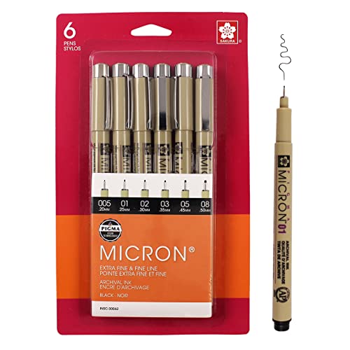
Sakura 30062 6-Piece Pigma Micron Ink Pen Set, Black https://www.amazon.com/dp/B0008G8G8Y/ref=cm_sw_r_cp_api_tdoFzbDR665K5
If you haven't already found it yourself, I tried googling the names in the picture and I think it's Making Maps, Second Edition: A Visual Guide to Map Design for GIS.
First step is to figure out the scale of the map - How big is the place?
Second step is to choose the style you want to go in.
Third step is to practice on a separate bit of paper the artwork you are going to create, random mountains, forests, etc.
Note that in a perspective map the items in front can partially hide items behind them. If you have a very large map, then the symbols can be very small and still convey what is happening with the terrain.
Example: http://i.imgur.com/9aQF8YL.png
And of course there is the Classic Tolkien map
So start at the bottom and work you way up so that you do not have to paint over or draw over things.
Have small grid lines in a light distinctive color so you can keep things lined up and straight. (or else use a ruler) One of the reasons graph paper is blue is because the light blue can be filtered out, leaving only the black lines of the artwork.
Drawing by hand, an old school French Curve is great for drawing smooth curved line. for example
https://www.amazon.com/PARTH-IMPEX-Plastic-Drafting-Template/dp/B06WP8J9JL/
Do not just do tho obvious things, also mark locations of legendary events that can be used to drive players nuts "Rumored site of XXXX"
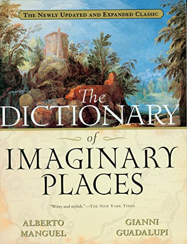
you could consider this book from 2000 (you can peek inside on Amz): https://www.amazon.com/Dictionary-Imaginary-Places-Updated-Expanded/dp/0156008726/ref=sr_1_1?ie=UTF8&qid=1484468189&sr=8-1&keywords=imaginary+places
Well, you'll likely find the graphics tablet route far more sensitive for doing what you've in mind. If you're truly planning on Game development, there's little reason to skimp unless you're just broke. Here's an option if you're looking to save cash. That said, it's totally possible to do this with a mouse, given enough patience and time.
Now, all things considered, what you'll find most helpful is practice. The problem with making maps is that you're never 'done.' You will always have room for improvement, so keep practicing. Setting realistic goals is the best way to get started, and then later you can expand so that you don't get overwhelmed too early on.
Honestly, I think tracing is a good way to get lost because you'll just copy the topical information and miss the purpose. Study climate guides and stare at real maps until your eyes bleed, because that's how you learn what shapes pass for real. You will never make a map with procedural generation that will top a map made by hand with experience and realism in mind.
What you're doing is fucking hard, man, but it can be done. I fully respect you because I don't think I could hack it.
something like your second one looks great! also like this
however, if you look at the customer review it is still a bit small. I am having trouble finding anything bigger, do you know where I could find one? I would take anything from big to VERY BIG
This is a political map but it's huge https://www.amazon.com/dp/B01AW2ZWTE/ref=cm_sw_r_cp_apa_v.O5xb0T69FTF
More vintage look https://www.amazon.com/dp/B00SVE5OGW/ref=cm_sw_r_cp_apa_maP5xbJX5F9FP
There are a variety of ways.
In terms of graphic representation - as in, 'art' - normally one uses shading effects to have pseudo shadows which the brain interprets as topography.
In terms of cartographic representation where ability to get actual data out of the map is important, we use contour lines (strong for quantitative, weaker but learnable for qualitative) or, with some modern maps, a shade gradient that is calibrated (good for qualitative assessment, weak for quantitative). The methods we use that support analysis are more complex.
The Raisz maps are good examples of shading....
If you are a keener, look at Imhof's book
I'm using Pigma Micron pens right now and I really like them.
I, personally, really love this book. Every page is full of illustrations and diagrams that explain geological phenomena. They're very nicely done and very informative—great for a visual learner.
I originally found this book in the library, and I loved it so much that I had to buy my own copy.