
What are
/r/CyclingMSP's
favorite Products & Services?
From 3.5 billion Reddit comments
The most popular Products mentioned in /r/CyclingMSP:


The most popular Services mentioned in /r/CyclingMSP:
Ride With GPS
MapMyRIDE
Strava
Komoot
Weather Underground
OpenStreetMap
AllTrails
Instructables
Bing Maps
Worldcat
Meetup
Google Docs
Google Maps
10 Minute Mail
The most popular Android Apps mentioned in /r/CyclingMSP:

The most popular reviews in /r/CyclingMSP:
The Rosemount segment hasn't started construction yet. It dead-ends at the refinery and picks up again a bit south. You can go around the west side of the refinery. It looks something like this
https://ridewithgps.com/routes/24226071
Not all of the trail shows up on the map yet, but it's there. I'll may start fixing that but it'll take a long time to show up on most of the cycling apps.
https://www.co.dakota.mn.us/parks/Documents/MississippiRiverTrailMap.pdf
Here's the route starting and ending near Caribou coffee by Nokomis.
https://ridewithgps.com/routes/37818654?privacy_code=e9voRpNPp2kRaPBi
Google maps doesn't show it, but there is a bike trail that goes to Hastings. Kind of. It's not completely finished yet. There is one mile of gravel, but is hard packed and passable on a road bike.
I'm starting at the green circle on the left.
I want to get to the red circle on the right.
The intersection I'm coming to is fairly busy (crossing Winnetka) and has three lanes. My intent is to cross and take a pretty immediate left turn.
At this intersection there's a left turn only lane. I don't want that one.
There's a straight only lane. (yellow question mark)
There's right turn OR straight lane.
In a car, I'd obviously take the STRAIGHT ONLY lane so I'd be set up to take a left right after the intersection.
On a bike, am I obligated to stay in the far right (right turn OR straight lane) and then do a lane change in half a block across traffic to hit the left turn lane?
That option seems much less safe and inconvinent for everyone but it leaves me feeling pretty exposed and the cars who want to speed through the intersection to hit the next light, often get a bit worked up about me being there.
I'm not saying they are right, but to their eyes, I'm in a middle lane and not "knowing my place" as a rider.
So... before I keep doing it, I wanted to get a feel for what is the "right" thing to do in this case as an empowered, but courteous biker.
Actual Map Links:
https://www.google.com/maps/@44.9856093,-93.3802096,175m/data=!3m1!1e3
(In this case, Bing had a better picture of the intersection, so I used their image. Forgive me.)
> Fort Snelling State Park Near the visitor center, a short trail goes right up to the historic fort (not to be confused with the gradual uphill that heads north to 54th St). At the main automobile entrance to the park, it’s pretty steep up to Post Road.
15% up the main "steep portion" https://www.strava.com/segments/5017506
7.1% up the entire length https://www.strava.com/segments/669989
This is the route I took going south to LaCrosse on a trip where I took Amtrak back.
https://ridewithgps.com/routes/23390047
Traveling by train with a bike was easy, but I wouldn’t be surprised if they considered the trailer a checked bag. I only used a big saddle bag which I removed from my bike prior to boarding. I made the trip in one day and can’t comment on the camping.
Worth noting is that I intended to go through the Trempeleau wildlife refuge but found it to be flooded in late July.
Traveling on the Wisconsin side is lower traffic and wider shoulders so I would recommend it. I would recommend camping near Nelson Wisconsin because the food options were good and because it’s approximately halfway. There was a bike shop near Fountain City that seemed pretty cool when I stopped in.
You don't say specifically if you're looking to ride every day/commuting or doing periodic rides. If you are looking to do non-daily big rides, it may just be a matter of being patient and picking your days. Feb 2021 and the last half of January 2019 are some of colder months I remember from the last several years, and you can see there were still plenty of days that were pretty pleasant weather to be riding in. https://www.wunderground.com/calendar/us/mn/minneapolis/KMSP/date/2021-2 https://www.wunderground.com/calendar/us/mn/minneapolis/KMSP/date/2019-1
Here's one I did a couple of years back. I remember it being not too bad of a route.
I should have a couple of others in my records somewhere. I'll post 'em if I can dig them up.
The Fulton route is fine, but I get bored out on the county roads, my suggestion is to go around Lake Minnetonka.
If you like hills this will get you on all of the big ones along the Mississippi. If not, you can adjust it to avoid the hills and just ride along the river and it's a beautiful route.
The ride out to Stillwater is nice, I enjoy that one, especially Wheelock Parkway between Como and Phalen. another popular route is the Grand Rounds, it's super easy to adjust that route anywhere from 10 to 50 miles.
I highly recommend riding in the Hastings/Prescott, WI, area if you want hills. Prescott is surprisingly close (20 minutes drive from my house in St. Paul on a weekend morning.), the roads are very smooth and quiet, and it is some of the most picturesque farmland I've seen. It reminds me of Amish country in Pennsylvania.
There are plenty of choices for routes depending on the length and amount of climbing you want. Here is one that I love https://ridewithgps.com/ambassador_routes/296-hills-out-of-prescott
That's not gonna happen, look at the opposite side of the river from the Greenway. It's all residential, universities and main roads. The best alternate is the Cedar Lake Trail. Drew a Strava route to show how to avoid main roads and stay mostly on Bike Highways. https://www.strava.com/routes/6576960
Hello everyone. I posted last week about the construction on the Narrows Bridge blocking’s the way through the lakes, now I’m trying to find a way around. The route I found going all the way out to Westedge Blvd has a small portion going on HWY 7 (between Westedge and Smithtown Rd). I couldn’t find any other non highway route through. Is that portion of HWY 7 going to be dangerous to ride on (or, significantly more dangerous than most other roads)? Is there any other way around the lakes?
Here is a link to the route I made on ridewithgps: https://ridewithgps.com/routes/32905828
The section I’m wondering about is in the southwest corner.
The Tour De Tonka 100 mile route is a good one - https://ridewithgps.com/routes/26403485. If you are trying for your first century you might want to consider an organized and supported event. The Jesse James Bike Tour is coming up in 2 weeks and has a 100 mile option.
Would something like this help for the southwest? These are the roads/trails I usually use. Not many stop signs or anything to slow you down. Looks like I forgot to connect the lines through Prior Lake. I also think out of Prior Lake you can take 21 out east.
Also could take a look at the Minnesota RAAM challenge 200 + 400 mile routes to see if there's anywhere interesting you can go:
https://ridewithgps.com/events/29271-minnesota-raam-challenge#routes/18538730/preview
I've been wearing a thin softshell jacket that I got from Costco for $20, normally over a long sleeved shirt, or hoodie if it's below zero. Here's the Amazon Link
It's working perfectly fine and I am never too cold. It's not bulky and very comfortable. So if you're looking for a low-cost item, something windproof like this will suit you.
Info on the dinner/auction here and the registration form is here.
Looks like they are close to selling out!
This is my favorite (flat) route and takes you all around south minneapolis on trails.
I'm glad you asked. For some reason I thought it was super-short. Turns out it's ~17.9 miles.
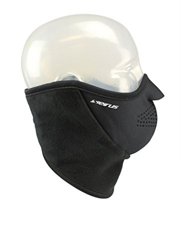
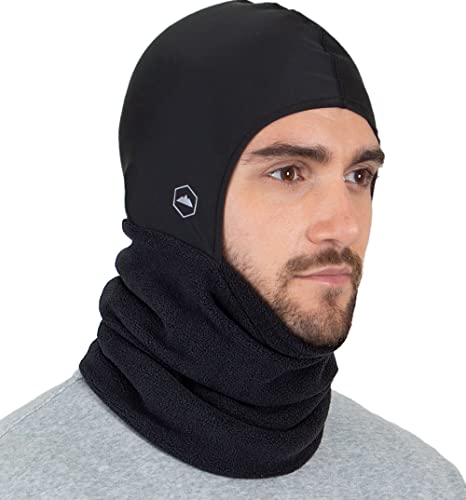
Snow sports helmets are an excellent first resort, and this little feller is perfect. Neck Warmer with Helmet Liner Hood - Balaclava Hoodie Neck Cover. Fleece Winter Ski Mask Snood Headliner. Snow & Motorcycle Neck Gator. Wind & Cold Weather Neck Protector for Men & Women https://www.amazon.com/dp/B07F27ZYZG/ref=cm_sw_r_cp_api_glt_fabc_VMM27SSBTQ06K0BBEPT1?_encoding=UTF8&psc=1
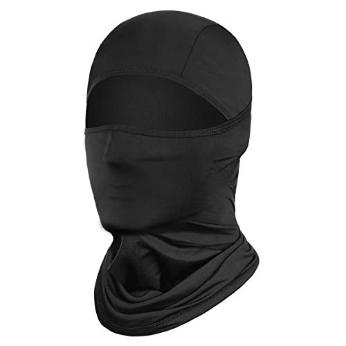
I use a thin balaclava like this one:
https://www.amazon.com/dp/B08591Z9TD/ref=cm_sw_r_cp_api_glt_fabc_BV9J82VV8ENEYJDA83C9
I usually pull the nose down so that my nose is exposed and the balaclava covers my mouth. This keeps the fog away from my glasses, and my breath keeps my face warm. I think anything thick would be way too hot, even in the coldest weather. Pair it with a thin skull cap and it’s nice and toasty!
Happy riding!
I noticed on the https://ridewithgps.com/routes/34806237 route that it included the old chaska railroad trail that has been closed off since the 2014 mudslides. Has anyone else been using that old trail?
It's been overgrown and blocked off with warning signs, so I thought that part of the route was no longer safe.
If you go to ridewithgps's website you can search routes by zip code.
I added 'gravel' as a keyword in the search and these two look pretty rad. Have fun up there!
I forgot one other tool that I bring on my MTB rides:
It took me just one time of breaking my chain in the middle of Lebanon Hills and having to ride my bike home like a scooter to throw this bad boy in the seat bag on my MTB and longer rides now.
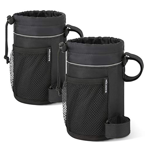
If it is not an aesthetic thing, these are a decent option and you can store all kinds of stuff in them. Also super easy to access your bottle.
So the shutdown has forced us to go to Race Course Plan B. For those interested, here is what the course now looks like.
The Start/Finish is the green marker. Riders than head west on MLK and turn left down to the hairpin corner then back around and into a .3 mile hill climb to the finish. The hill climb is sure to make each race very interesting and blown apart, so there will be racers strung out over the whole course after just a few laps making for a lot to watch.
This change bumps up our number of course marshals to 7 per race, so there's still plenty of opportunity for anyone interested in volunteering.
> Like it felt like I was going downhill but it was actually uphill.
Uhhh, you're thinking of a different section than I am. You'll absolutely notice this climb if you ride it.
If you're talking about that fucking hill then you should totally stop bragging so hard :P
I haven't done this entire route, but have heard good things. It was the century route for the 'Tour de Tonka' a couple weeks ago. A couple roads will be moderately more busy, but I think most have a relatively big shoulder if you're comfortable with country road riding.
> what detour do you currently use to get around this section?
i've been using this. i will try your route this week.
Yes, the section between pine bend to spring lake is being worked on already, i remember hearing something about issues with flint hills on that piece of land, thus the delay.
Lots of people use Ride with GPS to map and save routes (myself included), you can do a fairly robust search that should get you a decent few routes to start with.
You can search Komoot or Ride with GPS for nearby rides.
Gateway Trail, Luce Line, and Mississippi River Greenway (St Paul to Hastings trail) are 3 I normally do.
It'll be up on OpenStreetMaps, and the dozens of apps and maps that use OSM, much quicker than Google. Most of it already is.
OpenStreetMap is a good resource for stuff like this. Referencing that it looks like there a couple ways to get there but as others have said, there isn't a direct trail on the river through the Rosemount section yet.
Unless a shop already has some in-stock or generously wants to overnight some for you, this will be your best option for getting them this week:
I wear Dr. Martens insulated work boots many days ( https://www.amazon.com/gp/product/B001JPXON0/ref=ppx_yo_dt_b_search_asin_title?ie=UTF8&psc=1) , and on sloppy days I wear Columbia waterproof hiking boots.
My hands are more the issue in the cold, as my feet have been fine on a 17 mile roundtrip commute in as cold as -9 degree temps (although that was the coldest I've done, and my toes were chilled).
Keep in mind, too, with this type of gear that wind chill vs. actual temperature actually matters when it comes to things like boots - that's what I learned with my -9 degree ride.
I have bought one of these for each of my bikes. I haven't bought others but I've tried my friends. The metal is worth the weight. They are stable and super functional.
GUB Bicycle & Motorcycle Phone... https://www.amazon.com/dp/B07GKT8FBZ?ref=ppx_pop_mob_ap_share
One of those can things that you inflate with a pump.. then use to burst air in to the tire?
Like this: https://www.amazon.com/Air-Shot-Airshot-Tubeless-Inflator/dp/B01EOLV89C ?
Canned air... interesting. How'd that work? Some sort of adapter to go on the valve stem?
I have this mace from Amazon. I just use some heavy duty double-sided Velcro from any hardware (found mine at the Midway Menards, sure you can get it on Amazon too.)
It's a responsibility, even a little $7 fucker like that. It's not like a gun, but it's the same idea. Practice pulling it out and thinking through situations, you don't want to have no idea what to do when you need it and you don't want to panic and spray some innocent bystander.
The best thing you can do is be aware though. I live in a sketchy area of St. Paul and have never had to actually get involved with anybody, and the few times I felt like it could've gone bad, I probably could have avoided if I were paying attention.
I commute year round, have a CX bike that is used most of the time and a fat bike with 2 wheelsets (2" and 4.6" tires) for when there is snow on the ground. I only have to use the fat tires a couple of times a year, usually the lanes are plowed good enough for the other 2 options. None have studded tires. Full fenders are always a plus in the winter.
Haven't had an issue with locking either bike up while getting groceries.
As far as clothing just have a good pair of boots, dress in layers, and have something that stops the wind and you should be fine. I use lobster gloves instead of bar mitts and have not had a problem. I also just use a thin beanie under my regular helmet and a facemask if cold enough.
Have you seen the Shimano A530 Pedals? They're reversible, with SPD on one side and platform the other.
Have you seen the Shimano A530 Pedals? They're reversible, with SPD on one side and platform the other.
Have you seen the Shimano A530 Pedals? They're reversible, with SPD on one side and platform the other.
There are a few cheaper options than the FlyPedal if you were looking to save a few bucks. https://www.amazon.com/dp/B005FOP7S6/ref=cm_sw_r_cp_dp_T1_6VLDzbV0ZFJPT https://www.amazon.com/dp/B01HP0K8KY/ref=cm_sw_r_cp_dp_T1_sULDzbDRMS4ZZ
I've personally never used them, I ended up getting a set of pedals with a clip side and a flat side.
I bought these at Erik's in St. Paul and I've been very satisfied with them. I think they look a little cooler than the rectangular style but that's just personal preference. Easy to clip into and great for just hopping on and riding over to a friend's house or something.