
What are
/r/EarthPorn's
favorite Products & Services?
From 3.5 billion Reddit comments
The most popular Products mentioned in /r/EarthPorn:


![Silent Cries [Explicit]](https://m.media-amazon.com/images/I/41wdo46uEmL._SL500_.jpg)


The most popular Services mentioned in /r/EarthPorn:
500px
InterfaceLIFT
AllTrails
Flickr
Unsplash
OpenStreetMap
Google Photos
Shutterstock
Google Maps
Vimeo
TripAdvisor
Wikitravel
Forvo
IGTV
The most popular Android Apps mentioned in /r/EarthPorn:

Muzei - Reddit

Muzei Live Wallpaper

Exposure Calculator

PhotoScan by Google Photos

Nova Launcher

IFTTT

3D Auto Parking
Aurora Alert

Bronerville
Phases of the Moon Free

Educationboard Results BD

Photographer's Tools Free

Du Chinese - Mandarin Reading

RL Zooper collection

Walli - HD Wallpapers & Backgrounds
The most popular VPNs mentioned in /r/EarthPorn:
The most popular reviews in /r/EarthPorn:
muzei app with the reddit extension
/u/jeffry2dn , /u/Shipguy123098
Serious question? If so, here is a serious answer for you...
People make pop culture references because those references let them connect to people with shared experiences in a way they find fun and positive. They create a feeling of belonging to a community.
No, no one is going to be a part of -- or even familiar with -- some references that mean a great deal in the lives of other people. Still, the sharing of references brings happiness to people that do appreciate them.
If these comments are bothering you, you can add the Reddit Enhancement Suite to your browser. It gives you an option to "hide child comments" so that you can easily ignore a cascade of comments that don't appeal to you or distract from the comments you wish to read.
Apparently they do at 19 Nathaniel Maxilluli Street, Swakopmund, Namibia.
The first review: "One of our fav's - staff are friendly. Good atmosphere when busy but if a quieter night - food is still yummy so worth it. Love the Nam twist on Mexican - its not for the purists but you're not in Mexico. Will keep going back - even with the new menu that took my fav filling away."
Wow. Tacos errywhere.
OP is referencing the 1974 James Bond movie The Man with the Golden Gun where these islands were used as the remote base for the bad guy called Francisco Scaramanga, who is played by a younger Christopher Lee. Who most people know him as the actor that played Saruman in the "Lord of the Rings" trilogy of movies.
I'm the photographer (colindub) of this picture ("Antelope Rose") and was happy to see it got some love on EarthPorn!
FYI: There is a bigger version on interfacelift
Photo Details: Looking up and out while inside the Pure Imagination cave on the Sandy glacier. During the summer the water flow from the glacier works its way down and eventually will form a small waterfall. When the temperatures start to drop this will eventually freeze to what you see now.
Lots more on my Instagram
Prints for sale: prints.dontfix.us
Nikon d610 – ISO 400 – 20mm – f/8
Edit** /u/DaHitcha told me to remove bitcoin tip address
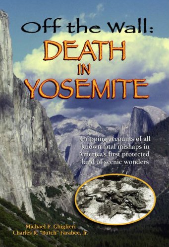
After car accidents, waterfalls / drownings is the leading cause of death in Yosemite. I recommend Off the Wall: Death in Yosemite if you’re planning on spending much time there.
here is audio
and a more in-depth guide: http://www.travlang.com/languages/icelandic/Icelandic.pronounce.html
the d looking character makes a th sound, like in "the" i believe.
8 mile hike, 4 miles there, 4 miles back. At the 2 mile mark, there's a really cool beach, though its deadly dangerous so you cant swim there. I think it took us about 6 hours just hiking alone, though the trails were super muddy for a good 3 miles, so could be shorter in drier conditions.
Swimming in the pool and under the waterfall was amazing though.
Edit: I should clarify, 3 miles of muddy = 1.5 muddy miles, doing it twice
Double edit: Here's where we went
Letchworth is beautiful and huge. This photo shows the Upper Falls at the southern end (Openstreetmap link).
There are tons of hiking trails all along the length of the park, up and down the gorge. The eastern side is less developed and quieter. The western side has roads with scenic views, picnic and RV areas, Mt Morris Dam, the works. A lot of it was built up in the 30s as WPA projects.
There's a great IFTTT recipe that does this anytime there a new top post in this sub. I have been using it for sometime and it is pretty cool to have some new, random, beautiful place show up every couple of hours
Edit: clarifying that this is for Android. Not sure if there's one for iPhone.
If you really want to learn chinese use du chinese it is great for learn how to read a recognize characters. It actually has the hsk levels (which is how china grades the difficulty if certain characters), flashcards, audio of how to say the word, and a variety of lessons. Its very useful and its easy itll give you notifactions every day at the same time for one lesson for you to take. It your interested: https://play.google.com/store/apps/details?id=org.sinamon.duchinese
Not OP but it could be Blanca Lake -- actually -- Blanca Lake is even prettier than this so maybe not.
And no I'm not letting out any deeply held secret -- Blanca is a major hike in the hiking books around Seattle -- but is a less crowded hike because it is fairly long and further away from the city than many closer in hikes.
But if you like this shot, Blanca will do you well. Blanca also has a glacier (the Columbia Glacier) that sits next to it.
Here is a hiking site with some amazing photos of Blanca
https://www.alltrails.com/trail/us/washington/blanca-lake-trail/photos
Shot a timelapse of it recently for a larger project, this might give you a better idea of why it got its nickname: https://vimeo.com/87526301 Sorry it's not more cleaned up, it was a private draft till I saw this post. You can see a close-up photo here: http://helioblog.tumblr.com/image/76355606250
Reminds of this news story: https://www.nytimes.com/2015/09/19/world/americas/tourists-thwart-turtles-from-nesting-in-costa-rica.html?_r=0
People are the worst especially as a group. Monkey see, Monkey do.
All Photos on Pixabay are available in the public domain. Please check out the other photos of the OC or leave him/her a nice comment. https://pixabay.com/de/schweiz-see-natur-alpen-schweizer-2710827/
This seems to be based off the following Shutterstock picture: https://www.shutterstock.com/image-illustration/highly-detailed-fragments-planet-earth-exaggerated-183862550
It is done by an artist, it's not a picture from the International Space Station.
Actually it's a song about folklore. Source
> In a 1995 interview with RIP magazine, Toadies lead singer Todd Lewis, who wrote the song, said: "It's just a story I heard long ago; it's just a really cool, eerie lake, and some stuff I heard and some stuff I just make up. I tend to do that. They dammed up this big river up there, and it's got all these spooky names like Hell's Gate. It's really cool."
The whole lake has some pretty creepy stories that revolve around it. I used to camp at a Boy Scout camp that is on that lake and I've heard plenty of those stories. Ghosts, murders, and unexplained drownings are some of the most common of the stories.
I used an app call Aurora Alert, which supposedly checks your location's aurora activity and cloud cover and alerts you when the potential is high. It worked fairly well, but, of course, I do my own weather and aurora activity checking too. If all else fails, stick your head out the window and see, lol.
Okay, so I'm a phoneticist who specializes in insular Scandinaian languages (specifically Faroese). The consonants and more importantly the vowels don't match up very well. In "vocal" you have /əl/ (dark l in my dialect), in "kull" you have [ʏtl̥] for the "ull" cluster (I've heard many speakers clip out the vowel at a talking pace), which has one vowel that doesn't exist in English and a consonant cluster featuring a consonant that doesn't exist in English, which is going to make it really hard to rhyme with something.
But don't just take my phonetics goobledygood for it, here's both side by side: https://clyp.it/veh2ohda
Were you on vacation? Anybody here from Nyköping? My great-great-grandfather was born there in 1844. His son, my great-grandfather, immigrated to the US in 1913.
Death in Yellowstone has a few pretty gruesome accounts of that happening, including one where a man jumped in to rescue his dog. The water is just under boiling in most of these springs (especially if they're clear blue without bacteria). When the man got out, his eyes where cooked solid white, and skin rolled off with his sock. I think the last thing he said before he died shortly after was "That was a stupid thing I did"
Edit: here's a version of the story from snopes: http://www.snopes.com/horrors/freakish/hotspring.asp
My bad, I believe it's actually called the Olomana Trail and it's on Oahu. Did this hike 3 years ago and just as we reached the first summit on the trail the rain started falling. On the advice of a marine who was returning from further up the trail we decided to abandon mission and return but not before I snapped a pic of the incoming storm.
If you can, find a book on the geology of the Canyon (like this one: https://www.amazon.com/Kauais-Geologic-History-Blay/dp/0974472301/ref=sr_1_1?ie=UTF8&qid=1520570523&sr=8-1&keywords=geology+of+Kauai) before you go. You'll really get a deeper appreciation of what you're seeing.
That is great, you'll love the country! The closest city you can fly to is Surabaya, from there you can catch a train to Probolinggo (only a couple of hours) and from there you can get on a (mini) bus towards a little town near Gunung Bromo to stay the night and get up very early for sunrise. Check out wikitravel and have fun!
Also, I played with this drone for a while before getting a DJI
This also just hovers in the air when you don't control it, and you can get it for 30 bucks easily as a refurb. Its a ton of fun too; it has built in tricks you can perform from the app by simply pressing a button. If you have kids its definetly worth it as you can code the drone also.
Easily the best 30 buck purchase I have made. (Note the link I gave is for a new one, so you will have to shop around if you want a refurb. Amazon seems to no longer carry the refurbs.)
Parrot drones are the best for the sub-100 price point. DJI drones are the best for 400+ price point. DIY racing drones are the best for the in-between.
Yikes! This is fast moving whitewater on slippery granite only meters from a half mile tall waterfall. It most certainly is NOT safe here. Maybe waaay upstream. OP is on the bridge, thankfully. Read Off the Wall: Death in Yosemite . Water kills in Yose.
> http://interfacelift.com/wallpaper/details/2887/while_waiting_for_milky_way_.html
It is a composite. Read the info at the link. Fun photos to do, but they sure don't represent reality. I spent many nights high above Berchtesgaden staying in a lodge up near the Jenner mid station. The stars were gorgeous up there, but only if you looked directly overhead. Europe has soooooo much light pollution. You'd definitely need a long(er) exposure to pull all those stars out for this picture
It's in Banderas Bay, only takes maybe 15-29 minutes from the marina in Puerto Vallarta. You can see the two islands from the shore, so you just drive out there. They are small islands, you'll see the entrance when you approach.
Here is google maps link: https://maps.google.com/maps?hl=en&ll=20.699119,-105.573463&spn=0.026737,0.041714&t=h&z=15
Thank you! I actually went higher than the Big Beehive, which you can actually see in the photo below. I climbed up another 600ft in elevation to Devil's Thumb.
Yeah, the Michigan version looks like the photo at this site. I back searched the OP's photo and found this, which says it's apparently Fairplay, Colorado.
Either way, it's pretty!
Yep, Monument Valley really is absolutely massive. I shot a few massive panoramas myself there to try and capture the grand scale of things, and they definitely don't do the place justice.
Going to Alaska was the best trip of my life. Cruising down Tracy arm and Glacier Bay National Park were the two wildest experiences.
If you're interested here were some of. My fav photos https://photos.google.com/share/AF1QipPkxQ0bbA0uINdcpIXFHSNE22CI11rB_qlkNOjdIDMbfdpPWek8TKJ5X4XgHqHlRw?key=WGhHcFp4ZDlVTHh5NE90VGkxSV9YWmdpUm1RYlhB
Ha, last year I started complaining about the heat. But then again, 25C in the beginning of May was quite unprecedented for Skye.
I actually hiked it round trip in about 5 hrs. Takes a bit of climbing but nothing technical. West Glacier Trail Trail
It was sad to see how fast all of it was melting.
If you don't have geotags on your pics or it's from a random source, you can always add location data with software. One valid cross platform, open source, way to do this is
http://geotag.sourceforge.net/
once you load it up you select the images you want to geotag and you can either use google earth (most convenient) or you can drag a marker in a built in google maps interface and the picture tag is upated as you move around.
In short, it's easy and awesome. it'd be even more awesome if you would create a layer in google earth (a kmz file) with links to flickr or picasa pictures with all the pictures referenced here.
I also suggest checking out panoramio or wikimapia as they're probably something you'd be interested in.
Photographer credits, source, and more resolutions: InterfaceLIFT.com
Camera/exposure details: >Nikon D300, Nikon AF-S DX Zoom-NIKKOR 12-24mm f/4G IF-ED, Adobe Lightroom 2, Adobe Photoshop CS4
Found the original :p http://www.fotocommunity.de/pc/pc/channel/2/extra/new/display/10159870
This means you pay for my flight to the lake right? lol
I'd recommend searching trip advisor first. But a great trip to take all year round is to Landmannalaugar, an outdoor natural hot spring surrounded with beautiful scenery, my family goes there every year between Christmas and new years.
Also I'd recommend a pubcrawl , I think its the only one in iceland but heard good things and the night life is something worth checking out plus a lot of local breweries witch are surprisingly tasty. And thirdly to sell out a little bit, if you want to commemorate your trip with a tattoo I am a up and coming tattoo artist and would love to seal your trip by stabbing you a million times..
Here's a pic I took this past summer just before climbing that path to the right. One of the most amazing places I've ever been in my life.
>Focal length: 62mm
Holy hell. Looks like a way wider angle than that.
EDIT: This dude's photos give me erections. And I love that he leaves his EXIF up. https://500px.com/photo/85017125/hammarskaftet-by-swen-stroop
The stars really are incredible, there! I took this stitched panorama the same morning: https://www.flickr.com/photos/jeffmoreau/9368937469/ I yearn to go back and explore more of Death Valley, myself!
>The Chocolate Hills are a geological formation in Bohol Province, Philippines.[1] There are at least 1,260 hills but there may be as many as 1,776 hills spread over an area of more than 50 square kilometres (20 sq mi).[2] They are covered in green grass that turns brown (like chocolate) during the dry season, hence the name.
From the wikipedia page
Actually, that is Poll Islet. The OP's image is not Poll Islet. No idea what it is. Looks like maybe a Photoshop or golf or something.
I love this image. It makes me feel like I'm alone on a chilly morning, maybe taking a walk enjoying some time to myself. The mist on the water seems so fluid and the colors in the sky are amazing.
The original is here and there are many more sizes for download. Enjoy!
> Fjaðrárgljúfur
Try Forvo.com
[The pronunciation from a native (click the blue play button for audio)]
To a layman like me, it sounds like: "Fh-yahr-reh-harg-luh-goorrrrrrrrrrr"
Nope, you're wrong. Less than 50% of Reddit's traffic is from the USA.
Seeing as I've got some incompetent fools claiming I'm wrong, here's the first link from google: https://www.similarweb.com/website/reddit.com#overview
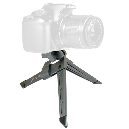
Haha, the tripod I have isn't light either... here's the Amazon link! F&V HDV-Z96 II Z-flash LED DSLR Photo Video Camera Dimmable Light https://www.amazon.com/dp/B011HTRFDW/ref=cm_sw_r_cp_apap_8OSSr5KXWMQS6
Not the same views, but I was on top of Chimney Tops last weekend, and I upload everything in full res for people to take/use/whatever.
I just moved down here, but I've been going every weekend. I might do Clingman's Dome this weekend, I can keep you in the loop if you want.
It was one of many shots taken during a storm a couple of months ago, the other one he's referring to was posted here as well. Really astounding.
https://500px.com/photo/89247531/light-show-by-mark-metternich
This is amazing! Do you have a license on this? Preferably Creative Commons: https://creativecommons.org/licenses/
I could see it getting included in some GNU/Linux distro wallpaper collections if so.
Source, more resolutions, and photographer credits at InterfaceLIFT.
Gear used: >Nikon D300s, Tokina AT-X 116 PRO DX AF 11-16mm f/2.8, Adobe Photoshop CS5.
Location: >Mesquite Dunes in Death Valley National Park.
I haven't used it myself, but I've heard good things about GIMP - and it's completely free.
Alternatively you could consider the photography subscription with Adobe - you get Lightroom and Photoshop for $9.99 per month.
It's a different picture from a different vantage point. Clouds are different, shadows are different, snow is different.
Compare: this pic vs OSX Sierra Background.
Same. If anyone else wants to set it up on Android you can download IFTTT and "add a recipe" where the trigger is a new hot post in /r/earthporn on your reddit app (if your reddit app doesn't work then you can download Now for Reddit which is what I have and I know it works) and the action is set new wallpaper.
Looks like the photo was taken approximately here. Spin the Street View for context. Beautiful place, southern Utah. Here is one version of how the sandstone monument got the name [Church Rock](http://www.wikiwand.com/en/Church_Rock_(Utah)
In my extremely biased opinion Marc Adamus is the best landscape photographer out there right now. If you're into this style you should check out his other work, it's just incredible: https://500px.com/MAPhoto
Sure! I only have Shutterstock and I don't have many good pics up there, nowadays I barely find the time to keyword them properly etc. :/
No, they can't. That's way overestimated. The snowest cities in the country (in terms of average snowfall) only fall around 100 inches yearly.
Even the TOP of Mt Washington only gets 280 inches early.
North Michigan just barely scratches over 200 inches.
https://weather.com/safety/winter/news/snowiest-places-most-snow
I'd have to agree with you there based on my limited personal experience (literally one time).
I was at Yellowstone for Father's Day Weekend (June 16/17 2018), and while it felt crowded, when we hiked Bunsen Peak, we only saw 3 other groups in our 4 hours on the trail. We only shared the peak with a very friendly couple. Like OP said, like minded people.
I believe these are the directions I used to get there the first time.
The trailhead isn’t marked well. I put Nick’s restaurant and pub on Tynecastle hwy in my phone. If you’re on route 105 and pass the restaurant on your left, maybe 1/4-1/2 mile further on 105 there’s a turn off to the right. You park there and fill out a permit. It didn’t cost anything any time I’ve been there.
The site I linked takes you to Calloway peak. But instead of turning left to Calloway, go right, which takes you to the spot in the OP etc. Or go to Calloway and backtrack, as Calloway isn’t too far off the trail.
If you have any questions let me know.
We might be talking about different hikes. This is the falls we went to. I don't think there would've been a different way to get there:
http://www.everytrail.com/guide/hanakapi-ai-falls-na-pali-coast-kauai
Here it is! I started editing the itinerary comments down because I rewrote them post trip to remember but there's some useful stuff in there!
The Nik Collection used to cost around $150 a month ago. But it's now free and includes seven tools/plugins(I use them together with Lightroom and Photoshop). The Nik Collection. A few of the plugins are great for color editing. Don't know about any other programs though.
I was actually just in Oregon's Umpqua National Forest (road trip). I was going to edit these (as for most my pictures I took along the trip), but I decided to throw these specific ones up for this thread (unedited). https://www.flickr.com/photos/comzee/sets/72157643240425504/ Do take note, I am only an amateur photographer.
I recommend using the program Stellarium (there's an Android and Iphone app as well, although it costs a bit) to plan your stargazing. You can get an accurate map of the night sky for wherever you are at any time.
>I thought NP stood for a state abbreviation. Thinking I'd lost my mind, I scoured a map of the US, only to realize that NP stood for National Park. The doctor was right. I can't make it on my own outside of the institute.
I'm halfway through Zen and the Art of Motorcycle Maintenance. This sounds like something he would say about Phaedrus.
You can go the back way from here. It's around 7 miles roundtrip and cuts out all of the elevation gain of starting from the bottom of the canyon. There will be a gravel road that gets you about 3/4 of a mile away from the trailhead, so add that if you don't have a high clearance vehicle to do the rough part of the drive just before the trailhead.
Yep, I shoot in RAW so everything needs to be color corrected to get back to the actual colors. This image is slightly enhanced but pretty close to what it looks like in real life—more images from the same place here: https://www.instagram.com/explore/tags/marblecathedral/
There's a hike to a Hot River Hveragerði
It would be an easy drive from you, the hike is fucking gorgeous, and the pay off dropping your pack and jumping into a geothermal river that's quite warm, is awesome.
Yes, completely agreed. I love passing by Sedona whenever I get a chance to, and it's fantastic for photography there. Wonder what it'd be like to live there.
Crossposted from /r/NorwayPics, Norway's photography subreddit: http://www.reddit.com/r/NorwayPics/comments/2hfjv0/amazing_sunset_view_from_the_top_of_reinebringen/
Sweet! You should definitely try to check out the Gentry Creek Falls if you get a chance. They're absolutely beautiful. I've been to them several times, the parking area is only 5 minutes from my home.
I would recommend reading this: http://www.everytrail.com/best/hiking-oregon
There are tons of hikes, some of my favorites are: Multnomah Falls (super crowded), Saddle Mountain (easy terrain, the view is incredible), Dog Mountain (springtime yellow wild flowers are amazing). Those are 3 I would recommend, but there are hundreds more
Alternatively you can check https://en.mapy.cz/, there is also an Android app available with offline maps.
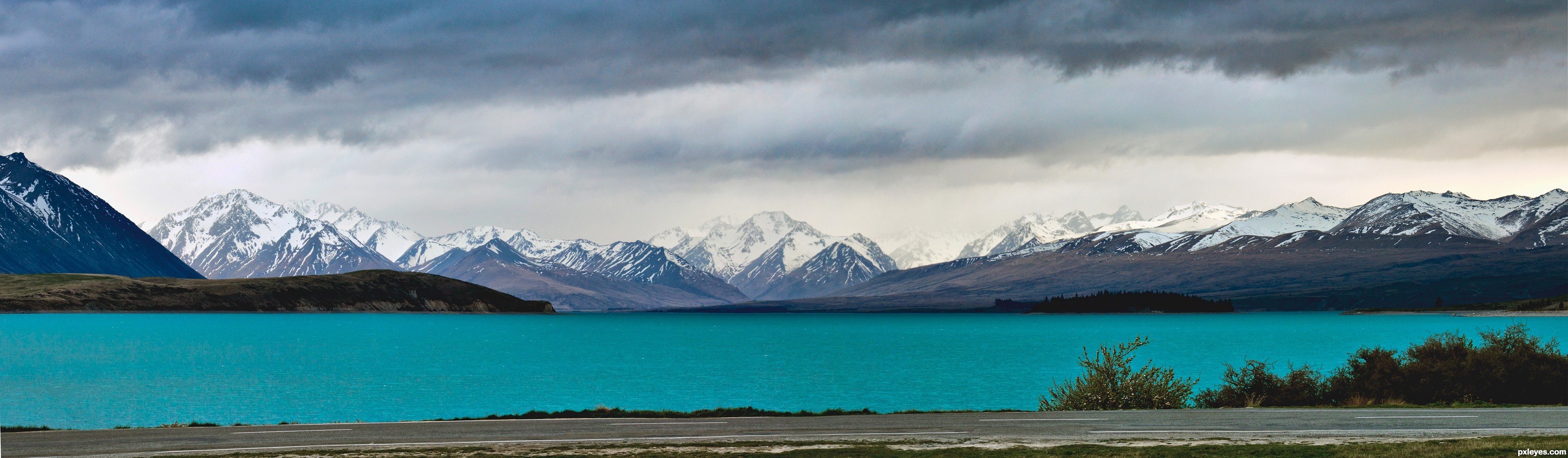
Looks like Lake Tekapo to me.
Fun fact: the water in Lake Tekapo is green due to glacial flour. It really is an amazing sight.
Here's an example link
A beautiful image of an iconic location. I especially love the rays of sunlight streaming through the clouds.
More sizes can be found here.
Mixed Yes and No.
The person ( u/Birdie725 ) asking to paint their work was right to ask. Using aspects of photo a painting is not copyright infringement, however reproducing a photograph, especially one that OP has posted presently and in the past, has an established style of photography. If a user on Instagram took that same resolution photo and posted it as their own it would violate copyright law.
So.
Although they may be new to painting, it was wise to ask permission, especially if they post that finished piece into say r/BobRoss, or r/Art. They also save themselves a world of trouble later on from people that might frown upon it's use without Photographer approval or consent.
https://thelawtog.com/someone-makes-illustration-painting-based-photograph/
That being said there are resources out there that u/Birdie725 can use FO FREE, due to people placing them in that web domain. Below is such a site.
I was on vacation last week in Montana and spent a day hiking in West Glacier National Park. Lucky for me, a storm passed by and I was able to get some video. This image is a screenshot of my favorite time lapse. Hope you guys like it!
EDIT: If ya want to see the video and more shots from that day, I posted the video on vimeo.
I have been this year on Skye Isle too, and managed to make a little free app for Android (iOS is on this way too) for visiting the full isle, hope that helps ( https://play.google.com/store/apps/details?id=boostcode.travelguide.skye&hl=it )
I get a bit amazed every time I see shots of the Milky Way. Reminds of this amazing video I just saw the other day.
Question though: how does one know where to shoot to capture these kind of images?
It's a beach in Marsa Matrouh and my favorite on the north coast. My favorite beach in all of Egypt however is Ras Shitan.
Goddamn Californian's! Look at this shit: https://maps.google.com/maps?hl=en&q=san+luis+obispo&ie=UTF-8&hq=&hnear=0x80ece6be7b6cc227:0xbc0290c2ceef0f46,San+Luis+Obispo,+CA&gl=us&ei=xN52UM6FAtHxqQGvloDABA&sqi=2&ved=0CLQBELYD
I'm so jelly I can barley stand.
You can tell that this is the American falls since you can see the Bridal Veil Falls (divided from the American Falls by Luna Island) next to it. The only way to get a good shot of the American Falls from that viewpoint is from the Canadian side of the river. This picture was taken above the Maid of the Mist docks, which you can see at the bottom between the trees.
One of the reasons why the city of Niagara Falls, New York has trouble with tourism is because you get a better view of the falls from the city of Niagara Falls, Ontario.
Sorry for your bad experience with Bucharest. I moved in Bucharest 8 years ago and I fell in love with it. Next time you'll be here, you need to contact Bucharest Greeters, some awesome people who are willing to show you what to visit, where to eat/drink, talk about a bit of history and have a great time with you.
Mamaia is to be avoided because is very very crowded. We have other great beaches you could visit (Sf Gheorghe, in Danube's Delta; Corbu Beach, Gura Portiei are only a few examples).
Edit: here are a few photos from tourists and not only of Bucharest. http://www.tripadvisor.com/LocationPhotos-g294458-w1-Bucharest.html
Surprisingly it looks a lot like Hartman Rocks in gunnison, CO. I don't think it is, but it is very similar!
Tell that to Maroon Bells.
Yep. The owners were pretty cool. Let us watch her work and she answered a whole bunch of questions from my wife. It was AirBnB .
Location is Reflection Lakes.
I took the picture on Labor Day weekend.
The golden tree
In September 1990, a fire devastated a part of the forest of Brocéliande in the surrounding of Tréhorenteuc and the "Val sans retour" (= Valley of No Return). After the fire, a reforestation of the site policy has been set in place. In memory of this event, an artist made the Golden tree. If we look a bit closer, this tree looks like the woods of a reindeer. Actually, it is a tree covered with gold leaves. The tree is surrounded by five other trees but which are charred. The burnt trees represent the fire and the Golden tree the rebirth of the forest after the bleak.
Must Purchase:
*Park entrance fee (RM15)
*Climbing permit (RM200)
*Climbing insurance (RM7)
*Mountain guide (RM150)
*Dorm bed on summit (RM70)
It's Kolufossar, one of the smaller ofshoots and not the main one.https://www.shutterstock.com/image-photo/waterfall-kolufossar-iceland-1079721854
I found the image on this site
This isn't a Pride of Madeira (Echium candicans https://www.ecosia.org/images?q=pride%20of%20madeira#id=B2A46ED0D11C9EC260007C76FDD68D4C24ECC303), this is a Puya berteroniana http://www.strangewonderfulthings.com/150.htm Which is even cooler.
They sometimes get planted near each other, so it easily could have been mislabeled.
It's more of a scramble than a trail. It is next to the Whiting Woods Motorway Trail
https://www.alltrails.com/trail/us/california/whiting-woods-motorway-trail
Great place for winter hiking
You will not be able to find it because it is not on the internet! I just made this hike a trail on AllTrails yesterday. Here is the link , should tell you how to get there. https://www.alltrails.com/trail/us/new-mexico/jemez-east-river-slot-canyon
This is where I ate. http://www.tripadvisor.com/LocationPhotoDirectLink-g189967-i40601859-Isafjordur_Westfjords_Region.html I don't think there was a menu per-se. I basically ate what they gave me...seafood and potatoes...but it was honestly the most delicious thing ever
Thanks for the detailed response! I wanted to see how big 1,500 sq km was and it turns out it's HUGE. Check out this comparison of DV vs. Lencois using Google Maps:
No comparison even! Lencois is ENORMOUS compared to DV!!!
Those wooded areas sound insane. I wonder if you'd be able to get a permit to backpack through that area. It would be awesome to travel along it's edge, taking day hikes out into the dunes, but being able to avoid direct sun and kind of just enjoying the scenery.
Queimada dos Britos sounds spectacular, hahaha! I can't believe people are still living there - the UNESCO world heritage sites I've visited has all been more like ghost towns or museums (couple spots in China), but that is great that this one is still a thriving community.
I cannot see the settlement in that pic at all, but mother of God, I know where I'm heading if mean aliens ever show up. What a spot!!! Restaurant looks spectacular, like something out of Africa!!!
I think as long as you took a compass and worked out a way to keep shaded (maybe a big canopy umbrella over you or something? Or maybe something like the bedoins wear? I think it could be done with some testing...
Man, this place sounds awesome. Santo Amaro is definitely being added to my bucket list!!! Thanks for all the information, and when I get around to planning the trip, I will definitely look you up. Good stuff!
This picture is from my visit on Dec. 18th. If you want to see a few more pics from that day. I have a few panoramas there as well :) Cheers!