
What are
/r/Tennessee's
favorite Products & Services?
From 3.5 billion Reddit comments
The most popular Products mentioned in /r/Tennessee:


The most popular Services mentioned in /r/Tennessee:
AllTrails
Lifehacker
Meetup
The Weather Channel
Weather Underground
Encyclopedia of Earth
Ancestry
Monosnap
Gmail
TripAdvisor
Geocaching
Wikitravel
EveryTrail
Scribd
Outline
The most popular Android Apps mentioned in /r/Tennessee:

Legal Heat

Memphis 311

DMV Genie Permit Practice Test
The most popular reviews in /r/Tennessee:
Food for thought, but if you go the southern route (through New Orleans, Birmingham, and Chattanooga) you'll run right along the Appalachians to Gatlinburg. Much more scenic drive than from Memphis. Chattanooga's also got tons of what you mentioned in your post. Sunrise at Snooper's Rock is cool
Foster Falls is a little out of the way (1 hour?), but I'm more familiar with that area than Chattanooga. Great waterfalls, a natural pool you can swim in, and right next to the Fiery Gizzard Trail. :)
Enjoy!
EDIT: Adding for easy hiking references https://www.alltrails.com/us/tennessee?ref=header
Slavery continued well after the war. This Pulitzer-Prize winning book is a must read: Slavery By Another Name by Douglas Blackmon
here's an Android app that organizes the TN . Gov website for your mobile. As far as figuring out what the politicians actually think I'm not sure. I've visited my Mayor while he was campaigning on the side of the road and asked about the other people. Local news websites tend to have more info on local candidates too, but you can never trust the bias.
It’s part of the new Window Cliffs State Natural Area near Baxter. There’s only one trail — the Window Cliffs Trail — there and it takes you across 9 creek crossings and straight up to the top of the cliffs.
To add to this, if you show up and suddenly find out you're no longer registered; These are the magic words:
"Give Me A Provisional Ballot With A Receipt as required by Law When Requested."
You can go to the election commission within two business days to show your photo ID and sign an affidavit to explain why you needed a provisional ballot and that you are who you say you are.
Confirm your photo ID is accepted: https://sos.tn.gov/products/elections/what-id-required-when-voting
https://lifehacker.com/what-to-do-if-you-get-turned-away-at-the-polls-1829664675
Click bait shit title. AR-15s are NOT "assault rifles". The "AR" stands for ARmalite, the first AR-15 manufacturer.
"Assault Rifle - a military rifle capable of both automatic and semiautomatic fire, utilizing an intermediate-power cartridge." http://www.dictionary.com/browse/assault-rifle
An AR-15 CANNOT fire fully automatic. Thus, it is not an assault rifle.
Here are a few of our local favorites. State parks for hiking: South Cumberland State Park, Big South Fork, Fall Creek Falls. Even closer hiking: Old Stone Fort (Manchester), Barfield Crescent Park (Murfeesboro). WATCH OUT FOR TICKS WHEN HIKING -- SPRAY WITH DEET, CHECK YOURSELF WHEN YOU GET HOME. Kayak: Stones River Kayak Rental (Murfreesboro), Higher Pursuits (Columbia), or just buy a kayak and use any lake access (East Fork, Jefferson Springs, Hamilton Creek Sailboat Marina). Entertainment: The Caverns (Pelham, TN), Bark Springs (M'boro), Mayday Brewery (M'boro).
Groups to go with: on meetup.com, Nashville Hiking Meetup is excellent, Paddle Adventures Unlimited was a solid group years ago, so was Nashville Outdoors Adventures Club...I don't know about now.
Get far away from Rockwood! Honestly. Oak Ridge is really neat for the history. The secret city. Chattanooga is a really pretty place and have a nice aquarium. Of course the Smokey Mountains are always beautiful, just stay away from Gatlinburg or Pigeon Forge if you don't care for crowds.
This is close to Rockwood and really pretty. http://www.tripadvisor.com/Attraction_Review-g54982-d665092-Reviews-Ozone_Falls-Crab_Orchard_Tennessee.html
Not much to do in Oak Ridge other than the museum of science/energy which is mostly for kids. Knoxville has a few more options but not much... this might help: http://wikitravel.org/en/Knoxville
Bourbon should be pretty easy to find. If you are shopping for bottles, try McScrooges. If you are looking just to drink it by the glass it should be pretty easy to find. It's kind of a college sports bar but Half Barrel has all kinds of even rare bourbons like the Van Winkle lineup for reasonable prices.
Last year's information: https://weather.com/forecast/national/news/white-christmas-forecast
In all seriousness, do you actually expect an accurate answer a month in advance? Do you know how weather forecasting works?
Bearwaller Gap is a good scenic but strenuous hike 66 miles outside of Nashville. It’s nearly 11 miles to hike, if you’re interested.
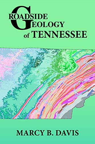
Back in 2014, and again in 2018, I did some photographic work on Roadside Geology of Tennessee and was surprised by how much I enjoyed that part of the state.
There are exceptional fossil sites in that part of the state, including the one where the one dinosaur has been found in Tennessee. There are plenty of beautiful things to see from wildflowers, to birds, to the Mississippi river. Frankly I find the farmland to be impressive as well.
As a Middle Tennessean all of this surprised me. I had for years teased at West Tennessee for it's lack of topography. No more. I love it there and it will forever be tied to some of my favorite road trip memories.
If you want to see the photos I took, they can be found here.
Whoa, calling Sheila Butt racist really leaves out her homophobia and hate. https://www.amazon.com/Does-Love-Michaels-Daddies-Sarah/dp/0932859941/ref=mp_s_a_1_3?crid=263ABLXD06D34&keywords=sheila+butt&qid=1667637155&qu=eyJxc2MiOiIyLjIyIiwicXNhIjoiMi4xMSIsInFzcCI6IjIuMTYifQ%3D%3D&sprefix=sheila+butt%2Caps%2...
Scary part? I already sweat terribly in normal 70-80 degree weather? I'm honestly looking forward to the 4 seasons though get tired of constant sunshine
This might be further west then you're interested in (by 55 miles or so), but Black Mountain Crest Loop is pretty nice. Moderate, 2-mile loop with an overlook and some big, cool rock formations. Not so much of a rigorous hike (if that's what you're looking for), but you can climb around on some of the rocks. There was a guy repelling last time I was there.
I haven't done Clemmer but if you're willing to drive a bit past Ducktown into Turtletown, one of my favorite hikes is Turtletown falls which is about 4 miles round trip, and Google rates it as moderate but it's on a former logging road so it's not too bad at all and has some beautiful falls. We've been there several times and it's one of our favorites.
https://www.alltrails.com/trail/us/tennessee/turtletown-falls-trail
But if I make it to Clemmer I'll let you know!
That Ruby Bridges book is available on Kindle. You can read it for yourself. I've seen cereal boxes with more text on them. https://www.amazon.com/Ruby-Bridges-Goes-School-Scholastic/dp/0545108551/
You'll have to buy a dead tree copy of the MLK book if you want to see it.
I can't answer your question exactly, but since there have been no replies so far, I'll tell you what I know.
The vast majority of the park area is on the south side of the river. That's where the Park HQ, visitor center, all of the camping, and most of the hiking trails are located. There are several hiking options on the south side including the Bluff Trail, Eagle Trail, and Collins River Nature trail. I've done all of those, and they're enjoyable and easy to moderate. On the other hand, the Gorge Trail beside the old mill is short but steep and requires some walking over wet rocks to get down to the river.
Across the river, on the north side of the park, is where you'll find the Downstream trail and view of Twin Falls. You'll have to drive out of the main park area 10-15 minutes to reach the Downstream trail head. From the parking lot and surrounding area you'll be able to see Twin Falls pretty well, so there's not a big incentive to hike the Downstream trail. In my few dozen visits to the park over the years, I've only been to the north side once, and I've never hiked the trail.
I did find a few things online about Downstream Trail. See here and here, where it's referred to as the "Caney Fork Gorge trail". It sounds like you could hike the trail without scrambling over wet rocks, but I can't be certain based on the limited descriptions.
Enjoy your visit!
I do not, though I can see why you would think I was mistaken. The Southeastern USA Plain is a level 2 (l2) ecosystem designation which identifies a specific region in Tennessee and adjacent states. In Tennessee it identifies the area west of the Plateau Escarpment (l4). For more information see: http://www.eoearth.org/view/article/152145/ and http://www.epa.gov/wed/pages/ecoregions/level_iii_iv.htm
I did not make a Parler account.
As someone who has WC software in multiple hospital networks, let me be the first to inform you that they get breached and sweep it under the rug bi weekly. If you have been to a hospital before your SSN and other data is out there.
Preventing bot accounts is extremely hard. You can make bot accounts by simply using 5 minute email apis https://temp-mail.org/en/api/ Selenium for all the form actions and one of the thousands of libraries to defeat recaptcha. https://pypi.org/project/python-anticaptcha/ Please stop talking about things you have no knowledge about.
So now everyone just needs to keep a handheld radio in their car, and then if they get pulled over, they can say "no, officer, I wasn't using my cell phone... I was tuning my radio."
(a)(3) states (in part): "does not include a radio."
So here are a couple FM radios that look like an iPhone. Just plug this bad boy into your aux input and tune to your heart's content! Nevermind that you already have a radio in your head unit ;).