
What are
/r/UAVmapping's
favorite Products & Services?
From 3.5 billion Reddit comments
The most popular Products mentioned in /r/UAVmapping:


The most popular Services mentioned in /r/UAVmapping:
Agisoft Metashape
Geosetter
CNET Download.com
Google Groups
darktable
Mapbox Studio
GeoServer
QGIS
RawTherapee
MeshLab
Blend4Web
The most popular Android Apps mentioned in /r/UAVmapping:

The most popular reviews in /r/UAVmapping:
This guy built one with a Pixhawk and Piksi.
I've been playing with a Navspark NS-RAW set to get an RTK setup going but I'm busy with school and work which leaves little time to build. Frankly, I think RTK is too much for me to implement on my current setup and a post-processed setup is much more likely to happen.
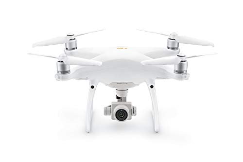
Phantom 4's are starting to get hard to find so snag one if you see the unit itself for less than $1,600. All the accessories and 3 extra batteries should be around $500. Make sure you don't get the "+" model.
You know Pix4D so as far as GCP's we use inexpensive 5 gallon bucket lit with the center painted black. We like orange as there is next to nothing in nature that color so it stands out well in many scenarios. You should be able to find them for around $1.60 each so you can stock up for little cost. They are also inexpensive enough that if it is an ongoing project you can leave them there.
For survey equipment I would recommend the Emlid RS2's. If you have RTK network services then you will only need 1 receiver as a rover. It doesn't look like Ontario has very good coverage except the southern edge. I would contact a nearby Land Surveyor. If you cannot find a service then you will need a 2nd receiver to act as a base station. Receivers are $2,500 each so you can ROI that pretty quickly against renting equipment.
I'd say that would put you around $5k and the re-occurring cost of Pix4D and the network corrections services. The RTK networks are usually between $500-1,500/year.
Can't recommend Phantom 3 Pro or Inspire 1 enough. Travel with them internationally often. They do great 4K/1080P video, are compatible with DroneDeploy Android app, and have ~15 minutes of flight time each.
If you create a free DroneDeploy account they include example data for you to check out and one of the examples (construction) is from Inspire 1. Incredibly good results and 3D models.
I use either Greenshot with a hotkey assigned and manually save the frames or "Free Video to JPG Converter" and save 1 image a second and delete any image which isn't pointing in the area I want to capture - http://download.cnet.com/Free-Video-to-JPG-Converter/3000-2194_4-10764760.html
The best route would be to set the camera trigger with a switch on your transmitter and manually take them, or set it to autotrigger at certain waypoints.
I haven't used Maps Made Easy before. I've tried both Pix4D and Agisoft Photoscan which both work really well and have free trials if you wanted to test them out.
DO_DIGICAM_CONTROL requires a "dummy" waypoint for each photo...
CAM_TRIGG_DIST does not require a waypoint for each photo...
For survey missions the Trigg_Dist is the way to go...
no matter what when you are flying you will never get exactly where you want the photo taken with DIGICAM_CONTROL. With TRIGG_DIST you will get exactly where the photo was taken.
I hope that makes sense.
Reference:
https://groups.google.com/forum/#!topic/drones-discuss/OBReIhed2lg
Try a parabolic antenna. Their cheap and have helped us. 3000ft and no issues. If that doesn't work you have some radio interference going on. Does it do this in rural locations?
This is the one that I got. It's smaller and easy to put up by yourself. Just big enough for this small table.
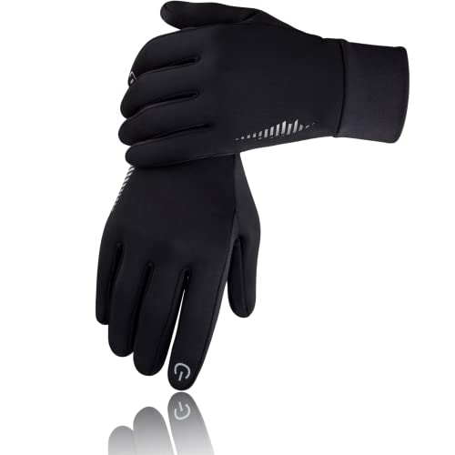
Touch capable running gloves and pocket hand warmers.
Something along these lines. We've found gaming laptops deal with point clouds and meshing very well. I don't know if you care which version of Windows 10 but over this exact model I would look for W10 Pro, 16GB RAM and 1TB storage but you are going to start breaking your budget pretty quick. We are using RTX cards but they are still pricey on laptops.
Do you record a flight log/track with GPS details? A once a second log should be enough for your purposes.
If so, use the flight log geolocation data to Geotag your thermal images using time as the common field, then pass these through ODM.
Geosetter will work to do the Geotagging http://www.geosetter.de/en/
Take a look at GeoSetter, it can display location information from your exif data onto a map. Then you can see what photos are in your area of interest and which ones are outside.
>(industry standard is 30% side and 60% foreward)
Is that the case for forestry mapping? Volumetric Surveying we go way higher than that for side, and higher for front.
AgiSoft suggest 60% side / 80% of forward overlap "at least." (warning PDF) and Pix4d is pretty similar 75% frontal and 60% side overlap bumping that up to "85% frontal and 70% side overlap for forests"
That's the + models and the RTK. The regular V2's are getting hard to find!
Why not on planes? because shipping them is easier and more reliable and they almost always end up at the destination on time in intact. And they take up space.
This may or may not be important to you.
If you check them in as luggage (box), then they are not treated as well.
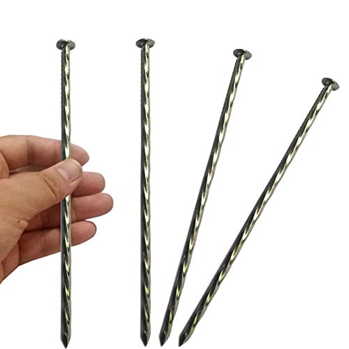
use garden stakes to secure them to the ground. middle and corners. Just punch them through the material, no need for weights. https://www.amazon.com/gp/product/B08GHTVB2D/
Don't travel with them on planes. Ship them to your hotel and back.
[https://www.amazon.com/Control-Targets-Mapping-Surveying-Harlequin/dp/B07RVFHD43/\\](https://www.amazon.com/Control-Targets-Mapping-Surveying-Harlequin/dp/B07RVFHD43/\). Use garden stakes to secure them.
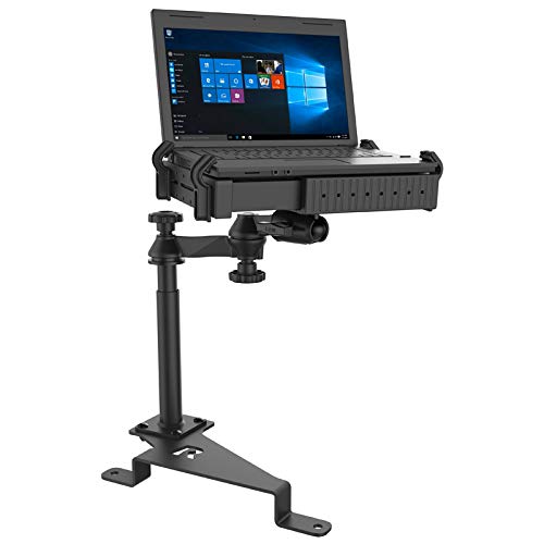
Its an adjustable mount for a laptop. I put a tiny 12v fan up underneath it.
I'm planning on putting a plate on the inside edge of the bed to bolt another to for when I'm flying.
https://www.amazon.com/RAM-No-Drill-Laptop-Mount-F-250-550/dp/B010G60DXG/
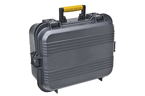
This case. I found about this from the survey equipment rental place we use... best deal in town. I have used it as a floating platform to launch the drone from before.
https://www.amazon.com/gp/product/B0029KDHT0/ref=ppx_yo_dt_b_search_asin_title?ie=UTF8&psc=1
​
The pack is a 10 year old kelty internal frame. It must be a multi day one. i am not sure the specs. The pack is big enough for food, water drone, batts, and a Trimble r10. I carry the tripod.
Maybe you could use the same tape as on skateboards and stairs? It's pretty resistant and can be changed when worn down, it's also rather cheap! Griptape Amazon link