
What are
/r/bikedc's
favorite Products & Services?
From 3.5 billion Reddit comments
The most popular Products mentioned in /r/bikedc:


The most popular Services mentioned in /r/bikedc:
Ride With GPS
OfferUp
Strava
MapMyRIDE
Nextdoor
SurveyMonkey
EveryTrail
Google Groups
Telegram
Notion
Freecycle
The most popular Android Apps mentioned in /r/bikedc:

The most popular reviews in /r/bikedc:
Here you go-- https://ridewithgps.com/routes/36286569
There were probably 200 riders broken into groups of 30 or 40, which made navigating city streets a little easier. Drivers generally give groups more space.
The TransVA (Ride with GPS link) has a decent route between Purcellville and Point of Rocks that is a mix of paved and unpaved surfaces (the original route used White's Ferry, but this is the reroute around that closure).
The next best options that I've tried upstream of Brunswick all add quite a bit of distance and require at least a brief stretch on Highway 7, which has 60+ mph traffic with an inconsistent shoulder.
The OfferUp account Nisa has listed this bicycle and my bicycle (the blue bike) for sale. Since I don't have the serial # on the blue bike I can't do much and it wasn't worth much to begin with.
I'm not sure if thieves continue to use the same account to sell stolen bikes but in case they do, and your bike is stolen in NW DC it might be this person.
The Hills of Anacostia are supposed to be good. WABA does an annual ride "The Hills of Anacostia", it's supposed to be limited to experienced mountain bikers because it's a real tough ride.
https://ridewithgps.com/routes/4266621?lang=en
Bicyclespace also runs it
You could check out the Fairfax Cross County Trail. Mix of paved, stone dust, and natural surface trail.
You can also do the W&OD/White's Ferry/C&O loop.
On the MD side, you can take MacArthur to Falls to Glenn to Travilah (all paved) and catch the C&O back.
If you're up for a challenge, and want to do some real forest road climbs, this is a little farther out, but epic. Begins and ends a Devil's Backbone Brewery in Nelson, VA: https://ridewithgps.com/routes/5638712
DC Bike List compiles group rides every week.
Hains Point is a good option on weekend mornings as it's mostly runners and other cyclists, but I'd avoid it until cherry blossom madness calms down in a week or two.
The Arlington Loop is just about 17 miles, entirely on trails with only a handful of street crossings.
edit: formatting
The "Monument to Monument" route is one way to do it.
https://ridewithgps.com/routes/20661685
Washington City Paper's "Gear Prudence" has posted reports of biking one way and using the train for the other, but I'm not sure which routes he's used.
You might want to also ask this on the Bike Arlington forum.
I saw on #BikeDC Twitter that someone uploaded the route to Ride With GPS. I've had great results loading those routes on my Garmin, so maybe they work in Strava too?
The Sky-Mass loop ride goes through Fort Valley on the return leg. I think it's a fantastic route, really enjoy it every time. There is traffic on 678, so you need to be extremely observant to stay safe.
Sure, here's a RideWithGPS link: https://ridewithgps.com/routes/34970754.
I rode MacArthur Blvd. out of Georgetown to the CCT trail, but you could take the trail all the way there instead if you wanted. I also rode the Sligo Creek Parkway instead of the trail (which as a first-time rider I thought was great BTW).
If you're going used, Facebook Marketplace seems to have a lot of options. So does LetGo. However, you might be better off going to a bike shop like College Park Bicycles, which specializes in having a ton of used bikes that they will set up for you and stand behind if something breaks.
A hybrid or city bike is likely what you need. Though if you're going to do a whole lot of gravel, something more like a gravel bike might be better. Either way, don't end up with really skinny tires!
Washington Area Bicyclist Association might have some classes you could take, and they definitely have a ton of resources to start you off.
Bare minimum gear is going to be a helmet and some lights. Something like this is cheap, easy to keep charged, and good enough to make you visible. But if you end up getting into real night riding, and especially if there aren't a lot of streetlights, get a really good headlight! I have a Magicshine brand light with vertical fade, so I can see far ahead without blinding others. Even with that cheap front light, try to point it down a bit so you don't blind people.
There are a lot of other things you can buy, and some people will even insist you must, but for now, just stay safe and ride your bike.
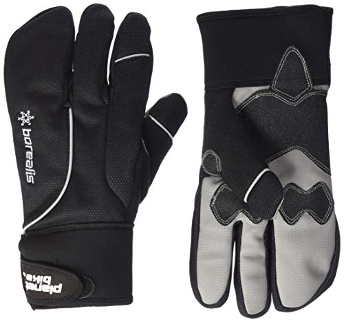
Waterproof, medium-visibility, warm and cheap gloves on Amazon. They're only medium visibility because they aren't reflective, but I've had no issues using my hands to signal when im changing lanes.
Wool socks are also great.
If you use a heart rate monitor and know your zones, keep your pace at zone 1 or 2 for the climbs. If you don’t have the monitor, a way to measure your pace is to see if you can have a normal conversation while climbing. That will help to conserve energy.
I rode skymass with a friend a while back and while climbing to Hogback, we kept it at a conversational pace. By the time we go to Thornton Gap, we were a little tired but not crushed. You could try riding part of skyline or even skymass as preparation.
Are you looking to just tool around the city on a bikeshare and look at trees? Or are you looking for a more serious bike route that also includes some nice blossoms along the way? If the latter, check out this ride: https://ridewithgps.com/routes/2326307
Whenever I want to steal a route from an organized ride, I search for something like, "ridewithgps bike to beach", and there are usually numerous routes that people have logged.
Here's one of the results from that (for OP):
https://ridewithgps.com/routes/30715843
The Bike Rack 40 is a good start. Many group rides start by heading northwest up MacArthur to get out of the city, once you make it to Potomac you can really do whatever. Loop back on Persimmon Tree for something shorter, head west on River to explore further out in Montgomery County, it's up to you.
28s will be enough for the C&O Canal Towpath, but on any reasonably nice weekend there will be tons of people by Great Falls. The trailhead is in Georgetown, just across the river from Rosslyn.
For something close by, you can ride laps around Hains Point until you want to throw yourself in the Potomac from boredom.
Hey GlennGruma, you're in a great spot to commute up to Rockville on a road bike. Beach Drive, which starts at the base of Tilden (www.goo.gl/maps/52tv2) and then runs all the way up to a nice little park near Rockville (www.goo.gl/maps/rxexu).
You'll see lots of bikers on this stretch, and there's almost no cars on the weekend. Actually, it's closed to cars on the first half of the route during the weekend. it's not tricky to get there, just stay on Beach Drive (which changes it's name to Jones Mill Road for a small bit).
Here's a map of the route that leaves from downtown, so you'd want to connect with the route near Tilden: http://www.mapmyride.com/us/washington-d-c-dc/a-ride-mapped-on-03-27-2011-route-30465866
When you get there you have plenty of options for how you get to Rockville, just check out Google Maps.
I might not be any help with the 23rd but I've been toying with the idea of a 70 mi "Tour De NOVA". I plan on doing this some time in mid July with a start time of about 9pm, thus making it a "dusk till (almost) dawn" ride.
Start point is negotiable, but covers Ffx, DC, Arlington, and Alexandria counties. While I can't do the 23rd I'd like to know if this is of interest for a July outing.
RideWithGPS has a function to search other publicly shared rides/routes and to sort them by length. Here is a search you can use to find some routes for yourself.
This is a fun ride with very low traffic and a few climbing hills that are spaced out. You can extend the ride down river road if you want to get a full century in. Its the route of this http://www.potomacpedalers.org/?page=farmtour
If you don't want to drive across the Bay Bridge to ride on the Eastern Shore, you can get somewhat similar rides (not quite as little traffic) on the western shore of the bay.
For example, https://ridewithgps.com/routes/810730 (That ride is longer than you want, but it's basically an out-and-back so you can turn around earlier.)
I know of this route to Solomons (200 km out-and-back, starts outside the Beltway in Crofton MD):
https://rusa.org/cgi-bin/permview_GF.pl?permid=780
https://ridewithgps.com/routes/810730
I haven't done the ride myself, but it's a Crista Borras route, so I'm sure it's fine. (Crista is probably the best bike route designer in the DC area, and probably the best cue sheet author in the world.)
The WABA page links to the DDOT survey you can use to leave feedback on the project. Please do, it would be great to have better bicycle access in the NE.
I actually completely forgot about this until I saw your post, but last summer I used these cooling towels which did wonders. You just keep it moist and hang it around your neck, and it really helped keep me cool. Link
High end ebike rider here.
My advice is don't. Don't leave it anywhere, ebike are high value target to bike thieves. A battery angle grinder can cut any lock in seconds and they will do it in broad daylight.
If you ABSOLUTELY have to try and lock it up within eyesight and keep the time as short as possible. I use this:
Pretty HD chain but with an ebike that doesn't really matter.
Both my partner and I have had bikes stolen and have seen (and stopped) others bikes from being stolen so if you do decide to get your own bike I would highly suggest investing in good locks and chains, I also have an alarm that I set for my bike linked here if you're interested.
Since you are making the jump and selling your car I would totally second starting out with the Capital Bikeshare until you get used to the roads and know more about how you want to use a bike. Also if you do decide to get a bike I would look into Gearin Up Bikes sales - I got a specialized there that was very affordable for my price point and I loved it. Don't feel like you need to rush into getting a bike, find the one that is right for you there is nothing worse than a bike that doesn't fit or do what you need it to imo.
Also def take the time to learn the bike lanes and bike twitter is also helpful just to stay informed also people drive like idiots so be careful!
Best of luck!!
Aw man, I don't actually have it with me today and I can't quite find the one I got on Amazon. Here's a close example except mine was a lot cheaper.
Please edit your comment to include the full link, not the shortened version:
https://www.amazon.com/dp/B01MTGFSIA
(Reddit automatically removes posts and comments that use shorteners, so it's best to avoid them.)
Second the Abus with cable. The standard MO here is a pry bar to pop the u lock or battery powered angle grinders. The abus will hold its own against a pry. https://www.amazon.com/ABUS-Granit-X-Plus-540-160/dp/B00HN47JZU
EFEALL AirTag Bike Mount for Air Tag, Anti-Theft AirTag Bicycle Mounts, Bike AirTag Mount to Hidden Air Tag, Airtag for Bike Holder Fit Headset Tube 31.8mm(Not Included AirTag) https://www.amazon.com/dp/B09QWB7KHC/ref=cm_sw_r_cp_api_i_327R2V3EFK7CRF1Y0JZG?_encoding=UTF8&psc=1
You're talking about the washer, and it's got a linear curve on it to mate with the curve of the seat post? I googled "biycle seat post washer" and there are some maybes -- or may be worth a call or trip to a bike shop, seems like the kind of silly little thing that would get lost, so they may have spares.
Alternately I agree with the other advice, you can just replace the whole clamp. Like say this one comes in various sizes and colors.
My partner and I are going to ride most of the C&O this year. His bike only accommodates 28s so we got him these to be safe: https://www.amazon.com/GravelKing-Knobby-Aramid-Folding-Black/dp/B083VV3S5Z
I have one like this from Amazon if you don't want a dedicated quadlock case.
Works great on streets in the city, works with most cases, and can take it off your bike at a moments notice.
Not perfect but this one has cars and a bike lane, but not able to be quite as interactive as the OG rug https://www.amazon.com/Traffic-Bedroom-Playroom-Nursery-Learning/dp/B09N6NLTVF
Wow, I totally forgot MLK is this weekend. With the cold temps, possible snow, and pandemic situation, I agree it makes sense to be cautious about a trip and route. Definitely wouldn't want to be in a situation to need emergency services right now.
Out-and-back rides on the C&O or W&OD are nice for that since you can turn back any time if conditions deteriorate, and are close enough to the city that friends/family can likely help if necessary. (W&OD also has the metro at Wiehle-Reston for a bailout option.) Keep in mind that if you ride far enough, weather and trail conditions can be significantly different than the city. Last winter I did a loop of the C&O Canal and W&OD where the trails were dry near DC but had quite a bit of snow further out.
If you want to try to loop the C&O and W&OD, that could be a good compromise that keeps you relatively close to the city but is more interesting than an out-and-back. Here's an example route that favors low traffic gravel roads for the connection between C&O and W&OD.
Over the summer I created my own little 90-mile route from downtown DC up to Sugarloaf Mountain and back via the C&O Canal and Poolesville, MD. Takes you all through Poolesville, which should be beautiful and colorful this time of year and has plenty of road-side farms you could stop by. Mostly road but with some gravel, and the climb up the mountain is very fun with a spectacular view at the top.
I don't have a car, so rides like this that I do basically just start from DC and go out wherever I want to go.
Here's a description, the route file, and some pics: https://www.notion.so/ryanthornton/Sugarloaf-Mountain-Climb-f7d65bfb4e364fa4ae97d0e8f72ced86
I haven't had any problems. Use a U-lock like one of the kryptonite ones, make sure it's around your front wheel and frame. This is how I lock it most the time.
If you intend to keep it out in public for more than like an hour, I'd also maybe get a wire + u-lock. Something like this. You lock the front-wheel and frame and then the wire goes to the back wheel.
Also bring the bike into your apartment and don't lock it up outside.
TBH, if I'm gonna be out for a long period of time, I won't use the bike. I use the bike mostly for errands.
Really it's all just a time and numbers thing. If you leave a bike out in some apartment complex garage or on the street....given enough time someone can break into it. Like there have been videos of people with full...mechanical saws breaking locks. Nothing is truly un-breakable.
In this weather, I like the waterproof (i.e. wind proof) version of these:
https://www.amazon.com/dp/B07FSHFNYS/
They’re too heavy for the mid-season but this time of year that’s exactly what I want.
layers, layers, layers!!! I wear a cold weather base layer (great thrift store find), a wool flannel, and a windbreaking jacket ($40 on Amazon), tights, over-the-calf socks, thermal booties, two hats, a gaiter, pogies, and gloves. My commute is closer to 20 min. and I also hate being cold, so fewer layers would work for a shorter commute and more cold-tolerant person.
I highly recommend paying close attention to what it feels to ride in the 20s, 30s, and 40s, and adjust accordingly. Trial and error.
No personal experience, but this route looks very similar to yours and the author probably didn't die, so that's a plus. https://ridewithgps.com/routes/32102558
Basically, I'd recommend looking at routes on ridewithgps to see what others have done, but note that sometimes people post awful routes.
https://ridewithgps.com/trips/65352075 - can easily jump on this from Crescent -- just ignore the section that goes on C&O for your purposes; also take any of those N/S roads off of MacArthur in the Potomac area up toward Oaklyn Drive
in Arlington head up Military and hit the series of roads including Williamsburg, Chesterbrook, Yorktown etc. If you're feeling good head up toward Great Falls on the VA side (Riverbend Park) -- just avoid Georgetown Pike at all costs
Not an awning, but I use this Transition Towel for my bike races. Stays put on your hips and goes on the car seat afterwards if you need to absorb moisture.
I think he's referring to his ongoing gag on the MABRA board about protesting Jared's race results. For example, see the top message: https://groups.google.com/d/topic/mabra-uscf/xooPFhquW4g/discussion
Looks like RideWithGPS has some routes if you enter DC as a starting location and "Airy" as a keyword. Here's one for example: https://ridewithgps.com/routes/19207466
Getting to that start point is easy as it seems like it's on the Rock Creek Park trail.
Spokes has some great routes posted online that I like to use. The 3 Bears route goes through Arlington and McLean and can be easily adjusted for the sort of distance you want to hit. I usually do those on weekdays since they go through residential areas so I'm not worried about traffic.
A bunch of local group rides start in Georgetown, go up MacArthur and then loop through Potomac and back down. This is a good early morning weekend ride.
Bikenetic posted a few routes on Facebook last summer that I'll have to dig up. They start from Falls Church but are solid road routes that I'll do every once in a while.
ETA: found the bikenetic route I was thinking of: https://ridewithgps.com/routes/32367008 just saw it was created by Pete Beers, RIP.
There are crazy hill rides in Arlington with more concentrated hills, but this one hits many of them without having to stare at turn by turn the entire ride. Take Chain Bridge out of DC, for extra...wait for it...HILLS! https://ridewithgps.com/routes/11088862
Bike Washington has some good suggestions:
http://bikewashington.org/routes/index.htm
If you want to try some of skyline drive, Skymass is gorgeous:
You could also easily add miles by starting closer in to the city and riding out to the starting point of those rides -- like this*, which I do when I leave from home rather than drive to the start -- but I tend to find that I enjoy the roads on my first links a lot more.
* Don't do that little detour at miles 28-30... that was private property and I got yelled at.
Frederick Covered Bridges might be a nice ride this time of year. I haven't ridden this one yet, but I saw the Prince William Cycling Club recently did a similar route. https://ridewithgps.com/ambassador_routes/222-frederick-covered-bridges
Might want to check with some of the local bike clubs in the area (Reston Bike Club, Pototmac Pedalers, Prince William Cycling Club,etc...)
Prettyboy Reservoir up in Baltimore County is gorgeous. I'd recommend the That Dam TT route, but park somewhere not close to the start
I haven't done it yet but Michaux State Forest in Pennsylvania (a bit north of Frederick) looks great.
Never been in fall, but I've done some riding out of Capon Bridge, WV, which is about 2 hours from DC. Park in town and ride south on Capon River Rd. Hop on 259 south for a bit, turn onto Capon Springs Rd. and ride out to the Capon Springs resort. There's a nice gravel climb up to the WV/VA state line. Turn around, then pick up Back Creek Road further down the mountain and take that north. You can go all the way up to Gore, ride on 50 for a bit, and take some of the back roads on the north side of 50 back towards Capon Bridge. (You'll still have to get on 50 to get over the hill into town.) Or you can cut off Back Creek early and take back roads into town.
Roads, but very empty scenic farmland roads with minimal car traffic. Here’s a link to the one time I tried and failed to do something similar to your ride. But check out the roads I was on in and around Poolesville. They’re absolutely great for riding.
https://ridewithgps.com/trips/39965328?privacy_code=8rsqRHaLerwqQIu2
It's about 60 to Annapolis taking into account better roads and a detour due to a bridge that's out.
I was going to do this two weeks ago but had some technical difficulties involving an SUVs bike rack that didn't function.
https://ridewithgps.com/routes/26113360
Here's one of my favorite routes in the area and its possibly one of the least traveled too, as all the roadies always work West and ignore the lesser known gems of to the North. Starts in DC and goes to Baltimore via Rock Creek Park to its uppermost boundary, through wonderful country roads leading to Patapsco, and enters Baltimore via their version of Beach Drive - utterly gorgeous and all downhill for the final stretch. Its intentionally hilly but nothing an average rider cant handle and the stops along the way break up the mileage nicely. Once you're in Baltimore you can take a Marc back or the Amtrak, or just ride the way you came.
Baltimore is an awesome destination and you'll feel like you really accomplished something when you park your bike and grab a meal at one of the city's fine eateries.
If you have any questions or doubts, let me know. I've done this route probably a dozen times and it never disappoints. Hope you enjoy!
+1 to taking the longer trek with fewer, more gradual climbs.
If you're up for the hills, getting over the fact that you're going to annoy these drivers might be the most stressful part of the ride. It's a 5–10% grade once you start climbing..
I haven't ridden it during peak traffic times but the stretch that's probably the worst for traffic is the descent down Klingle before it becomes Porter on the other side of the creek. People drive fast down that hill but they're mostly heading onto Beach Drive so you might have a calmer climb.
It is dirt/cinder type surface, so I've heard.
Check this link: http://www.everytrail.com/guide/c-amp-o-canal-towpath-trail-section-1
here's the picture from the page showing someone riding a road bike on it: http://imgur.com/lDi3E
I debated taking my fixed gear bike, but will ride another bike with fenders instead because of the rain we're getting :)
​
Basically look for "Anacostia hills" in any route explorer.
Here's the one time I rode there: https://ridewithgps.com/trips/36030471
Highly recommend using some of the same roads I did between Potomac and Dickerson. You can/should take a more direct route on Mt. Ephraim road rather than that left turn I took (I was looking to add miles because I did not have a round-trip planned -- my kids and wife met me for a father's day lunch and drove me home -- and I landed up on dirt for some portion of that)
Your best bet for a pit stop / refuel is in the town of Poolesville itself. There's a cafe (Cafe 107) that's fairly popular with the biking crowd, but I don't know if they're serving now. If not, there are a couple of convenience stores there too. The rest of the trip (once you get passed Potomac) is mostly farmland and hard to find a bottle of water.
I live in College Park and bike to and from DC all the time, often avoiding Route 1. I mapped two different ways, one starting from the DC REI and the other from Nats Stadium. The route that starts from the stadium is practically car free all the way to UM. Let me know if you have any questions!
There are no mountains in D.C. For a proper climb, Round Hill, VA to the top of Mt Weather is 1500 ft over 13 miles.
This route is full of punchy hills, and some short climbs: https://ridewithgps.com/routes/5320571
Bicycle Space in Adams Morgan (now closed) used to host a weekend ride through Rock Creek that was pretty great. Being closed they obviously don't run it anymore, but I found the route on ridewithgps.com. It's a fun route, a bit hilly though so be ready for that or adapt it as you like. The thing to remember is the main roads in the park are in a canyon, so you can keep riding in and out of it to get some elevation or just ride up and down to keep it relatively flat. Sections of Beach Drive from Broad Branch Road to Military Road and from picnic grove 10 to Wise Road and from West Beach Drive to the DC line are closed on Saturdays, Sundays (7:00 AM Saturday-7:00 PM Sunday), and holidays to cars, so it's a pretty great way to enjoy the park without any cars. The trail that runs parallel to beach drive is decently well maintained and works great for some nice casual cycling, except over the summer the part south of the zoo around the tunnel on beach drive washed out, so it's closed until further notice as well. You can still take the trail, but now you have to go through the tunnel which is a bit narrow and loud, so it's a bit annoying.
Like another poster mentioned a big chunk of beach drive is currently closed for rehabilitation which NPS keeps track of here. They are currently working on the black section of the linked map.
This is the light I use on my back pack or seat post. It was a clip and a mount so I can move it as needed. Super bright, multiple patterns and rechargeable.
Cygolite Hypershot – 350 Lumen Bike Tail Light– 7 Night & Daytime Modes–User Adjustable Flash Speeds- Compact & Durable–IP64 Water Resistant–Secured Hard Mount–USB Rechargeable–Great for Busy Streets https://www.amazon.com/dp/B07W62CCL2/ref=cm_sw_r_apan_glt_fabc_FJTDPR98WNMJNRAXE13X?_encoding=UTF8&psc=1
I run the bontrager flare RT on my helmet. Super bright for how compact it is and rechargeable. Rei or trek bike stores sell them.
Hope that helps.
I used to bike commute in the winter.
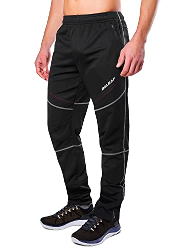
Fleece-lined outer pants were pretty much necessary especially when it was snowing https://www.amazon.com/Tesla-TM-YKB01-BKG_Large-Windproof-Cycling-Thermal/dp/B07F2BFJ65/ref=sr_1_6?dchild=1&keywords=polar+fleece+lined+bike+pants&qid=1606925294&sr=8-6 (or something like it) and then I had long lycra bike pants underneath.
Also a good neck gaiter and a high viz jacket. Mine was too thin and I was pretty cold a lot of the time, so maybe err on the side of bulky and warm.
My commute was like 20 mins at like 530-6am in all weather, and my feet did get cold, there are these little fabric booties you can put on over your shoes that keep the wind off your feet. I was too lazy to put them on every morning but if you're on a longer (2-3hr) ride you might want them.
Obv gloves.
As for traction I never had that much issue slipping and sliding, but that was on salted roads so ymmv.
This light will throw enough light to see on CCT and MVT:
LEZYNE Lite Drive 1000XL Bicycle Headlight, Very Bright 1000 Lumens, 87 Hour Runtime, USB Rechargeable, High Performance LED Headlight for Mountain & Road Bikes https://smile.amazon.com/dp/B07QNLJC5W/ref=cm_sw_r_cp_api_fabc_oXLXFbPBGYQ15
The skill I find most useful but non-intuitive is to be able to turn your head over your left shoulder and assess whether it is safe to merge left, for example to get around an obstacle or to prepare for a left turn. I would practice this a lot.
Many posters here mention taking the lane, and other maneuvers. This is part of a school of thought that is both discredited and very useful known as Vehicular Cycling. The bible of Vehicular Cycling is a book called Effective Cycling by John Forester.
Vehicular cycling more or less holds that since most bicycle crashes happen as a part of crossing or turning at intersections, bike lanes make cycling less safe because they introduce more places of potential conflict between bikes and other vehicles. Thus cycling is safest when bicycles act as any other vehicle, for example taking the lane and riding with other traffic.
It is discredited because we now know that cycling becomes safer the more cyclists there are, so that motorists become used to encountering cyclists. The best way to get more cyclists is to have cycling infrastructure like bike lanes. This outweighs the benefit of reducing the points of conflict. (It's also discredited because vehicular cycling presumes that the principles of traffic engineering are good to begin with, but they're profoundly not.)
But if you talk to most experienced urban cyclists, including those who strongly advocate for bike lanes, you'll find that on a personal level most follow the vehicular cycling model. So it's good to familiarize one's self with it.
I really like these pants https://garneau.com/int_en/stockholm-tights-1060201
And this jacket from Amazon has done a great job keeping me warm ttps://www.amazon.com/dp/B015H1SIMI/ref=cm_sw_r_cp_api_i_3LtdCbTJ9WV6F
All that plus a headband, wool socks and good gloves.
Really depends on the length of your ride too. I go 8mi each way so i tend to overheat towards the end.
I use one of these, usually on medium, which would be about 500 or 600 lumens, and aim it about 15-20ft ahead of the bike. It's got a tight beam pattern, and doesn't blind other riders.
edit: most of what everyone else says is dead on. Please don't be that ass with the flasher (every headlight that I've ever looked at puts out maximum lumens on flashing mode, and will blind other riders.) Point them where you want to see in order to avoid obstacles - not at the sky or straight ahead. I have a long history of doing endurance mountain bike races, so if you ever want to discuss real lights for seeing in the dark (race speeds! AT NIGHT! IN THE WOODS!) Let me know.
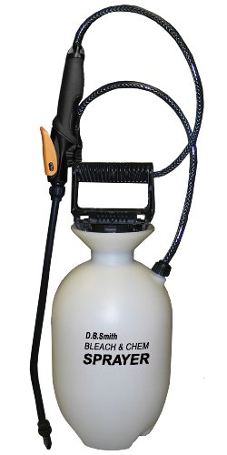
Get an inexpensive runner carpet to park the wet/salty bike on. Use a hand pump garden sprayer out in the alley on the weekend.
Lots of people swear by bar mitts, but that doesn't really help you because they won't let you get into the drops. They make road-bike specific ones, but they keep your hands on the hoods (you can use the brakes, but again, not from the drops). I'll be honest - I have other options and don't need to bike in weather colder than 30F, but I've never had any issues my gore-bike winter gloves and a thin polyproplyene liner glove. I've worn this combo skiing in 10F weather and had no issues. I originally bough the gloves because I fancied myself hardcore and thought I'd bike commute through the shit weather, but with the amount of ice we've had I never really had an opportunity to try them on the bike save for a few times in temps around 30F. Pretty sure mine are the "countdown" model, and I use a liner glove like this http://www.amazon.com/Schampa-Polypropylene-Glove-Liner-Medium/dp/B005345XPU/ref=sr_1_2?s=sporting-goods&ie=UTF8&qid=1424799125&sr=1-2&keywords=polypropylene+glove
I use ones like these, they keep rain & snow out of the eyes.
Also, crisis averted, but if you've never had something like this balaclava, you should check them out.