
What are
/r/geology's
favorite Products & Services?
From 3.5 billion Reddit comments
The most popular Products mentioned in /r/geology:


The most popular Services mentioned in /r/geology:
ScienceDirect
SemanticScholar
ResearchGate
Worldcat
QGIS
Google Scholar
Wikimedia Commons
Google Maps
Geocaching
Indeed
Encyclopædia Britannica
Barnes & Noble
SlideShare
OpenStreetMap
Coursera
The most popular Android Apps mentioned in /r/geology:

BioInteractive EarthViewer

Flyover Country - trip map

FieldMove Clino

Rocklogger

Periodic Table

Geology Quiz

Radioactivity Counter
Eras Geologicas

All-In-One Offline Maps

Advanced Color & Gamma Control
The most popular reviews in /r/geology:
Expanding concrete will crack that no problem. Just need a drill. It's called dexpan, sells for 40 bucks on Amazon.
Dexpan Expansive Demolition Grout 11 Lb. Bucket for Rock Breaking, Concrete Cutting, Excavating. Alternative to Demolition Jack Hammer Breaker, Jackhammer, Concrete Saw, Rock Drill (#1 (77F-104F)) https://www.amazon.com/dp/B00ET9OVW6/ref=cm_sw_r_cp_apa_i_9UKfDbCBGHG5S
The observed waves do not conform to any known seismic activity in that only one (of three) types of waves was observed whereas earthquakes typically produce all three types of waves. Secondly, the tone of the wave was distinctive rather than muddied and random.
The only parallel that comes to mind is: Imagine banging a large cymbal and instead of hearing the distinctive crash sound you heard a single tone, like a flute, come from the cymbal. Or better yet, imagine dropping a large glass platter on the floor and only hearing one of the tones. Can't happen, right? Well something did that and it's a bit difficult to understand what it could be.
From what I understand Earthquakes typically go off with a bit of a sudden bang (reflecting a single-ish sudden movement of the earth's crust) and big bang like events produce big bang like tremors (P wave and S waves). After these waves follows a third type of rolling wave that always comes later (it's slower) and is always associated with the P and S waves of the earthquake. This time, no P and S waves, but we get rolling waves.
(see also this article on the same event: https://weather.com/news/news/2018-11-29-unusual-seismic-waves-around-the-world)
I would recommend looking into local rockhounding groups for your area. Here's is a book on California rockhounding. Here is also a list of musems and geological sites to visit in Cali. I'm not American but this is how my parents helped me when they found i was into the subject and now i'm doing it at University! :)
As far as I know, tourmaline is only used to look pretty. And I guess the new age stuff.
Edit: turns out I am wrong. Tourmaline has piezoelectric and pyroelectric properties which apparently has industrial use. Source 1 Source 2
If you want to read more, try this article:
Lameiras, F.S., Nunes, E.H.M., Maria Leal, J., 2008. Backgrounds for the Industrial Use of Black Tourmaline Based on Its Crystal Structure Characteristics. Ferroelectrics 377:107-119
Are you a student? Any optical lab should have some resources and TAs on hand to help with understanding and correct identification.
When I took my optical classes A few things that I used to help were the Elsevier's mineral and rock table, Minerals in Thin Section, Nesse's Optical Mineralogy book, and the textbooks used from mineralogy and petrology.
What to expect (if you want to excel):
More work than most of your peers. Most people can make it through the degree track with some effort, but to make it mark, you have to give it that extra push. This is basically true of most disciplines.
On Writing:
Being a strong creative writer is most certainly a plus. You have a knack for identifying structure on a sliding scale within a given piece of work. If your university offers a Technical Writing course, or maybe a Writing in the Earth Sciences course I would advise you to take it. I was a strong writer coming into school, and was really able to benefit from a technical writing course. You can always study the structure of peer review articles for ideas on how to properly write as well.
On math skills:
They can be developed as long as you put the time in. Personally, I struggled at a basic level (College Algebra). I put a bit more focus into Pre-Calc, and began to really get the underlying purpose of mathematics, and stifled the train of thought that is 'These are just numbers! What am I doing?!'. The purpose of these skills comes into focus with Calc I and II, and as long as you recognize that and are willing to put the time in you can really gain a lot from it. It's just a matter of figuring out the most efficient way of honing your skills.
On critical thinking:
If you truly can think abstractly, and have a serious interest in the field, go at it. In fact, the community will want you to.
Overall:
It's just not that easy, but with some serious focus you can really get a leg up on the competition.
Added point - keep the thought of graduate school at the forefront throughout your undergraduate career. Also, find and advisor whom you can really relate with, and are comfortable with. It makes things a little easier.
https://www.amazon.co.uk/Field-Guide-Identification-Pebbles/dp/1550173952
But this guide works in the USA as well, as rocks do remember.
And they tend to be the same excluding the geology or geochemistry.
...Actually, and this is a little crazy, both of us are wrong.
I thought those ponds looked familiar, so I went on google maps, and I believe that those are the Texas Gulf Potash Ponds near Moab, Utah. I've driven past them before when I visited the Arches and Canyonlands National Parks several years ago.
Wikipedia Link for the Ponds - This also explains how they get the water in the ponds.
I think that looks like a match, right? So, you weren't taking a picture of the Grand Canyon at that point, though that IS the Colorado River there.
To start this off I’m not religious at, but all faith is definitely compatible with science. Anyone who says otherwise is plain wrong.
The creation story in Genesis is not meant to be read literally. Even some of the Fathers of the Church, like Saint Augustine, didn’t take Genesis literally. Instead, he thought everything was created in an instant. Of course this position isn’t really taken seriously anymore, but it goes to show that young-earth creationism is not and has never been the traditional position of Christians. Augustine said that if one’s interpretation of the Bible conflicted with well-established scientific findings, that interpretation must be revised.
Likewise, anyone who says that Christians cannot be successful scientists is also wrong. Nicolas Steno, the founder of stratigraphy, was a devout Catholic. Georges Lemaître, who devised the Big Bang Theory which is the foundation of modern astronomy, was a priest. Einstein was a pantheist. And to top it off the man who led the Human Genome Project, Francis Collins, is a Christian. Many faithful scientists believe that science can enhance, not deteriorate, faith.
The philosopher Thomas Aquinas believed that faith and reason could never conflict, since the same God created them. If God exists, he would likely create a world that people could study and interpret.
After looking up the volcano you reference I was able to find some images with the volcano "Androy Massif" highlighted. I understand the "outer" ellipse is due to erosion and further down this subject I was very interested in the fact that many of these structures date back to the super continent Gondwana.
Quick reverse image search returned this. It's the Hoher Kasten in the Swiss Alps.
Progressive deformation of a wobbly fold hinge. Keeping in mind that the stretching lineation (Ls) is within the axial plane and perpendicular to the hinge line, you get to a point where the fold gets irregularly stretched, exagerating any irregularities in the hingeline. These elongate around Ls till they ressemble the digits of a glove.
The need thing is they are not interference patterns and form in a single deformation episode, as a result of progressive deformation. I've usually seen these folds at the base of thrust sheets or in deformation zones in highly plastic rocks such as high-grade gneisses.
One of the standard refs is : http://www.sciencedirect.com/science/article/pii/0191814180900413
but there is a good figure in Ramsay and Huber.
rock (n.) "stone," Old English rocc (in stanrocc "stone rock or obelisk"), also from Old North French roque, from Medieval Latin rocca (767), from Vulgar Latin *rocca, of uncertain origin, sometimes said to be from Celtic (cf. Breton roch).
Found on Etymology Online.
I'm not a structural geologist, but I don't think that's right. An inactive fault is still a fault and can be re-activated after vein deposition. This random paper has a few faults that alternate between calcite vein deposition and slip, for example.
There's no timescale I'm aware of that distinguishes between faults and non-faults on the basis of when their last slip event occurred. Even if a fault is completely sutured, I'm don't know what you'd call it if not a fault? A paleofault?
Probably my favorite is the oldest text that I have, an 1865 edition of "Geology: For teachers, classes, and private schools" by Sanborn Tenny, but right up there is "Index Fossils of North America" by Shimer and Shrock.
... and of course, I have to mention for Shimer and Grabua's classic "North American Index Fossils". It can be found relatively cheap on the net($30.00-$40.00), or you can download, it in various formats, free from the California Academy of Sciences.
*Rocks from almost every age exposed Archean to present.
*Pilbara ancient landscapes. (Hamersley Range)
*Hypersaline Shark's bay (grades from 40 ppt to 450 parts per thousand) with its stromatolites and other marine features http://www.eoearth.org/view/article/155995/
*Some really significant meteorite craters
*Greenstone belts (metamorphosed mafic/ultra mafic volcanic sequences).
*On a professional level there is a lot of geological scientific research, O&G, geothermal, and mining operation activity that occurs in parts of Western Australia while preserving sites for future learning opportunities. http://www.dmp.wa.gov.au/7818.aspx
The best thing you can do to encourage your niece's interest in geology is to get outside and do geology! Identifying rocks, looking for fossils, and seeing cool geologic features are great ways to encourage learning. Check national and state parks in your area to find opportunities!
This may seem intimidating, but there are a number of resources that you and your niece can use to help. There are a few books on Amazon that would be pretty helpful. Here's a link to one!
Rocks: Hard, Soft, Smooth, and Rough (Amazing Science) https://www.amazon.com/dp/1404803343/ref=cm_sw_r_cp_api_ucikyb6Z2WCMV
Things like geodes and rock/mineral kits are great ways for your niece to explore Geology at home as well! The best part about Geology is seeing and touching it. That's true for children and adults!
Because that's the definition of a Monz*o*nite? It's not really clear what you're asking here. Do you want an explanation of how they form? They're generally high-degree partial melts of other continental rocks and since potassium is more incompatible than silica, it concentrates in the melt and you have something lying on the bottom side of the QAP triangle. More on Google.
There are plenty of environmental/hydrology jobs out there for geologists that its not really an issue. http://www.indeed.com/jobs?q=geologist+environmental&l= is a link that shows some jobs. Play around with search terms some to see what you can find. MS is the way to go in geology for 99% of jobs I feel. A doctorate actually narrows down your choices by a lot.
The reason so many oil and gas jobs are talked about here is because oil/gas geology jobs have gone in a cycle. Oil/gas jobs were/are a boom and bust cycle. Its currently in one hell of a boom. They pay a lot more, but you work insane hours on some projects. Environmental jobs are more 9-5ish, pay less, but are not oil and gas. When/if oil prices job, those oil/gas jobs dry up and they gotta look for work, while environmental jobs tend to be more steady.
Richmond Hill, Bryan, Georgia.
The weirdest part to me is, there's another body of water in the upper right which ~~is just begging to connect~~ is now connected to that river.
You could run SILLS in a VM with Windows as the guest OS. I run Windows on my Linux laptop at work using Virtual Box, as they make us use encrypted USB keys that can't be opened in Linux. There's a version of Virtual Box for OS X.
https://www.virtualbox.org/wiki/Downloads
Edit: Spelling
Get a copy of "The Bible, Rocks and Time: Geological Evidence for the Age of the Earth".
It was written by two Christian geology professors. The book destroys Young Earth arguments using Scripture and science and examines the history/progression of geologic concepts and principles, and their relationship to the Church.
Read and study. https://www.amazon.com/Seashell-Mountaintop-Sainthood-Humble-Discovered/dp/B003156EBA Everything else.
Build your own outline of geology, all the sub subjects. Read and study a basic text or summary articles on all, taking notes.
Go places and apply, analyze.
Get a proper compass, study some structure.
Get a great hand lens. Study soil sediment sand.
Get a trowel, look at soil structuring.
Get a hammer. Crack rocks.
Sketch everything in your notebook.
Once you get a bit of an overview, determine whether you're going to be a tourist geologist, or try to study one thing or one area.
For example, I haven't done geology professionally since maybe 2000. But right here, where I live, there is a great geomorphologic system that's undescribed. I'm not sure what I'm looking at overall, but I know a few bits already.
Then there was an excavation for utility repair, and magic! Alternating clay with organic rich horizons, all the way down. I didn't jump in to collect samples, but I wanted to.
Geology is where you find it. I imagine that were I to do a real study now I would be likely to find a publisher.
Can join geologic societies, sign up for conventions, go on field trips. If you're enough fun, people might start inviting you. Because an "expert" in something, and the invitations are even better.
FieldMove Clino is an app that acts as a compass and clinometer to measure dip/strike directions. It also uses GPS and can plot the measurements directly on a map. I haven't used it for actual data capture (I rather still use an actual manual compass), however it is fun to use on excursions and field trips.
FieldMove is a map-based digital field mapping app for geological data capture. It is fairly expensive, but is actually a full blown mapping software that works very well with tablets.
For more apps just go to your preferred app store and search for "geology", or look at the "related"-tab on the FieldMove store page.
> Someone else jump in with another theory as I'm keen to learn this one myself.
Nevada is a hotspot for hydrothermal activity, and is chockfull of both active and extinct [Quaternery] hydrothermal systems. Some are currently "on tap" for geothermal energy production.
The water in these geothermal systems is extremely hard, and leaves behind precipitates, sometimes carbonates and sometimes silica, when it cools and depressurizes. One of the side effects of these systems is the development of sinters across the region. These areas are chock full of hydrothermal quartz flooding, and have been known at times to preserve microbial filaments and the like [see, for instance: Lynne, B. Y., Campbell, K. A., Moore, J., & Browne, P. R. L. (2008). Origin and evolution of the Steamboat Springs siliceous sinter deposit, Nevada, USA. Sedimentary geology, 210(3), 111-131.].
I suggest that these roots may have become encased in amorphous/cryptocristalline silica when one of these hydrothermal systems flooded the pore space in local sediments when it got in the vadose zone.
In the specific case of the Virgin Valley opal, you may want to see this paper for the mode of formation:
http://www.sciencedirect.com/science/article/pii/0375674282900103
Read this: http://www.amazon.com/Geology-Underfoot-Death-Valley-Owens/dp/0878423621
My personal favorite experience was hiking through an old mining valley (sorry I don't remember the name of it) where we found huge chunks of kyanite and stuff.
Death Valley is beautiful if you can appreciate it and there's a good amount of stuff you can see by just stopping at road cuts or doing scenic routes like artist drive.
That being said, if your party doesn't want to experience heat and you drag them out to hike in Death Valley in the summer, they will probably hate you-it gets hots. I'd recommend keeping it restricted to a drive through experience, get out and see the salt flats and stuff but avoid long hikes.
It's definitely worth the detour either way though. But it's certainly possible I'm not giving it as good of a review as it deserves. I've only been a few times and it's a very large area. Wait for more responses before you let mine affect your enthusiasm.
I read a report once about using the grain size and shape of quartz grains to tell the difference between aeolian and fluvial deposition. I also wonder how much things like graded bedding, imbricated grains, and organics differ amoung depositional environments. Edit: I just re-read your question. You seem like you have at least a base understanding of sedimentology. I am not an expert by any means. I will see if I can find that report. Double edit: Meh. Here is the abstract. I can't find the full report for free. https://www.researchgate.net/publication/229655970_Using_quartz_grain_size_and_shape_analysis_to_distinguish_between_aeolian_and_fluvial_deposits_in_the_Dallol_Bosso_of_Niger_West_Africa
The word "tsunami" is Japanese for "harbor wave", because tsunamis cause little or no visible effect in deep sea, and often Japanese fishermen would be out at sea fishing in deep sea when a tsunami came, and in the evening they came home and found their home village devastated by the tsunami, and thus they theorized that tsunamis only happen in harbors and elsewhere close inshore.
These two MOOCs might be useful?
Concepts of rocks and how rocks form are introduced in intro geology, and then expanded in sedimentary geology or igneous and metamorphic geology courses, e.g., mineralogy, petrology, sedimentology, depositional environments.
The problem with learning to recognize rocks is that it's best done with hand samples available. You can look at pictures and it helps, but holding a specimen and noticing textures, etc. is important.
You can see an example of this on a larger scale in Wisconsin east of Antigo. Here is an article from 2015 which discusses this further.
"T. Rex and the Crater of Doom" by Walter Alvarez is a perfect book that documents the unraveling of the KT extinction mystery.
"Rough-Hewn Land" by Keith Meldhahl is a book that really took me by surprise in it's clarity and narrative. It covers the evolution of the western cordillera.
While not about geology, per se, a book written about two geologists (and a dog) that is fantastic is "The Sheltering Desert" by Henno Martin. It's the story of he and a fellow German geologist hiding from Hitler's army in the Namib Desert. It's available online, too!
First off, have you tried searching in Portuguese? Many articles written by Brazilian researchers include the abstract translated into English.
From my research I know Brazil has significant limestone production around the country because of lime's use in agriculture to raise the pH of oxisols for crop production.
That does seem to make sense I think. In case it helps here should be my data:
https://drive.google.com/file/d/0By-u5dPy9kStYVo2SVlqaEY5cnM/edit?usp=sharing
It's not amazingly organised so sorry about that but hopefully you should be able to mostly see what I have done
The Story of Earth: The First 4.5 Billion Years, from Stardust to Living Planet
Hazen is an amazing lecturer and writer. Not a textbook reads more like a story, you will learn a ton from it.
https://play.google.com/store/apps/details?id=net.psyberia.offlinemaps Free usgs topos and many other maps to download gps enabled. http://www.mobilemaplets.com This one's the shit. You can download maps people have made or georeference your own geologic maps and download them for offline use. Also free. I've uploaded quite a few geologic maps around Colorado and Wyoming (including the 1:500000 state wide maps from the '90s)
For the lazy, labradorite images.
That one looks like a pretty good one too. You can view it on Google Books here. You can actually view quite a bit of a lot of geology books on there, not just short previews.
https://www.alltrails.com/trail/us/colorado/south-arapahoe-peak-via-arapahoe-glacier-trail
It was fairly easy to get to, just need a little high clearance vehicle to access the last part of the road. The hike isn't super challenging but if you're not used to high altitude it might be a little hard.
For those who liked the photo I recomend to see the other photos that I posted in this flickr. I was playing at being a photographer but I think geology can't go out of fight. I took photos from Nasca Desert(Peru), Salar de Uyuni(bolivia), Lagunas Coloradas, and other places. Thanks, reddit! = ) https://www.flickr.com/photos/123717092@N06/14128316736/lightbox/
I think it is highly bioturbated limestone.
This is a similar example from Miami(link). https://www.researchgate.net/profile/Lee_Florea/publication/24001702/figure/fig6/AS:267833426837506@1440867873085/Figure-1-Sample-of-peloid-ooid-grainstone-from-the-Miami-Limestone-Macropores-are.png
Edit: spelling
Their prediction was a failure but an earthquake did happen one month after the predicted timeframe. i found a research paper on this topic. here is the link:
If you're not already familiar, Google Scholar is an excellent resource for finding literature on a variety of subjects.
For example- Trezona anomaly.
The links on the right hand side of that page are clickable, and you should be able to view the entire paper for most of those. Other ones you may have to requisition through your school's library.
this was my exact copy I dont think you should worry with a newer or older edition.
Oh but we have measured isotopic ratios for Martian rocks!. Plus there has been measurements from satellites and spacecraft sent to Mars. Notice the date on that article is submitted 1976.
If you want to go for interesting old things, look up the Barberton Greenstone Belt microbes; there is some of the earliest evidence of life there, with a lot of ideas about microbes eating the glasses produced by exotic volcanic and hydrothermal activity, and even microbes involved in eating products of meteor impacts. Your university should have access to most academic journals; this is from 2003, but should give you a nice start with looking for other things: http://www.sciencedirect.com/science?_ob=MiamiImageURL&_cid=271865&_user=464575&_pii=S0016703703002096&_check=y&_coverDate=2003-11-15&view=c&wchp=dGLbVBA-zSkzS&md5=4b11dc9a8bb32e4394592b5fba19d032/1-s2.0-S0016703703...
Geology in the Field noted above is the gold standard and very well known. If you can't afford to buy it check this link to see which library closest to you has it. http://www.worldcat.org/title/geology-in-the-field/oclc/11866897
If a library does not have it near you, ask your library to do an ILL (Inter-library Loan) or have them purchase it. They probably want to spend money on things other than movie DVDs and this will give them a chance to do so.
Here are a couple of books on two important figures in geology and their contributions to our understanding of Earth. (if you plug in your zipcode into worldcat it will tell you which library closest to you has the book). Notice the map on the right side bar? The second link I provide is about the guy who drew it. Happy Reading.
The World's Greatest Geological Wonders with Michael Wysession. This series puts together a lot of information in an understandable format. You initially want to turn off the DVD because Wysession is a bit dry but the knowledge he lays on you keeps you coming back for more. My Geology department shows one video a week of this series. This link will show you the closest library that has the series or you can just buy it off an online website. library location
This guy (My MSc Adviser) has a bachelors degree in English. The quality of his writing, paired with a very clear analytical head has made for a very successful career as a geoscientist.
There is a coursera course called high performance scientific computing that I would highly recommend. It starts out by teaching you python then moves on to Fortran 90 and parallelizing Fortran code using openMP.
John McPhee's books are written for the non-professional. If his books are too hard, then college textbooks will be even harder. You can try here, an ebook repository
I've seen cool features like these in the Bushveld Complex UG1 chromite layers at the Dwars River locality.
Too irregular to be a fossilized tooth. See on the right side, where the nice linear side of the triangle part suddenly curves off before reaching the black material? That shouldn't be like that if it's a tooth. If the curving part was a different material like the upper black part, it might more reasonably be some other stone that the tooth is set in, but since it's the same material as the triangular part, it's just a rock. Compare to this fossilized tooth that looks generally similar to your piece
As I am sure you know, there has been A LOT of work done since 1966. I really like this paper, which deals with mafic cumulates under the Peninsular Ranges Batholith in California.
I wondered about something like this. Since it works for you, I'll give it a try. What did you do for the steel. I see this which would work though I don't know that it needs to be galvanized.
Yes! Staurolite is one of her favorites right now, I mentioned that in another comment but she loves that they are also known as "fairy crosses". Re: the vest, that's exactly what she's wanting, we found some paleontology costume sets that might do the trick (this one is technically for bug catching but she loves pink and it has everything else I think) but wonder if a museum gift shop online or in person may have something better so we can support those institutions instead of a big corporation.
Seconding Blakey. I purchased this book while on my last trip to the Colorado Plateau and it is just fantastic.
If you're interested in this, I would recommend looking around because the price on Amazon is about twice of what I paid.
A crack open geode is always a good bet like one of the other users mentioned. Also, a mineral handbook and hand lens are another good option.
Another thing that might be even more immediately interesting though would be a sample tray of fossils and minerals. Here is a cheap one on Amazon:
its from a structural lab book https://www.amazon.com/dp/1405116528/ref=cm_sw_r_tw_dp_C35JFb4VVQJFG?_x_encoding=UTF8&psc=1
I haven't heard of anything like thai. There is the Roadside Geology book series, And there is the Fly Over Country app (https://play.google.com/store/apps/details?id=com.ionicframework.app303739), which is close,
but I haven't seen anything quite like what you're looking for.
GSA should be able to create an app like it too, since the conferences have a huge amount of field trip roadstop guides.
Check the GSA website for field trip guides for your route/area though, they go back decades.
Any arguments made for a global flood are specious and fall apart when examined critically.
I would recommend The Bible, Rocks, and Time. It is a well written book by two Christian geologists the explores most of the arguments, for and against, an ancient Earth, creationism, and the Noachian Flood myth. I goes into great detail explaining the evolution and history of Christian thought about these subjects and provides context for scriptural claims.
The authors destroy the arguments put forth by young earth creationist using both science and scripture. Damn good read.
https://www.amazon.com/Bible-Rocks-Time-Geological-Evidence/dp/0830828761
The problem with spending a ton of money on a Brunton is that it's a field tool. They get lost. Also, I was in the field with a fellow grad student one time who dropped his on a talus slope. We watched it roll and then bounce about 100 yards to the bottom. RIP. A basic compass can take fine structural measurements... I use this one along with a clinometer to get the dip.
I have mVPM and Smart Geology but I find them both a little lacking.
This periodic table app is nice, and you can customize how much info it gives you
Bausch & Lomb "Hastings Triplet Eye Loupes" are my personal choice, although they can be expensive - I carry a 10x as my standard and a 20x for hardcore mineral ID
Amazon has a lot of scammy loupes these days, but this Ade Advanced Optics build is what I have for my 'backup' lens & can attest that it's high quality with nice glass, especially for that price: https://www.amazon.com/gp/product/B000P9MI7O
Only downside is it's a bit heavy, making it awkward on a lanyard, but overall a professional-quality lens at a lower price, so great for a starter.
Regardless, try to get a 'hastings' style lens and not a 'coddington' style loupe - they're different lens arrangements and the hastings can be a bit more expensive, but has a better FOV and less distortion.
Here's a working link. It's supposedly written at more of a graduate level, but as an undergrad taking Geochem right now, it's fairly easy to parse.
khan academy is where I went to refresh on math after being out of it for a while. There was a nice testing section where you could take quizzes. I had taken trig 3 years before and it got me up to snuff and then some for calc 1.
As for preliminary geology, it seems people have a misunderstanding of your question. Just start taking the classes, most schools have the path set for you. if you want advice on what to do to learn geology before you take it, well, get a textbook or watch youtube vids.
khan Academy would be a good start to get familiar with the basics up to differential equations.
Understanding the theory for the math is important as it's the basis of many concepts.
Also don't sleep in class, it is not productive.
Simon & Schuster's Guide to Rocks and Minerals
https://www.amazon.com/Simon-Schusters-Guide-Rocks-Minerals/dp/0671244175/ref=asc_df_0671244175/?tag=hyprod-20&linkCode=df0&hvadid=265989256760&hvpos=&hvnetw=g&hvrand=12872894245236141258&hvpone=&hvptwo=&hvqmt=&... This is the book I got when I took minerology. It is a bit of a text book, but tells you all you need to know for identification
Look at:
Groom, K.M., Allen, C.D., Mol, L., Paradise, T.R. and Hall, K., 2015. Defining tafoni: re-examining terminological ambiguity for cavernous rock decay phenomena. Progress in Physical Geography, 39(6), pp.775-793.
One doesn't need to post an alternative model. One simply needs to kill the hypothesis.
I already posted, but Fig. 3a here kills the GIIH: https://www.semanticscholar.org/paper/The-Quaternary-evolution-of-Herndon-Bay%2C-a-Carolina-Moore-Brooks/ff737d95f502eff65674119b74f25d29563983c5
I don't know what a "hardo" is. I'm a real PhD type geologist.
I need not provide an explanation for the bays. I simply need to point out evidence that kills the glacial ice hypothesis. Examine Figure 3a of the Moore paper. https://www.semanticscholar.org/paper/The-Quaternary-evolution-of-Herndon-Bay%2C-a-Carolina-Moore-Brooks/ff737d95f502eff65674119b74f25d29563983c5 An older rim segment lies within a later rim. Were an impact involved, the older rim segment would not survive within the younger rim. Therefore an impact did not form the younger rim. This is dispositive.
Hi! This figure from Sillitoe (2010) might help: Anatomy of Telescoped Porphyry Cu-system. Sorry, my brain is not working enough to explain this since it's way past midnight here.
I personally like the Plainsman Premium Cabra Brown Leather Gloves. Leather and thick enough to keep your hands safe from most things but thin enough you can still feel what's going on.
https://www.amazon.com/gp/product/B07JP85FPK/ref=ppx_yo_dt_b_search_asin_title?ie=UTF8&psc=1
Taurus mountains are rich with Gastropod fossils. You can easily find Clypeasters.
For further info, I'd recommend this book: https://www.amazon.com.tr/T%C3%9CRK%C4%B0YEN%C4%B0N-%C3%96NMEL%C4%B0-OMURGASIZ-FOS%C4%B0LLER%C4%B0-Nurdan/dp/9754034710
I think this book is exactly what you're looking for. Although, I don't think I've cracked it open in more than 20 years....
https://www.amazon.com/Historical-Geology-Reed-Wicander/dp/1305119568
Hi, I'm the author of this site. One of my sources for my SAF trip was the work of David K. Lynch, Phd. I would recommend checking out his site: http://www.sanandreasfault.org
Dr. Lynch has also published a field guide on the SAF:
https://www.amazon.com/Field-Guide-San-Andreas-Fault/dp/1941384080
Hi, I'm the author of this site. One of my main sources for this article was the work of David K. Lynch, Phd. His site is http://www.sanandreasfault.org
Dr. Lynch has also published a field guide on the SAF:
https://www.amazon.com/Field-Guide-San-Andreas-Fault/dp/1941384080
If he's incorrect about this feature being a surface expression of the fault, I'd be happy to make a correction if you could point me to some reputable sources.
I got it here
Would a product such as this be appropriate? It is intended for paving slabs and the like so could potentially be too strong for a specimen, however, could perhaps be tested and diluted?
If you are using your GPS to collect point data, find a GPS averaging app. I use this one, aptly named GPS Average. It works fast and gives me data that is reasonably accurate.
If you're collecting track (line) data, you may want to consider getting a blue tooth GPS unit, like this Dual Electronics XGPS150A Multipurpose Portable Universal Bluetooth GPS Receiver.
Like the other folks said, it's not the app, but the hardware under the app that's giving you trouble. The above will provide you some work-arounds.
Thanks for the advice. I’m about to get some more work done and go to sleep. I just got a cheap diamond tester pin same day delivered from Amazon which is reading that most of these crystal looking “gems” in each rock as diamonds. Definitely taking that with a grain of salt though after reading some of the 1 star reviews (HMKIS Diamond Tester Pen, High Accuracy Jewelry Diamond Tester+ 60X Mini LED Magnifying, Professional Diamond Selector for Novice and Expert, Thermal Conductivity Meter https://www.amazon.com/dp/B08MTG5NHJ/ref=cm_sw_r_cp_api_i_3XTV65M09MK0VP8SP0ZN?_encoding=UTF8&psc=1).
Sedimentary rocks in the field was always highly suggested by my professor in that topic. It is quite good, although I am sure I wont remember all the techniques, but thats on me and my small brain.
The Geology in the Field series is great, because it only shows what analysis you can perform in the field without special gear. When lab techniques are necessary they say it.
There are more books like for metamorphic rocks.
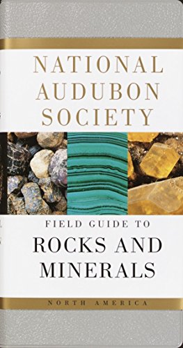
my favorite: National Audubon Society Field Guide to Rocks and Minerals: North America (National Audubon Society Field Guides) https://www.amazon.com/dp/0394502698/ref=cm_sw_r_cp_api_glt_i_YMJ54BXJMH8Y5KR8QEA9
Theres an app called Australian geology travel maps. You can download a bedrock geology map for each state individually and its super useful.
https://play.google.com/store/apps/details?id=solutions.trilobite.ausgeology
Howdy, just a few thoughts.
I really like u/NV_Geo's idea, I think a rock hammer + a weekend camping/hiking/collecting trip would be spot on. The Roadside Geology books are fantastic and would allow the two of you to continue pursuing sweet rocks beyond this birthday adventure.
Another thought I had was the Audobon Field Guide to Rocks and Minerals. There are plenty of reference websites to look up minerals, but this is a fantastic and handy resource with lots of good pictures.
Maybe once your wife is a bit more geo-established, you could consider a hand lens (link goes to the one that I have). Some rocks are fundamentally uninteresting even under high magnification :) but others are really cool, especially once you have a grasp on a few basic minerals and can start to recognize them.
Finally, on a more aesthetic front, you could make or obtain a nice pendant out of your wife's birthstone. This is something you could look for together at a local gem and mineral show, for example.
Good luck!
>The Val del Bove commences near the summit of Etna, and descending 403 into the woody region, is farther continued on one side by a second and narrower valley, called the Val di Calanna. Below this another, named the Val di St. Giacomo, begins,—a long narrow ravine, which is prolonged to the neighborhood of Zaffarana, on the confines of the fertile region. These natural incisions into the side of the volcano are of such depth that they expose to view a great part of the structure of the entire mass, which, in the Val del Bove, is laid open to the depth of from 3000 to above 4000 feet from the summit of Etna. The geologist thus enjoys an opportunity of ascertaining how far the internal conformation of the cone corresponds with what he might have anticipated as the result of that mode of increase which has been witnessed during the historical era (Lyell, 1830).
Here's a map of ice flow direction in Finland during the last glaciation. Town of Jyvaskyla for location. Here's a pub with a geologic map of the region. There's also alignment of the layering and structural features with the modern lakes, but it's not universal. There are many unit geometries transverse to the alignment of the lakes.
It can get very complicated when classifying rocks. For example there are all types of igneous rocks. They are defined by their chemical composition and mineral assemblage. For example "Mafic rock, in geology, igneous rock that is dominated by the silicates pyroxene, amphibole, olivine, and mica. These minerals are high in magnesium and ferric oxides, and their presence gives mafic rock its characteristic dark colour." http://www.britannica.com//mafic-rock
Here is a link I looked at that shows about Isostasy: http://www.britannica.com/science/isostasy-geology
There is a nice video in it that shows what would happen if the mountain top was removed.
Anyways, I understand about the collision of the plates, but I mean, couldn't you also consider it the development of mountains and their roots?
My only point was that if you wanted to know the practical limitations of radiocarbon dating, this board (or anthropology) would be the place to do it, despite the fact the underlying mechanism is in particle physics. Likewise, I believe this is a good place to ask about AAR limitations, despite the fact the underlying mechanism is in molecular biology. Like radiocarbon, the practical limitations are going to be due to things like contaminates and uncertainties in the depositional history, etc.
I never meant to say that most geologists were interested in radiocarbon dating. Also, most geologists I know aren't interested in the things that are millions of years old, but I'm sure this changes drastically depending on where you live, so that probably explains our different viewpoints on this.
Here are a ton of sources of AAR used as a dating tool. I'm not sure if you want something more specific than those results. It's definitely widely used enough for this not to be a totally out-of-the-ballpark question to ask here.
It's likely a roll front, oxidised fluids flowed though a porous sandstone changing the oxidisation state of iron and manganese oxides.. The interface between oxidised and reduced fluids is fractal like, its called viscous fingering, it occurs when two fluids interact. Forms branching like patterns, in 3D.
https://www.slideshare.net/mobile/monatom/02-boberg-iaea-roll-front-development-expl
Suekane, T., Koe, T. and Barbancho, P.M., 2019. Three-Dimensional Interaction of Viscous Fingering and Gravitational Segregation in Porous Media. Fluids, 4(3), p.130.
Thank you for the link, there's a lot I still don't know about the park! This was shot on the Natural Bridge trail. Hope that helps!
This is the place. Most of the stuff is translated to English, but some is still in French/Vietnamese. http://www.tripadvisor.com/Attraction_Review-g293924-d590925-Reviews-Geological_Museum-Hanoi.html
If you think it's definitely an intrusion maybe it's funny weathered ring schlieren? What is the host rock? To me it looks like some sedimentary business and one wouldn't be able to form schleiren. Is it some really dusty granite?
Like this: https://imgur.com/rsupCwF
Most of these fossil guesses are probably right on.
I have a BS in Geology from UM-Rolla (2003), and am back for a MS in Geology there now. I think we are a better undergrad school for Geology than Mizzou.
Rolla has several emphasis areas you can choose with your geo degree. For example, my undergrad emphasis was Groundwater and Environmental Geochemistry. They have geophysics and petroleum emphasis areas as well. Petroleum is pretty big on campus right now and the GE/PE/Geo depts are all under the same big department now, and there is a lot of interdisciplinary work between them.
Cost to go here shouldn't be any more than Mizzou. Housing is likely a fair bit cheaper. But you do sacrifice a lot of the big college lifestyle here, and its 1.5 hours from any 'big' city.
Edit - Paleontologist is in your nick, so I thought I'd say something about that. Dr. Francisca Oboh-Ikuenobe teaches here and she afaik is a pretty well known/respected paleo prof. Here is some information about her. Some of her work: http://scholar.google.com/scholar?hl=en&q=Oboh-Ikuenobe+&btnG=&as_sdt=1%2C26&as_sdtp=
Here's the full story translated from Russian:
Naryn region: A landslide occurred at the Kara-Keche coal deposit. No injuries.
From Aizhamal Jamankulov - September 15, 2020
The press service of the Ministry of Transport and Roads reported that a landslide occurred at the Kara-Keche coal deposit in Naryn region. According to preliminary data, the volume of descended rock mass was 900 thousand cubic meters. There were no victims or injured.
The landslide occurred at the 37th kilometer of Dyikan - Kara - Keche highway. The mountain mass blocked the Kara-Keche riverbed, destroyed power lines and blocked the road on this section. According to the decision of the Civil Protection Commission of Zhumgalsky district, the road is temporarily closed due to the danger of passing this section.
"At present, the earth mass is slipping into the Kara-Keche River. Measures are being taken to eliminate the consequences of a landslide," said Zarylbek Monoshev, head of the Road Maintenance Department of the Ministry of Transport, who is now at the scene.
Kara-Keche is considered one of the largest coal deposits in Kyrgyzstan. Coal reserves there are estimated at 400 million tons. Three companies - "Charbon", "Ak-Zhol" and "Kara-Keche" branch of "Kyrgyzkomur" State Enterprise - mine coal on the territory of the deposit. They provide coal to the city of Bishkek, as well as Chui, Talas, Jalalabad and Naryn regions.
Kyrgyzstan consumes at least 2.5 million tons of coal annually. The bulk of coal is mined at the Kara-Keche deposit. CHP of Bishkek consumes 1 million 140 thousand tons of coal per year, of which 680 tons are supplied from Kara-Keche.
Translated with www.DeepL.com/Translator (free version)
Great Geological Controversies is an exceptional review of past geologic schools of thought. I think this book is important for geologist to read because it lays out the foundation of the science throughout history. It's a bit pricey because it is a textbook but you could probably find a cheap copy if you dig around a bit.
Great Geological Controversies (Oxford Science Pubns) https://www.amazon.com/dp/0198582196/ref=cm_sw_r_apan_glt_fabc_2551X27NSN33BXWC6190
Karen Wynn Fonstad's THE ATLAS OF MIDDLE-EARTH is a great resource for discussing the possible geology of Middle Earth. She is a cartographer and geologist.