
What are
/r/BikingATX's
favorite Products & Services?
From 3.5 billion Reddit comments
The most popular Products mentioned in /r/BikingATX:


The most popular Services mentioned in /r/BikingATX:
Ride With GPS
Strava
MapMyRIDE
Google Maps
OfferUp
OpenStreetMap
IFTTT
AllTrails
Aliexpress
Wikimapia
Facebook Marketplace
Instructables
Internet Archive
The most popular reviews in /r/BikingATX:
Here's the route: http://www.mapmyride.com/routes/view/662422650
The destination was posted before the ride. If you couldn't handle going north, you only have yourself to blame. Elevation gain of less than 500 feet and you're complaining? You live in Austin. There are hills. If you want a flat mile-long ride because you can't handle a hangover (or a bike, apparently), move to Florida.
Made this looking over the map so hope it helps. May also be worth reaching out to the event to see if they have made any official GPX maps just in case too.
I'm confused. Did this happen on the National Instruments campus or at the Domain?
Edit: Here OP, use this bypass instead. Gotta get off your bike for about 30 seconds to cross the train tracks but otherwise it shouldn't add too much more time or distance to your commute.
Most of the good hills in Austin are represented in Das Hugel route, see https://ridewithgps.com/routes/26466396. For more info about Das Hugel, check dashugel.com.
A great route, if you can get to it, is Spicewood Springs Rd. off of 360.
It's not super long, but it's very scenic. As you can probably tell from the map, there are a lot of roads in NW Austin that are long and scenic, and they are all very damn hilly at points (Yaupon Dr., Rain Creek Pkwy.)
Anyway, enjoy your visit, and good luck!
OP, that looks like a fun ride.
It sounds like you could easily ride 60 miles given enough time and preparation. I would however suggest riding a full 100 miles (or close to it) prior to the Katy ride just to be sure and feel more confident.
As far as routes go I've been meaning to ride this. It's a combination of two regular rides I do plus some BBQ in Lockhart. I'm down to go with you if you'd like a riding buddy. : ]
This might be fun metric-century route. Park your cars just off of Hamilton Pool road, load a cooler with ice & water & snacks, then top-off mid ride. Only 2 mi of sucky highways to worry about.
As a more intermediate area to try before Lime Creek, I highly recommend the Far West / Northwest Hills part of town. Some of the best hills north of the river in that area. That hill up Far West is a bitch, which makes it a great measuring stick for conditioning... especially if you climb it all the way from where the bike path begins on Shoal Creek.
I have a long commute that lets me explore south austin, but since I haven't lived here for a winter yet, I don't know what a lot of the roads look like in complete darkness.
https://ridewithgps.com/routes/34567365
I threw this together in a few minutes based on the key of climbing on dark neighborhood streets and descend on the brighter, but busier thoroughfares.
Curious to see what people suggest for the north and west sides.
Check out the Tour Das Hugel route. It is designed to hit every major hill in the Austin area. Not recommending to just go ride the whole thing but you can find some good hills on there .
Good idea! I haven’t seen any, but will check the city’s GIS data page and see if they have anything once I’m in front of a real computer.
Edit: Looks like the city doesn’t have GIS data available, but openstreetmap’s cycling layer group does include water fountains once you zoom in far enough.
https://www.openstreetmap.org/#map=16/30.2694/-97.7616&layers=C
Hope that helps, stay hydrated out there!
A basic Bafang BBS02 mid-drive install with a good enough 48 volt lithium battery is available through Amazon for $829, if you're a Prime Member.
>Foremost, you'll need to get used to riding in the streets & bike lanes.
No. I don't. Riding a bike for me is exercise that I enjoy. I stay off-road mostly and have no need to use it as transportation. If I can't find a safe route, I won't do it and I would encourage you to do the same. Too many people in this town blocking traffic and/or getting run over.
> South 1st, S of Slaughter has bike lanes you should feel safe in.
Yes, I ride this way to Mary Moore park and it's something I'm very comfortable with, however it doesn't go north which is the goal.
> Old San Antonio Rd. has no bike lanes... Speed limit's high
No thank you.
>Routes that get you to Aud. Shores:
>Chill, scenic & safe, with lots of stops.
Cool, thanks.
Something like this? https://ridewithgps.com/routes/37453304
I think this is either wide neighborhood lanes, dedicated, or a sidewalk in extreme cases. Just depends what you consider too sketchy I think. There's a few back trail connections to the Veloway and you could alter your plan to not ride on Slaughter sidewalk if you wanted, but I would think you would have to at least cross it at some point.
But I tend to build routes that are maybe longer and quieter than they need to be and tweak from there.
60 miler - https://www.strava.com/routes/3609159
Could cut out some of it by turning on Bee Cave instead of going through Lost Creek, but that'll cut out some climbing. Could also cut out River Hills-Cuernavaca to drop more miles (and climbing). Additional option is to keep going on 620 and turn at Anderson Mill instead of going down through River Place (again, less mileage and climbing).
Here's one variation.
https://www.strava.com/activities/209468121
To get the full distance, I go down River Hills and up Cuernavaca, then turn around and ride the 2 in reverse. If I remember right, this particular ride was after a heavy brunch and a pint of 10% abv pumpkin stout, so I cut the ride a bit short.
I think this is where their trace tool would come into play? It requires premium instead of basic but you could probably emulate similar functionality by opening the current route on one screen and then remaking it on their route planner. (I think that's essentially what Manual Trace is anyway)
I'm surprised someone shared a RWGPS route without routing on it, but I guess it's possible they imported it from a GPX/TCX track instead of making it on RWGPS.
And just take it out as far as you like. Nice country, light traffic, decent road surfaces. You can park on the Georgetown square and have no worries about theft or vandalism.
If they're doing the "Mellow's to Nelo's shop ride" that can get you there and back (but the Northbound route isn't anything I would consider commuting on). http://www.mapmyride.com/us/austin-tx/mellows-nelos-loop-route-270134255 The reason that they don't use Shoal creek the whole way down is because the trail isn't complete the whole way, and you have to take sidewalks on Lamar. Regardless, that's what I would do if I were you and commuting though. I do it all the time, and it's very safe.
I've never done it myself, but I did plan out a route incorporating taking the Metrorail up to the Leander Station and riding from there. http://www.mapmyride.com/routes/fullscreen/592255990/
Report back with a ride review if you do ride out there.
Not sure why I'm downvoted.... 360 is all shoulder, so you're flying by traffic, it is my go-to 5-7pm route
Here's an example with some distance west out on Bee Caves, too. https://www.strava.com/activities/132097625
I did a copy cat of the Bicycle Sport Shop "Holy Roller" gravel ride. Had a blast out there. Perfect cross bike route with a little bit of everything.
On mobile, hopefully this link works: https://www.strava.com/routes/193545
As others have said, finding others' solo rides on Strava is a great resource. With cycling, the comfort level offered by different roads often depends on the time of day or weekday/weekend. With experience you'll learn the routes. Start with out-and back-rides taking a comfortable route out. That way you're never too far away to turn around if things get sketchy and you can ensure you return feels safe. I'm sure you're familiar with the Walnut Creek Trail. This also acts as a sort of entryway to some longer country rides. You'll have to figure out what works for you, but here's 7 miles past the end of Walnut Creek to a spot where you could turn around or do some exploring - https://ridewithgps.com/routes/30055483. That service road along the highway has fast traffic but isn't busy and has a big shoulder. A lot of people go west on their solo rides but you have to be ready for a lot of climbing if you're doing that.
Just call them Presta or Schrader -- both types often have removable cores.
You can buy "Slime" brand tubes that come with sealant inside already, or you can add it after the fact. 700x42? This looks close -- 29" is the same as 700c, and 1.85" = 47mm, which is pretty close to what you're looking for -- close enough that it should work.
Thanks for the tip. Are these the ones you recommend? I know very little, does this mean i'm switching to tubless?
Why are these so much cheaper than other tubeless onces (I've heard they're over $100 each)
If you go look at Walmart and look in the bicycle aisle, over half their accessories say Bell.
Similarly, you won't find too many Bell products at your local bike shop -- and when I started looking at the websites for some of the local bike shops, most didn't even mention Bell products even where they do mention other accessory brands (though Austin Tri-Cyclist does mention selling Bell helmets, and ATX Bikes mentions one.)
When your local dentist spends $7000 on a tri-bike that he barely rides, and wants a $225 helmet ... does he buy the one that says "Bell"?
We could argue about if Bell deserves a reputation as being a "budget brand", but it definitely has the reputation.
Either way, it's a bit weird for Bell to say "If you have a $10 head, wear a $10 helmet”, because they do sell a $10 helmet (though the ones that adults can wear start at around $20), and this slogan is decades old, well, back then a $10 helmet was probably pretty typical, so they're arguing against their own products to a degree.
(But it would make more sense if they were less of a department store brand (if that phrasing is less concerning) back then. I really don't remember.)
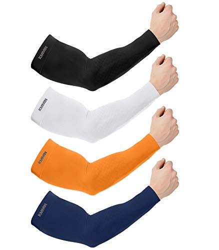
I wear these sleeves with regular cycling jerseys: https://www.amazon.com/gp/product/B07HVZTJ3M/ref=ppx_yo_dt_b_search_asin_title?ie=UTF8&psc=1
Highly recommend.
Also, I really like this sunscreen on my face: https://www.amazon.com/gp/product/B004D281CK/ref=ppx_yo_dt_b_search_asin_title?ie=UTF8&psc=1
It's water based mineral sunscreen and dries almost powdery. No problems with it getting in my eyes and it works great.
I've been wearing sunsleeves for years, but I needed to replace them and my cycling shirts anyway, so I got this: https://www.amazon.com/gp/product/B09NW82MX8?psc=1. Merino wool, long sleeves, hi-vis color.
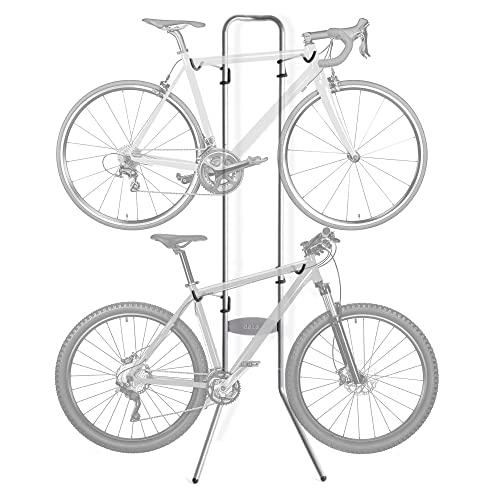
I looked at that but eventually decided on this with room for 2 bikes and it has worked just fine for me, had for over 3 years now
Oh man, I hadn't seen this website, thanks for the link! I highly recommend this route for your commute (from the website linked, it's the "hipster highway" lol). https://www.strava.com/routes/1504491
There are rides from Red Horn. Bat City Rides. 65 miles, avg about 20mph. Rides are labeled expert for good reason.
I typically ride about 15 mph and sprint up to 20mph, but haven't ridden much the last two years with all the rides being canceled. My average speed has dropped, so I need to just get out there and keep riding.
There is a guy in Pflugerville who is an active cyclist and posts to RidewithGPS. Often I look at routes and recognize the person, he does a great job and I've found neat bypasses that way. RidewithGPS routes. Like I said my speeds are slower, but a good workout for me to do the 50-mile rides.
something like this. the only sketchy bit is crossing MOPAC on Slaughter. https://ridewithgps.com/routes/37453250
you could avoid that buy taking Davis under MOPAC and weaving your way through neighborhoods to Escarpment, then taking LaCrosse to the Veloway. Or get on the Veloway and take it to where it crosses Slaughter Creek and ride singletrack until you find a way to enter the Veloway. this includes a bit of mtb trail, so it might not be ideal if you have a road bike with skinny tires.
https://ridewithgps.com/routes/9764823
Would highly recommend incorporating the Willow City Loop as part of your Fred to Fred route. The area just north of Willow City is some of the most scenic road riding in the Hill Country.
I started cycling as a young UT student too!! Got my first adult bike from Ozone. It was a hybrid and I remember my co worker looking at it like I was a total loser lol, he was mr Fixed Gear. ANYWAY.
I started by riding down Duval everyday and back. Then I found some social groups to ride with (hard RN w the pandemic, but they exist!). Cycling was and has been a huge part of my life, I hope you find the same joy!
And to answer your question, theres a lot of good info here already but, check out Clown Dog and/or Bike Farm. Yellow Bike Project has a Saturday sale that happens Feb 20th, 9am-12pm. Orange Bike Project (UTs garage shop) is something to look into!
If you give us your height/price range, I bet some of us would help, I might even have something that could work for you, you'd have to put a little bit of money to get it working, Univega Activa like this one.
Thank you! I ended up doing just that and took this route, minus the last fifteen miles. Had to ride the access road for a very short amount of time and it was terrifying and dangerous and stupid, as expected. A couple of points the access road had a nice shoulder though.
I ride from south Austin everyday for work and while S Congress is generally okay I still avoid it most of time time. There are good routes on either side of Congress through the neighborhoods. Here is one for example just west of Congress: https://ridewithgps.com/routes/35598720 going through Travis Heights along east side drive is also nice.
Here is another route which shows how you can use the sidewalks to navigate to Metric Lane from Shoal Creek. Metric is the bike friendly alternative to Burnet. The route below is a guide to guide you through the intersections; use the side-walk and crosswalks, not the road obviously.
100% road. I hope you're not one of those people who weaves through the Minuteman on their aero bars, but even if so, you should know there's nothing here that is that flat, straight, and smooth in terms of paths. Aero bars on the road only, and away from other riders. You'll have more fun if you ride some of those hilly roads we have. It's not hard to get down some of the popular routes.
Thanks all. If I head out, will probably just drive out to Lockhart and do a nice loop from there.
Thinking something like...
For the most part you need to go East: https://ridewithgps.com/events/70850-gravel-rides. Most of the named ones in that list are copies of routes organized by Spinistry, Bike Austin, or Capital City racing. I think I remember running into some closed gates on the Alcoa Scouting.
If you use your phone to track your rides, you can use RideWithGPS to plan/build your ride and then push it to your phone. Mount the phone on your handlebar and follow the cues. I send my routes to Wahoo Elemnt Bolt, and it works well.
If you can't do this, than pull up Google Maps and zoom in on the MoPac Service Rd and Duval Rd. on the NE corner of the Domain.
- Use the crosswalk to cross Duval and follow the sidewalk to Burnet.
- Cross Burnet and then cross Gracy Farmsand follow the sidewalk all the way down to Park Bend Dr. You'll cross RR tracks close to PB.
- Take a right on the sidewalk for a few feet and you'll intersect with the North Walnut Creek Trail.
- Take a right and you can follow it 1.2 miles to its north end at Amherst Dr and Balcones District Park.
- If you take a left on the Trail, you can ride 2.1 miles to Walnut Creek Metro Park.
As an out-and-back from the Domain, you'll likely get 10 miles.
I don't know.. does this look welded to you? Perhaps they are, but they look janky as fuck.
I remember there was a big hoopla about these trailers some years back. The city was hesitant to give out permits for them, or at least that's the gist of what I got from the Chronicle article which I cannot find.
That's a nice ride. There are also several fun county roads east and west of Parmer that you can use to vary the route, distance, and hills. Indian Hills is off west of a county road at the end of Parmer (Ronald Reagan is what Parmer is called out this far) and is a fun little roller-coaster.
Here is a route I found that's close to that BSS ride: http://www.mapmyride.com/routes/view/10845310
Yeah, though if you start before Liberty Hill on Bagdad Rd you can skip most of 1869. I like to ride 1869 east because its downhill and I can maintain 25+, but going westbound you may get some unappreciative redneck traffic. In the same area, Oatmeal Loop is really nice with very little traffic. Or if you want bonus miles and skipping 1869 you can take CR 201 up to Bertram and start 1174 there. That area is one of my favorites to ride because there are a lot of options with very little traffic.
Here's the map from Benbrook Park on Bagdad to the end of Cow Creek and back (60 miles): https://www.strava.com/routes/1153009
Scenery isn't really a draw for this route. The main draw is the rolling terrain.
I like to tack Cuernavaca/River Hills loop onto it off Bee Cave as well as City Park/Pearce Loop, which is one of the best stretches of road in Austin. For scenery, nothing beats The Lake Loop or just do some out and backs on Fitzhugh toward dripping springs, Wimberley and towns out that way.
The Dam Loop.
360 > Bee Cave > Bee Cave Pkwy > 620 > Anderson Mill > [bunch of side streets] > Jollyville > 360.
The loop itself is less than 50 miles and there are a bunch bonus loops you can tack on there. I do variations like this
My favorite ride might be tricky for you to access, but it's excellent for a longer ride.
Get to Cesar Chavez, ride the lance armstrong bikeway to Congress. Ride Congress until it dead ends at South Park Meadows, take a left. Ride the frontage road of I35 until you get to a small road before a hill. This is Old San Antonio Road. It will take you all the way to Buda. Take a right at the CVS onto main street. Once you're in Buda, take a right at the light past the train tracks - this road will let you ride all the way to San Marcos if you're adventurous.
Here's a map from my Strava... I did this last July so I'd imagine it's a lot nicer in the spring. https://www.strava.com/activities/173657283
yeah, the roads can get pretty chunky and rutted, but still doable on a gravel bike.
just check the route that the lockheart breaker gravel ride did and follow that
As far as true gravel grinding goes you are going to need to drive outside of town 30-45 mins to get to something more than a few miles of park paths or mountain bike single track. I threw together this list of modified routes from gravel rides: https://ridewithgps.com/events/70850-gravel-rides You can also check https://gravelmap.com/
Curious what you end up linking together. If you look into the Southie trail system there are probably close to 90mi of trail to connect, McKinney is the only "official" campsite on it though, for a multi camp location bikepacking trip around Austin, you may have to get "creative". You could consider starting in West Austin and riding a big Southie day to McKinney then taking more country roads out to Buescher State Park and then riding a day at Rocky Hill Ranch, something like this: (not my route, but it looks like it could be fun) https://ridewithgps.com/trips/23958735 then turn around and come back.
You can also get an estimate using Strava (or most other free apps) Here are some big hills/common routes on the West side: https://ridewithgps.com/routes/17581719 https://ridewithgps.com/routes/16849039
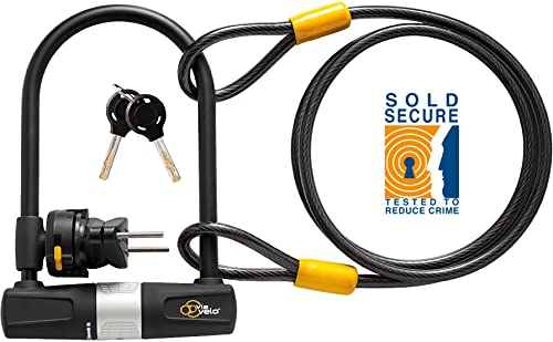
Honestly even the best lock can be defeated quickly so NEVER bank on a lock. The Lockpicking Lawyer recommends a kryptonite chain lock like this one since they are hard to pick but more. importantly hard to cut with an angle grinder since they aren't rigid like a ulock. I am going to uses a chain lock going forward.
Also the guys that stole my bikes recently worked as a pair so even one vomiting would still allow the lookout to grab it after a moment.
Thanks for this info. I actually had success leaving it strapped on while I was out on a ride on the Northern Creek Walnut trail. I saw other vehicles in the parking lot leaving their bike racks on, too. For reference, I have nothing fancy. Just an Allen Mount Rack from Amazon. I imagine a bike hub like the Walnut Creek Park isn't a place to worry about a bike rack.
But you're definitely right, I wouldn't feel comfortable leaving my bike unattended. I've read quite a bit about them being stolen, especially during the pandemic.
Sweating is unavoidable during the summer. If I need to go somewhere and not be sweaty, I usually bring a change of clothes and these wipes.