
What are
/r/bicycletouring's
favorite Products & Services?
From 3.5 billion Reddit comments
The most popular Products mentioned in /r/bicycletouring:


The most popular Services mentioned in /r/bicycletouring:
Ride With GPS
Komoot
Strava
MapMyRIDE
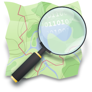
OpenStreetMap
Bikemap
Garmin Connect
Google Maps
Vimeo
OsmAnd
Weatherspark
Flickr
Facebook Marketplace
WordPress
MAPS.ME
The most popular Android Apps mentioned in /r/bicycletouring:

Maps & GPS Navigation — OsmAnd

HERE WeGo - Offline Maps & GPS

MapLocs Cycling Route Planner

Maps & GPS Navigation OsmAnd+
Locus Map Free - Outdoor GPS navigation and maps

MAPS.ME – Map with Navigation and Directions

Locus Map Pro - Outdoor GPS navigation and maps

Moon+ Reader
Elevation Profile
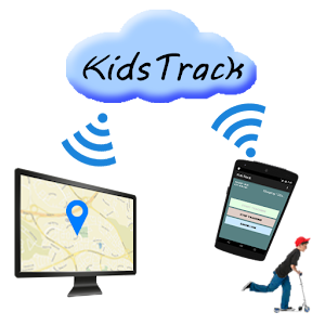
KidsTrack
BikeComputer Pro

Tiny Travel Tracker - Free
Vespucci OSM Editor

Windy: wind, waves and hurricanes forecast

Mapy.cz - Cycling & Hiking Maps with navigation
The most popular reviews in /r/bicycletouring:
As clever as this is, I think your basic objection -- that they "copied' your content without permission -- is totally off base. They had no legal or ethical obligation to ask permission. Like Twitter and other UGC services, Tumblr gets a broad nonexclusive content license from you for anything you post on Tumblr, and it also gets from you the right to give that license (sublicense) to third parties who develop services based on the content. See paragraph 6 here:
https://www.tumblr.com/policy/en/terms-of-service
Use of your content by third parties in online services is governed by the Developer API terms of use, whether or not the third party is actual developing anything or building an API:
https://www.tumblr.com/docs/en/api_agreement
As you can see, pretty much anyone out there in the media has broad rights to display what you put on Tumblr so long as they follow the terms of the API agreement, because you gave those rights to Tumblr and you gave Tumblr the rights to give others those rights.
Also, in-line linking without permission is totally standard on the internet. Notice how every news site anywhere embeds youtube videos and tweets all over the place? Yeah, maybe sometimes they ask, but they don't have to. If you don't want your stuff linked to, don't put it online.
Also, if you are embedding someone's content, obviously check back for dickbutt, because that's the price of showing content you don't control.
I did about 1000 miles like that, heading west with end points fixed, and a deadline. I admittedly was lucky with the wind, but I used www.windy.com to plan my route 2-3 days ahead (keeping in mind the pace I needed to keep), so that I could account for wind strength and direction.
GL!
I use a tiny Abus chain lock (https://www.amazon.com/Abus-Chain-1500-Web-Lock/dp/B01GTQIICA) There are "saddle leash" cables too. Both can be defeated but at least make them work for it. Definitely get rid of the quick release and there are locking seat post clamp bolts available.
You're getting a lot of conflicting advice on shoes; here's my 2¢. I pedaled 4570 miles/7354km across N America—in comfort—using a pair of cheap Skechers tennis shoes and MKS Sylvans, and no clips were needed. The sneakers you show look fine, mine weren't stiffened in the least.
Don't sweat the 'flex' in the sole or anything else. You're using a basic platform pedal. The whole benefit of them is that you can make small shifts of your feet at will. Get a hotspot on your foot? Shift it to another spot on the pedal for 30 seconds, problem solved. Who cares if it's inefficient, it's 30 seconds.
Have fun!
#17: FWIW, you can solve the cell service problem with OsmAnd or Skobbler, which let you save entire states to your phone. I used the Southern Tier map set on that route, but I usually needed something supplemental to get to Warmshowers hosts or for the few times I went off-route. Battery became a big problem in several cases, and I still recommend paper maps. If you have an Android, I highly recommend that first app. Skobbler is probably the best choice for iPhone users.
There you go:
https://ridewithgps.com/routes/37977719
I whipped that up in about 10 minutes, by following the EV4 route and the OSM Cycle map overlay. Copy it to your routes if you wish to modify it.
These are some beautiful bikes, but you could almost rename the article "Most Beautiful Touring Bikes in Portland (USA)".
I recently bought one of these (Condor Heritage Tourer, from London, UK), and I think it deserves a place on this list. But then I might just be biased! ;-)
Well it is a small old town, with a lot of old churches, ruins of a small castle, etc., a lot of history. It is up on a hill by a beautiful lake, and the old houses there have a very distinctive architecture style. You can find some more pics and useful info here : http://wikitravel.org/en/Ohrid .
Looking again at your route, if you don't mind going over hills I would suggest to go over Mt.Galicica, it is also a national park and has great views up there, and visit the city Bitola. From there then head south into Greece to follow your existing route.
What did I like about it? Well I am from Macedonia, so it is kinda local to me. If/when you pass from Skopje you can message me to get a beer and chat or if you need help with your stay. Also, don't skip the Matka Canyon if you are in Skopje.
While this person went to San Diego, I think you can get value from this link. There is a lot of information here. https://ridewithgps.com/routes/7083079
In the description, there is a link to a forum post where the person goes into detail.
2011 CruX S-Works Pro. Everything factory except the wheels: Velocity Dyad 40-spoke rims, Shimano Deore hubs, Armadillo All-Condition Elite tires.
Panniers: Arkel 45s. Trunk bag: Arkel Tailrider. (both new. never even had panniers before.)
Full kit: http://lighterpack.com/r/9pplzm
Mini tour (as just completed): http://www.mapmyride.com/routes/view/787356759
Go for it. It's beautiful, and safe.
Here's my Strava: https://www.strava.com/athletes/3254009?utm_source=top-nav
If you scroll and find July-August of 2014, you'll find GPS tracks for all 19 days of riding.
Looking for a way to compile all the days onto one map...
This was the original route, but after doing 10 miles of dirt/gravel road between Alma and Midland today, I've decided to skip the UP until next summer when I have a bike with wider tires (I'm rocking 28mm now)
Don't have experience with a lot of units, but toured in France last year w/ the 820. Good experience. The worst thing is figuring out how to load high quality base maps.
My basic workflow was:
- Create / load new regional basemaps using http://garmin.openstreetmap.nl/
- Create route using Ride With GPS (and esp the Open Cycle Map layer). An example.
- Load gpx onto the garmin, and ride.
I didn't realize how much mental energy it saved me have directions right on my handlebars. Not worrying about staying on route, while easily making detours, really freed up my mind to focus on more fun things happening on tour.
I use one of these bike stands - sturdy as hell even with a full load. Best money I ever spent on a bike accessory.
I use https://www.bikemap.net/ and make my own routes. It's fucking fantastic. And you can upload the GPX file to an app like OsmAnd and get much better information than Google could offer.
Edit: Click 'new route' in the top right hand corner. Just in case you miss it like I did when I was advised to use it.
My friend, you have come to the right place. Welcome to the wonderful world of touring with a GoPro.
In many ways, a GoPro is like a child. It demands constant attention and care.
- The batteries drain in hours, you have three that you charge feverishly at any available outlet to feed your ravenous ward.
- You always remove it from your bike mount when you go in for gatorade, you can't trust it to strangers.
- It produces the finest memories you will have, it documents your best moments, but only if you pay it persistent attention (turning it on and off to capture things throughout everyday. Setting the camera up down the trail, so you can walk back to your bike and ride by by it, then stop your bike past it and collect the camera.)
>The first idea we had was to stick it to my helmet on time lapse mode and let it take a still photo every 60 seconds of our entire trip, then create a 20 minute slide show with music from the entire journey.
Time-lapse stuff usually looks bad if it is not on a stable platform (your head will move around a lot.) Also you won't have the batteries for this. Each battery is only going to give you a couple of hours in constant time-lapse mode.
Mount it on your handlebars and shoot video in 1080 and 30 throughout the day, it's way easier to turn it on and off when it's not on your head.
Then pull it out of the case when you stop for the night and interview everyone...they love that.
Also, you should cross post this to /r/gopro.
My latest GoPro bike touring video: https://vimeo.com/96334753
It says right there "Bicycling directions are in beta." I see some potential routes along the coast that will save you distance and hills, have nicer weather and be more scenic than any of the freeways you'd be chasing through suburban Orange County. Gag.
I would stick to the coast all the way to Carlsbad, then cut east at Palomar Airport Rd until it turns into San Marcos Blvd and intersects your mapped route at E. Mission Rd in San Marcos, like this. One hour less time riding is one more hour for guzzling adult beverages.
I've heard Camp Pendleton might not let civilians ride through the base, in which case you might have to ride a few miles on the freeway. I'd check on that before going anywhere.
Here is one that has been on my list for a while:
http://www.mapmyride.com/us/estes-park-co/tour-de-rmnp-route-106496981
First overnight in RMNP, second somewhere near Frasier/WP. Ends up being about 70 miles days I think. Up and over Trail Ridge road (Old Fall River road if you want dirt) and Berthoud Pass. I think you still need to walk your bike through Blackhawk. I tried to avoid narrow shoulders/high traffic where possible, but I am not too sure about that state of Hwy 40 as I haven't been that way in a while. Also, you can cut some distance/climbing if you start/end in Nederland and just take the peak-to-peak to Estes.
I did the reverse, and would highly recommend biking up to Albany and then following the Erie Canal.
Actual route I followed is here but I was a little bit aimless about it and probably wandered from the optimal route a few times.
If you want a supported hosting platform, Wordpress.com might be better than Medium, inasmuch as the Wordpress content-management system has a very convenient plugin (Leaflet Map) for embedding maps with your cycling route overlaid on it. I don’t think Medium offers the same range of possible features.
Well, yes, a member here did publish through Amazon, although it's fiction and not a bicycle touring account.
Northern Tier: A Novel, by David Axel Kurtz
https://www.amazon.com/gp/product/1549944401/
It's a fantasy fiction about a future post-war world where long distance cyclists carry letters and mail. Books for bicyclists.
It's in my list of items to get at some point (too busy buying bike tools and working on bikes to sit back and read, but maybe over the Winter season...)
If you think your adventures would make good reading then go for it!
Mountains are not more difficult, just slower. If you start on the east, you will have 2000 miles experience till you hit them, so as someone else said already: You should be fit by then.
I recommend going a bit more north, its more scenic with more national parks. Its better than the desert. I dont recommend the Route66, as its designed for cars/motorbikes and has a lot of traffic and sometimes sections you are not allowed to ride on.
Source: I rode a lot on my bike, including across the US and canada. You can find routes I did here: www.unlocked-achievements.com
PS: If you think hills are bad, you dont realize how much wind can suck. Have a look here http://mashable.com/2012/03/28/wind-map/ and at the prevailing winds before you plot a route. It makes all the difference, this summer I cycled against headwinds for 3500km from Dakar to Morocco.
Awesome! I lead a ride around lake moultrie using some of the moultrie passage section a half dozen times a year or so. Great place to ride, we're thinking about doing an overnight to the sandy beach camp spot on the north side of the lake soon, your pictures make me want to do it all that much sooner.
I've never cycled around those area, but the orange line is Japan National Route and those can get pretty busy at times. Most of the time drivers will slow down and give you space, but rarely some drivers will drive quite fast 50cm away from you which can get quite scary.
As for camping, I only checked your first campground but that place will cost you 600 yen per night, and if you wanna go cheap you could go camp in a local park or Michi no Eki after closing hours and use the money on onsen or sentou.
As for Kyoto I'd suggest you try Tsujiri, they got amazing shaved ice with shiratama.
Hope you enjoy your ride!
Oh I actually just snapped a pic there because it was so nice out and the water was gorgeous.
I started on the Southeast side of town, 410 and Rigsby, and tried to catch as many creek trails as I could. About 36 miles one way. Here's my route:
https://ridewithgps.com/routes/37602967
Haha I was so curious that I went off to look and found this. I guess Google does funny things with elevations, but it's still nice to find this to add to my bucket list. I'm torn between doing it as a road bike challenge, bringing some touring/camping gear and treating it as an overnighter, or mixing in some of the gravel nearby (I have no idea how doable it is on light gravel tires though, haha).
You could pick up the valley TransVA and go north. The grand departis going southbound from DC in early Oct. so it might be fun to wait till then and high-five south bounders or join yourself!
Otherwise look on ridewgps or some people use Strava and Komoot.
> To be honest I commute on my fixie but I've yet to do a ride longer than 70 miles.
Plan your tour. (Bike paths take a longer way than as the crow flies.) From home, on a weekend, simulate a 2-day section of your tour, with the tour bike and baggage. If you don't like it, there is plenty you can change. Going in just like that would be playing the lottery.
> I plan on stopping at friends' houses along the way
Lucky you!
> so baggage should be minimal - maybe 50 ibs.
Princess Vespa? Is that you? 50 lbs is anything but minimal. Optimize! Exploit your friends, especially their washers!
> Is there anything dangerous I should be aware of, you think?
No. (Idk the region, though.)
[Edit re: dangers. Test and take a spare tube and patch kit. Train patching in the field (In a pinch, find/beg some water: submerging the tube lets you find a subtle puncture). Check bike shop locations and cell phone coverage (for calling your friends to pick you up in an emergency). Have pasta for lunch. Plan where to resupply your water bottles.]
But plan your tour. Get maps. Check terrain and prevalent wind. Worst case: heavy bike & baggage, hills, headwind and upright posture -> Joggers will overtake you. You can still have fun that way! But I wouldn't count on it.
Get real bike pants. Get a bike on which you can take on different postures; that helps keeping limberness in arms & neck and circulation where you sit on the saddle. A low posture helps very much to endure headwind. If you have problems in your test: Different posture/saddle can change a lot.
Don't worry! A bike tour can be great fun even if several things go wrong.
Accuweather is predicating another heatwave this summer for most of Europe. I was thinking of going to northern France in August so this caught my eye.
Looks like the strava route builder tool to me. Pretty cool idea. It generates routes based on the most commonly bicycled roads, so you get the wisdom of the locals no matter where you are.
Yea man would highly recommend plenty to see.
Don’t have a route but this is one from a mate that I used that roughly follows where I went
https://ridewithgps.com/routes/33203700?privacy_code=XyP1bEmYmU4LMGKF
Haha nice! Wish /I had ideas for you. Would love to find out what you decide to do! Happy biking and congrats on the baby-to-be!
​
There are some routes along the coast of Maine that might suit you. Take a look at this: https://ridewithgps.com/routes/33631595
You might want to look at this site which shows historical averages to get a sense of your odds. Looks like for Bozeman the historical PoP is 35% in mid oct, with typical high temp around mid 50s and low around freezing.
I've done this ride a couple of times as a two-day double century.
Here's my route for Day 1: http://www.mapmyride.com/routes/view/417963214
Day 2: http://www.mapmyride.com/routes/view/417967186
Where you camp will depend on your final route and how many miles you'd like to ride per day, but I like Samuel P. Taylor and the Petaluma KOA for camping in Marin/Sonoma. The KOA is kinda corny, but it's close to the Lagunitas Brewery and has a hot tub.
The Bay Trail along the Peninsula is great, but last time I biked it the wind was brutal when I was heading north in the afternoon. Camping options are limited - you'd have to head into the hills to find a spot.
Here is a little hill very close to home that I ride frequently:
http://www.mapmyride.com/routes/view/507183830
I struggle in spots to stay above 2 mph! My speedometer won't read below that. I'm guessing my real balance trouble starts around 1.7 mph.
It was difficult because this was the first time either of us had ridden for longer than a day, so there were kinks and aches that maybe more seasoned or experienced riders don't have, or are better prepared to deal with. There was also a typhoon that rolled up the west side of the peninsula, so we were subjected to some pretty serious wind and rain for 2 days of the trip. We only had 5 days to get to Busan, but we were convinced we could make it.
I didn't track it personally, but I found this that mirrors our route almost exactly.
From the Bronx to Brewster you can ride on protected bike trails which are paved and beautiful almost the entire way! I did this three years ago: http://connect.garmin.com/modern/activity/168617288
I just finished my first four day tour via road bike last night. I have the opportunity to go with another redditor on the transam to Oregon in May. While my gearing won't be too awesome, I am fully confident my physique will by the time I hit real, actual mountains.
My bike handles great (maybe my experience with it helps) but everything was 60-70 lbs overall.
My rear wheel is 20 spoke, but I have put it through the ringer many a time with out it even thinking of coming out of true. (they are Rolf Vector Comps after all...) I put 200+ miles and 6300+ feet of climbing with that load, which absolutely blows away anything I have ever done previously.
Ended up doing my first actual century because I felt like hitting MORE hills and at least 60 more miles. (My tour was actually over by the first 40 miles or so of my century ride as linked) First century my previous best was 65 miles and 1750 feet of climbing last May pushing a 22ish lb bike over a lot of rolly polly ez pz fast rollers instead of 6-8% hills and 1/4th to 1/2 mile 2-4% mountains.
Are you going on the north side via Trois-Rivieres?
If so there are some great restaurants in Trois-Rivieres, along the main street, Rue-des-forges. And if you're doing it all in one day then its also your last chance to get a great meal before Quebec City. I still remember a salad I had there called "bleu bleu bleu", which had Blue Cheese, blue berries and something else blue (maybe a bottle).
There's a crazy steep hill here as you cross the 138 from "Chemin Vieux" over to "Rue du Roy", near Neuville. I make a point of going that hill up each time I pass through. (I'm pretty sure you could avoid it and stay on the 138, but it's a fun challenge.
The first time I hit that hill I had to unclip and start again part way up (no walking just had to change gears and regain my balance). Never again. The last time two pedestrians said "bravo" as I past them with momentum to spare.
Here's the route I took most recently, which enters Quebec city from the north side along the 138. It passes by a few more cheap hotels before getting downtown, but going right along the fleuve following Chemin Sait Louis and Grande Alle, is my favorite route.
Well now I'm getting hyped lol.
I don't know if you need an account to view it, but I've been tinkering with the route on Ride With GPS, and here's what I got so far, if you have any suggestions that would be great.
(paging) /u/lukekubacki is doing a similar trip starting in Chicago, I'm sure he'd be interested in the input too.
I can confirm that the campsites that u/ffffrances suggests are good choices. This year we did the route counter-clockwise so that we could finish with the bay trail ride from SF and enjoy the views and great tailwind. The wind going north on that route is always brutal and can be fun if you are doing SJ to SF only, but not as fun when it's the ending quarter of a 18-20 hour in the saddle double century. Here's our route for reference as well and good luck, it's an amazing ride well worth doing!
https://www.komoot.com/plan you can use that to plan your route.
I bought the world map package for myself for tracking on mobile and can see the types of roads (and choose the type of biking you want to do - gravel, road etc and it will adjust the route). Quite good for planning my trips :)
Sure thing. I've given myself the whole month to do the trip, obviously that gives me plenty of time to take days off and enjoy the beautiful valleys I'm crossing. Also a lot of my colleagues live around this area, so I'm stopping off and taking detours to go and visit them. So far I've wild camped three nights and the rest I've stayed at campsites, not a fan of Hotels (too fancy for me).
If you want to see my day to day tracks, you can follow me on Wikiloc Or if you want to see my original plan (and all the different variations) you can check out my planning on Komoot . Hope this helps.
I believe Adventure Cycling offers their maps in "GPX" format for download when you buy them. Those GPX files can by imported by OsmAnd (https://osmand.net/help/faq.html#importing_gpx), and many other offline GPS maps too.
Grand Canyon is in fact closed (and northern AZ gets plenty snowy/cold, but it sounds like you'd be OK with that.)
I did a more or less north/south chunk of the Southwest on my way to Tucson this summer, some of which might work for you. You can find the map <strong>here</strong>.
The most beautiful sections were in western Colorado through northern AZ, especially Monument Valley. It would probably be a lot more enjoyable this time of year, also. It's pretty lonely out there, but that was something that I appreciated a lot. The section south of Flagstaff was beautiful also, but the map isn't accurate there, and you'd want to head West out of Globe rather than South, because there's a huge, avoidable climb unto Oracle, and the descent down into Superior was the most beautiful single place on the whole ride. (If you're into rock climbing, you might wanna bring gear and play for a day... or a week.)
Entering Turkey with a EU vaccination certificate in July was not a problem. Neither was entering Bulgaria a few weeks before that without having the mandated PCR or vaccination. It really depends how strict the agents on duty are.
As a German, I found the app from Auswärtiges Amt helpful to stay up to date
What?! No one in this thread has mentioned canned fish? Sure sure, it's not as calorie dense as a lot of other things canned or otherwise but it's a fantastic source of healthy fats and that all-important protein. Plus it's cheap, tastes great, and is crazy stable. You can find my favorite brand, Bar Harbor, for a great deal on amazon - half the price or less than you'd see at a grocery store. I really, really dislike travelling without them, on bike or otherwise. Put it on a cracker with some avocado and you're good as gold- that's a meal right there.
Since you're currently on a trip you can hit up some warm showers hosts and see if they'd be willing to let you ship it to them, I've hosted people before who have had all kinds of things mailed to me for them.
Another thing, I used to be in the habit of just having a pound of whole in-shell walnuts in my bike bag. I'd cycle through them and replenish twice a month or so. Plus cracking them in your bare hands is great for building palm callouses.
Sure! Honestly, I don't see any headlights that I'd buy but the Cygilite 2W is pretty good. For a headlight you could do really well getting a high lumen light from Amazon. I use a rechargeable one that I've used for over a year now and it works great. Similar to this one.
I bought a jacket off Amazon 1 year ago that I use pretty much everyday. It's a Paradox Rain Jacket. When I bought it, it was $17. I thought, "It might not last 1 year, but for $17, that would be good enough." It is actually really good and like I said, I pretty much wear it everyday. It's a great "chilly" weather jacket, but not great for extreme cold. Good to throw on over some warmer inner layer, while doing a good job at being waterproof and wind-proof. The fit is great too, it's real slim so it doesn't feel baggy. I always get compliments on it, but it was fricken 17 bucks. For the price, highly recommend.
I've got a garmin fenix 2 that I bought refurbed on amazon that has a mode that is supposed to last for 50 hours. The mode is best for hiking, but if you just want to track a roude I think it would work. I haven't tried it to see if it really lasts that long, but it might be worth a look.
Turn-by-turn directions just doesn't work well with touring. I just find myself spinning in circles trying to follow the directions and whenever you lose internet you're SOL.
I bought a Garmin and it's made touring so much more enjoyable. I plan the tour before on the Garmin web interface, import the GPX files, and boom I've got easy-to-follow satelite maps. I just need to glance down every now and then to make sure I'm following the right general direction.
EDIT: In case you're interested, this is the one I have.
A guy in Denmark showed me these two:
https://play.google.com/store/apps/details?id=fi.bitrite.android.ws
https://play.google.com/store/apps/details?id=dk.shelter.app
I think Shelter is only available in Denmark though. And you're welcome.
this is a app with shelters in Denmark. If you are going to camping. but it is in Danish.
App: https://play.google.com/store/apps/details?id=dk.shelter.app&rdid=dk.shelter.app
Zen and the Art of Motorcycle Maintenance talks about it :
> You see things vacationing on a motorcycle in a way that is completely different from any other. In a car youre always in a compartment, and because youre used to it you dont realize that through that car window everything you see is just more TV. Youre a passive observer and it is all moving by you boringly in a frame.
> On a cycle the frame is gone. Youre completely in contact with it all. Youre in the scene, not just watching it anymore, and the sense of presence is overwhelming. That concrete whizzing by five inches below your foot is the real thing, the same stuff you walk on, its right there, so blurred you cant focus on it, yet you can put your foot down and touch it anytime, and the whole thing, the whole experience, is never removed from immediate consciousness.
https://www.google.com/search?gcx=w&sourceid=chrome&ie=UTF-8&q=usbr+35
US Bike Route 35 runs right by my house-I live near the lake. I live in Ottawa County, so there's a lot to do and see. Any questions in particular? We have great beaches.
Also, I work at a bike shop that's just off of USBR 35. :)
http://blog.adventurecycling.org/2010/05/meet-paul-vandenbosch-developing-usbr.html
It's a spot called Nickel Creek. Basic info: http://www.eatstayplay.com/html/ca/a8262p1446c2035.html
The directions don't tell you how to get there... basically as you go south out of town there's a sign that says camping to the left before you go up the big hill. Turn RIGHT at that sign and go down the road a mile or so. Takes you to a parking lot at a trail and you have to hike about a half mile down the trail to the campsite. It's free, primitive, pit toilet. About a 2 minute walk to a beautiful beach with a sea arch and all. Great spot.
Good point, in fact, I actually experienced this first hand recently while riding through the cities south of San Francisco. This road was listed as a "preferred cycling route" in a San Mateo County biking map. The road was definitively not safe to ride on (there was much more traffic when I rode it then when the streetview image was taken, everyone changing lanes to get on and off the freeway) , and I got off it as soon as I could. I'm usually irritated by drivers who honk at me, but in this case I was more like
"you have a good point angry motorist, what the fuck am I doing riding on this road?"
It was pretty difficult because of the elevation. There was one stretch where we climbed about 1500 ft in 4 miles which is especially tough with a fully loaded bike on gravel. The pic is about halfway through that climb. I rode my Salsa Marrakesh with 38mm Marathon Plus tires which were fine most of the time. There were certainly sections towards the end that 2 inch knobby tires would have made things a little smoother, but overall it wasn't too bad. Lots of pickups, no logging trucks probably since it was 4th of July weekend. We started a little bit past the official start listed on the Oregon bikepacking website since we had a ride and didn't see a reason to ride the highway in Hillsboro if we didn't have to.
Link to Strava is here ---> https://www.strava.com/activities/630229668
Yes! very do-able. During the last trip in France I did Saint-Cyr-Sur-Mer - Cassis - Marseille early in the morning after not a very successful wild camping attempt :) ..not sure about the alternative roads but I just kept following D559 all the way, traffic was relatively low during morning hours and entering the city wasn't that hard though it took a lot of time to get to the Vieux-Port due to congestion in the city. There were some cyclists I encountered on the way, road is really not that hard, although you get to climb somewhat but then a long descent follows which gets you right into the city - https://www.flickr.com/photos/pkug/9497035146/.
Asia - The others have cultures too similar to the US, so I think submersing yourself in a totally different way of life, will only be beneficial for you in the long term.
I've visited SE Asia a fair bit, and recently cycled from North to South Vietnam. It's a spectacular country. All around Cambodia, Vietnam, Laos and Thailand, there is great, and i mean fantastic networks for backpackers. Wifi is freely available, even better than the UK (where I'm from) The roads are better than you'd imagine once you're out of the main cities, which can certainly be hectic.
As a specific route, I'd suggest flying into Bangkok, cycling over the border to Siem Reap, on to Phnom Penh, then over the border to Siagon in Vietnam. Up the coast to Hue, then over into Laos. Then fly home from there.
I've just set this out on GM. Obviously a very rough guide that would take a lot more research, but if you need any advice for the Vietnam leg of the journey, just let me know.
Regarding the southern islands of Thailand and in particular the Full Moon Party mentioned above. I've been, and I wouldn't recommend it. It's what I'd imagine spring break to be like. Just full of drunk idiots, pi$$ing in the sea, passing out in their own vomit. I love to party, but it's not what I was in Asia for, and I'm guessing if you're looking at this trip it might not be your thing either.
This is very true. I had the battery it came with, plus two wasabi batteries and it was a huge pain in the ass to keep them all charged. The quality of the footage makes up for it, and in some ways it makes you evaluate the worthiness of turning on the camera. I would chew through all 3 batteries everyday.
This is me last summer with my H3 Black: https://vimeo.com/68021025
I carried a mid-sized dSLR with a reasonably bulky lens with me for a year through Europe and Asia.
I don't regret it at all- it was totally worth it for the photos. I had it strapped on my back rack so I could reach behind and grab it as needed.
I had a dry-bag to put it in if it really rained, and the camera bag had a shower cover for lighter stuff. If it was going to pour down all day I'd put it in a pannier.
I also had a GoPro Hero2 mounted permanently looking forward, but very rarely used it.. I found the battery didn't last long, and it was before you could have a remote say strapped to your handlebars, so it it was a pain to turn on and off and make sure the right setting was activated. I ended up mainly using it for timelapses!
Photos are here, you can judge for yourself: http://dc-onabike.smugmug.com/
Or a little bit of video: https://vimeo.com/davecollett/
All that said, I've now got the Olympus OMD EM1, which is weather sealed, so you don't need to worry as much. It can be bulky with a big lens, or nice and small with a pancake lens.
I made and used an alcohol stove out of a Venom can much like this one: Venom stove. It was cheap to make and worked like a charm; I used it for every meal on a San Francisco to LA tour last year. Also the denatured alcohol it uses for fuel can be found in most good hardware stores.
Great idea! Here's one of my favorites, taken in Burgundy, France
edit of course you have my permission to use it
Well, I think you're on the right track with the bracket fixed solution.
If you can't put some kind of guard over the light mounted at the same crown fork point, then you'll need some kind of handlebar mounted supporter.
How about a Handlebar Expansion rack? Buy two and you can fit a bar to your preferred length.
There aren't a whole lot of handlebar rack options out there. There are some one piece handlebar and rack solutions but they often obstruct crown mounted lights.
Got to think out of the box. Could theoretically use 7/8" Motorcycle Mirror 10mm brackets with U shaped rod to create a suspending rack right off the handlebars.... OR use some kind of handlebar bottle cage mount with some aluminum flat bar. You could bend the bar and make a nice front suspender for bags to maintain clearance.
Here's the route I took for SLO to SB: https://www.strava.com/activities/168216193. I utilized the Pacific Surfliner, which has bike cars. They encourage you to reserve your bike spot in advance (when you buy your seat), but the process is quite simple.
It's fairly easy as there is usually a tailwind, but there are plenty of rollers along the way. The trick is where you'll camp the first night. There are several hiker-biker sites once you hit the coast around Gaviota, but they'll definitely be more than half way (mile 65-70 or so of the 110 miles you mention).
My touring setup utilizes a skewer-mounted rear rack from Old Man Mountain. They're expensive, but they won't damage your bike and are compatible with just about any road bike, since they don't put weight on the frame. They are also totally bomb-proof and made in California (in Goleta, actually...you could visit the shop where your rack was made on your way to Santa Barbara!).
You could add a pleasant third day to your route by continuing south through Carpinteria to Ventura and then hopping on the AMTRAK at the Oxnard station.
Enjoy!
Nice. I have toured in Japan as well. Here's my route, starting from Fukuoka:
https://connect.garmin.com/modern/activity/826756332
Or on Strava, because Garmin sometimes times out and fails to render very long rides:
https://www.strava.com/activities/387635146
Kyushu (the island containing Fukuoka) really is one of the best places to cycle in Japan. It's amazing. But the whole of Japan is just great. Even cycling in Osaka is possible, even though it is a big city. Cycling around the Mt Aso area was sweet too.
Be advised that cycle theft seems somewhat uncommon in Japan, but I think it is a thing in Kobe, Kyoto, and Osaka.
Here you go. I combined a bunch of tracks into big "chapters" if you will. The route between Spokane and Wisconsin is where I tool a train, FYI, so I can't help you much if you want to ride that way, but it should be pretty detailed otherwise.
https://ridewithgps.com/collections/33765?privacy_code=cstVELh6ny8Y8nCH
One important note: There's a segment in Montana, south of I90 just before you get to Tarkio. Absolutely do not go the way I did. You have to cut through private property to get back to the road. Whoops! I mean no regrets but a guy did get pretty mad.
I was down there in April and rode around from the edge of the quarter up to Audobon Park down to the River. I just rode around the streets uptown checking out the architecture. It was early in the morning. The streets were in lousy shape, potholed. There is a loop around town on Ride with GPS. I didn't do it. https://ridewithgps.com/routes/34643978
This should be the relevant track. The climb in the middle is kind of rough (I thought about turning around) but it's well worth it. There is a beautiful waterfall along this route that is well worth pulling over and exploring too.
https://ridewithgps.com/trips/75590873
I still need to clean up the routes a bit but if you like I'll send you the tracks from my whole tour so you can check it out. I wouldn't say going off route always worked out 100% but I have no regrets.
Update: We decided that we do want to go to Europe vs. Asia - but Korea and Thailand are on the list for future. Girlonaroad made excellent points about the Danube and the merits of eastern europe and and the merits of an east/west ride generally. With the caveat that from the Schwarzwald to Budapest can be a bit of a tourist highway on the EV6.
Mbrevitas also got us going with his routes through the alps which are difficult but not out of reach for our skill set.
What we decided is that beyond following the Danube we wanted some physical challenge that seemed formidable to us. That challenge became "crossing the alps" - albeit in a way that was manageable for us.
So, that became: start MUNICH>SALZBURG>GRAZ>LAKE BALATON>BUDAPEST>NOVI SAD>BELGRADE (or the reverse). It has a mountain stage and a river stage. Balanced western and eastern europe. It is 1,300 Kms and roughly 13,000M of elevation. It follows some EV routes but also some less trafficked austrian and hungarian bike routes (OSM). Not sure if the link below will work. Fine tuning obviously TBD
What do you think? Would also love to hear from people who have traveled these routes.
​
Hi Craker,
This is Chad from Ride with GPS, and I saw your comment about running into unknown surfaces on your trip, so I wanted to let you know that we are getting ready to release a new route overlay that shows paved and unpaved surfaces. We've been working on the backend for a few months, and the product is getting ready to release in the next couple weeks. This should help avoid occurrences like this in the future.
Awesome job completing the tour with your daughter -- especially conquering terrain like you've pictured! It sounds like a great story, and may be worth sharing with a Ride Report - https://ridewithgps.com/help/ride-reports/
Enjoy the ride, and keep an eye out for the surface type update coming soon. Cheers!
It's a bit short for your needs, but The Way Of The Roses would make an excellent taster route, over 2-4 days depending on your legs and loading, though I did run into the occasional bit of heavy traffic in the Dales.
Careful with the google short link. Some places will poopoo them.
Just click the link and then it will un-shorten it for sharing.
Example: Click Here
I've just been using Strava, but the others mentioned here seem better. Strava can track and record offline, but I don't know if you can navigate with it offline.
EDIT - Yeah, I just checked, you can't load a pre-planned route if you're offline. You can go online, start the route, then go offline, though. Not sure how useful that is.
Portsmouth-Wellston-Athens-Hocking Hills-Chillicothe-Xenia-Cincinnati
Originally planned to head north east out of Athens but it was too hot and too much elevation. Instead of camping at Great Seal State Park we went to a KOA in Hocking Hills.
Don’t know that wasn’t allowed. There was a trail through the valley I was going to take from Erie to Pittsburgh which went through the oil state park area and it was cycling accessible. Check out my route at https://ridewithgps.com/routes/32415072?privacy_code=PWQzgp2TYCPG7sXF and see if that helps.
Somebody already suggested Hebridean Way. What about:
St Columba’s Way from Iona to St Andrew’s.
OR
Southern loop: Glasgow-Edinburgh-Jedburgh-Hawick-Annan-Dumfries-Castle Douglas-Newton Stewart-Girvan-Ayr-Ardrossan-Glasgow. Approximately 540km with 4,000m elevation. Do-able in 5 easy-ish days and on cheap as plenty of wild camping. Can be extended at Ardrossan by ferry to Arran (Brodick) touring the island then taking ferry to Kintyre (Lochranza-Claonaig). Options from there include Kintyre 66, Islay, Argyll to Glasgow via Rest & Be Thankful or (fab route) up to Oban via B8024 loop and A816 then train back to Glasgow.
OR
Inverness-Pitlochry via A9 cycle path then A924 to Bridge of Cally and A93 over Glenshee to Braemar. B976 north to meet A939 over the Lecht to Tomintoul. Lots of options from there to get back to Inverness, including Spey trail and make-your-own whisky trail.
Then again, there’s this - https://ridewithgps.com/routes/35949918 - which I start in two weeks.
Whatever you choose to do, if in Scotland: do not forget to book bike on trains (limited space and very popular) and, more importantly, not forget midge repellent.
I did this route last summer in about 12 days. https://ridewithgps.com/routes/33514768 This route is from Bergen to Oslo but I just turned it around and started it from Oslo. Very beautiful scenery, and covers almost all the highlights including the rallarvegen and lots of nice mountain lakes, glaciers and nature for camping between Oslo and Bergen. Its mostly on the road and a few easy gravel roads. Its not the easiest because there is quite a few long ascents but they are almost unavoidable because of the fjords and the panoramic views at the tops make it worth a lot. From Bergen you should take the train back and relive your journey from the train window. Just make sure you have your bike reservation in early because there is only space on the train for like 6-8 bikes. In the route there is 1 or 2 roads I would change afterwards. If you PM me I can send you the Komoot route and tell you which two roads I would change.
Yes, on ridewithgps. The route is called Banff to Tsawwassen, https://ridewithgps.com/routes/33507872 Although from nelson to castlegar I rode on the highway, cutting about 105 km from the 1478km. I also took a city bus from hope to agassiz, as it was all just highway cycling and I had to catch the last ferry back home to the island for the night.
Yes I believe so! PM me later and I'll letcha in. I was able to find the 'exact' same deals on SlickDeals, which also reveals the corporate code.
I did Barcelona to Alicante this February, just a one week trip. The wind mostly came from North East, so I had a nice tail wind. Maybe you can use this website to figure out the wind direction at the time your considering:
https://weatherspark.com/averages/32026/Barcelona-El-Prat-de-Llobregat-Cataluna-Spain
I used AirBnB a lot for sleeping, which were available in any major town along the route. I usually just booked a place in the afternoon, when I decided not to ride any further that day. The price was mostly below €30, which is lower than many campsites. I only did wild camping one night and had no issues with it.
I'm doing the same as you: early may, ring road, 4 weeks.
Clothing: I'm bringing synthetic base layer(wool is fine too), down sweater for the cold nights, goretex hard shell jacket and goretex pants.
Shelter: bivy bag is fine for a few nights but for an extended period of time I much prefer to carry a tent. Preferably a strong tent, I heard so much about the legendary winds of Iceland...
Sleeping bag: you could be fine with an 32° F(0°c). But Im going for an -7°c. Look up the average temp, it does go below freezing in may and that's in reykjavik, could be colder elsewhere.
For me warm food is so much more satisfying. I couldn't live on raw food for a month. Probably going to carry my msr whisperlite stove, haven't decided yet. I'm not planing to eat out frequently.
I don't know for critters but there is no dangerous animal in Iceland so it should be fine.
Are you riding the ring road clockwise or anti-clockwise?
Depends on lots of factors! My lowest gear is around 17 inches. Here is a loop I have done several times:
http://www.mapmyride.com/us/woodstock-ny/meads-mountain-rd-route-309482163
But I have never done that with camping gear along for the ride!
Well, I did go up this hill: http://www.mapmyride.com/us/delhi-ny/big-pond-rd-route-288017949
to camp at the end of a day: http://s140.photobucket.com/user/kukulaj/media/Nomad/little%20pond%202013/IMG_1770_zps3e2e401d.jpg.html
That's 8%... 10% isn't sooooo much steeper???
I don't know about the rest of the trip, but I've ridden and posted before about this route from Bloomington to Louisville. There is one hairy bit along US 50, but this is 80% quiet, country roads. One stretch of it is even a one-lane oil road that follows the original wagon trail that used to connect the two cities. It runs through forest and is beautiful, especially in the fall. Also, around Louisville it's actually surprisingly easy to find sneak camping on the Indiana side of the river, like within 5 miles of downtown.
> I'm sure there is a better route, but how do I figure out what it is, or maybe it's just not a very enjoyable ride.
The worst part about trying to find the 'better route' is that people have such different tastes. For example, I find 'bike paths' generally to be more bad than good, for my style of riding. I'd much rather be on a long, uninterrupted, small regional highway, 95% of the time. Tell me that a two lane rural highway goes 200km direct to a given destination and I'm happy as can be. Only need to think about the cycling, and fight the psychological and physical battle. The cartographic battle's already dealt with. On the other hand, some like nothing more than a scenic, winding bike trail, wherever they can find one, and will divert far off course to hit each one along the way. My ideal route is someone else's nightmare, and vice versa. The only thing everyone can agree on, I think, is roads in disrepair. Even if we don't all agree on what the ideal route is, sites like Bikely and MapMyRide can at least advise to that extent.
I just now googled "stretch muscles cold or warm" and the first result says:
> Don't consider stretching a warmup. You may hurt yourself if you stretch cold muscles. Before stretching, warm up with light walking, jogging or biking at low intensity for five to 10 minutes. Even better, stretch after your workout when your muscles are warm.
https://www.bikemap.net/en/r/5663395/#5.62/61.949/7.659
shows just 1,257 m Ascent and 1,256 m Descent for 994 km of the route!
It sound's flat :) According to my feelings, they just forgot to mention that the data is average per day! :)
haha, thanks! Nah, had I been in the coast of Portugal I would have probably had more choices, it was in the central interior part, in Abrantes, where I got the new wheels (luckily I could hitch a ride for the 20 KM I had left to the city). For that part of the bike trip, I was riding on Estrada Nacional 2, I found it more interesting than the coastal EuroVelo route which I was on for a while as well: https://www.bikemap.net/en/r/3828164/#5.24/39.418/-7.877
So earlier in the trip, I wore out the rear tire when I was still in Galicia (Spain) and it was also a pain to find 26" touring type tires (1.6) locally, so I had a wider tire in the back wheel for a while. Then when this happened the new tire got punctured by the rim, so I had to get two new wheels and one new tire (again!) in Abrantes, Portugal, and they only had one model to choose from (again, they said 26" is not such a standard anymore). Yeah, I get what you say about upselling... so annoying. I have also learned I should carry my preferred tires (Schwalbe Marathon +) in my replacement kit as well as the brake pads and so on... yep, definitely learning the tough way :)
Just seen your edit, I rode east to west yes. I followed the gpx file I found on https://www.bikemap.net/en/r/1928772/ . I think its easier direction, the climb is a bit more gentle. One difficulty was finding the start of the ruta at Afalfal. I think there is some new hydroelectric work going on there so the start of the ruta is blocked. I had to cross the ice cold river and bushwack up through a steep hill to get onto the ruta. This was the advice I was given after asking at the hydro works and some guy in the village.
Used mostly official bike routes, there are signs everywhere. Vienna to Linz is along the danube (I think it goes further to Passau). It is really uncompilcated.
Check: https://www.bikemap.net/de/routeplanner/maybe
I did not plan in advance, and just went where and as long as I felt like.
first two days heading west was a pain in the ass, headwind, which I heard is typical (westwind). And thats why 99% go from west to east ...
Not yet but I'm planning my summer 2018 tour. I plan to ride EV1 at the northern, down through Norway, then hop to UK for JOGLE then EV6 all the way to the end. I guess I'm spoiled by the wonderful information Adventure Cycling provides because I find it much harder to get information on EV routes. For example EV6 is one of the most popular routes but I can't find any published maps or guides. I thought I'd pull down GPS Tracks BikeMap has a page which they state is official EV6 GPS tracks but you have to stitch many of the files together and there are gaps (e.g. Hungary has many open sections). I'm still committed to doing it but there is a much lower level of organization relative to AdventureCycling in the US.
I rode from midtown Manhattan to the center of New Haven, around the "town square" and to the train station (Metro North). If you want to avoid city riding in NYC just take the Metro North from an intermediate station. Or turn around halfway and go back.
Equipment, just a tube, patches, pump, and small lights to bike home after the train ride back. Cash for food. Water.
I'm planning a similar route up the west side of MI, and here's my route: https://www.strava.com/routes/1149331
It mostly follows USBR35, but I made some deviations based on areas I wanted to see personally.
I did this ride last summer. I'm actually on a mini tour right now but get home Monday/Tuesday and can give you some details. It's a pretty fun little ride but can be tricky and there's a lot of riding on dirt paths.
edit: I guess it's personal, but w/e nothing on strava is private anyway. Day 1: https://www.strava.com/activities/159764797 (I have a relative in monument, but there are places one could probably poach, I also left after work) Day 2: https://www.strava.com/activities/159764791
I sort of described it below a bit more. If you look at the map you'll see a few places I got a little spun around, the route finding is not always obvious, even if the general direction is.
Here's a map of the Romantic Road route. I accessed it just west of Munich and only did the southern portion, but I've visited Rotherburg ob de Tauber and Wurzburg before, by train, and both are worth checking out.
https://ridewithgps.com/routes/27553789
At the end of that, I accessed the B-K radweg at Füssen. I'd love to do the whole thing some day, it was really special:
We actually got the train out to White plains and then did this:
​
https://ridewithgps.com/routes/29659743
​
It was really really beautiful. Much nicer than 9W or the rail trail that goes all the way. Too many cars on 9W , and the rail trail is all gradually up hill and littered with bumpy tree routes.
​
This route was pretty much car free, beautiful tree lined roads and huge massive mansions and country clubs for most of the journey.
​
Highly recommended!
Take Ranchomofo's advice. The actual route we followed was kinda meh for the most part. We pretty much stayed on the highways. But it was still great. We followed this gpx track. It was actually really hard to find specific suggestions for touring routes in Albania.