
What are
/r/GoogleMaps'
favorite Products & Services?
From 3.5 billion Reddit comments
The most popular Products mentioned in /r/GoogleMaps:


The most popular Services mentioned in /r/GoogleMaps:
Google Street View
Bing Maps
Wikimapia
OpenStreetMap
APKMirror
Google My Business
Waze
GeoGuessr
The Weather Channel
Chrome PDF Viewer Plug-in
iOS
Google Contacts
Roadtrippers
Android
vgy.me
The most popular Android Apps mentioned in /r/GoogleMaps:

Google My Maps
Google Street View

GPS Status & Toolbox
GPS Test

Velociraptor - Speed Limits & Speedometer

Maps & GPS Navigation — OsmAnd
ScoutLog - Save map markers
Graticule - simple real-time location sharing app
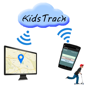
KidsTrack
Fake GPS GO Location Spoofer Free
Road Warrior Route Planner

GPS Fix

GBookmark

SCANN3D
Save Location
The most popular reviews in /r/GoogleMaps:
Might be a something that caught a very strong glare for the photo. might be some kind of glitch in he data pipeline. Bing maps shows nothing there: https://www.bing.com/maps?osid=9a085076-5bb5-4ca4-96ac-1d3c5b98eb52&cp=-15.316554~-75.08958&lvl=19&style=h&v=2&sV=2&form=S00027
Most likely because the homeowner requested it—which is pretty easy for anyone to do. From Google Street View’s Image Acceptance and Privacy Policies:
> Blurring policies: […] If you see a face or a license plate that requires additional blurring, or if you would like us to blur your entire house or car, submit a request using the Report a Problem tool. Please note, however, that once Google blurs an image the effect is permanent. If you submit a request to have your personal home blurred from Google Street View imagery, all historical and future images of your home will also be blurred.
Using data from Streetview website, I drew on the map the minimal coverage that should be published for Kenya. By minimal I mean the listed towns and the major roads between them. Since they actually listed regions and not towns, maybe they'll cover more (I hope so). But looking at the coverage for Ghana, Senegal and Tunisia I'm not sure they will cover a lot of things.
As you can see it will probably miss a big part of the country in the north (which is emptier, and probably security concerns near Somalia and South Sudan). I think we can also expect some trails in Mount Kenya NP since they covered towns around it.
For interested people, the data I found is HERE.
This is the file that list all locations (past, present and few future) where Google sends cars. You can find interesting things there, like India (which was planned, but Indian government blocked the publication of pictures) or new Austria coverage. It's used for the list visible on https://www.google.com/streetview/understand/ but only lines with the entry ""publish": "Yes" will be in the list.
Not that you're likely to run into any trouble, but that's probably illegal to do with Google. And you'd be better off using OpenStreetMaps anyway - the data is open and flexible, so you can do stuff like this pretty easily:
- Go to openstreetmap.org and frame your place
- Choose your favorite "style" with the layer button on the right
- Under the "share" menu, download the area as an image. One of the format options is SVG - use that.
- Open the image in a vector editor (such as Inkscape or Adobe Illustrator), and delete whatever elements you want quite easily, and even add labels and such if you'd like.
- Export the cleaned-up image as a bitmap/raster image
Cleanup may require a little doing because it seems that each letter is an individual element, but still better than trying to erase them otherwise.
This works because SVG is a vector format, meaning all the roads and labels and such are still separate shapes and not "smashed together" and rendered into a flat image, so you can edit them individually.
Well done! How did you find that?
A few other quick google results, which provide more information:
http://wikimapia.org/9651563/Chabrier-Omega-Transmitter-Station-E
Here's a video of the demolition of one of these radio towers (although not this one, I think): http://wikimapia.org/9651563/Chabrier-Omega-Transmitter-Station-E
Oh wow! I've actually read that article before. Never ever would have thought to go find the spot though. That's awesome that you did. Have you seen this? https://www.amazon.com/Pink-Floyd-Story-Wish-Were/dp/B07ZPHT6G2/ref=sr_1_15?dchild=1&keywords=wish+you+were+here&qid=1623328624&sr=8-15 If you haven't and you're a Floyd fan, I highly recommend it. It was one very bizarre part in it that in 25 years of being a huge fan I had never heard about. I'll leafe it at that so as to not spoil it in case you havent seen it.
OK, then it's not really a Google Maps issue.
It will either be hardware or software. You might need to wipe your phone and reload Android, but that's a bit drastic and you might want to try other things first.
This app used to help, but from it's current description it wouldn't seem like it would. Try it and please report back if it made a difference.
https://play.google.com/store/apps/details?id=com.eclipsim.gpsstatus2
I too have never really had issues, but after putting a new OS on my phone I suddenly did have issues that manifested itself as drift/mislocation in Maps. I found out that an app I'd installed for other reasons before I wiped my phone is what many with similar issues use as a solution; so I put it back on and haven't had issues since then. Try GPS Status, the free version should be all you need. It acts as an interface between your GPS and GPS requesting app; you should notice it appearing in the status bar when you use an app that uses GPS. I've had no issues since then.
If it solves your issue I'd love to hear back so I know whether to recommend it to others, and also so I can mention it to Google as something for them to look at adopting.
I'm not an expert. I think it works like your eyes. With one eye you can see an image. With two eyes your brain can 'see' depth; your brain can calculate where an object or point is relative to your position. My cats do the same when they want to jump: they move there heads to estimate the distance.
Google takes a lot of pictures from different angles and calculates where points/objects are so it can present it to you as if it's 3d.
Googling 'photogrammetry' or 'aerial photography 3d mapping' might give you a better answer then mine.
Or try https://play.google.com/store/apps/details?id=com.smartmobilevision.scann3d to do it yourself.
There isn't public transit live navigation as there is for walking and driving and biking. I wish there were! You should try Moovit through; I installed it for a while but eventually went back to Google Maps, despite the lack of live transit navigation. Perhaps you will like Moovit better than I did!
First, the phones will need the My Maps app installed: https://play.google.com/store/apps/details?id=com.google.android.apps.m4b&hl=en
Create a new My Map in someone's Google Drive, then share it with everyone involved. Make sure you allow them to edit the map! When they log into the My Maps app, they can go to the hamburger menu and then select "shared with me" to find the map, open it, and drop pins on it.
One downside is that it won't show you who dropped each pin, but if you specifically tell each person to add their name/initials in the description box for each pin, you'll be covered.
Do you mean that tower in the distance? I was wandering around that same area on Street View a few months back.
If you zoom out to map view, then look in that direction you can find this: https://goo.gl/maps/BrgALfR8zdB2
So if that's what you meant, it's an observation tower in China: http://www.tripadvisor.com/LocationPhotoDirectLink-g1152390-d1851568-i85439948-Fangchuan_Village-Huichun_Jilin.html
I don't have a google maps solution but ill share how I create custom GPS navigation routes for biking. I'm sure it can be used for walking as well.
First I use the website https://ridewithgps.com/ on my PC to create a route or loop I want to go on. It's very easy and free and shows you elevation and distance and all that. I then save and export the file to my google drive to a folder I created just for routes. This is for biking but I can't see what difference there would be walking. A route is a route.
From there I use the free android app OsmAnd which is very customizable. I can import the route from my google drive to the app and that gives me turn-by-turn navigation for my rides. It can be used for walking too. What's nice is all the routes you import over time can be easily brought up again.
If you have any questions let me know.
Use wikimapia http://wikimapia.org/#lang=en&lat=29.277640&lon=31.238594&z=15&m=b&search=29.2782185N%2C31.2474457E
it's pretty handy. Also if you contribute with your known places, you'll increase the awesomeness of the tool to others.
It seems to be adjacent to a lake. Wikimapia calls it a reservoir, it may be drinking water, so maybe there were concerns about it as a terrorist target because it's so close to the border? Just a guess.
It could be something like Windows updater or some other 3rd party software on your PC that automatically updates all your programs. Here is a suggestion. Verify what version of Google Earth is currently installed, uninstall it and look in your downloads folder for a previous version and install that one. If you can't find it you can download previous versions from the internet. I use File Hippo - https://filehippo.com/download_google-earth/. To the right are all the older versions. *disclaimer - if you have any saved maps, images, KML or KMZ files then make sure you back those up before deleting or reinstalling a previous version. Lastly, find out if you have auto update enabled anywhere on your PC and make sure it's disabled.
/u/PalCsoke is right but I want to expand on it a bit. You'll mostly see it on businesses that aren't really taking the reins in regards to their online footprint, but it can also be indicative of businesses that either a. no longer exist b. never existed in the first place or c. already have a claimed listing, but someone mistakenly added a duplicate.
If someone claims the business, Google will send a postcard to that address with a code on it. The business would then go to the URL on the postcard and input the code to confirm they are running the business at that location. A random person would not be able to claim the business as their own unless they staked out the business' mailbox and pilfered the Google postcard when it arrived.
When you confirm your listing you're actually creating a Google My Business account. This allows you to customize your listing and to interact with customers in various ways. It extends well beyond Google Maps. There's even a whole other subreddit for it.
Bing has worse aerial imagery there, and the reflection doesn't show up. I can't see anything on the roof that might 100% identify the source, but the resolution is too low to really see what's there.
Nevertheless, have a look for yourself:
That's weird. Did my link work or just take you to search?
https://www.bing.com/maps?osid=861c8351-32bd-41bd-a707-7a6ef5fed60a&cp=28.685124%7E-81.150771&lvl=21&style=v&v=2&sV=2&form=S00027
Same with this?
https://www.bing.com/maps/
I don't think it'd be blocked anywhere that reddit would work
Google doesn't save up imagery to release it in one big batch; it releases it when the processing is done. The processing starts right after the imagery was taken. There is new imagery taken and posted daily, with the locations constantly changing.
You can see where they are currently collecting imagery at https://www.google.com/streetview/understand/.
Report it to Waze instead. Google owns Waze and road closures reported on the latter will be reflected on the former.
There's a dedicated team working on it right now that you should help out: https://www.waze.com/forum/viewtopic.php?f=129&t=236437
Yeah, everyone and their mother and their grandmother and their great-grandmother hate Maps Lite, but Google apparently doesn't give a shit. I've actually really been loving the OpenStreetMap site's look, but don't know about its directions/search functionality. But between that and other map sites, I think I will not be using Google's new shitty product.
You're going to be hard pressed to find one that exports to video of any kind. If you found one that does the animation and you just need to record video of it, you might try ShareX. Free, great quality, and easy to use. I used it to record some Google Transit demonstrations.
There is also driving mode, which used to have an easy shortcut in the app but now is buried and hard to find.
This shortcut makes it one click and you're good to go.
https://play.google.com/store/apps/details?id=com.keigun.drivenowshortcut
Perk
Yes
On a mobile device you want the Google app called "My Maps"
eg https://play.google.com/store/apps/details?id=com.google.android.apps.m4b
On a desktop, you want to start with Google maps, hit the menu, then YourPlaces (in third section), then the tab called Maps. At the bottom of the frame you should see "Create Map"
Whichever account is currently showing in the hamburger menu, is the one that your searches and timeline will show for. Make sure your main account is always showing in that menu.
On a side note, my wife and I used to do this, it became a massive pain, so we stopped. For keep, we just use a shared note for our shopping list. For bills we switched to an app called Prism which organizes and let's us set our bill pay through one app. We've had our current setup for a few years now and it works really well.
I would also advise setting up your family share for Keep, calendar, apps, and Google purchases.
You need to submit them through the Street View app: https://play.google.com/store/apps/details?id=com.google.android.street
When you import a 360 photo you'll have the option to set an exact location if it isn't already in the image's EXIF data. You can also opt to attach it to a place listing as well, but it isn't required.
Yes, you can
Did you take it with the Google Photos app?
To include them in Maps you need to instead use the Street View app. The photosphere camera is also built into that app.
The newest version of the Street View app includes the ability to import any photospheres it finds on your device that were taken with the camera app.
It's not dependent on GE being installed. They used to require a plugin to show 3D Earth content in Maps (which I believe did require GE to be installed) but now they do it purely in Web GL, no plugin required.
Those links I gave you do change a "setting" so to speak. If you click the lite mode link, Maps will open in lite mode on your browser from then on. Same for the link to the Web GL version. Note that this is a browser/cookie-based setting and is not tied into your Google account in any way.
It's possible you may have enabled lite mode on your desktop at some point in the past and just never noticed. But if you go to that Web GL link on your desktop and still get the flat satellite view, it's because Web GL is either disabled in your browser or your graphics card/drivers don't support it. There's some good information here about it: http://superuser.com/questions/836832/how-can-i-enable-webgl-in-my-browser
Personally, I prefer lite mode so I can see the latest satellite imagery in Maps. If I need to see 3D buildings/terrain I can just open up the actual Google Earth app.
So Google services are usually super, super data efficient. My guess is that it's probably not even one of the most data-consuming apps on your phone, even if you have it open the most.
There are apps out there, that will analyze the data each app is using: https://play.google.com/store/apps/details?id=com.mobidia.android.mdm
A basic way you could test it with an app like that, is delete your saved map, disable offline data, and do your drive. Then before you do that same drive again, then downline the offline map, and reset the data on the data usage app. And then compare the results.
That won't fully answer your question, but it will give you a very rough estimate of what percentage of data that offline maps is saving you.
You can hike by moonlight for a few nights after the full moon.
I'm reminded of one of my favorite travel memoirs, <em>Looking for the Lost</em>, in which the author explores a region of Japan on foot. Alan Booth wrote two such books in his life in Japan. In the first, he walks the entire length of Japan. The second is concentrated in a certain area, the site of certain folklore. Can't recall the name of the first book, but the second is a masterpiece, full blown, and I love to recommend it.
Self-powered travel is noble and glorious.
According to historical imagery in Google Earth desktop it happened between Dec. 2006 and Dec. 2007, so I did a search for "wisconsin tornado 2007" and yep, that's it: https://weather.com/storms/tornado/news/tornado-scar-wisconsin-10-years
https://www.apkmirror.com/apk/google-inc/maps/. Version 10.6.3 is the last to have the compass. I'm still using it and won't be upgrading. Compass is too valuable.
It's not available in navigation mode anymore although it's still accessible in driving mode. They really should have added an option to toggle that compass on and off. I had to downgrade to version 10.6.3 to get it back. Downloaded it from here. https://www.apkmirror.com/apk/google-inc/maps/
Dunno, but I bet it's related to the 'Liberation School' just to the East http://wikimapia.org/#lang=en&lat=31.405700&lon=20.559776&z=16&m=b&show=/25250135/ar/مدرسة-التحرير&search=31.407753%2C20.537564
Unfortunately it looks like the OSM data is a bit weird in Fresno. Individual properties are laid out as residential areas, but most building outlines are missing in the area of interest.
First a general way for all Waze users:
1) Tap Orange Dot in the lower right of the screen
2) Tap Map Issue in the menu options
3) Tap Map Issue (left side of screen)
4) Tap type of Issue (General map error is fine)
5) Optional - add a comment if desired describing the problem
6) Hit send.
Note instead of step 2's Map Issue, you can report a closure via Closure and select the arrow going into the intersection. This will prevent your app from routing you through that street and if enough people report it this way it closes for all. An midlevel editor can get it added very quickly in the WME (Waze Map Editor).
If the editor needs more information they will contact you via the report. If you signed up for emails you will get it that way but don't reply via email since that returns to a no reply trash can. Reply via the app's inbox or go to the location in www.waze.com/editor
​
I'll also send you a link to the Northern Region Discord Channel where the Pennsylvania Editors are easily reached.
​
It normally takes a few days for any changes to reach the map for changes to road configuration. Closures are almost instantaneous to be added or removed if the road segment is already in the app.
Listed on OpenStreetMap as Ajdabiya river water tank. Looks like it's part of this project.
This below is a close up of a entry/exit point. It's worth noting that it is busiest highway in the country
Instead of something a little proper like this below
I've had the best luck editing OpenStreetMap. You can designate the type of road (public, private, walking, etc) and we've seen Google ingest the data and changes periodically. More importantly by marking roads with the proper distinction Google will not route public traffic using those paths, but if you are on your property it will utilize the appropriate roads.
Very nice, Thank you very much for that ;)
A quick google and some more info can be found on their page here -> https://www.android.com/auto/
​
Works beautifully !
Probably a logging area. Pull all the logs to the center, then have one route to pull them out.
You can see a similar radial pattern of logging scars in Louisiana this aerial photo. And the Mallard Grade Trail which runs along the site "was originally a railroad used to transport logs".
Hello,
Businesses and organizations should not be adding themselves via Maps, but should use Google My Business.
As for why categories in Maps or Business are limited and not whatever you want... that's because they are categories, not keywords. Imagine trying to find something on the map if they could use absolutely anything rather than standard categories.
Do you have a smart phone with GPS and can you install MapMyRide? Or RunKeeper, which can also be set to track cycling. Using that would allow you to check the actual distance and your speed.
I came across thisArticle
it looks kinda better on bing maps, the black thing is blue on there
https://www.bing.com/maps?osid=68f4e50b-ed25-47f1-ac4d-7b3410d4900a&cp=38.714964~79.855738&lvl=19&style=h&v=2&sV=2&form=S00027
You can see it on Bing Maps.
I can only assume that the censorship is a result of blending older (higher magnification - no structure) and newer layers of map tiles.
Bing Maps has much clearer imagery for that area, but it doesn't allow you to enter exact latitude or longitude, and some of the area is obscured by clouds.
Not much infrastructure there- I wonder if this was a dispersal base for a Long Range Aviation bomber regiment, or something, during the Cold War. I can't see anyone parking big airplanes there for the long term.
Edit: called it! I think. Apparently it would also have served as an emergency landing site for Buran (the Soviet space shuttle).
Any map I'm finding clearly shows the fort 3-quarters of a mile north of the 45th parallel, even the Wikipedia Map. And as I'm reading the article, it seems to say that the 1842 Webster-Ashburton Treaty changed the definition of the boarder so that the old lines would be used, even though they were a little north, and that this gave to the United States Island Point, upon which construction of the old fort had started, and upon which the newer fort sits today.
probably not. If the government would concern about the privacy issues, they would not allow to drive street view cars by Yandex Maps or Belarusian company called Interfax either without automated blurring people’s face or license plate.
Driving around in Iraq and taking pictures is dangerous.
In Germany, the government requirement was that any house could opt-out of pictures _before_ being published. Google built a UI to do this and many people used it, so that the resulting imagery in the few cities that Google published was spotty.
The amount of labor in guessing which house should be blurred and doing so from every angle made "Blur"many not worth the effort back in 2011.
Either software has gotten better, or Germans have gotten more reasonable... Google is driving Germany right now: https://www.google.com/streetview/explore/#sv-headed
Here's a good place to start - it gives you the guidelines for how your picture should be handled, etc :
​
https://www.google.com/streetview/earn/
​
There are some links on the page, as well, that point you to the Street View app and interaction w/ Local Guides. I haven't read it all, but I was browsing the other day and saw this page.
​
Placemaker which is a Sketchup plugin provides you a licence to download the HR aerials. Now for vectors all you need is OpenStreetMap, and Placemaker uses that as well to provide steets, water, and usually simple building models.
Well, looks like some folks have already started, and now it's starting to take un-named road submissions:
Please upvote and approve changes:
https://mapmaker.google.com/mapmaker?gw=39&fid=0x880f01cd33a856b1:0x1c4ed0a3354796c5
Here's the street view with sattelite imagery and correct routes. :
https://www.openstreetmap.org/edit?node=4705784275#map=18/41.91566/-88.20550
hi to everyone in here and mister blue and giovann198p and nath.an and Benica11 and Jenny Edison and Necla Goturler and Geomat my league of theme parks is up and going right now so if you want get in a play it right now you can. https://www.geoguessr.com/leagues/pzQrF3hmXoK8FKTs
Yes, exactly, having GPS in a desktop computer would make no sense at all. GPS requires a clear view of a large portion of sky so that there is nothing between four or more satellites and the device. It's preferred that the satellites being used are as far apart as possible. GPS is just plain not intended for indoors or even close to buildings.
OP, your computer does not have GPS. if it does have wireless do you have it turned on? Again it doesn't matter if you're connecting with it, it matters if it's on. If it's on then it will be looking for nearby devices to help figure out where it is located; and if somebody has moved a device, whose location was already known, from a distance away to close to your computer then that could fool Maps into thinking that you're close to that device since that will then be one of its few indicators as to your location.
Try turning off your WiFi. Also, tell us if this shows your correct location, and if not how far away is it? https://tools.keycdn.com/geo?host=199.7.159.51
It being Qualcomm related would explain why One Plus devices are also experiencing these issues.
Im going to try using this app as a temp-fix for now and see how it goes:
https://play.google.com/store/apps/details?id=com.androidlab.gpsfix&hl=en_US
Maps does not just say "in 500 feet", it also warns you just as you approach the turn. The only time I've had trouble with it not doing so is when I was using an old phone that couldn't keep up; is your phone perhaps lagging? If so there are versions of Maps made for such phones, look for Google Maps Go and then as a separate download there is Navigation for Google Maps.
There is an app for this.
https://play.google.com/store/apps/details?id=com.levionsoftware.instagram_map
Haven't tried it lately but it was pretty good when it first came out. Only downside I remember is that you have to download your location file to have the location data.
I have been using two apps when I visited the USA. it was very difficult to find ATMs and other tourist spots with the google maps so I downloaded two apps as a test to check which one is the best one among both. One was waze app and the other was Voice GPS Driving Directions. I have found both very good and keeping both as my daily guides.
Install the tried and true Google Earth.
Draw your route. Right-click on it, on the left pane, and Save as .Kml file.
Install this fine Android app. The are others...
Import the Kml file and start navigating.
Finding the best app for you is the hard part. Just look for one that accepts kml import and real-time map navigation along the route you draw.
Highly recommend this app: https://play.google.com/store/apps/details?id=com.dan.timetoleave
It's super reliable and customizable.
Google Now used to have this feature, and it was awesome. I occasionally get a TTL notification from Maps, but it's not reliable.
Offline google maps blows.I got tired of it and installed this.Night and day better.I downloaded all of my province(Ontario)was just 150 MB approx.Interface is much better aswell.
https://play.google.com/store/apps/details?id=com.navigation.offlinemaps.gps
The map is dynamic.. it's constantly updated. There are no incremental releases of the data; so if you're getting data then it's the latest data.
Of course you run the risk of it stopping working completely one day. And you won't get some of the latest features.
Have you tried Maps Go? Go is a series of "light" apps that Google makes for those whose phones might not be high powered.
https://play.google.com/store/apps/details?id=com.google.android.apps.mapslite
Make sure your GPS hardware is even working:
https://play.google.com/store/apps/details?id=com.chartcross.gpstest
If it can pinpoint your location correctly, then you can go back to Google Maps to figure out it's problem.
Ha, I think I know exactly where you’re talking about.
The way Mexico City’s shops tend to be organized actually has a rather interesting history! The roots go back to the city’s earliest days, before European contact and the conquest of Cortés. Quoting from Gods, Gachupines and Gringos: A People’s History of Mexico:
> Although the native peoples lacked some of the technology of the Europeans they were by no means primitive. [...] They had a complex market system. While men dominated business, women ran the markets. Then, as now, shops selling similar goods would be on the same street. Today in Mexico City, businesses along a single street still specialize in one product: a street for office supplies, another for self service copies and camera equipment, another for eyewear and optical examinations, and yet another street for wedding dresses. Calle Miguel Schultz has funeral parlors.
This is a late reply, but if you're using Android, check out ScoutLog - it lets you save map pins along with a title, notes and photos, and you can organize them using tags. All the data is stored on your device so you don't need internet to access them, and you can share the location to another app for navigation. It also supports syncing the data across multiple Android devices and the PC via Google Drive.
Edit: You can also import all your current Google Maps starred places by going to https://www.google.com/bookmarks/, clicking "Export bookmarks", then moving that file to your Android device and sharing it to the ScoutLog app.
As far as I know, Google Maps starred places is a pretty limited feature. I'm working on a location bookmarking app for Android called <strong>ScoutLog</strong> which lets you save places along with photos and notes, and categorize them with tags.
If you try the app out and like it, I'm working on a good way to import starred places from Google Maps, but that feature probably won't be out for another month or two. If you want to import starred places into the app now, you can do it manually and I can walk you through the steps.
Actually, I just did a quick test and I don't think this method will work for you. For one, while My Maps layers can be displayed in the Google Maps app, they aren't displayed in Navigation mode. You'd have to select a stop, choose navigation to that stop, go there, exit navigation, manually select the next stop, etc. Way too much of a pain in the ass.
I don't think you're going to have any luck finding anything that will work in Google's own Navigation. You're going to need an app that - even if it relies on Google's data - uses its own navigation and allows you to specify your own custom routes/markers/overlays. The closest thing I've found (that doesn't have across-the-board abysmal reviews) is Road Warrior. You'll need the pro version ($5/month or $50/year) for stuff like syncing across devices, but you might at least give the free version a shot.
One way to do this may be with Google's My Maps. Which is their map creation tool. You can add points and label them how you like. It used to be a part of the main maps provision but now it's more hidden.
You can then find the map you've made in 'Your places' in the Android app, or there's even the My Maps App.
It seemed to be easier and better when they were more closely linked. You can't use streetview while you're making a map in My Maps