
What are
/r/CampingandHiking's
favorite Products & Services?
From 3.5 billion Reddit comments
The most popular Products mentioned in /r/CampingandHiking:


The most popular Services mentioned in /r/CampingandHiking:
AllTrails
EveryTrail
Google Docs
OpenStreetMap
TripAdvisor
Instructables
Costco
Google Maps
Roadtrippers
Flickr
Wikitravel
Vimeo
Wikimedia Commons
Imgur
Meetup
The most popular Android Apps mentioned in /r/CampingandHiking:
BackCountry Navigator TOPO GPS
BackCountry Nav Topo Maps GPS

Hiking Project
GPS Logger for Android

Glympse - Share GPS location

Maps & GPS Navigation — OsmAnd

Real-Time GPS Tracker 2
KidsTrack

Avenza Maps

My Tracks
TrailLink - Trails & Maps

what3words

Family Locator & Friend Tracker
GPS Reset COM - Navigation Tools & Repair
US Topo Maps Free
The most popular reviews in /r/CampingandHiking:
At the VERY least I’d pack a clotting sponge. 0.32 oz can keep you from bleeding out. QuikClot Advanced Clotting Hemostatic Sponge to Stop Bleeding Fast, 25g https://www.amazon.com/dp/B00HJTH0DA/ref=cm_sw_r_cp_api_suWUAb8J7CX8E
Yeah, except there’s a Rep in Utah who wanted this to happen so that it can be used for development.
“That's the big rub for Bishop. A national monument designation generally means new development — like oil and gas drilling, expansion of cattle grazing — is off limits. Only the existing leases that are grandfathered in can be developed.”
I'm a stickler for trying to get colors right.. it can be a struggle sometime. The colors around sunrise are often subtle, but beautiful. What I really love, though, is the interaction of light & shadow on snow as the sun rises in the sky on a clear day. Even if it's cloudy, though, it can still be fun.
Ah shit sorry hah, sno seal, I knew it was sno something had to go back and check.
Bake the gloves at the lowest setting for a dozen minutes or so to open them up, then lather that stuff on and keep rubbing in until nothing will go in anymore.
I skied in -10 base temps, -20 mountain not including wind chill with Kincos covered in sno seal, hands didn't get cold at all...
Meanwhile, half the planet away. It looks almost the same:
https://monosnap.com/file/EsoImgLGwTASJVQFePC0Ww4LiSdFhj
West Texas USA (although the mountain in the picture is across the other side of the Rio Grande River and it's Mexico)
Do yourself a favor and pay close attention to the length of the hammock body. 11 ft (132 in / 335 cm) is the recommended length. I haven't found a single hammock on Amazon that long, and there's no need to buy a short chinese hammock when you can buy an American made 11 ft long hammock for not much more, and it'll probably weigh much less than the Amazon hammock too. Here's an example that's just $42. If you really want to get into it, visit /r/hammockcamping for some recommendations. The only problem with that sub is that they're snobbish and won't recommend anything on Amazon even if that's the best option for you, like if you're slightly shorter than average and will only hammock while car camping where bulk and weight aren't issues, then this hammock is a good value and very easy to use.
Not sure if the one in OP's picture is San Antonio hot springs, but imo San Antonio Hot Springs are the best in the Jemez area (and possibly the best geothermal springs in all of NM). Note - it says 0.6 mile trail, but that's only if you have a high clearance vehicle that can make it down the shitty road. A lot of people park near where the shitty road meets the paved road, and they walk the 5+ miles. SA Hot Springs is actually hot (extremely hot) relative to Spence and McCauley which are more 'warm' springs.
https://www.alltrails.com/trail/us/new-mexico/san-antonio-hot-springs
Ha! I actually follow the artist who I think was commissioned for that design on dribbble - I definitely drew inspiration from their design and a couple others.
Edit: found it!
Also, consider what kind of underwear do you have. I really love these Exofficio Boxer Briefs, I wear them every day and they are less stinky on the trail than normal underwear. They are super expensive, but oh so worth it. Incredibly comfortable as well. You can get them for less than $20 if you find the ones on sale on amazon, or sometimes can get good deals in packs of three from places like Massdrop. And you know that is a referral link from my Massdrop account.
Near Forks so probably vampire or werewolf related. AllTrails shows the Rugged Ridge to Indian Pass trail nearby. There are several other un-named trails on gaiagps as well.
We're visiting from Vermont, where we essentially live at sea level, so we did this hike on our sixth day in Colorado. We've been sleeping at 9,500 feet in Breckenridge and did a couple of hikes/nature walks earlier this week to acclimate for the 14er day. We initially planned to do the entire Democrat, Lincoln, Bross route, but by the time we reached Mount Cameron, about a half-hour shy of Mount Lincoln, the weather was looking bad. We turned back and descended in some freezing rain, but the weather was clear again down in the meadow below. Great hike! We'll be back for more 14ers, for sure.
- Replace the nalgene bottles with smartwater bottles.
- Ditch the sawyer water pouches (because they will break). Get a Cnoc pouch from litesmith instead.
- That pillow is absurd. Look into a Sea2Summit UL pillow, a litesmith cheap pillow, or a cheap amazon knockoff pillow.
- Ditch the lifestraw (it's absurd anyways) and only bring the sawyer squeeze. Maybe bring a few micropur tablets as a backup (and bring a spare sawyer o-ring).
- Ditch all of those glowsticks and flare.
- Ditch the paracord.
- Get a much smaller first aid kit.
- Ditch the hatchet, knife, and definitely get rid of the gun.
- I don't know what backpack that is, but it probably weighs too much.
- Are you going to eat that emergency ration? or is it just a backup? ditch it.
- Ditch the SAM
- Whatever that circle thing is on top of the tylenol you can go ahead and ditch also.
- Same with whatever the hell that orange thing is on top of your tent, ditch it.
- Also the orange thing under the gun, ditch that too.
- Get a lighter sleeping bag. 28oz for a 55 degree bag is kind of absurd.
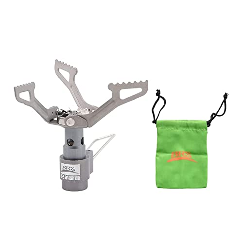
- You have a fuel can but no stove/pot. I recommend the BRS3000 and this
- Seriously, bringing a gun to a hiking trail is 110% unnecessary and only serves to scare the people around you (ruining their trip). Don't bring it. Bring bear spray instead if you are afraid of animals. Bear spray will work better, anyways.
Here is my gear list. I've posted it before, but I'm so proud of how I've recently organized everything I had to show it off.
I just realized I meant to say Uneva Peak, not Ute, sorry. Here's the route I took in case it's still useful. After turning right at the loop the campsite was located next to the lake running along the other trail.
I use one of these.
I call it my “Shenis”.
I did some googling... apparently the Street View app has similar photosphere functionality?
https://play.google.com/store/apps/details?id=com.google.android.street&hl=en
> create photo spheres to add your own Street View experiences. Start with your phone’s camera or add a one–shot spherical camera (like the RICOH THETA S) for easy 360º photography. Then, you can publish to Google Maps to share your photo spheres with the world.
I'm surprised to learn both that there's a dedicated street view app, and that it has a built in photosphere feature...
...typical google with their incoherent approach to software support...
Hi I used google earth to import Image as overlay. great way to position it right, scale it and set the transparency.
Then draw the outline as track and save as klm file.
Then convert to gpx file and upload to your device
I own a garmin oregon gps but this time I tried to use my phone. downloaded random android app called gps compass navigator https://play.google.com/store/apps/details?id=com.evo.gpscompassnavigator&hl=en and ended using only that app. Alternitive app that I use is the wikiloc app https://play.google.com/store/apps/details?id=com.wikiloc.wikilocandroid&hl=en paid version since I have hundreds of my trails there.
This was right here near Lake Quinault in the Olympic National Forest.
I was actually here with a search and rescue team, but I was the furthest one out in the field, so I had a nice unobstructed view. On the other side of me is like 100 people's campsites :).
EDIT: Here is a view facing the other way: http://i.imgur.com/R1ow8.jpg
Have you tried polesforyou.com? Not only is it a central European dating site, but you can also buy tent pole replacements there!
I don't know if they can match the color, however.
4 day 3 nights and 1st time in Trinity Alps which was glorious. Info and pictures from my recording of the journey below.
Check out my activity on AllTrails. https://www.alltrails.com/explore/recording/stoney-ridge-to-granite-lake?p=19369179
My brother has a DUI. Recently he told me that because of the DUI he would be unable to enter Canada for 10 years.
Because I don't like anecdotal evidence, the internet corroborates his story.
A Canadian official website says that you can try to apply for a waiver, though.
I'm no expert, but that alligator doesn't have enough teeth. They usually have 80, and I can only see a little more than half that number here. Since they can regrow them many times, I wonder if this one is very old, or perhaps there is something environmental affecting the number of teeth.
Or maybe it got in a fight, lost a bunch, and some of the new ones haven't broken through. Like I said, not an expert... just found it intriguing.
I am from this area and like the other poster said, just have at it wherever you can and leave no trace.
A good book for anyone interested in hiking this are: https://www.amazon.com/dp/0874806267/ref=cm_sw_r_cp_apa_i_KklyFb337QT20
Honestly, no. AllTrails will eat your battery if you use it as a GPS and the maps are not good. The milages on the site aren't to be trusted, but it's pretty good for doing basic research to see what's around you. The trail reviews are also pretty good.
If you're doing anything more than a couple miles, do independent research on your own after finding one because the information on AllTrails is often wrong by a considerable amount. It's crowdsourced data and I've made corrections based on provable documents from multiple official resources all saying the same thing, just to have the corrections denied and entirely different distances put up instead... which were still wrong and I wasn't able to figure out where they even came from. Totally arbitrary numbers.
For GPS, Gaia is a much better app.
https://www.gaiagps.com/
Backcountry Navigator is also good if you're good at reading Topo maps. It's a little confusing, but good once you understand it.
For just basic tracking (no maps) I love GPS Logger.
https://play.google.com/store/apps/details?id=com.crittermap.backcountrynavigator.license
My go to app. Download the off line topo map of the area you'll be in and you're good to go. I used it just recently on a 40 mile hike on the AT through the GSMNP and had zero issues. Was able to get my position lock in to about 3m in less than 10 seconds but my phone is quite new. Google Nexus 5X.
Well i can only recommend it to you! I don't know where you live, but in Europe we have pretty cheap flight to Kyrgyzstan and it seemed to us it was the perfect moment to visit the country (still "out of the beaten track but also developed enough to be easy to visit and to enjoy). You can check my other pics of this trip here
This is the out and back 10mi hike we did. Took some altitude adjustment at first but an otherwise easy-ish hike with a crazy good reward! Fairly busy but easy enough to feel alone while staying close to town. Dogs allowed! Bring bug spray for the lower elevations, and permits for overnight use.
You're partially correct.
Most of his family, including his father called him Teedie while he was young. It wasn't until he gained popularity at Harvard that he allowed a small group of friends to call him Teddy. His father died at the beginning of Roosevelt's sophmore year at Harvard so it's unlikely that he routinely called him Teddy.
He detested it when people he didn't know, addressed him with such familarity. It's not so much that Teddy was reserved for family, more like he tolerated it with people familiar to him.
Source: The Rise of Theodore Roosevelt by Edmund Morris
I have a Klymit Insulated Static V. Was on sale for $45 on an Amazon deal of the day once so I picked it up. Pretty happy with it. Not sure what an additional 150 would bring to the table other than perhaps less weight or more insulation.
Whats the obsession of taking a quilt instead of a sleeping bag for thru-hikers? According to Amazon, my sleeping bag is only 1lbs (16oz).
I am planning on doing the PCT next year. So I wanted to know, should I stick with my bag or make the switch?
It's a loop. The northern end connects with the North Country Trail. When we did it, we did half the loop, set up camp at the Triple Fork Camp, then did a day hike along the NCT and finished the loop on the way out. https://www.bing.com/images/search?q=minister+creek+trail&view=detailv2&&id=DB2A0DEFA27DB721A0784C47206C4727E8B65EAF&selectedIndex=5&ccid=mwzo97HG&simid=608010041224594115&thid=OIP.M9b0ce8f7b1c6b8f4dd5f22f7a22117c6o0
Took this photo in Feb 2017. Bad place to be during a flash flood. Always know the forecast before you go. This is a great resource to check for flash flood warnings.
So this was part of the IAT northeast of Katahdin. It's part of the new monument park, Katahdin Woods and Waters. It really doesn't get much action as most people stop at Mt Katahdin. We canoed south about 15 miles on the East Branch Penobscot and then headed north covering about 35 miles or so by foot back towards Matagamon.
This is the map I created when planning this route. The Red line is day one in the canoe. Then the other colors are each day heading back north. Our actual route had some minor changes but this gives you the idea... https://www.alltrails.com/explore/map/woods-and-waters Also, I should mention none of those distances are accurate as I hand drew those lines on the map where I estimated the trail to be. The total trip was about 50 miles. AllTrails has since updated this area with the actual IAT trails so you can see how far off I was with my estimations.
It's such a beautiful area! Here is the hike we did in case anyone is interested: https://www.alltrails.com/trail/us/oregon/bald-mountain-from-lolo-pass-trail
I don't think you're going to find any map that isn't at least a little bit of an exaggeration on the part of cell companies attempting to sell the public on their service.
After some quick googling, I did find this website, but the information seems to be pretty limited for backcountry areas. It looks like most users submitting data haven't traveled far from roads at all. I looked in some heavily used backcountry areas on the east coast that I'm familiar with, and even there the data was pretty limited.
If you had access to a GIS software package, you could figure out the location of cell towers and then do a viewshed to approximate where good service might be found.
Ultimately, though, your best bet is probably going to be to get out there on your own and figure it out for yourself.
> If you want to go, just leave a message and tons of people would offer to go with you.
Lots of people do this for the solitude -- it's a feature, not a bug. Also, you're acting like this is the 19th century. Ever heard of these Spot GPS emergency messengers? There are lots of products like this where you can still be safe far off the grid. It's like anything that carries some inherent risk -- take the proper planning and precautions and you should be fine.
I bought one of these...
https://www.amazon.com/B%C5%8DnDry-Hydration-Pack-Bladder-Dryer/dp/B081TL2VFN
​
Throw the bladder right in the closet without issue now. No mold.
That's pretty heavy! You might want to try and shed a few pounds. A while ago some guys did an AMA about how they did the AT in under 100 days, they averaged 25 a day, and listed everything they took with them. I look at it as a kind of guide if I was gonna go ultra-light. My pack is around 25 lbs now (was ~30 before) and I found it very difficult doing 15 miles a day for a 3 day trip. I'm pretty sure most people doing the miles you are looking at do it ultra-light, which in my guess is <15lbs
Location is Reflection Lakes.
I took the picture on Labor Day weekend.
I'd probably head to south east asia. Lots of americans there already because extradition to the US is rare.
A list: http://wiki.answers.com/Q/Which_countries_have_no_extradition_treaties_with_the_United_States
Just to be clear - some inflatable mattresses are okay.
Just not the ones that car campers use that come in Queen size and are designed for use indoors.
Like this: https://www.walmart.com/ip/Intex-Queen-Dura-Beam-Airbed-with-Pump/33563031
There are plenty of inflatable pads that offer great insulation from the ground, and are also super comfortable.
I would definitely second seeing Big Bluff and Hemmed-In-hollow. There's also a cabin or two along that route if you're interested in seeing those.
For a good meal, hit up the Ozark Cafe in Jasper. It's not far from Kyle's Landing, and has some pretty good grub. One time I went they even had live music! http://www.tripadvisor.com/Restaurant_Review-g31696-d1102880-Reviews-Ozark_Cafe-Jasper_Arkansas.html
https://www.alltrails.com/us/colorado
I think this site will be the best for what you're looking for.
My favorite, though it's biased, is Mt Falcon. Not too crowded and it's perfect for getting away to ponder or be absorbed in the nature. It has a decent amount of trails.
My wife and I develop Gaia for iOS, and our colleague Abhi develops the Android app. Ask us anything :)
I'll mention we have a cool multi-layer map feature beta-testing for iOS right now - https://www.dropbox.com/s/13qod4u2u2wf1l6/gaia-layered-maps.m4v
Also, our new iOS release just came out yesterday, with new topo and aerial sources.
I recommend bringing gaiters.
Don't ditch the second source of light, just in case. I'd replace your flashlight with a tiny backup light, my one of choice is this (no batteries required): https://www.amazon.ca/Coghlans-1202-Dynamo-Hand-Powered-Flashlight/dp/B00661ELMU
Get a smaller pair of binoculars, e.g. https://www.bushnell.com/binoculars/shop-all-binoculars/powerview-8x21-compact-binoculars/BU-132514.html
Dried fruit instead of apples maybe? At least for some of the days.
Lighter rope.
No problem man, glad to help out. If you're interested in learning more of the nuisances of hammock camping, I suggest taking a gander at The Ultimate Hang Website. They've got some really good stuff there and even have a companion book (amazon link) that's a quick read, but has some really good info in it.
Sounds like you probably don't NEED the Whisperlite as you're not really taking advantage of its features and carrying all the extra weight of a Whisperlite.
There are tons of cheap canister stoves on Amazon. Since your friends use a Jetboil, it sounds like you can buy canister fuel. I currently use this stove. https://www.amazon.com/BRS-Outdoor-Camping-Portable-Ultralight/dp/B00NNMF70U/ref=sr_1_1?s=sporting-goods&ie=UTF8&qid=1510073163&sr=1-1&keywords=bsr+stove&dpID=41J7KacqzpL&preST=_SX300_QL70_&dpSrc=srch I do find it is loud, but I bet it's much quieter than the Whisperlite which IIRC is very loud.
I've never understood the advantage to the Jetboil systems. IMO, they add a lot of extra weight to gain the fuel efficiency advantage of having a heat exchanger added into it. To me, they are simply not worth the extra expense and weight penalty.
Not cheap and it'll add almost two pounds to your base weight, but this is the one that we got for one of my brothers when he was overseas. It held together well. There's a cheaper (and I expect lighter version) of just Psalms and Proverbs. There's more than enough encouragement in those two books for two weeks, so that may be a good option.
Olive oil is more stable than butter as it won't go rancid and can be kept in a bottle. Ghee is also more stable, I believe. They may be better options.
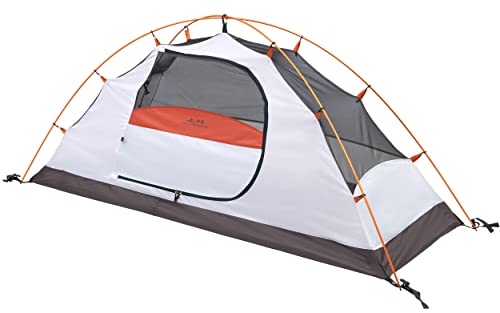
no pic. here's a link to what I had in 2011, not sure how outdated that is but it'd give you a sense. I did it again in 2013 or so and added a pound or two to my pack, mostly in the form of a 1p tent. I MUCH preferred a single person tent. I got one of those Solong ones made for tall dudes.
re-reading that list there's nothing I brought that I didn't end up wanting. Lots of lessons in general, mostly stemming from this book. Essentially think about the need, and alternatives to fill that need. Think about overlapping items and how to pare it down. Think about how happier you'd be hiking 200+ miles if you left 5lb of stuff at the trailhead and try to find ways to do that.
Birkhead Wilderness area in Uwharrie has an 11 miles loop with plenty of places to camp. You can also do a loop or figure 8 in Uwharrie national forest - here's an example: https://www.alltrails.com/explore/recording/uwharrie-dutchman-s-creek-figure-8-8c8a58f
The AT is great for beginners because there's so many established sites and predictable water. Highly recommend the Guthook app for it. Not a loop but you can easily shuttle and do the 17 mile roan highlands (several hostels on US 19E provide shuttle service).
Just north of the NC border is the Grayson Highlands/Mount Rogers area. Lots of trails including options here for 11, 16, and 20+ miles loops.
I live in the rockies and have traveled to high altitude areas without any problems. A few friends have also done the same, live in the rockies, and have not had good experiences on their travels. I have also met some insanely fit people get sick and evacuated out from the Everest base camp trek and the hike to Machu Pichu.
In summary, altitude sickness can be pretty random, and you won't know how sensitive you are until you get there. Ask your travel clinic about diamox.
If you walk, hike, or climb over 10,000 feet, only go up an additional 1,000 feet per day. For every 3,000 feet you climb, rest at least a day at that height. “Climb high and sleep low”: If you have to climb over 1,000 feet in a day, make sure you come back down to a lower altitude to sleep.
If you really want to see mine - check out my google doc for my full gear list. I just got ski's which should be my last piece of gear for a while (note - I am surely lying - there is always something else I 'need').
Added a public google doc here. Thanks for the suggestion and hope it works! It was as easy as uploading it to google (it automatically converted and only needed a few tweaks).
Hey,
I got a 40$ 2-3 person coleman and never been wet. And I use it backpacking in the backcountry
I've been through a torrential thunderstorm and down pour in the Adirondacks, not even a drip. A tight tie down, and water proofer(recommended) in the right spots is all it takes
i bought two pairs at walmart, they are the same pants. comfort waist band, 94 nylon/6 spandex. They are alittle big to size. I bought my normal size and they are roomy, but very comfortable. they are alittle narrow at the bottom, but def not skinny jeans. I wore them all day yesterday, love them.
Found the link:
https://www.walmart.com/ip/Wrangler-Men-s-Performance-Outdoor-Pant/53174868
Most of what I've read says that cutting & sucking or anything like that is a waste, and probably makes it works.
Snake kits aren't worth much if you're close enough to get medical help, but if you're 30 miles out w/o service then it's better than nothing.
Do whatever you can to restrict movement around the area, and don't try and run our or anything because it would increase the blood flow and spread the venom faster.
>DO NOT apply a tourniquet.
>DO NOT apply cold compresses to a snake bite.
>DO NOT cut into a snake bite with a knife or razor.
>DO NOT try to suck out the venom by mouth.
>DO NOT take stimulants or pain medications.
>DO NOT take anything by mouth.
>DO NOT raise the site of the bite above the level of your heart.
That's from wiki answers. Which obviously isn't a reliable source, but it's not that far off from what I've heard elsewhere.
Here's some sources that may help you: http://wiki.answers.com/Q/How_do_you_care_for_a_snake_bite_if_you_are_alone_in_the_woods_and_cannot_get_out
Updated: I should say, I'm no expert or anything. I've just lived in AZ so I've heard things 2nd and 3rd hand, and I did some googling after seeing your post. Anything I posted here came from those two sites, so take this comment with a grain of salt.
I just got an MSR MugMate for solo trips. Previously I've used a Nalgene french press, which makes a great brew, but it's overkill when soloing.
Ultralight folks just use a bandana to make "cowboy coffee".
Full album here.
I happened to run into the Lodge's chef at basecamp and he gave me a ride up to the core area, for the standard fare. Saved me a day of uphill which I'd done before. Then did the mandatory Ridge trail and made my way out over a couple more peaks and down a river valley. About 60-70km of perfect vacation in mid July.
Thanks. Glad you liked it. At the bottom of the trip report I have all the practical stuff listed: https://sites.google.com/site/flexpeditions/home/kamchatka/trip-report
Let me know if you want any further details
There's a full pack list on the second entry ("Preparation"). Here's the Google Docs link to it:
The last two columns have my pre-trip notes on some items along with my post-trip observations.
For anyone wondering, this hike is called the Makamakaole Stream hike in Wailuku, Maui. It is about 4km long out and back. It has tons of water crossings as well as bamboo forests, technical terrain, waterfalls and a pool at the base of the bigger waterfall. It’s all super green and would definitely encourage you to check it out if you’re ever in the area :)
Harriman State Park is one of my favorite spots, but you will need a car to get there. It has great views and you can even find some more technical hikes, if that's your thing. I've heard that there's a bus, but I don't know anything about that.
You can head up by train to Cold Spring, NY for a hike along Breakneck Ridge, but there's no camping unless you head over to Fahnestock State Park.
I was looking at the Harriman maps, and it looks like you can actually take Metro North to the Manitou station, hike in to Bear Mountain State Park, go across to Harriman, and camp there. I don't think there's camping in Bear Mountain SP.
Nice shot! I could not get that close to mine but it was a great vantage point. This is just north of Lafollette, TN.
I followed this guide as best I could. It isn't difficult, but dealing with all that cord can be a pain because you want to make sure you have enough to finish. I'm happy with the result though.
I got to the top of the stairs the back way (Moanalua) last week. It was really windy.
Here's the GPS trail on everytrail
you can see the radio tower at the top of the stairway in photo9
Take a trip to Pisac. Absolutely amazing views and a great hike down the mountain. We took a taxi to the ruins at the top of the mountain and took a trail to the bottom (the trail ends in the market--sort of an exit through the gift shop thing).
In Cusco, take a bus out to the Tambomachay ruins. Check them out then walk down the road to the Pukapukara ruins and the Qenko ruins. You can walk all the way from Tambomachay back to Cusco. These three ruins are less interesting than Sacsayhuamán and Pisac, but the walk down the road back to the city is fantastic.
EDIT: I forgot to mention that there is one ticket for all of these ruins (maybe including Pisac--I can't remember). Go here for more info. I didn't pay for a guide for any of this--it is really easy to figure out once you are in Cusco.
Sunset Crater near Flagstaff has some great short hikes. Walnut Canyon is also in the area and has a nice short loop trail. Stop in Winslow and search for a flatbed Ford. Petrified Forest is a good drive through with a few short hikes and is right off of I40. El Morro National Monument is a pretty cool stop with free camping. Has a great short hike where you can see Ye Olde Graffiti left by early settlers. You could take the back way in to Santa Fe and drive through the Valles Caldera area. Maybe hit up Bandelier and have a look around Los Alamos.
Give /r/roadtrip and roadtrippers.com a look.
Definitely take scenic UT12 if you are going to Capitol Reef from Bryce. Lots of scenery and pull outs and hikes like Lower Calf Creek Falls.
Oh, and check out Cedar Breaks NM, maybe on your way from Zion to Bryce. Great place to camp if Zion campgrounds are full.
If you can easily gather larger amounts of reviews you might consider Amazons Mechanical Turk to have it done for you. Will cost you some, but since it sounds like rather dumb work it should be cheap.
Just get these for soap.
6 Packs Portable Disposable Travel Hiking Washing Hand Bath Toiletry Paper Soap Sheets(Random Color) https://www.amazon.com/dp/B077NDQ58Q/ref=cm_sw_r_cp_api_glt_fabc_ZHAWE268JJG6Y3ZMPP48?_encoding=UTF8&psc=1
I use them and they are great.
I also took a regular kitchen sponge and cut a 1cm c 2cm block out of it and use that to clean my cook stove. Super light and effective.
Got some of these for a 25 mile hike for my son. He has really liked them. https://www.amazon.com/TBMPOY-Outdoor-Lightweight-Mountain-Running/dp/B07M7YH5DN/ref=mp_s_a_1_14?dchild=1&keywords=hiking+pants+men&qid=1625064929&sr=8-14
I have a few Columbia "fishing" shirts. They are button up and really lightweight. most have venting in the back and pit area. They do have a upf rating and I wear them in the hot sun to prevent sunburn. They are button up with a collar. So far they have held up great- I've used them camping, hiking, deep sea fishing, freshwater fishing, you name it!! They tend to be on the pricier side so I usually pick a few I like and drop them in an Amazon wish list. From there I just monitor the prices until one drops. You can get them in every color so it gives you a variety if you need a certain color for work or whatever. Here is a link to one if the many options on amazon. They have sportier looking ones and dressier looking ones.
Here is another one -- this one seems well vented with great pockets and a more work/sportier look to it than the other link. I actually own the short sleeve version of this one. Great buy in my opinion.
edit: Added a link. Also to clarify they use the term "Omnishade" to delegate UPF or not. It is described in the product description.
The Adirondack Mountain Club pro crew made a documentary about 10 years ago, but I don't know if it was something that was ever distributed to the general public.
I'm sure the Appalachian Mountain Club has probably done something similar, but again, I don't know if anything they produced was made publicly available.
The AMC did write the book on trail maintenance- literally. You can purchase a copy of the AMC trail maintenance guide on amazon: https://www.amazon.com/Complete-Building-Maintenance-Appalachian-Mountain/dp/1934028169/
It's less about trail maintenance and more about general management of backcountry areas, but if you're interested in this sort of thing, I highly recommend Forest and Crag, by Laura and Guy Waterman. It details the history of outdoor recreation on the east coast, with a focus on NY and New England. It's a pretty good primer on some of the major issues that recreation managers have to deal with: https://www.amazon.com/Forest-Crag-Adventure-Northeast-Mountains/dp/091014673X
Last I checked, the ASPCA recommends the "Come With Me Kitty" Harness. I have one, and I would recommend it as well. This is the only one (out of three so far) that my cat has not managed to be able to "back" out of.
I got mine at petsafe.net. I am not affiliated with any of these orgs, products, etc.
edit: for anyone curious, here is a no-affiliate link to amazon reviews of it:
https://www.amazon.com/PetSafe-Kitty-Harness-Bungee-Leash/dp/B000OBIW9Q#customerReviews
All the recipes I got from this Backpack Gourmet book. (Hint: you can look inside the book on Amazon and see a bunch of the recipes)
The lasagna is pretty much just a basic lasagna with some salsa added. I've made the spicy chicken pasta before and it is delicious. It's the first time I'm making the other two.
I highly recommend the book though. There are a ton of great recipes I'm looking forward to trying, especially some breakfast ones. And you can always just make them to eat at home, the don't HAVE to be dehydrated lol
This pack is advertised as 40L, but it doesn't look like it has all that much usable space since it's divided into the main compartment, 2nd compartment, and then two zippered front pockets. It has a hip belt, but looks like mit might just be 1" webbing, non-weight bearing means you'll be carrying all the weight on your shoulders. The site you linked to doesn't include the weight of the pack... Amazon has one that lists it as 1200g or 2.6lbs... which probably means it doesn't have any suspension. It also says it's 100% polyester, not the best material for a durable pack.
https://www.amazon.com/Brandit-Cooper-Rucksack-Large-Black/dp/B00Q6UK292
Can you attach a sleeping mat? Well, using the existing compression straps... I'd guess no, the top strap doesn't look like it can be extended enough to slip in a mat. However, with all those MOLLE attachment points, you could just attach one with some cord or accessory strap.
Amazon it has worked great so far. The feet for mud are definitely heavy for backpacking. I try to weigh the terrain against the added weight.
What's wrong with a large stainless steel hipflask? The cheap ones may rust, but you can go with stanley for instance. Just keep in mind they make plastic ones too. I wouldn't buy those.
Edit: if even those hold too little liquid for your needs, get a stainless steel water bottle off amazon. Single walled is cheaper and I don't suspect you care about the temperature of your drink. You could even tie it down and leave it in a river somewhere to chill down some.
Edit2 : here's one choice
Stainless Steel Water Bottle 500ml/750ml/1000ml Steel Water Bottle BPA Free for Outdoor Drinking, Running, Cycling, Hiking, Camping https://www.amazon.co.uk/dp/B075R8LQ7Q/ref=cm_sw_r_cp_api_i_4WS-AbJ14DWT8
Doesn't matter who your carrier is. No service in the backcountry (mostly). All you need is GPS on your phone. Now, if your GPS sucks, there are fixes for that, and maybe you can get a tech wiz to show ya how to use it properly.
https://play.google.com/store/apps/details?id=com.discipleskies.gpsreset
But you do what works for you! Nothing wrong with old school.
- Always buy your pack last, after you know what it’ll carry. Watch YouTube DIY vids about, and have a friend measure, your torso & waist dimensions.
- Always buy shoes first - professionally fit your shoes + insoles + socks at REI or a running store. Spend a full hour trying on many combos.
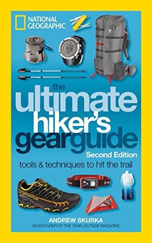
- Spend $8 on https://smile.amazon.com/Ultimate-Hikers-Gear-Guide-Second/dp/1426217846/ to learn everything in between.
- Just go. You’ll learn more by doing than on r/
Waterproof Vinyl Stickers Pack for Water Bottle Laptop Bike DIY (50 Pcs Outdoor Adventure Style) https://www.amazon.com/dp/B07R1X9K34/ref=cm_sw_r_cp_api_i_8ShrEbKCXER4J
Since I’ve seen a ton of people with ridiculous shipping costs. This is similar and there are other packs on amazon that are pretty cheap
I have it and it's served me well.
However if I were to buy again, I'd probably go with this one, just because it's more stable with a pot of water because it wouldn't be so top-heavy due to the canister being off to the side. Sometimes it's hard to find a fully flat surface out in the woods. It's just safer overall.
Can't go wrong either way though.
I like GPS Logger for Android. It's not built into OSM, but it lets you download the GPX files and you can use the data for uploading into OSM along with other purposes.
I use PDF Maps and download the free maps from the Forest Service to the app.
I like the idea of a biolite camp stove, but not for the price. Also, they are pretty heavy. I personally have an MSR Pocket Rocket, which works well, but I've built tin can wood stoves to play with around the house.
My tin can twig stoves only take a few simple tools and a few minutes to make, now that I know how to do it. I can build a really good performing stove in an hour or so, or a fairly good one in a few minutes. Since they are made out of tin cans and cost basically nothing, and since even the poorly performing ones do the job needed, I've stopped bothering to take lots of time to make them.
My tools of choice are a punch (a nail, tent peg, or similar) to punch a hole, tin snips or just decent scissors, needle nose pliers.
To improve the stove, one can make a battery powered blower to deliver air. I have not found it very needed, as I'm never in that much of a hurry to heat my water or cook. The difference between 3 minutes or 8 minutes is really nothing, if you think about it. Start the fire, then begin getting out your meal. Three minutes later, refill the can with twigs, then put the water on. Five minutes later, you've got a hot meal that cost you basically nothing to prepare and for which you did not have to carry the fuel.
The only trail that I know of that goes through there is the Appalachian Trail. There are a couple of little loop trails that go right around the bald; they're each only a mile or 2 long, and they both start and end at the parking area right at the base of the hill.
There's an AT road crossing about 5 miles north of Max Patch, at TN 107 right where it crosses into NC. Right here, if my google-fu is strong today. (pan southwest from there and you can see the big grass area of Max Patch) You could park there and have a pretty easy 5ish mile walk to Max Patch. It'll be uphill, but it's fairly gradual. A little over a mile from the summit you'll pass by one of the AT shelters, Roaring Fork, which would be your last chance to refill on water before the bald. The shelter also has a privy, which seems to be a feature that wives enjoy more than peeing in the woods.
I had no idea you couldn't camp on the bald. I know campfires are prohibited, but lots of AT hikers camp out up there. There's some spots along the AT between the bald and the shelter where you can camp, or you could backtrack back to the shelter and stay there. End of October you'll probably have the whole place to yourselves.
This trail currently holds the personal record for most water crossings in a day and longest water crossing. The really long one is when you cross the Little Missouri River if I'm remembering it right. It's a great trail, super scenic :)
If you aren't familiar with All Trails I would check out the map they have (people have marked campsite on it) and read through some of the recent trail reports. Here's a link to that particular trail -> link. Not to shill for All Trails or anything, but if you use the app you can access the map even with your phone on airplane mode. Keep the phone's GPS on and you'll have a super precise map with elevation and distance data. You don't even need the paid version to do so.
5 days sounds reasonable with the dogs. I think we did it in 3 and it was pretty strenuous.
this is something I just stumbled upon. I was trying to find an easy and cheapish way to charge my electronics for when I go to festivals. This one seems pretty good but the solar cells seems a bit small. Next step is making the larger panel to hook it up to.
I started a r/Philly hiking group, if you're interested. Also, I made this spreadsheet of hikes, which you might find helpful.
I've been to French Creek several times, and while it is great for day hikes, I wouldn't recommend it for overnights. If proximity is most important, check out the Batona Trail in NJ. If beauty is more important, head towards the AT.
My garage is my gear shed so the car is kept outside. We have 2 large racks like this. On each row there are boxes.
Row 1 - Duffel bags
Row 2 - Backpacks
Row 3 - Sleeping bags, hammocks
Row 3 - Dry Bags, Cooking Stuff
Row 4 - Water bottles/bladders, Tents
Row 5 - Chairs, 10x10 Canopy
Row 6 - Fuel, bear canisters
Row 7 - Avalanche gear, helmets, climbing tools
Row 8 - Ski equipment, snowshoes, trekking poles
Our ski's and poles are hung up on the wall and we have a handful of coolers laying around. Plus there is one 'miscellaneous' box that holds all the little stuff. All my clothes are kept inside.
It is so important to me to be organized. It makes trip preparation easy and forces rigorous cleaning after trips (which makes gear last longer).
I've posted it a few times to campit, but here is my list again just because I am proud of it.
I personally find geargrams.com limiting, but hopefully they continue to build out the site features.
Hey guys, someone suggested adding it to a public google doc (thanks yeahthisismyrealname!) so here you go! Anyone can view, no login required. Hope that helps you guys.
Posted this over in r/ultralight but it is geared more towards trip planning than just saving ounces. The idea is you add your gear and then check off what you plan on bringing. The other sheets are for planning your food and for planning the trip itinerary details. Hope you guys like it and is useful! Any suggestions or ideas for improvement are encouraged!
Edit: Public Google Doc version available here
Mine is viewable in this subreddit. I posted it a week back. You can make google docs viewable to people with the link, which is what I did.
my packing list I'm a sea kayak / multi-day camping guide
A great trail right across the NY-NJ border, in Harriman State Park, is the Jackie Jones Firetower / Big Hill Shelter loop trail. You can park on the side of the road, it's about 1 mile till a firetower with beautiful views from the top, and then another 1.5 miles till the shelter, which has nice views of the NYC skyline.
If you're looking for a shorter hike with rewarding views, just to the firetower and back is really quick and fun! The trail has a lot of ruins of an old estate on it, but there is a lot of graffitti and a moderate amount of trash, which might make it less romantic.
Either way, you'll probably want to go to Harriman State Park, it has a lot of trails, and is close to NJ.
​
Here's a link to the hike I was talking about https://www.alltrails.com/trail/us/new-york/big-hill-and-jackie-jones-mountain-loop
Spent Labor Day weekend backpacking the Pecos Wilderness in New Mexico. Here is our AllTrails route, but we opted for climbing Truchas Peak instead (13,100') instead of North Truchas due to the weather.
You don't provide much info on what you're looking for, but here's two great resources for marked trails, topographic maps, trailheads and trip reports.
https://www.alltrails.com/ https://www.gaiagps.com/
Go nuts and make your own adventure.
I believe that I took this one at Little Heart Lake, it is about midway up the trail. https://www.alltrails.com/explore/trail/us/washington/big-heart-lake-via-west-fork-foss-lakes-trail
You HAVE to go to Twin Falls Plant Reserve in Munising!! It isn’t overrun with tourists and is the ultimate hidden gem. It’s a very short hike in and out to two separate waterfalls, each of which you can climb down and inside the basins to get under/behind the falls. Way better than Munising Falls where you stand on an observation deck. View comments from the link to get proper directions! :)