
What is Reddit's opinion of
Mapy.cz?
From 3.5 billion Reddit comments
➔ Mapy.cz website
By popularity on Reddit, this Service is:
100 reviews of this app found across Reddit:
You can see the actual colours on this site.
You can see the red colour on the boats on Google as well, which suggests to me that it's some kind if camera error.
I think Český Ráj is pretty good, it has a big hiking space with lots of things to see (including several castles).
- You can get a train straight from Prague to Turnov.
- Or to Sobotka with just one train switch on Mlada Boleslav.
ps: you probably have it but just in case, I wanted to let you know that for hiking mapy.cz is your friend.
You can look on https://en.mapy.cz/, it has the parking zone colours marked as lines along the sides of the roads. Blue is residents only, purple is mixed residents and paying customers, orange is paying customers only
Radzig moved on. He built an entirely new castle just a few kilometers from Skalitz, in 1412. It was called "Veselé" ("A jolly place"). In early 1500s it is recorded as abandoned, and in 1550s it was rebuilt as renaissance chateau under a new owner.
mapy.cz offer touristic (outdoor) maps for Slovakia with marked hiking trails and “travel tips” highlighting some interesting observation decks, waterfalls, mountain peaks, etc…
A lot of hiking paths are officialy closed in winter. Either for nature protection or safety.
https://turisticky.sk/turistika/zimna-uzavera-tatry-2021/
This website has a list but I am not sure how well will google translate it.
Furkotský štít for example is closed.
https://en.mapy.cz/turisticka?x=20.0753906&y=49.1430677&z=13
This map shows which hiking trails are closed. select outdoor and display the hiking trails in top left corner.
You have to zoom in to see the trails.
I would recommend Brdy, which is a hill range south-west of Prague, very easily accessible by train (~20mins from Smichovske Nadrazi towards Beroun). You can plan a route that takes you to Karlstejn, an awesome medieval castle.
I'm not sure how much you know about hiking in cz, but it's amazing! There's a huge amount of signposted routes everywhere. You'll notice them as a colour strip (red, blue, green or yellow) sandwiched between either two white strips (walking only) or two yellow strips (walking/cycling). You can use mapy cz and switch on the "tourist" map (which here means hiking rather than tourism) and it'll show you the routes.
Once the pandemic is over, try it here. You will feel right at home. You might not meet anyone, so just enjoy the scenery. The nearby castle is a busy place, though.
The sign at 2:01 is right here.
Probably the best alternative for all the map apps I've found so far is mapy.cz (web, app, privacy policy).
Has
- route planning
- offline maps download for whole world
- offline search of places, but without route planning
- hiking maps, with height countour lines
They started originally with local maps, later added maps from openstreetmaps for the rest of the world. I've found the maps pretty accurate even in middle-of-nowhere villages in the world.
IIRC their business model is that companies pay to have info on the map, not spying on users. Also works without even having account with them, you just won't be able to use a few features like saving locations.
As a side note, I use Mapy.cz instead of Google Maps and it's an order of magnitude better for hiking, at least in my country. Here's the same location on both: https://imgur.com/a/Q3mlN5j (and here's the live map). I mean... just look at it.
Features include offline, tracker and dark mode.
There's also the "Windy Maps" app, which is basically the same app with different branding and less features.
Nakładka turystyczna jest niesamowita! Wszelkiego rodzaju szlaki piesze/historyczne/rowerowe są dobrze oznaczone - super pomoc w planowaniu wycieczek rowerowych/pieszych.
I don't know about the best, but my favourite for sure are Chlebicky Letna at the intersection of Milady Horakove and Kamenicka
Affordable = on the street. However, there are "blue zones" in many districts (districts 1, 2, 3, 4, 5, 6, 7, 8, 13, 16, 22), meaning that you have to be a resident to park there. Not sure what the requirements would be for you as a foreigner. Oh, and every district has it's "own blue zone", so e.g. if you get a parking permit for district 2, you still cannot park in district 4.
If you want more help, you need to provide approximate location where you want to park. This website http://www.parkujvklidu.cz/prague-parking/ should also provide some information. Or you can check https://en.mapy.cz/ and if you zoom-in close enough on the street, you might see blue lines on the sides - that means that there is a blue zone (no lines -> no blue zone, but it doesn't necessarily mean it's allowed to park there).
My advice is don't come to Prague with a car. If you are a student, you won't need it. Getting around Prague in a car is nonsense + parking is really difficult, and for the out-of-Prague trips you can use trains and buses (they are cheap, safe and mostly convenient).
I recommend this:
http://chalupa-kaproun.cz/wp-content/uploads/2015/06/dablova-prdel-korner-pavel-001.jpg
It is called Ďáblova prdel (Devils arse), but it is really out of hand. Personally, I have never been there, but some day I will visit it. Just for annals reasons.
Here is the map:
https://en.mapy.cz/zakladni?x=15.2584964&y=49.0876383&z=16&source=base&id=1931936
Unfortunately, no subreddit wiki, sidebar, sticky posts or other nice features... Our only mod is extremly inactive, yet refuses to nominate other mods and does just the minimal activity required not to be stripped off his moderating privileges by the reddit staff :-( .
If the app doesen't work, there is a ticket machine accepting NFC contactless cards (including Apple Pay/Google Pay) at Anděl here: https://en.mapy.cz/s/3e5sY, you'll pass it if you follow the tram tracks from Na Knížecí (the bus stop near Anděl) to the stop where tram no. 9 stops.
This is my favorite map when it comes to colors.
https://en.mapy.cz/zakladni?x=14.4193413&y=50.0945102&z=15
Worldwide it uses OSM data, has an android app with offline maps. Really good. But it lacks some Google features of course.
You can either take the metro or use the bike. From Delta, you can take the "promenade du chemin de fer", which is a nice dirt road, and then leave at the first exit (Demey), or take the Boulevard des Invalides, then you can continue on a bike lane until your destination. I recommend using mapy (https://en.mapy.cz/) to plan cycling routes (just put the route and choose MTB and it will show you a path following the best cycling lanes), it's much better than Google Maps.
By metro, you leave at the last stop (Herrmann-Debroux) and walk 1-2 minutes. Either way, it's maybe 5 minutes from Delta. I recommend taking the bike, it's fast and easy. With a folding bike, you can take it easily on the train and don't have to pay extra.
Of course you could also bike all the way from Mechelen but it's a stretch and the bike roads outside Brussels are unfortunately bad :)
Check Idos.cz, go to Turnov, then Hruba Skala, check out the chateu there, then walk on the red tourist path to Valdštejn, check out the ruined castle and then take the yello tourist path back through the rock city and thank me later.
​
Start in Nadrazi Branik (southern part of Prague) and run to Karlstejn (through Slivenec, Maskuv mlyn, Kuliva hora, Vonoklasy, Karlik, Morinka). Slightly under 30 km, elevation over 500 m. Most of it is tourist trails or dirt roads. Then just take the train back, it's fast, cheap and goes often.
Also, I suggest you use mapy.cz for planning runs like this. They have awesome outdoor layer that Google Maps don't have and you can download maps and routes for offline use in their app easily.
PS: Take enough water with you, last time I ran out of water and there is nowhere to refill.
There's a board game club Paluba near Anděl, open on Tuesday, Wednesday and Sunday evenings. They have an English Meetup page.
Vegetka – asian vegan food by weight
Sociální Bistro Střecha – vegan menu, brunches
Jídelna Kuchařek bez domova – cheap vegan menu, amazing desserts (unfortunately closed until mid-august)
There are "official trails" everywhere here, it doesn´t really mean much. If you really don´t want to sleep outside (imo much better option), just plan a route and book accomandation along with it, you can see all the accomondation options in the map. It will be a bit of a pain to plan that, but that´s just how it is.
Imo by far the best area with good accesibility from Prague is "CHKO Kokořínsko," especially the SW part. CHKO Brdy is much better suited for a bike, and really not that interesting to spend several days in (and no options for accomondation whatsoever).
Alternatively you can check https://en.mapy.cz/, there is also an Android app available with offline maps.
If you are still looking for more sightseeings or travel tips, you could also try our czech tourists map server called en.mapy.cz, they are my favourite ones.
I think that one third of total area is forests. Locally it depends how the area is hilly, so for example, north of Prague is mostly flat fields but south of Prague is more hilly and full of forests. You can clearly see it on the maps website here https://en.mapy.cz/turisticka (which is actually much nicer than google maps, at least for hiking).
I don't really know much about hunting, but definitely you can't hunt for free and you must be registered.
OK, I ruled that one out as I did not see the building with the arches... though I "looked" from the wrong angle... https://en.mapy.cz/zakladni?source=pubt&id=15212478&gallery=1
Puclice is in the Pilsen region, in the lowlands but close to Šumava (the Bohemian Forest mountain range). My grandfather (*1940) grew up 30 km from there and fondly remembers the end of WWII, when US troops liberated their village. He was given a chocolate cube and got all dirty not knowing how to eat it. The Blacks laughed at him for being the same color as them. Later, the Soviets took all credit for the liberation, though Western Bohemia was saved by the Americans.
>Siberia
The title says "Average Altitude in Europe" though. I suppose the data was taken for the whole Russia.
Check out this map, white is for altitudes c. 400m+ and there is not much of it in the European part.
Go to https://en.mapy.cz and zoom in to the maximum level. Both sides of each street are lined with the color of the relevant parking zone. Clicking the zone provides additional info.
If there are no colored lines, it means either there are no parking places or the zonal system does not apply (verify on aerial map or the "Panorama" feature (equals Streetview)).
The fire part could be a problem - it's forbidden to make a fire in CHKOs (Protected Landscape Area) and naturally, in national parks as well. You need to find a designated camping area for that (these are usually staffed and paid for, so you can say goodbye to isolation if that's what you're looking for).
Ofc you can risk it and make fire anyway, but in recent drought it's not the most responsible thing to do and also you can get caught in which case you'll be given some dressing-down and probably a fine as well.
EDIT: Ignoring all this, I can wholeheartedly recommend the Brdy area; easily reachable by train from station Hořovice or Příbram (idos.cz is your friend for finding how to get there). It's a former military training area that has only recently been handed over back to public use and as a result, it's pretty much untouched by commercial tourism. There are some very nice places like Padrťské rybníky etc and you can traverse the entire hill range in two or three days. Just be careful with that fire, ok?
Thanks a lot, that is great input!
One of the reasons i decided to do this trip was to see the Transfagarasan so its nice to hear the cycling conditions there
Here is the route that i planned - https://en.mapy.cz/s/nomujafavo - I appreciate any extra tips and comments
Thanks again
I think this is very bad generalization. Parks can be placed everywhere. Some cities have even terrain advantage. In Prague you can walk from city center outside of Prague almost exclusively in parks and forests. But that's because Prague is hilly and most of those places for parks are not suitable for buildings anyway.
At some recycling points lots of examples here on Mapy, there are big red boxes for recycling electronics & batteries - like the one shown on the far right in this picture at the recycling point next to Dejvická station.
I tried to get Mapy to show only recycling points which contained those electronic recycling facilities, but couldn't manage it. Maybe some smarter than me/or familiar with the website will be able to do it.
As far as donating the electronics, I'm really not sure. But I hope this helped.
Here is a very detailed 3D map of the Usti nad Labem region that Chernarus+ is modeled after.
The names in game seems like "germanized" versions. I think it's because they're much easier to read and grasp for not cz/sk folks.
F.e anytime you have something ending with -ice, it is -tz in German (Přibyslavice - Pribyslawitz) and so on. Most of the names kinda sound similar, but is written in german spelling. Check this 19th century map for example.
I once got absolutely shit-faced on that stuff in U Kruhu, at Palackého 6 (not far from Wenceslas Square)
Since you mentioned Czech republic, you might consider Bohemian Paradise. You can check the trails in the area - as well as other trails - using the tourist map.
Yes, as Ignotus3 said, it tends to be really windy up there, so pack a windbreaker, warm cap and gloves (even in summer, they are useful). Oh and it tends to get wet up there pretty randomly, so expect some rain showers. Also the snow tends to be in this part of Krkonoše till early summer. June should probably be fine though.
If you wan to climb using your bike from the Czech side of the border, I believe the best approach would be from this direction (used Svoboda nad Úpou as a starting point because of the train station there) But expect that some parts are really rough (sometimes you'll probably have to dismount and carry your bike up a larger rock etc.) so it is only suitable for MTB and experienced rider. Also during the summer it tends to get really crowded and you are expected to give way to people on foot and not to jeopardize them in any way (and there are some pretty narrow places).
Better approach si probably from Polish town of Karpacz I can't imagine going through Úpa valley as it is really not suitable for bike (maybe even forbidden), plus there really is a steep climb at the end. As far as I remember, going via Luční bouda (west from Sněžka) on bike is forbidden. Also going uphill from Pec pod Sněžkou (under the cable car line) is pretty impossible (again, maybe even forbidden) because of hundreds of steps on the road (they are also at the very last part of the peak). They look like this.
Keep in mind that this whole area is protected as a National park, so there are some restriction and not every location is reachable by bike. And park rangers do check the area. But it is definitely possible, I've seen people on bikes there a couple of time.
It's all right but a bit too touristy (not to the Prague's U Fleků level, of course, but still). I liked Lokál pod divadlem (https://en.mapy.cz/zakladni?x=13.3762567&y=49.7461825&z=17&source=firm&id=12963184) better.
Handball:
Talent Plzeň will be playing at home on the 11th at 6PM at the "Městská sportovní hala" (address: Úslavská 2357/75, here )
Tickets should be available at the gate, unlikely to be sold out.
Matches: http://www.talentplzen.cz/zapasy
Your list looks solid. I don't think it will fill up your four days though, if the weather is nice you might want to consider taking a day trip/hike to the Šumava mountains. The trees might still have some yellow/red leaves left which makes it arguably the most beautiful time to visit (lasts about 2-3 weeks, started last week). You can take the train from Plzeň directly south (runs roughly every two hour 5AM - 7PM, direction Železná Ruda) and get off at basically any stop after Dešenice and choose any trail that goes up the hill from the train station. For more detailed planning you can use the tourist map https://en.mapy.cz/turisticka - once you zoom in, it will show you all the trails you can use.
i think mapy.cz is better app for actually navigating than all trails(also has free offline maps). But in Doi suthep there a big network of trails. Get grab app, and bring day pack and water and go for it. The monk's trail is most popular, there is caffine trail that goes from Wang Bua Ban Pha Ngoep waterfall across the road, and Gee house trail from nong ho Monestary. https://en.mapy.cz/s/gebararaha (monk's trail)
https://en.mapy.cz/s/pobodavono (caffeine trail)
https://en.mapy.cz/s/melovogubu (gee house trail)
I would say it depends what kind of riding you're looking for.
If you want to go rather slow sightseeing then following the wineyards is nice and slightly hilly. I know the route until Weinheim.
If you want to go roadbiking with very little stops and higher speed then maybe following the B3 is the quicker option but rather with a lot of traffic.
mapy.cz let's you bike-route and chose the type of bike you're riding:
https://en.mapy.cz/s/nulepusura -> Roadbike https://en.mapy.cz/s/deledanodo -> MTB, meaning probably also some forrest roads / gravel roads included which are excluded for roadbikes
>How’s long do these take roughly. Thinking of banging out one this weekend.
really recommend these websites:
https://www.walkhighlands.co.uk/ (pick a hill there and you have several path options including difficulty and time)
en.mapy.cz (pick the outdoor map layer) the best map app with all the trails and contour lines etc.
And this is why European light-controlled intersections ALWAYS have priority signs as a backup for the lights (like this - see the "main road" signs above the lights in this direction and STOP signs for the perpendicular street). If there's a problem with the lights (which either gets noticed by the police or called in by someone else), they get switched off or marked as inactive (flashing yellow/orange) and you go by the signs instead. Sometimes the lights are even disabled on purpose to speed up traffic on the main road (which actually happens quite a lot at this particular intersection).
This photo really feels like "wow, Ore mountains really look awful in snowless winter, let's take a photo that'll make them look even worse". IRL it isn't as bad as this, even though it's not exactly beautiful. https://en.mapy.cz/s/gobahuzumu
The shop isn't duty free, they call it Travel Free and I guess it's probably vietnamese owned shop selling questionable alcohol and cheap tat.
Just a general tip: mapy.cz has viewpoints marked (and generally the map is more detailed than Google Maps): https://en.mapy.cz/zakladni?x=14.4111296&y=50.0766683&z=15&q=Scenic%20viewpoint So in case you choose to go to Petřín/Strahov or Vyšehrad this should help you find the right spot
You can usually buy commercial paper maps for hiking or biking in your area that contain the information you are asking for. There are also free websites and mobile apps that provide the same.
One common source of map data is https://www.openstreetmap.org/ which itself also offers different views/layers. You can find plenty of websites and links to apps on their wiki: https://wiki.openstreetmap.org/wiki/Using_OpenStreetMap
I (in central Europe) use https://en.mapy.cz/ (switch to Outdoor) and their Android app.
As you can see the LEGO model isn't precisely exact but if it represents Prague's Central Station and there is some park in it with some shady business, it must be the Vrchlického sady aka Sherwood.
Mhm... a v cyklopruhu o sirce 70cm si pripadate bezpecne na kole? Protoze tam vas muzou liznout treba i o fous a nic se jim nestane.
Vcera jsem se jel projet do Jiznich Cech na motorce na par mist kde se casto jezdi na kole (a plno cyklistu jsem i potkal, bylo jeste hezky) a vazne nase komunikace neumoznuji predjeti o 150cm treba autobusu kdyz maji na sirku 3 metry, viz treba tady https://en.mapy.cz/s/lalacaluko
Nemluve o mistech kde je plna cara, tech mame vic nez dost a 150cm tam proste nejde udelat ani kdyby jel cyklista ve skarpe.
Navic na tehlech okreskach jsou krajnice naprosto vymlaceny a lemuji to tam stromy - je problem se tam potkat na motorce s protijedoucim autem.
Podobna mista mame po cele republice a prekvapive jsou v mistech kde cykloturistika docela jede.
A prase te stejne porad vezme natesno, Policie to poradne nema jak resit a prokazat a jedine kdy se to bude resit by bylo pri srazce jenze pri srazce uz z podstaty veci asi doslo k naprosto jinemu pochybeni a to by i zakon 3m odstupu nic neresil...
Mno co, az pojedu na vylet s rodinou tak holt budu tlacit cyklistu pred sebou dokud z kola nespadne. Pak bude hodnocen jako pesi a muzu ho objet jako se objizdelo celou dobu.
There are fancier signs, at least most I've seen show the coat of arms and also the district like this.
Not a motobker myself, but quite common place to meet other bikes is "Pekelné doly" https://youtu.be/CQLKXhmD790?t=143
bit far from Zlín though.. https://en.mapy.cz/turisticka?x=14.2075512&y=50.6693117&z=10&source=base&id=1839494
Interestingly, I could find any mention of it except one sentence - South of Hlohová is a radio transmitter from the Ministry of the Interior. these aerial Czech maps are pretty good
Z mojej skúsenosti mapy.cz zvyknú v tom plánovači ukazovať veľmi dlhé časi oproti realite, neviem ako to počítajú. Ale mapu samotnú majú super, mám ju aj offline stiahnutú. Tá hiking mi zvykne ukázať reálnejšie čísla.
Pre úplnosť linky:
https://mapy.dennikn.sk/ - Kedysi bolo mapy.hiking.sk ale teraz us presmerúva sem
Allora posso aiutarti meno, perchè io fin'ora ho girato quasi solo le alpi :(
Ho dato un'occhiata e mi sembra che Kompass abbia qualcosa, specie per il centro Italia, fatti un giro qui e qui per farti un'idea (di solito questo negozio è ben fornito). Altrimenti, devi un po' vedere le anteprime delle cartine che ti danno su Amazon o su altri siti: vedi come sono segnati i sentieri, se ci sono le curve di livello, che dettagli ci sono... eccetera. In generale meglio stare sulle 1:25.000 che sono più dettagliate ma anche lì dipende.
Sennò mi butterei sulle app, che di solito Openstreetmap ha buona copertura (ma te lo dico senza aver verificato). Un buon sito che usa Openstreetmap eche puoi usare da casa per verificare che sentieri ci sono è Mapy.cz (ha anche un'app), così vedi se ti piace. Poi con OSM si aprirebbe un mondo, ma è meglio partire con calma :)
>OpenStreetMap
https://en.mapy.cz/zakladni?x=9.2440466&y=47.0888090&z=14 is also cool. I can see there types of elevators (cable car, skii elevator or transfer of goods)
Slovakia is like most of Europe rather densely populated so you can't get too far from people. Even though some forests are protected it wasn't always the case so you will find many logging paths or paths that hunters use. Also it's going to be summer break in a month so the nature trails will be fuller. I think it's unrealistic to expect to find no other people on the trail and it's near impossible to find no sign of human activity. I like to use this map for planning. It's rather detailed.
You could do that with a map, it just depends on the type of map you'd use.
​
For an app, my personal go to would be Mapy.cz with its Tracker feature. Don't worry, the app can be set to english, but the images are in czech.
It's quite interesting what is considered as a city in different countries. For example, some areas of Prague look like this, while Paris itself is practically only a city centre.
Wow, good question. While Prague isn't exactly in center of state, Brno is practically in Moravian corner (bottom right), closer to Slovakia and Austria borders than Prague is to Germany borders. You can of course take train and travel to Prague in about three hours.
Avoid D1 highway at any cost! There are accidents practically every day and you can simply stay stuck for hours at one place! In case you decide to travel on D1, totally use Waze as it should warn you about traffic accidents in advance and offer you better route around. I never traveled here, but I heard a lot about it and it's kind of meme here.
Of course there are other "big cities" except of Brno which could be situated in better place for your needs. It honestly surprised me that for example IKEA have showrooms only in Prague and Brno, but other buildings are just warehouses. Meanwhile Brno really looks like big village compared to other big cities here :D
BTW:
https://idos.idnes.cz/en/vlakyautobusymhdvse/spojeni/ - route planner, could be pretty useful when you need to get somewhere. There is of course even smartphone app. Finds all possible routes from place A to place B in Czech Republic. You can choose if you want to use trains, buses, trams or everything together. Our train network is pretty dense, so you can get by train even to small towns usually.
https://en.mapy.cz - Czech maps portal, have even own clone of StreetView (called Panorama) with usually more actual photos.
this advice was considered with context of e.g this place: https://en.mapy.cz/zakladni?x=14.4142602&y=50.0688754&z=20&base=ophoto - there is single lane, from right side there is sidewalk, and from left side there are tram rails, but behind kind of curb - there I tend to get decent speed and go in the middle of the lane.
> Cars already pass inches from me
where? Some two-lane road?
No, the Kingdom Come castle is Pirkštejn:
https://en.mapy.cz/zakladni?x=14.9546406&y=49.8407619&z=17&source=base&id=1702533
Kost is here:
https://en.mapy.cz/zakladni?x=15.1350694&y=50.4902238&z=17&source=base&id=1911250
Egyébként a cseh mapy is elég jó ilyenekre: https://en.mapy.cz/zakladni?x=18.4078358&y=47.5883854&z=17&source=osm&id=40364241
I usually use outdoor map, it looks nicer. For example here: https://en.mapy.cz/turisticka?x=14.4462967&y=49.8771749&z=13
Testing is for everybody. Here are all the testing sites listed: https://en.mapy.cz/zakladni?x=14.5104000&y=50.0765000&z=11&q=covid
Use Chrome, it can translate any site. Use a telephone, just ask if they speak english 💡
Not po všednu, but po všech = after everyone else.
Ratíškovice is a village well known for its wine. Also has a dedicated vineyard railway. (Been there, very nice!)
Two of my climbing friends got married. We prepared treasure hunt for them with other friends and this map was part of it.
They got treasure chest with money and congratulation messages without a key. The key was hidden near the place where they married (Paličník - Mallet with date of wedding on the map).
Our local climbing area has tradition of summit registers/books as most of rocks here are small rock towers. So the key was hidden in the summit register with message about their wedding nearby and plead to other climbers to leave it there and maybe adding some kind words.
Also this map is only small part of overall area - Jizerské hory, Czechia - terrible coarse-grained granite which easily makes hands bleed and tears clothes, but still has its magic :)
Real life map of area: https://en.mapy.cz/turisticka?x=15.2528143&y=50.8743194&z=16
Puns (ie. rock names from top left):
- Grál - Grail
- Strážce Grálu - Grail guard
- Parsifal - Parzival
- Hrad rytířů - Knights Castle
- Trosečník - Castaway
- Koráb - Sailing ship
- Liščí skála - Fox rock
- Mechová věž - Moss tower
- Travnatá věž - Grass tower
- Plotnová věž - Slab tower (but plotna in czech is also hotplate)
- Věž (pod paličníkem) - Tower (below Paličník)
- Medvídek - Teddy bear
- Paličník - One who uses mallet/Malletor
- Palička - Little mallet/drum stick
- Skřítek - elf
- Supí hlava - Vultures head
- Kohoutí hřeben - Roosters comb (this works in both languages)
- Klínová hora - Wedge mountain
- Pytlácká skála - Poachers rock
- Sluneční stěna - Sun wall
Two of my climbing friends got married. We prepared treasure hunt for them with other friends and this map was part of it.
They got treasure chest with money and congratulation messages without a key. The key was hidden near the place where they married (Paličník - Mallet with date of wedding on the map).
Our local climbing area has tradition of summit registers/books as most of rocks here are small rock towers. So the key was hidden in the summit register with message about their wedding nearby and plead to other climbers to leave it there and adding some kind words.
Also this map is only small part of overall area - Jizerské hory, Czechia - terrible coarse-grained granite which easily makes hands bleed and tears clothes, but still has its magic :)
Real life map of area: https://en.mapy.cz/turisticka?x=15.2528143&y=50.8743194&z=16
Puns (ie. rock names from top left):
- Grál - Grail
- Strážce Grálu - Grail guard
- Parsifal - Parzival
- Hrad rytířů - Knights Castle
- Trosečník - Castaway
- Koráb - Sailing ship
- Liščí skála - Fox rock
- Mechová věž - Moss tower
- Travnatá věž - Grass tower
- Plotnová věž - Slab tower (but plotna in czech is also hotplate)
- Věž (pod paličníkem) - Tower (below Paličník)
- Medvídek - Teddy bear
- Paličník - One who uses mallet/Malletor
- Palička - Little mallet/drum stick
- Skřítek - elf
- Supí hlava - Vultures head
- Kohoutí hřeben - Roosters comb (this works in both languages)
- Klínová hora - Wedge mountain
- Pytlácká skála - Poachers rock
- Sluneční stěna - Sun wall
Two of my climbing friends got married. We prepared treasure hunt for them with other friends and this map was part of it.
They got treasure chest with money and congratulation messages without a key. Key was hidden near the place where they married (Paličník - Mallet with date of wedding on the map).
Our local area has tradition of summit registers/books as most of rocks here are small rock towers. So the key was hidden in the summit register with message about their wedding nearby and plead to other climbers to leave it there and adding some kind words.
Also this map is only small part of overall area - Jizerské hory, Czechia - terrible coarse-grained granite which easily makes hands bleed and tears clothes, but still has its magic :)
Real life map of area: https://en.mapy.cz/turisticka?x=15.2528143&y=50.8743194&z=16
One more zoom and you'll get small clickable triangles -> rock towers with description and link (bottom right) to local climbing website with grades (local variation on Welzenbachs scale) and route descriptions
Puns (ie. rock names from top left):
Grál - Grail
Strážce Grálu - Grail guard
Parsifal - Parzival
Hrad rytířů - Knights Castle
Trosečník - Castaway
Koráb - Sailing ship
Liščí skála - Fox rock
Mechová věž - Moss tower
Travnatá věž - Grass tower
Plotnová věž - Slab tower (but plotna in czech is also hotplate)
Věž (pod paličníkem) - Tower (below Paličník)
Medvídek - Teddy bear
Paličník - One who uses mallet/Malletor
Palička - Little mallet/drum stick
Skřítek - elf
Supí hlava - Vultures head
Kohoutí hřeben - Roosters comb (his works in both languages)
Klínová hora - Wedge mountain
Pytlácká skála - Poachers rock
Sluneční stěna - Sun wall
en.mapy.cz/ is a great for tourists/cycling, there should be also an app in English.
As suggested, good start is in Czech Switzerland in Hřensko and then going south following Labe and Vltava rivers. Generally, nicer countryside is south of Prague or at borders.
Many have already answered to the question, so I'll just put the link to my favourite OSM derived map, mapy.cz. It has clickable POIs and many more interesting features, albeit mostly hiking oriented. Hope you find it useful!
Sumava is a great choice in terms of beautiful nature, but sadly the public transport around it isn't great.
Your biggest issue is crossing over from the area around Železná Ruda all the way towards the Lipno dam lake. These two parts are barely connected so you'll always have a hard time getting from one to the other by public transport. It's not that far distance-wise but a very long drive on slow roads even by car, let alone public transport.
My personal recommendation is to stay closer to Železná Ruda for the entirety of your hike. Start out in Dešenice (on the train line between Plzeň and Železná Ruda), head towards the German border and then along it all the way to Železná Ruda, through the town and use the first two "emergency shelters" at Hůrka and Poledník before turning north toward Prášily or Hartmanice where you can catch a direct bus and be back to Ruda in less than an hour.
Before you reach Železná Ruda, you will be in "CHKO Šumava" which is a lesser form of natural reserve than a National Park, it is illegal to camp there but legal to bivouac, i. e. you aren't supposed to build a tent/shelter or fire but you can lay down a mat and sleep on it. But if you are respectful to nature and hide in the forest no one will care. Once you enter the National Park you can only use the designated "emergency campsites" but you cant sleep anywhere else.
I've taken the liberty of sketching out a route of my proposal :-) https://en.mapy.cz/s/kocekejeka . Be aware some parts of the route between the "emergency campsites" are closed off until July 14th
If you have any further questions, feel free to leave them below or PM me. I'm quite familiar with that area (dozens, if not hundreds of one day hikes and I can neither confirm nor deny having ~~camped~~ bivouaced there...)
> brief occupation of a small part of the country was simply a "misunderstanding."
It was like 30 m (100 ft?) from the actual border.
>then started turning away Czech citizens who were attempting to visit a church in their own country
It is a chapel actually.
>Borders between European Union countries are often barely visible as citizens enjoy freedom of movement across the bloc.
There's a brook marking the border.
>it’s all over town
Its not really though. My wife’s family lives about 20 minutes away from Louka. From what I remember, there was exactly one window, on one very small building in the center of the town painted like this (the one in the photo). The rest of the village was rather uninteresting. It’s definitely not a place you want to mark on your map as a future destination to visit.
Honestly I was not aware of it being forced. That I would definitely don't like to see. Web version[0] has no such wall.
> What batshit company is this?
I still believe Seznam.cz is not a batshit company at all.
In the picture is not a Czech edition. It is the 1964 Slovak edition.
This is the 1961 Czech edition. I am affraid that it is difficult to buy it, because here it is unknown and most secondhand bookshops would not buy it.
If you are in Prague you can try it in Antikvariát Jiří Novák, Dělnická 336/45, Praha 7. It has no web site. Location in map
Bohemian Switzerland is nice, you may also try to look for acomodation in Jetřichovice or Vysoká Lípa to be closer to the centre of the area.
A good choice, although with less wild nature and more countryside-style landscape, might also be the Bohemian Paradise (Český ráj) region, another sandstone area with lots of natural and historical sights. Towns like Turnov, Malá Skála or Podkost offer good starting points.
Central Bohemian uplands westwards from Lovosice might be interesting if you are into vistas and steep hills.
However, almost any a bit more forested and diverse area can be interesting for hiking depending on your preferences. You can try to browse https://en.mapy.cz/turisticka - a Czech map portal with a specialized map focused on tourism-relevant content.
You, as a non-resident, can't long-term park in most of Prague - the blue zones are not only in P1 and P2, but in most districts. Short-term (apx. 2 hours) parking is possible, you need to pay around 20-40 CZK / hour, depending on the location and district. But finding a parking space large enough for a van might be problematic (also some streets are quite narrow). Some zones allow for free parking on weekends etc. - https://en.mapy.cz/ if you zoom close enough, you will see streets with colored lines along them (zones) - if you click on them, there is an extra info about blue zone in that street (price, free hours etc.).
Your only options for long-term parking are to either park in a private parking lot / garage or leave the car somewhere in the suburbs where there are no blue zones.
If your shipment for to the customs, it goes to the post office integrated with customs office. In Prague, it's here. After that, you're going to receive a mail (physical one) from Czech Post asking for either power of attorney (plná moc) for them to process, or you take this mail and go there physically. There you get the originals of the customs documents, speak with customs officer, pay fees in cash, get your parcel.
I could list a ton of stuff but I would mostly recommend you to go through https://www.gotobrno.cz/en/ , which summarizes all the good stuff really well. Since you did not specify your interests in any way, the website has very practical categories you can start with and go from there.
I cannot really think of any personal recommendations, since most food places are good. The general rule is that the busier a place is, the better it probably is. If you want traditional Czech stuff, Stopkova at Česká street is quite renowned, if you want someplace more student-y (read: cheaper) to eat, then Veselá Vačice, Dřevěný Vlk or Pod Studnou. If you want bars, then Air Cafe, Bar který neexistuje, Super Panda Circus, High Five. For coffee, places like Skog, V Melounovém cukru, Placzek, .... There are really a lot good places here, definitely more than bad ones, so it's best to just go out and see what interests you or to look at the website I mentioned first.
For entertainment, I dunno... the small cinemas (Kino Scala, Kino Art, Kino Lucerna) are a more interesting experience than the big multiplex cinemas and offer a wider variety of movies than just regular blockbusters. If you want places to visit, then just go to Google Maps or try a more in-depth czech map alternative, which can give you a lot of good travel tips.
Well. Depends on what you are looking for. Czechia has quite a lot to offer in this regard. But architecture did not stagnate since medieval times. Buildings can be very old, but most of them got through multiple renovations and updates (lot of renessaince/baroque/etc. period changes). Also no town stopped evolving and growing since that time. So cities have old center and everything around it is new.
Old town of Prague and Český Krumlov are most famous. Castle and monastery towns like Loket, Sázava, Kutná Hora, Litomyšl, Znojmo etc. are also really nice. Many old churches (Levý hradec 884 but current form is from 1664), cathedrals (Olomouc (1204), Brno (11th century), České Budějovice (13th century), Hradec Králové (1339)) or rotundas (Znojmo (1020), Starý Plzenec (first mention 976), Budeč (895), Říp (1040))
Anywhere you point a finger on the map, there is medieval castle or its ruins in 15 km radius (30 km hike with 6 castles/chateaus on the way is more than possible - for example Valdštějn castle (+/-1270) - Hrubá skála chateau (1350) - Trosky castle ruins (1380) - Kost castle (1340) - Drábské světničky ruins (1250) - Valečov ruins (1300+): https://en.mapy.cz/s/comupodupa ).
Last year I told my wife I want to make a short detour on our return journey from vacation near Šumava National Park to Brno. This vs this. About 100 km detour to visit godforsaken places unattractive to everyone who didn't play KC:D while avoiding two beautiful UNESCO sites and getting stuck in a traffic on our famously always-under-construction highway. Imagine the difference in excitement levels for both of us.
For the record she's still with me.
Hi, I'm using these maps: https://en.mapy.cz, they have also very good touristic maps (I prefer these maps over Google maps), you can plan your route a than export to GPX.
​
My workflow is that I plana route there, export it to GPX (on icloud/google drive) a then open it in Garmin connect mobile app.
I would suggest to start your hike as soon as possible. Ideally at 5 or 6 in the morning. Weather in Tatras is usually good till 12:00 and then get worse. So it's good to be in lower altitudes after noon.
I'm using mapy.cz to plan my hikes. You can also see weather there.
And hike Skalnate pleso -> Velka Svistovka -> Zelene pleso is really beautiful, I would definitely recommend it.
No, this is in Jizerske hory near "Jizerka". Tatra mountains are border between Slovakia and Poland, not Czech Republic and Poland.
Realistically, you can do any of the peaks with marked trails under 12 hours without a guide, unless your physical condition is really bad. Most of them can be done as a 6-9 hour hike. The easiest without a doubt would be Predné Solisko as the current top comment states.
Here's a list of the ones open to general public: Kriváň, Predné Solisko, Kôprovský Štít, Rysy, Východná Vysoká, Slavkovský Štít, Jahňací Štít. I suppose Ostrva and and Veľká Svišťovka also kind of count as peaks.
I just glimpsed over KAM pages and schedule and I can't say if the system is same as in my days, so take my info with grain of salt and always pay attention to info you receive from KAM.
​
If you do not have yet a block and room number you may be asked to choose one later once their system is online (again, we used to do this, I'm not sure if it is still the case). In that case you may have option to choose from 3 blocks with NW/SE orientation.
NW oriented rooms look over quite a busy street during the day, quieter during the night.
SE oriented rooms look over monastery, cemetery, race track and parking lot - arguably quieter in average except when people are returning home in the evening/morning and when there is any event in the nearby race track - in that case it is loud as hell.
​
See yourself in the map: https://en.mapy.cz/s/3sDFq
There is a T-34 on a plinth by the motorway between Brno and Breclav. There was another one behind the big Albert supermarket in Znojmo not sure if its still there but it's a nice town anyway if you like wine.
https://en.mapy.cz/zakladni?x=16.7683715&y=48.9184593&z=16&source=base&id=2059283 https://en.mapy.cz/zakladni?x=16.0599781&y=48.8473257&z=17&source=foto&id=443297
As mentioned elsewhere, the tank museum by Lesany is worth a visit half an hour from Prague, also nearby is Konopiste castle for a double header. They have IS-2, T-72, BMPs, Hetzer, Tancik, T-34 and other tanks and SAMs, artillery all sorts of stuff.
But what about all those folks that spent horrendous amount of money to buy the super expensive overperfoming car with top speed of 300 % of maximum allowed speed? Has anyone thought about them? /s
In all seriousness, folks like this are preventing this area in our city becoming a pedestrian zone only. Despite the fact it is the main hub for trams and for trains (both local and international). Despite the fact there is a route around this part. Despite the fact this area is right next to historic core of the city and because of all the traffic it is the most hated part of the city.
But no, the car always has to get through, right? Don't get me wrong, I like driving a car (or a truck as in /r/trucksim), but the how we ended up in this car worshipping era is beyond me.
Yay. Be careful (beware of slipery slopes) an you will enjoy it :)
​
Děčín is quite good choice to stay (it is close and big enough), if you wanna be there for more days. You can try to find something in Jetřichovice or Hřensko which are closer, but selection of places to stay will be smaller.
Places to visit: Pravčická brána is a must. Othervise is really good just wander through rock labirints (look at en.mapy.cz - tourist view and go for stroll using marking system - it is reliable and very well done)
Děčínský sněžník is nice option to go for hike (outside of Bohemian Switzerland NP but in protected area Elbe Sandstones).
Unfortunately, no subreddit wiki, sidebar, sticky posts or other nice features... Our only mod is extremly inactive, yet refuses to nominate other mods and does just the minimal activity required not to be stripped by his moderating privileges by the reddit staff :-( .
If the app doesen't work, there is a ticket machine accepting NFC contactless cards (including Apple Pay/Google Pay) at Anděl here: https://en.mapy.cz/s/3e5sY, you'll pass it if you follow the tram tracks from Na Knížecí (the bus stop near Anděl) to the stop where tram no. 9 stops.
I really doubt they're made them up. Most of the bigger czech cities have german names and vice versa. Look at this map, Sassau is Sazau (Sázava in czech). You can easily check the rest of the game locations.
40-45 mph? Around here there are on-ramps like [this one](https://en.mapy.cz/zakladni?x=12.3678690&y=50.0978786&z=16&source=coor&id=12.36995034763791%2C50.09697697579198) where I've done 65 mph through the turn and then up to 80 before merging. And I drive a Yaris with about 55 HP at the wheels...
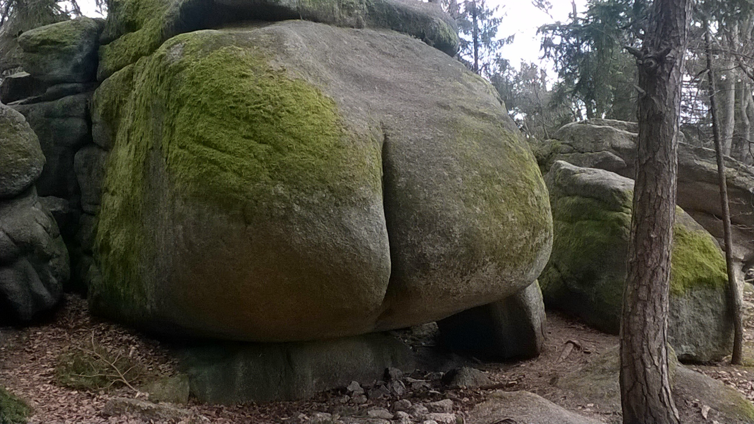
It's a sandstone. Similar rocks are very common here in the central Europe.
Exact position: 50.5863064N, 14.4544406E