
What are Reddit's favorite android apps in the category maps and navigation?

MapQuest GPS Navigation & Maps

BART Runner

BikerSOS - Crash detection

LA Metro Companion- Bus + Rail

SpeedView: GPS Speedometer

MBTA Scout
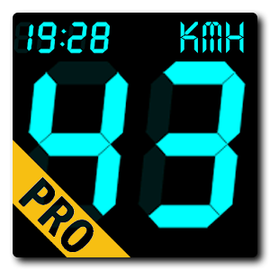
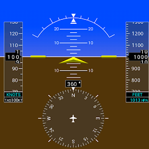
DigiHUD Pro Speedometer

Winnipeg Transit +
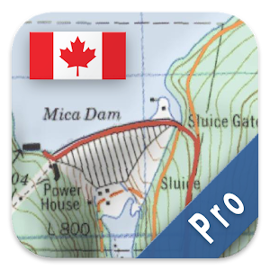
Canada Topo Maps Pro

Micro
iOnRoad Augmented Driving Pro

BMTC

MARTA On the Go
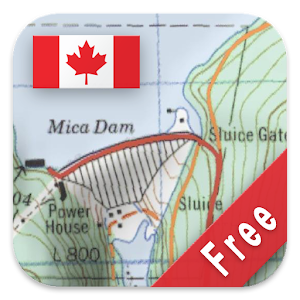
Canada Topo Maps Free

FindTaxi - Taxi Finder
Valet

Travel planner
RTC’s real-time Nomade

Clever Taxi

Pubtran
Mazda Mobile Start

Caltrain

Yandex.Metro — detailed metro map and route times
MBTA Boston Bus Tracker - Commuting made easy
SEPTA

SmartNavi - Step Navigation
Track Recorder(Torque OBD/Car)

Probus Rome: Live Bus & Routes
Gett

Taxi Berlin (030) 202020
London Oyster Sync & Refunds

Karta GPS - Offline Navigation

TripGo:Transit,Maps,Directions

TriMet Tickets
Embark
RTA Smart Drive

Yahoo!乗換案内 無料の時刻表、運行情報、乗り換え検索

Zoro Taxi - Calling All Cabs
RU Direct

Karwa

Naonedbus - Bus, Tram à Nantes

Liftago Taxi
Singapore Transit Card Reader
BBBike Android Client

乗換案内 無料の電車やバス乗り換え案内 時刻表 運行情報

DC Metro and Bus

it Taxi

Addinsight
JR-EAST Train Info
ETA SPOT

Presto Card Checker

Taxa 4x35 (Taxi booking)

MyTransLink
![[공식]고속버스모바일](https://lh3.ggpht.com/E1hMSAwoxNx4AU3chb6zTU7QuJNZlpkrJZJtpL4qQ0hjShhkCDw2odKoHdqKhRLzkOA=w300)
[공식]고속버스모바일
Tallinn Transportation +Widget
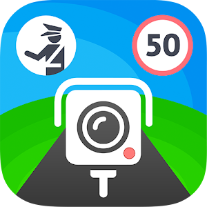
CamSam - Speed Camera Alerts

CoPilot RV USA- GPS Navigation

全国の ICカード これひとつ

Metro on the Go - Saint Louis

Wojhati

Salzburg Verkehr

Panther Taxis

HUDdle - Head Up Display
Ride Metra

New York Subway – MTA map and routes of NYC Subway

ParkenDD

Singapore MRT Lah 2.0

iTaxi Center

TranSapp

TappCar

Approach by WhenHub

Lisboa MOVE-ME

Nexar - AI Dashcam
Taxi Digital Portugal

Tube Map - TfL London Underground route planner
BusNavi

e-podroznik.pl

Head-Up Nav HUD Navigation

NAVITIME - Map & Transfer Navi
NoMoreSurge - Avoid Surge

Davao City Jeepney Guide

Greenville Trolley Tracker
KuaidiONE
GlassCockpit 1000

Taxi-Link
MEO Táxi
iOnRoad Augmented Driving Lite

MonTransit

Omnilineas

Next Stop Paris - RATP
STHLM Traveling - SL Planner
Santander Cycles
Car Locator
Yahoo!カーナビ - 渋滞情報も全て無料のナビアプリ

Melbourne Bus Finder
EnLighten by Connected Signals

Next bus Barcelona

Maltese Roads Traffic Updates

AVV connect
SG Dr Bus: SG Bus Daily Route
Western Wheels

InterUrbanos Madrid Bus EMT
Gear Fit Navigation
LiveTransit Vancouver
Bike Citizens - Bicycle GPS
Speed Cameras & Traffic Sygic
AT Metro Track My Bus
Avare External I/O Plugin

Polaris GPS Navigation

RouteXL

ACUI Key&Touch (Tablet)

DISA

NAVIGON Italy
Twin Cities Metro Transit

Weigh My Truck

Koncept Cars | The Perfect Fit
Defi Meter C

CoPilot UK + Ireland Navigation
Drive Link

Bike Share Philly Map
TowIt
원내비
NavSpeedo

SuTrans - Red vožnje

Transport Urban
BusPlus

Boating Europe HD
LibertasApp
Trucker App & GPS for Truckers
Traffline: Traffic & Parking

Elevation Profile
Moyeu (for Hubway)
Pay24
ParkBot Lite

רב-קו
Pumpdroid
MoveBlue
SaferCar
BipReader - Tarjeta Bip Balance via NFC

Transperth
Metro Now (for DC Metro)

7 Ways Navigator

London Tube Master +
cab4me taxi finder
London Transit (LTC) Buses
E2M Carte Blanche Ukraine: GPS
Road Mode

DroidEFB - Fly with Android
HKeTransport
reBART - walk, bike, BART
Top Android App reviews:
I like to use opencyclemap.org because it shows the roads, but also the trails for biking and hiking. More trails are shown than the official park maps for my area, which is good for hiking, and trails that are bike-able are shown that otherwise I wouldn't know about.
I use an app on my phone that lets me save these 9and other) maps for use without a network connection, so I can see where I am on a map with GPS without using data.
Edit: The app I use is made by Atlogis. I think it's also available for iPhone. It's probably not the only app that can save maps for offline use, just search for offline maps when looking for apps.
Creo que hablan de esta https://play.google.com/store/apps/details?id=com.matungos.stm.mvd
Fuera de eso ¿Tanto te cuesta buscarlo ? La pregunta va en serio aunque quedó de medio hijo de puta que no quiere ayudar xd
If they're flying into Love Field, there's a short bus ride that goes to the Green Line and is still about 3 hours total.
Also get the DART Regional day pass. There should be a ticket machine at the rail station or download the DART app. Regional passes work on Dallas, Denton, and Fort Worth public transit systems. $10 for a regional day pass last I checked.
Winnipeg Transit + is the best available on Android in my opinion. Everybody recommends Winnipeg Bus Live instead because there's nothing wrong with it, and people have been using it for years, but it certainly is lacking compared to the newer Winnipeg Transit + app.
Give it a try instead of just going with what gets the most up votes, you won't regret it (especially if you compare them side by side).
https://play.google.com/store/apps/details?id=com.kieran.winnipegbus
You don't really need them if you use an app like this one, uses your gps to show you the nearest stops on a map
If you find yourself roaming parks or trails or travelling where cell signals are faint (or you don't want to use up expensive mobile data) then an app that allows you to download offline maps can be great.
The maps offered by Open Street and Open Cycle tend to show trails that maps such as Google do not. The app I use and recommend is Topo Maps Pro by Atlogis: https://play.google.com/store/apps/details?id=com.atlogis.camaps&hl=en
That's the Canadian version, but there are versions for many locations. There are also free versions so you can try it out. The interface is respectable and one can choose from a long list of map imagery, including Google and satellite. It's helped me navigate trails in parks around me where the provincial government doesn't list them. The GPS pinpoints where I am and then I'm good to go.
A redditor made and posted this app a few months ago. I've used it for real time bus and rail info. It's simple and works.
https://play.google.com/store/apps/details?id=com.remulasce.lametroapp&hl=en
When I was taking bus to work (working from home) I used
https://play.google.com/store/apps/details?id=com.kieran.winnipegbus&hl=en
It all depends on what Phone you are using.
I have Android and when I was taking the bus (working from home now), I used https://play.google.com/store/apps/details?id=com.kieran.winnipegbus&hl=en
I just discovered Canada Maps Pro
It has large topographic map selection as well as route planning and tracking. It also allows for map caching for those times you are in the bush with no reception. Once recorded, the track can be replayed on the map and it displays all the stats of the trip.
I had an app that did this on my old android when I was riding my motorcycle a lot more.
Not sure if this is it, but looks similar: https://play.google.com/store/apps/details?id=at.bikersos&hl=en_US
Hello! the prices of bus tickets and such have been answered already so I'll adress the accessibility part and schedules.
If you have a smartphone I recommend downloading the STM app, its pretty intuitive but in it you can check bus timetables as well as routes and bus stops. You can also mark the places you want to go and it will recommend buses that go from the place you are now to there, and you can even follow most buses in the app via GPS.
Most services have not linear schedules, some work 24hs with more frecuency, some with less frecuency at night, some have services only during the day and stop around midnight, etc. You need to keep track of that beforehand so you don't end up someplace without a bus service at night for example.Here you can also check bus times individually (write the bus number where it says "Linea" and select the day you want to travel (for example "Hábiles" means Monday to Friday) and you can see the timetable for that bus and where it is expected to be in the most important intersections (you can google-map those) you should keep in mind though that bus can be late/earlier than where it says in the apps, so I'll recommend being at the bus stop around 10 minutes earlier for the bus you want to catch, and don't be surprised if it isn't there 10/15 minutes after the assignated schedule. The most reliable way to know when a bus will be coming is through checking the GPS service.
After flatspin999 suggestion, I started looking around for the best app (android) for the speed limit purposes. All but one that I found required the screen to be on and for the app to be in focus ( not in background ). This app (https://play.google.com/store/apps/details?id=org.mrchops.android.digihudpro&hl=en_US) can have the speed limit ( or minimum ) alerts that will still work while the screen is off. The only way for that to work is to set it to window mode.
Like templeofdank has mentioned, Under $50 is going to be tough. If you are willing to save your pennies though, this unit is a really good option.. I have a 1984 XV1000 and am currently using a GPS app on my phone and a decent handle bar mount. I also have a Veypor (a different unit, not the same as the one in my link) which I am currently integrating into a leather holder.
(edit: a bunch of things)
The trimet tracker app works well for getting bus/max route and stop time info quickly. Google maps will still be your main tool for getting around of course
https://play.google.com/store/apps/details?id=com.beagleapps.android.trimettrackerfree
I have just come across this app to keep me within the speed limit. https://play.google.com/store/apps/details?id=org.mrchops.android.digihudpro
You can set different speed limits with different notification and color codes. So far it is good. Anyone tired it? Any other similar app that is worth teying?
This one is well made and constantly being updated. It has all the big features (location, search, etc.). AFAIK there's no iOS version in the works yet though.
I seriously recommend it. It seems to have all the features of any other app, but with a better layout.
https://play.google.com/store/apps/details?id=com.kieran.winnipegbus
This isn't something that is hard to do, a smartphone app could do it.. hmm one sec.
yup There is at least one android phone app that does a similar thing; BikerSOS - Crash detection
Having played with this app and its big disclaimers I think its a nice idea but could be done better.
DigiHUD Pro. Fantastic for providing useful information while driving. The pro version is very nice. Speed brackets can be allocated, so the color of the text can change based on how fast you are going, which helps keep me honest with myself about how fast I am driving. It also allows a live Google maps view, including satellite imagery, to keep a birds eye view of the area. I used Waze for a while, but I wanted a bit more customizability. I just use Google Maps when I need actual navigation directions. Oh, and I used the icon from Speedtest in place of the original, I felt it worked better visually.